close
Trail Conditions
- Unknown
- Snow Groomed
- Snow Packed
- Snow Covered
- Snow Cover Inadequate
- Freeze/thaw Cycle
- Icy
- Prevalent Mud
- Wet
- Variable
- Ideal
- Dry
- Very Dry
Trail Flow (Ridden Direction)
Trailforks scans users ridelogs to determine the most popular direction each trail is ridden. A good flowing trail network will have most trails flowing in a single direction according to their intension.
The colour categories are based on what percentage of riders are riding a trail in its intended direction.
The colour categories are based on what percentage of riders are riding a trail in its intended direction.
- > 96%
- > 90%
- > 80%
- > 70%
- > 50%
- < 50%
- bi-directional trail
- no data
Trail Last Ridden
Trailforks scans ridelogs to determine the last time a trail was ridden.
- < 2 days
- < 1 week
- < 2 weeks
- < 1 month
- < 6 months
- > 6 months
Trail Ridden Direction
The intended direction a trail should be ridden.
- Downhill Only
- Downhill Primary
- Both Directions
- Uphill Primary
- Uphill Only
- One Direction
Contribute Details
Colors indicate trail is missing specified detail.
- Description
- Photos
- Description & Photos
- Videos
Trail Popularity ?
Trailforks scans ridelogs to determine which trails are ridden the most in the last 9 months.
Trails are compared with nearby trails in the same city region with a possible 25 colour shades.
Think of this as a heatmap, more rides = more kinetic energy = warmer colors.
- most popular
- popular
- less popular
- not popular
ATV/ORV/OHV Filter
Max Vehicle Width
inches
Radar Time
x
Activity Recordings
Trailforks users anonymized public ridelogs from the past 6 months.
- mountain biking recent
- mountain biking (>6 month)
- hiking (1 year)
- moto (1 year)
Activity Recordings
Trailforks users anonymized public skilogs from the past 12 months.
- Downhill Ski
- Backcountry Ski
- Nordic Ski
Jump Magnitude Heatmap
Heatmap of where riders jump on trails. Zoom in to see individual jumps, click circles to view jump details.
Trails Deemphasized
Trails are shown in grey.
Only show trails with NO bikes.
Save the current map location and zoom level as your default home location whenever this page is loaded.
Save
No description for Milton has been added yet!
Login or register to submit one.
Activities Click to view
- Mountain Bike
194 trails
- Hike
227 trails
- Trail Running
227 trails
- Horse
6 trails
- Snowshoe
122 trails
- Downhill Ski
16 trails
- Nordic Ski
19 trails
Region Details
- 14
- 2
- 64
- 70
- 34
- 9
Region Status
Open as of May 2, 2021Stats
- Avg Trail Rating
- Trails (view details)
- 256
- Trails Mountain Bike
- 194
- Trails E-Bike
- 1
- Trails Hike
- 227
- Trails Trail Running
- 227
- Trails Horse
- 6
- Trails Snowshoe
- 122
- Trails Downhill Ski
- 16
- Trails Nordic Ski
- 19
- Total Distance
- 120 miles
- Total Descent
- 10,135 ft
- Total Vertical
- 427 ft
- Highest Trailhead
- 1,172 ft
- Reports
- 7,946
- Photos
- 1,440
- Ridden Counter
- 85,196
Sub Regions
-
Halton Region Agreement Forest (HAFTA Trails)
- 20
- 25
- 9
- 1
-
Hilton Falls Conservation Area
- 6
- 10
- 3
- 2
-
Kelso
- 1
- 18
- 25
- 9
- 2
-
Mountsberg Conservation Area
- 1
- 14
Popular Milton Mountain Biking Trails
Milton Mountain Bike Routes
| title | rating | distance |
|---|---|---|
| Agreement Forest Easy | 10 miles | |
| 2019/20 HAFTA FAT BIKE LOOP | 10 miles | |
| Kelso Challenge 2021 - Course #5 | 9 miles | |
| Hardtail Hell | 20 miles | |
| 2020/21 HAFTA FAT BIKE LOOP | 10 miles | |
| 2018/19 HAFTA FAT BIKE LOOP | 7 miles | |
| KWCA Kelso 1 | 3 miles | |
| Kelso Challenge 2021 - Course #6 | 8 miles | |
| 2021/22 HAFTA FAT BIKE LOOP | 11 miles | |
| Kelso Challenge 2021 - Course #7 | 8 miles |
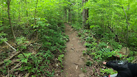
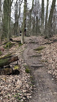
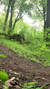
Photos of Milton Mountain Bike
trail: Roller Coaster
272 |
Jul 13, 2019 @ 6:32pm
Jul 13, 2019
trail: Roller Coaster
267 | | 2 comments
Jul 13, 2019 @ 6:32pm
Jul 13, 2019
trail: Roller Coaster
244 |
Jul 13, 2019 @ 6:31pm
Jul 13, 2019
trail: Declined
98 |
Jul 6, 2019 @ 11:28am
Jul 6, 2019
trail: Declined
206 |
Jul 6, 2019 @ 11:28am
Jul 6, 2019
trail: Declined
180 |
May 8, 2018 @ 3:41am
May 8, 2018Videos of Milton Mountain Bike
trail: Hidden Gem
34 |
Jun 5, 2021
trail: Digger Downhill
720 |
Feb 12, 2021
trail: Ugly Up
0:10 |
541 |
May 29, 2020
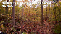
trail: No Dab
2:05 |
157 |
Oct 5, 2019
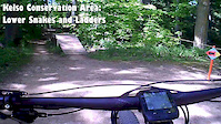
trail: Snakes and Ladders
1:23 |
799 |
Jun 8, 2019
trail: Disco Inferno
3:26 |
485 |
Aug 15, 2018
trail: Lora's Run
1:53 |
338 |
Aug 5, 2018
trail: Disco Inferno
2:44 |
470 |
Aug 5, 2018
Current Trail Warnings
| status | trail | date | condition | user | info |
|---|---|---|---|---|---|
| Broken Spokes | Jun 18, 2022 @ 7:55pm Jun 18, 2022 | Dry | natedagreat | Orange fence across the start of trail.... |
Recent Trail Reports
| status | trail | date | condition | info | user |
|---|---|---|---|---|---|
| Back Track | Jul 4, 2022 @ 6:11am 2 days | Dry | BigAirGar3 HAFTA | ||
| Turkey Trails | Jul 3, 2022 @ 1:09pm 3 days | Dry | rprouse | ||
| Rated P.G. | Jul 3, 2022 @ 1:07pm 3 days | Dry | rprouse | ||
| The Rotweiller Trail | Jul 3, 2022 @ 1:06pm 3 days | Dry | rprouse | ||
| The Southern Edge | Jul 3, 2022 @ 1:05pm 3 days | Dry | rprouse | ||
| Turkey Shoot | Jul 3, 2022 @ 12:06pm 3 days | Very Dry | LadyBoss | ||
| Bell School Line | Jul 3, 2022 @ 12:06pm 3 days | Very Dry | LadyBoss | ||
| X-treem Trail | Jul 3, 2022 @ 12:06pm 3 days | Dry | LadyBoss | ||
| Wide Open | Jul 3, 2022 @ 12:06pm 3 days | Very Dry | LadyBoss | ||
| Lora's Run | Jul 3, 2022 @ 12:06pm 3 days | Very Dry | LadyBoss |
Activity Feed
| username | action | type | title | date | |
|---|---|---|---|---|---|
 | NolanBikes11 | wishlist | region | Hilton Falls Conservation Area | Jul 5, 2022 @ 3:59am 22 hours |
| JTessman | wishlist | region | Halton Region Agreement Forest (HAFTA Trails) | Jul 4, 2022 @ 9:30am 2 days |
 | BigAirGar3 | add | report | Back Track | Jul 4, 2022 @ 6:11am 2 days |
| LadyBoss | add | report | Turkey Shoot and 12 more | Jul 3, 2022 @ 9:27pm 2 days |
| kiawah | wishlist | route | Hardtail Hell | Jul 3, 2022 @ 6:25pm 2 days |
Recent Comments
| username | type | title | comment | date | |
|---|---|---|---|---|---|
 | report | global warming, its here! | Jun 29, 2022 @ 12:59pm Jun 29, 2022 | ||
| report | snow on June 29? | Jun 29, 2022 @ 11:48am Jun 29, 2022 | ||
| report | What is the issue? | May 13, 2022 @ 6:15pm May 13, 2022 | ||
| report | Any details on the problem? | Apr 11, 2022 @ 5:47am Apr 11, 2022 | ||
| report | Removed | Mar 30, 2022 @ 1:18pm Mar 30, 2022 |
Local Badges
-

10 Blue Trails930 awarded -

10 Black Trails433 awarded -

10 Green Trails606 awarded -

Completionist1 awarded -

Big Ride 30k1,815 awarded -
Completionist1 awarded
Activity Type Stats
| activitytype | trails | distance | descent | descent distance | total vertical | rating | global rank | state rank | photos | reports | routes | ridelogs |
|---|---|---|---|---|---|---|---|---|---|---|---|---|
| Mountain Bike | 194 | 86 miles | 6,286 ft | 32 miles | 367 ft | #41 | #3 | 1,366 | 7,897 | 42 | 33,394 | |
| E-Bike | 1 | 1,188 ft | 10 ft | 249 ft | 10 ft | 5,640 | 63 | |||||
| Hike | 227 | 109 miles | 8,261 ft | 39 miles | 427 ft | #31 | #3 | 70 | 7,782 | 3 | 2,373 | |
| Trail Running | 227 | 109 miles | 8,261 ft | 39 miles | 427 ft | #31 | #3 | 3 | 7,777 | 6 | 377 | |
| Horse | 6 | 7 miles | 325 ft | 3 miles | 197 ft | #84 | #1 | 2,727 | 1 | |||
| Snowshoe | 122 | 63 miles | 4,239 ft | 23 miles | 427 ft | #8 | #4 | 1,912 | 3 | 68 | ||
| Downhill Ski | 16 | 2 miles | 1,378 ft | 2 miles | 269 ft | #1 | 5 | 256 | ||||
| Nordic Ski | 19 | 16 miles | 1,220 ft | 6 miles | 259 ft | #60 | #8 | 366 | 142 |
- By brenthillier
 NSMBA TRAILFORKS & contributors
 - Admins: apply
- #4036 - 33,526 views
- milton activity log | embed map of Milton mountain bike trails | milton mountain biking points of interest polygons
Downloading of trail gps tracks in kml & gpx formats is enabled for Milton.
You must login to download files.