close
Trail Conditions
- Unknown
- Snow Groomed
- Snow Packed
- Snow Covered
- Snow Cover Inadequate
- Freeze/thaw Cycle
- Icy
- Prevalent Mud
- Wet
- Variable
- Ideal
- Dry
- Very Dry
Trail Flow (Ridden Direction)
Trailforks scans users ridelogs to determine the most popular direction each trail is ridden. A good flowing trail network will have most trails flowing in a single direction according to their intension.
The colour categories are based on what percentage of riders are riding a trail in its intended direction.
The colour categories are based on what percentage of riders are riding a trail in its intended direction.
- > 96%
- > 90%
- > 80%
- > 70%
- > 50%
- < 50%
- bi-directional trail
- no data
Trail Last Ridden
Trailforks scans ridelogs to determine the last time a trail was ridden.
- < 2 days
- < 1 week
- < 2 weeks
- < 1 month
- < 6 months
- > 6 months
Trail Ridden Direction
The intended direction a trail should be ridden.
- Downhill Only
- Downhill Primary
- Both Directions
- Uphill Primary
- Uphill Only
- One Direction
Contribute Details
Colors indicate trail is missing specified detail.
- Description
- Photos
- Description & Photos
- Videos
Trail Popularity ?
Trailforks scans ridelogs to determine which trails are ridden the most in the last 9 months.
Trails are compared with nearby trails in the same city region with a possible 25 colour shades.
Think of this as a heatmap, more rides = more kinetic energy = warmer colors.
- most popular
- popular
- less popular
- not popular
ATV/ORV/OHV Filter
Max Vehicle Width
inches
Radar Time
x
Activity Recordings
Trailforks users anonymized public ridelogs from the past 6 months.
- mountain biking recent
- mountain biking (>6 month)
- hiking (1 year)
- moto (1 year)
Activity Recordings
Trailforks users anonymized public skilogs from the past 12 months.
- Downhill Ski
- Backcountry Ski
- Nordic Ski
Jump Magnitude Heatmap
Heatmap of where riders jump on trails. Zoom in to see individual jumps, click circles to view jump details.
Trails Deemphasized
Trails are shown in grey.
Only show trails with NO bikes.
Save the current map location and zoom level as your default home location whenever this page is loaded.
Save
No description for Sunrise has been added yet!
Login or register to submit one.
Activities Click to view
- Mountain Bike
54 trails
- Hike
52 trails
- Trail Running
52 trails
Region Details
- 10
- 12
- 14
- 16
- 2
Region Status
Open as of Jun 3, 2022Local Trail Association
Stats
- Avg Trail Rating
- Trails (view details)
- 54
- Trails Mountain Bike
- 54
- Trails Hike
- 52
- Trails Trail Running
- 52
- Total Distance
- 15 miles
- Total Descent
- 710 ft
- Total Vertical
- 26 ft
- Highest Trailhead
- 30 ft
- Reports
- 1,149
- Photos
- 54
- Ridden Counter
- 34,745
Sub Regions
-
Markham Park
- 12
- 14
- 16
- 2
Popular Sunrise Mountain Biking Trails
Sunrise Mountain Bike Routes
| title | rating | distance |
|---|---|---|
| Markham D24 Old Lap | 8 miles | |
| Markham Park Full Lap Advanced | 8 miles | |
| Markham Park Adaptive Lap | 2 miles | |
| Markham Park Full lap Blue trails | 4 miles | |
| 13 mile Markham Park All-Mountain Ride | popular ridelog | 13 miles |
| 17 mile Markham Park Ride | popular ridelog | 17 miles |
| 20 mile Markham Park Ride | popular ridelog | 20 miles |
| 7 mile Markham Park Ride | popular ridelog | 7 miles |
| 10 mile Markham Park Ride | popular ridelog | 10 miles |
| 10 mile Markham Park Ride | popular ridelog | 10 miles |
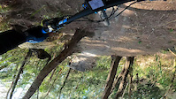
Photos of Sunrise Mountain Bike
trail: Gun Range
38 |
Apr 2, 2022 @ 10:48am
Apr 2, 2022
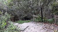
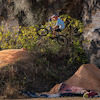
trail: Deep Dark Forest
153 |
Sep 6, 2020 @ 5:19am
Sep 6, 2020
trail: Deep Dark Forest
184 |
Sep 6, 2020 @ 5:19am
Sep 6, 2020
trail: Redback
122 |
Sep 6, 2020 @ 4:52am
Sep 6, 2020
trail: Redback
155 |
Sep 6, 2020 @ 4:52am
Sep 6, 2020
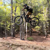
trail: Access Road
96 |
Sep 6, 2020 @ 4:51am
Sep 6, 2020
trail: Access Road
116 |
Sep 6, 2020 @ 4:51am
Sep 6, 2020
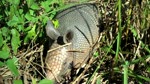
trail: Armadillo
98 |
Sep 6, 2020 @ 4:50am
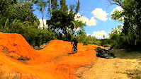
Sep 6, 2020Videos of Sunrise Mountain Bike
trail: Gun Range
|
Jun 5, 2022
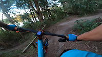
trail: Iguana Ridge
16 |
May 15, 2022
trail: Gun Range
57 |
Feb 21, 2022
trail: Armadillo
0:31 |
409 |
Dec 27, 2014

trail: Connect
1:20 |
131 |
Jun 20, 2012

trail: Connect
0:45 |
133 |
Jun 20, 2012
trail: Armadillo
3:24 |
386 |
Dec 17, 2010

trail: Gun Range
8:15 |
295 |
May 25, 2021 , Sunrise
Recent Trail Reports
| status | trail | date | condition | info | user |
|---|---|---|---|---|---|
| Warm Up Loop | Apr 22, 2022 @ 3:51am Apr 22, 2022 | Ideal | MtbMiguel | ||
| Side Chick | Apr 22, 2022 @ 3:51am Apr 22, 2022 | Ideal | MtbMiguel | ||
| Warmup Loop Expert | Apr 22, 2022 @ 3:51am Apr 22, 2022 | Dry | MtbMiguel | ||
| Deep Dark Forest | Apr 22, 2022 @ 3:51am Apr 22, 2022 | Dry | MtbMiguel | ||
| Access Road | Apr 22, 2022 @ 3:51am Apr 22, 2022 | Ideal | MtbMiguel | ||
| Armadillo | Apr 22, 2022 @ 3:51am Apr 22, 2022 | Dry | MtbMiguel | ||
| Fishing Hole | Apr 22, 2022 @ 3:51am Apr 22, 2022 | Ideal | MtbMiguel | ||
| Redback | Apr 22, 2022 @ 3:51am Apr 22, 2022 | Dry | MtbMiguel | ||
| Traverse Trail | Apr 22, 2022 @ 3:51am Apr 22, 2022 | Dry | MtbMiguel | ||
| Area 51 | Apr 22, 2022 @ 3:51am Apr 22, 2022 | Dry | MtbMiguel |
Activity Feed
| username | action | type | title | date | |
|---|---|---|---|---|---|
 | MTBDan23 | wishlist | region | Markham Park | Jul 5, 2022 @ 4:17pm 10 hours |
| FernunDhAe | wishlist | region | Markham Park | Jul 2, 2022 @ 5:00pm Jul 2, 2022 |
 | patalo65 | add | video | practice | May 15, 2022 @ 7:26am May 15, 2022 |
 | FloridaHasMTBToo | ridden | trail | Area 51 and 2 more | Apr 25, 2022 @ 6:52am Apr 25, 2022 |
| FloridaHasMTBToo | ridden | trail | Access Road and 1 more | Apr 24, 2022 @ 3:45am Apr 24, 2022 |
Recent Comments
| username | type | title | comment | date | |
|---|---|---|---|---|---|
 | report | Id va | Aug 27, 2021 @ 7:26am Aug 27, 2021 | ||
| trail | Trail closed | Feb 21, 2021 @ 3:22pm Feb 21, 2021 | ||
| trail | Trail is rated pro/expert, not black but... | Jul 9, 2019 @ 4:53am Jul 9, 2019 | ||
 | trail | I'd consider it a blue in most other places.... | Mar 11, 2019 @ 9:24am Mar 11, 2019 | ||
 | trail | Double black FL style. Green trail If you rode... | Mar 11, 2019 @ 6:51am Mar 11, 2019 |
Local Badges
-

Completionist240 awarded -

10 Green Trails487 awarded -

Top 10 Trails3,984 awarded -

10 Blue Trails452 awarded -

10 Black Trails462 awarded -

Big Ride 30k1,944 awarded
Bike & Skill Parks
| name | type | city | rating |
|---|---|---|---|
| Pumptrack & Skills area | skill park | Sunrise |
Local Mountain Biking Directory
-
Markham Park Trail Building Fund
![Markham Park Trail Building Fund]()
-
Protech Bicycle ShopBike Shop
-
Mega CyclesBike Shop
-
Bike America - Sunrise Trek SuperstoreBike Shop
Activity Type Stats
| activitytype | trails | distance | descent | descent distance | total vertical | rating | global rank | state rank | photos | reports | routes | ridelogs |
|---|---|---|---|---|---|---|---|---|---|---|---|---|
| Mountain Bike | 54 | 15 miles | 709 ft | 3 miles | 26 ft | #38 | #17 | 54 | 1,149 | 4 | 17,015 | |
| Hike | 52 | 14 miles | 696 ft | 3 miles | 26 ft | #28 | #16 | 1,145 | 10 | |||
| Trail Running | 52 | 14 miles | 696 ft | 3 miles | 26 ft | #28 | #16 | 1,145 | 3 |
- By WimG
 FOGBP & contributors
 - Admins: SORBA
- #18424 - 6,632 views
- sunrise activity log | embed map of Sunrise mountain bike trails |
Downloading of trail gps tracks in kml & gpx formats is enabled for Sunrise.
You must login to download files.