close
Trail Conditions
- Unknown
- Snow Groomed
- Snow Packed
- Snow Covered
- Snow Cover Inadequate
- Freeze/thaw Cycle
- Icy
- Prevalent Mud
- Wet
- Variable
- Ideal
- Dry
- Very Dry
Trail Flow (Ridden Direction)
Trailforks scans users ridelogs to determine the most popular direction each trail is ridden. A good flowing trail network will have most trails flowing in a single direction according to their intension.
The colour categories are based on what percentage of riders are riding a trail in its intended direction.
The colour categories are based on what percentage of riders are riding a trail in its intended direction.
- > 96%
- > 90%
- > 80%
- > 70%
- > 50%
- < 50%
- bi-directional trail
- no data
Trail Last Ridden
Trailforks scans ridelogs to determine the last time a trail was ridden.
- < 2 days
- < 1 week
- < 2 weeks
- < 1 month
- < 6 months
- > 6 months
Trail Ridden Direction
The intended direction a trail should be ridden.
- Downhill Only
- Downhill Primary
- Both Directions
- Uphill Primary
- Uphill Only
- One Direction
Contribute Details
Colors indicate trail is missing specified detail.
- Description
- Photos
- Description & Photos
- Videos
Trail Popularity ?
Trailforks scans ridelogs to determine which trails are ridden the most in the last 9 months.
Trails are compared with nearby trails in the same city region with a possible 25 colour shades.
Think of this as a heatmap, more rides = more kinetic energy = warmer colors.
- most popular
- popular
- less popular
- not popular
ATV/ORV/OHV Filter
Max Vehicle Width
inches
Radar Time
x
Activity Recordings
Trailforks users anonymized public ridelogs from the past 6 months.
- mountain biking recent
- mountain biking (>6 month)
- hiking (1 year)
- moto (1 year)
Activity Recordings
Trailforks users anonymized public skilogs from the past 12 months.
- Downhill Ski
- Backcountry Ski
- Nordic Ski
Jump Magnitude Heatmap
Heatmap of where riders jump on trails. Zoom in to see individual jumps, click circles to view jump details.
Trails Deemphasized
Trails are shown in grey.
Only show trails with NO bikes.
Save the current map location and zoom level as your default home location whenever this page is loaded.
SavePopular Trail Networks
view all areas »
No description for United States has been added yet!
Login or register to submit one.
AKA: USA
Region Supporters & Maintainers
![USFS]()
USFSSponsor
Region Details
- 23,113
- 4,782
- 33,087
- 43,642
- 13,066
- 1,836
- 143
- 1
Local Trail Association
Stats
- Avg Trail Rating
- Trails (view details)
- 161,525
- Trails Mountain Bike
- 119,876
- Trails E-Bike
- 26,281
- Trails Hike
- 141,125
- Trails Trail Running
- 138,212
- Trails Horse
- 23,878
- Trails Dirtbike/Moto
- 9,417
- Trails Observed Trials
- 903
- Trails ATV/ORV/OHV
- 5,939
- Trails Snowmobile
- 4,785
- Trails Snowshoe
- 16,604
- Trails Downhill Ski
- 4,979
- Trails Backcountry Ski
- 2,614
- Trails Nordic Ski
- 14,127
- Total Distance
- 238,273 miles
- Total Descent
- 6,505 miles
- Total Vertical
- 32,708 ft
- Highest Trailhead
- 32,708 ft
- Reports
- 994,319
- Photos
- 252,367
- Ridden Counter
- 14,937,899
 Articles

The Ethics of Thru-Hiking with Kids
Jun 13, 2022 from outsideonline.com
Each year, more families seem to earn attention by taking to long trails with small children. What are their motivations, and is it bad for the kids?

First Impressions: Tom Bradshaw & Christina Chappetta Ride the Best Trails in Tallahassee, Florida
Jun 6, 2022 from pinkbike.com
Tom Bradshaw and Christina Chappetta spend a day being pleasantly surprised at the state capital's trails.

Appalachian Trail Hiker Dies After Falling from McAfee Knob
Jun 3, 2022 from outsideonline.com
The cause of Paul “Grandmaster” Classen’s fatal fall is still unclear

Should Lael Wilcox’s Arizona Trail FKT Come with an Asterisk?
Jun 3, 2022 from outsideonline.com
When one of bikepacking’s best athletes set a fastest known time on a legendary route, ultradistance cycling’s corner of the internet exploded...
Sub Regions
- Alabama (858)
- Alaska (1,004)
- Arizona (4,739)
- Arkansas (1,248)
- Armed Forces Europe (1)
- Armed Forces Pacific (52)
- California (11,922)
- Colorado (6,645)
- Connecticut (3,430)
- Delaware (342)
- Florida (1,370)
- Georgia (1,204)
- Hawaii (243)
- Idaho (3,354)
- Illinois (770)
- Indiana (504)
- Iowa (514)
- Kansas (241)
- Kentucky (552)
- Louisiana (112)
- Maine (2,189)
- Maryland (1,263)
- Massachusetts (14,355)
- Michigan (3,119)
- Minnesota (1,805)
- Mississippi (237)
- Missouri (838)
- Montana (4,007)
- Nebraska (102)
- Nevada (1,382)
- New Hampshire (3,331)
- New Jersey (2,520)
- New Mexico (2,090)
- New York State (4,431)
- North Carolina (1,621)
- North Dakota (704)
- Ohio (1,642)
- Oklahoma (312)
- Oregon (2,772)
- Pennsylvania (4,027)
- Rhode Island (920)
- South Carolina (436)
- South Dakota (540)
- Tennessee (1,095)
- Texas (4,266)
- US Virgin Islands (14)
- Utah (6,121)
- Vermont (2,423)
- Virginia (2,052)
- Washington (6,618)
- Washington DC (23)
- West Virginia (1,092)
- Wisconsin (1,541)
- Wyoming (1,316)
Popular United States Mountain Biking Trails
| status | title | difficulty | rating |
|---|---|---|---|
| Porcupine Rim La Sal Mountains | |||
| LPS La Sal Mountains | |||
| UPS Lower La Sal Mountains | |||
| UPS La Sal Mountains | |||
| The Snotch La Sal Mountains | |||
| Upper Porcupine ST La Sal Mountains | |||
| Captain Ahab (lower) Amasa Back | |||
| HyMasa (upper) Amasa Back | |||
| HyMasa Amasa Back | |||
| Unemployment Line Galbraith | |||
| Master Link Tiger Mountain State Forest | |||
| Captain Ahab (upper) Amasa Back | |||
| All-American Crystal Bridges | |||
| Atomic Dog Galbraith | |||
| Bull Run (lower) Mag 7 |
United States Mountain Bike Routes
| title | rating | distance |
|---|---|---|
| Thunder Mountain Shuttle Yourself Red Canyon | 15 miles | |
| Hall Ranch Technical Side Hall Ranch | 10 miles | |
| Vertigo Loop Highland Hollow | 4 miles | |
| Kenosha Pass to Breckenridge - CT Segment 6 Summit County | 33 miles | |
| Snake and Rice Canyon Loop Chula Vista Canyon Trails | 5 miles | |
| SDMB Featured Ride - Tucson Mountain Park - Starr Pass Classic Tucson Mountain Park | 10 miles | |
| Wondering Where the Lions Are Laguna Mountain Recreation Area | 18 miles | |
| Buchanan Waterfall out-and-back Brainard Lake and Peaceful Valley | 7 miles | |
| Great Blue Hill Loop Blue Hills Reservation | 22 miles | |
| Coney Buchanan Loop Brainard Lake and Peaceful Valley | 11 miles |
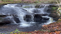
Photos of United States Mountain Bike
trail: Oly
174 |
Sep 29, 2018 @ 5:02pm
Sep 29, 2018
trail: Slim Shady
687 |
Dec 27, 2017 @ 10:21pm
Dec 27, 2017
trail: China Wall
193 |
Aug 30, 2017 @ 10:01pm
Aug 30, 2017
trail: Master Link
984 |
Apr 13, 2017 @ 10:04pm
Apr 13, 2017
trail: Lair of the Bear
653 |
Mar 31, 2017 @ 9:34am
Mar 31, 2017
trail: Irish Death
1,973 | | 3 comments
Mar 31, 2017 @ 9:33am
Mar 31, 2017
trail: Maple Hollow DH (Lower)
1,001 |
Jul 14, 2016 @ 4:28pm
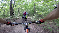
Jul 14, 2016Videos of United States Mountain Bike
featured
![Enders Cascade]()
trail: Cascades Boardwalk Trail
7 |
Nov 18, 2021
featured
![KMBC 2019]()
trail: Super D Bailout
2:10 |
105 |
Jul 1, 2020
featured
![Black River Trails]()

trail: Black River Trail
4:54 |
2894 |
Nov 18, 2015
featured
![The Little Big 2013]()
5:27 |
2603 |
Jul 21, 2014
featured
![Our Trails Unite Us - Helena, Montana]()
trail: 2006 Trail (north side)
1:41 |
134 |
Nov 2, 2021 , Helena
trail: Westridge
20 |
Jul 5, 2022

trail: Experts Only
27 |
Jul 5, 2022
Current Trail Warnings
| status | trail | date | condition | user | info |
|---|---|---|---|---|---|
| Horn Horn Park | Jul 5, 2022 @ 6:22pm 8 hours | Variable | plmn | Horn was hard hit during the flooding and... | |
| Upper Sparrow Farm Trail (Montpelier) North Branch River Park | Jul 5, 2022 @ 2:10pm 12 hours | Wet | scharny MAMBA | ||
| Tanager Trail North Branch River Park | Jul 5, 2022 @ 2:10pm 12 hours | Wet | scharny MAMBA |
Recent Trail Reports
| status | trail | date | condition | info | user |
|---|---|---|---|---|---|
| Sleeper Creek Trail Wharton State Forest | Jul 6, 2022 @ 1:17am 43 mins | Unknown | slingblade2 | ||
| Burnt Mill Trail Wharton State Forest | Jul 6, 2022 @ 1:17am 43 mins | Unknown | slingblade2 | ||
| Burnt Mill Trail Wharton State Forest | Jul 6, 2022 @ 1:17am 43 mins | Unknown | slingblade2 | ||
| Burnt Mill Trail Wharton State Forest | Jul 6, 2022 @ 1:17am 43 mins | Unknown | slingblade2 | ||
| Atsion Burnt Mill Trail Wharton State Forest | Jul 6, 2022 @ 1:17am 43 mins | Unknown | slingblade2 | ||
| Burnt Mill Trail Wharton State Forest | Jul 6, 2022 @ 1:17am 43 mins | Unknown | slingblade2 | ||
| Sleeper Creek Trail Wharton State Forest | Jul 6, 2022 @ 1:17am 43 mins | Unknown | slingblade2 | ||
| Burnt Mill Trail Wharton State Forest | Jul 6, 2022 @ 1:17am 43 mins | Unknown | slingblade2 | ||
| Atsion Goshen Pond Trail Wharton State Forest | Jul 6, 2022 @ 1:17am 43 mins | Unknown | slingblade2 | ||
| Atsion Sleeper Creek Trail Wharton State Forest | Jul 6, 2022 @ 1:17am 43 mins | Unknown | slingblade2 |
Recent Comments
| username | type | title | comment | date | |
|---|---|---|---|---|---|
 | trail | Rode up this today. Very steep. Very... | Jul 5, 2022 @ 10:24pm 4 hours | ||
| trail | I have crossed at bridge 3 in 2020. The owner... | Jul 5, 2022 @ 9:56pm 4 hours | ||
| trail | Trail is cleaned up and rideable now except... | Jul 5, 2022 @ 8:32pm 5 hours | ||
 | trail | Closed to bikes. Not sure where Trailforks is... | Jul 5, 2022 @ 8:31pm 5 hours | ||
| trail | Not open to bikes. Plus it’s completely... | Jul 5, 2022 @ 8:29pm 5 hours |
National Scenic Trails & Official Routes
-
American Birkebeiner Trail
- Mountain Bike
- Hike
- Trail Running
- Nordic Ski
-
Arizona Trail
- Mountain Bike
- Hike
- Trail Running
- Horse
-
Bay Circuit Trail
- Mountain Bike
- E-Bike
- Hike
- Trail Running
-
Black Canyon Trail
- Mountain Bike
- Hike
- Horse


Bike & Skill Parks
| name | type | city | rating |
|---|---|---|---|
| Alyeska Bike Park | bike park | Girdwood | |
| Angel Fire Bike Park | bike park | Angel Fire | |
| Attitash Mountain Bike Resort | bike park | Bartlett | |
| Bailey Mountain Bike Park | bike park | Marshall | |
| Bear Valley Resort | bike park | Bear Valley |
Upcoming Local Events
-
-
-
-
-
-
-
-
Activity Type Stats
| activitytype | trails | distance | descent | descent distance | total vertical | rating | global rank | state rank | photos | reports | routes | ridelogs |
|---|---|---|---|---|---|---|---|---|---|---|---|---|
| Mountain Bike | 119,868 | 160,882 miles | 4,080 miles | 66,724 miles | 32,707 ft | #1 | 238,648 | 988,624 | 11,536 | 12,446,958 | ||
| E-Bike | 26,281 | 48,877 miles | 1,092 mile | 20,093 miles | 14,245 ft | #1 | 723 | 701,035 | 948 | 222,576 | ||
| Hike | 141,125 | 208,762 miles | 5,465 miles | 84,988 miles | 32,707 ft | #1 | 11,086 | 959,630 | 4,107 | 654,061 | ||
| Trail Running | 138,212 | 204,972 miles | 5,350 miles | 83,490 miles | 32,707 ft | #1 | 800 | 959,303 | 3,231 | 321,546 | ||
| Horse | 23,878 | 59,568 miles | 1,539 mile | 24,004 miles | 14,419 ft | #1 | 216 | 309,500 | 440 | 4,240 | ||
| Dirtbike/Moto | 9,417 | 27,898 miles | 813 miles | 12,188 miles | 14,242 ft | #1 | 238 | 236,024 | 153 | 7,542 | ||
| Observed Trials | 903 | 2,349 miles | 295,522 ft | 1,031 mile | 12,001 ft | #2 | 109 | 5,002 | 8 | 2,346 | ||
| ATV/ORV/OHV | 5,939 | 19,072 miles | 2,196,194 ft | 7,887 miles | 14,242 ft | #1 | 166 | 233,021 | 88 | 3,304 | ||
| Snowmobile | 4,785 | 19,532 miles | 1,299,045 ft | 6,464 miles | 14,239 ft | #1 | 31 | 16,779 | 48 | 919 | ||
| Snowshoe | 16,604 | 21,390 miles | 1,944,505 ft | 7,503 miles | 32,707 ft | #1 | 107 | 60,845 | 722 | 17,383 | ||
| Downhill Ski | 4,979 | 2,233 miles | 1,788,537 ft | 1,886 mile | 14,209 ft | #1 | 26 | 6,559 | 156,664 | |||
| Backcountry Ski | 2,614 | 4,878 miles | 763,668 ft | 1,858 mile | 14,390 ft | #1 | 56 | 23,159 | 66 | 81,108 | ||
| Nordic Ski | 14,127 | 18,581 miles | 1,480,853 ft | 6,606 miles | 14,245 ft | #1 | 123 | 43,771 | 124 | 105,091 |
- By canadaka
 Trailforks & contributors
 - Admins: Map Team, chuktA, msmcfate, WillieJacobsz, PlumbBobM, ReckitRolley
- #3001 - 124,893 views
- united states activity log | embed map of United States mountain bike trails | united states mountain biking points of interest polygons
-
- subscribe
- 3d map
Downloading of trail gps tracks in kml & gpx formats is enabled for United States.
You must login to download files.