close
Trail Conditions
- Unknown
- Snow Groomed
- Snow Packed
- Snow Covered
- Snow Cover Inadequate
- Freeze/thaw Cycle
- Icy
- Prevalent Mud
- Wet
- Variable
- Ideal
- Dry
- Very Dry
Trail Flow (Ridden Direction)
Trailforks scans users ridelogs to determine the most popular direction each trail is ridden. A good flowing trail network will have most trails flowing in a single direction according to their intension.
The colour categories are based on what percentage of riders are riding a trail in its intended direction.
The colour categories are based on what percentage of riders are riding a trail in its intended direction.
- > 96%
- > 90%
- > 80%
- > 70%
- > 50%
- < 50%
- bi-directional trail
- no data
Trail Last Ridden
Trailforks scans ridelogs to determine the last time a trail was ridden.
- < 2 days
- < 1 week
- < 2 weeks
- < 1 month
- < 6 months
- > 6 months
Trail Ridden Direction
The intended direction a trail should be ridden.
- Downhill Only
- Downhill Primary
- Both Directions
- Uphill Primary
- Uphill Only
- One Direction
Contribute Details
Colors indicate trail is missing specified detail.
- Description
- Photos
- Description & Photos
- Videos
Trail Popularity ?
Trailforks scans ridelogs to determine which trails are ridden the most in the last 9 months.
Trails are compared with nearby trails in the same city region with a possible 25 colour shades.
Think of this as a heatmap, more rides = more kinetic energy = warmer colors.
- most popular
- popular
- less popular
- not popular
ATV/ORV/OHV Filter
Max Vehicle Width
inches
Radar Time
x
Activity Recordings
Trailforks users anonymized public ridelogs from the past 6 months.
- mountain biking recent
- mountain biking (>6 month)
- hiking (1 year)
- moto (1 year)
Activity Recordings
Trailforks users anonymized public skilogs from the past 12 months.
- Downhill Ski
- Backcountry Ski
- Nordic Ski
Jump Magnitude Heatmap
Heatmap of where riders jump on trails. Zoom in to see individual jumps, click circles to view jump details.
Trails Deemphasized
Trails are shown in grey.
Only show trails with NO bikes.
Save the current map location and zoom level as your default home location whenever this page is loaded.
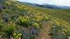
SaveThe Continental Divide Trail between Chief Joseph Pass and Carmen Creek is rugged and remote back-country riding. The trails in this area cut through the middle of the Northern Beaverhead Range and can be spectacular.
Primary Trail Type: Cross-Country
Shuttleable: YES
Land Status: National Forest
 google parking directions
 Access Info:
Access to these trails is via Chief Joseph Pass in the north; Big Hole Pass centrally or 4th of July Creek Road on the southern end.
Links
Activities Click to view
- Mountain Bike
27 trails
- E-Bike
16 trails
- Hike
28 trails
- Trail Running
28 trails
- Horse
17 trails
- Dirtbike/Moto
17 trails
- ATV/ORV/OHV
7 trails
- Snowmobile
3 trails
- Snowshoe
2 trails
- Backcountry Ski
2 trails
- Nordic Ski
4 trails
Region Details
- 11
- 2
- 2
- 10
- 2
Region Status
Open as of Nov 9, 2021Stats
- Avg Trail Rating
- Trails (view details)
- 28
- Trails Mountain Bike
- 27
- Trails E-Bike
- 16
- Trails Hike
- 28
- Trails Trail Running
- 28
- Trails Horse
- 17
- Trails Dirtbike/Moto
- 17
- Trails ATV/ORV/OHV
- 7
- Trails Snowmobile
- 3
- Trails Snowshoe
- 2
- Trails Backcountry Ski
- 2
- Trails Nordic Ski
- 4
- Total Distance
- 114 miles
- Total Descent
- 26,822 ft
- Total Vertical
- 5,060 ft
- Highest Trailhead
- 9,382 ft
- Reports
- 229
- Photos
- 71
- Ridden Counter
- 230
Popular CDT - North Beaverheads Mountain Biking Trails
CDT - North Beaverheads Mountain Bike Routes
| title | rating | distance |
|---|---|---|
| CDT - Sheep Creek | 13 miles | |
| The Fun Suffer Divide Day 6 | 24 miles | |
| The Fun Suffer Divide Day 4 | 16 miles | |
| CDT to Three Mile Ridge | 18 miles | |
| The Fun Suffer Divide Day 5 | 13 miles |
Photos of CDT - North Beaverheads Mountain Bike
trail: Carmen Creek Trail
1 |
Jul 5, 2022 @ 9:39pm
5 hours
trail: Carmen Creek Trail
0 |
Jul 5, 2022 @ 8:15pm
6 hours
trail: Carmen Creek Trail
1 |
Jul 5, 2022 @ 8:15pm
6 hours
trail: Carmen Creek Trail
3 |
Jul 5, 2022 @ 8:14pm
6 hours
trail: CDT (Big Hole Pass)
39 |
Aug 17, 2019 @ 10:04pm
Aug 17, 2019
trail: CDT (Bradley Gulch)
239 |
Oct 4, 2014 @ 10:27am
Oct 4, 2014
trail: CDT (4th Of July)
192 |
Oct 4, 2014 @ 7:39am
Oct 4, 2014
trail: CDT (4th Of July)
150 |
Oct 4, 2014 @ 7:37am
Oct 4, 2014Videos of CDT - North Beaverheads Mountain Bike

trail: Three Mile Ridge
554 |
Oct 3, 2014 , North Fork
Recent Trail Reports
| status | trail | date | condition | info | user |
|---|---|---|---|---|---|
| Carmen Creek Trail | Jul 5, 2022 @ 7:48pm 7 hours | Variable | wildbillmac simba | ||
| CDT (Three Mile Ridge) | Nov 9, 2021 @ 6:03pm Nov 9, 2021 | Unknown | chuktA TRAILFORKS | ||
| Dahlonega Road | Nov 9, 2021 @ 6:03pm Nov 9, 2021 | Unknown | chuktA TRAILFORKS | ||
| Foothills Road to Bighole Pass | Nov 9, 2021 @ 6:03pm Nov 9, 2021 | Unknown | chuktA TRAILFORKS | ||
| Keystone Gulch | Nov 9, 2021 @ 6:03pm Nov 9, 2021 | Unknown | chuktA TRAILFORKS | ||
| Lick Creek (078) | Nov 9, 2021 @ 6:03pm Nov 9, 2021 | Unknown | chuktA TRAILFORKS | ||
| Lick Creek Road | Nov 9, 2021 @ 6:03pm Nov 9, 2021 | Unknown | chuktA TRAILFORKS | ||
| Three Mile Ridge | Nov 9, 2021 @ 6:03pm Nov 9, 2021 | Unknown | chuktA TRAILFORKS | ||
| Anderson Mountain | Nov 9, 2021 @ 6:03pm Nov 9, 2021 | Unknown | chuktA TRAILFORKS | ||
| Anderson-Threemile Road | Nov 9, 2021 @ 6:03pm Nov 9, 2021 | Unknown | chuktA TRAILFORKS |
Activity Feed
| username | action | type | title | date | |
|---|---|---|---|---|---|
 | wildbillmac | update | trail | Carmen Spur C and 1 more | Jul 5, 2022 @ 9:43pm 5 hours |
| wildbillmac | add | poi | Gate | Jul 5, 2022 @ 9:39pm 5 hours |
| wildbillmac | add | trail | Carmen Spur C | Jul 5, 2022 @ 8:32pm 6 hours |
| wildbillmac | add | photo | in Salmon, Idaho, United States and 3 more | Jul 5, 2022 @ 8:14pm 6 hours |
| wildbillmac | add | report | Carmen Creek Trail | Jul 5, 2022 @ 8:01pm 6 hours |
Recent Comments
| username | type | title | comment | date | |
|---|---|---|---|---|---|
| report | Lol I tried to find this trail on Jun 17th but... | Jun 27, 2021 @ 12:31pm Jun 27, 2021 | ||
 | trail | Wasn’t too fired up on this one. Too many... | Aug 28, 2020 @ 7:35pm Aug 28, 2020 | ||
 | report | Th | Jul 3, 2020 @ 5:22am Jul 3, 2020 | ||
 | report | Thx for the report. I was thinking about... | Sep 14, 2019 @ 9:43am Sep 14, 2019 | ||
| report | When I was up on the Anderson-3mile stretch I... | Aug 22, 2019 @ 11:23am Aug 22, 2019 |
Nearby Areas
| name | distance | ||||
|---|---|---|---|---|---|
| Wagonhammer | 12 | 17 | 4 | 8.2 km | |
| CDT - Upper Bighole | 11 | 21 | 1 | 16 km | |
| Discovery Hill | 5 | 26 | 8 | 16.3 km | |
| State Line - Divide | 1 | 20 | 16.8 km | ||
| Chief Joseph Pass | 5 | 14 | 9 | 18.6 km |
Local Badges
-

Completionist0 awarded
National Scenic Trails & Official Routes
-
Continental Divide Trail
- Mountain Bike
- Hike
- Trail Running

Local Products
Activity Type Stats
| activitytype | trails | distance | descent | descent distance | total vertical | rating | global rank | state rank | photos | reports | routes | ridelogs |
|---|---|---|---|---|---|---|---|---|---|---|---|---|
| Mountain Bike | 27 | 110 miles | 26,033 ft | 52 miles | 5,059 ft | #4,256 | #1,909 | 71 | 228 | 6 | 67 | |
| E-Bike | 16 | 76 miles | 19,137 ft | 39 miles | 3,661 ft | #1,667 | #398 | 219 | ||||
| Hike | 28 | 114 miles | 26,821 ft | 54 miles | 5,059 ft | #3,545 | #1,767 | 229 | ||||
| Trail Running | 28 | 114 miles | 26,821 ft | 54 miles | 5,059 ft | #3,552 | #1,766 | 229 | 1 | |||
| Horse | 17 | 64 miles | 17,343 ft | 35 miles | 4,836 ft | #252 | #174 | 198 | ||||
| Dirtbike/Moto | 17 | 72 miles | 19,091 ft | 37 miles | 3,661 ft | #73 | #44 | 207 | 3 | |||
| ATV/ORV/OHV | 7 | 33 miles | 3,990 ft | 13 miles | 3,284 ft | #43 | #24 | 159 | ||||
| Snowmobile | 3 | 14 miles | 2,890 ft | 6 miles | 3,789 ft | #20 | #9 | 41 | ||||
| Snowshoe | 2 | 5 miles | 2,503 ft | 5 miles | 2,421 ft | #225 | #129 | 41 | ||||
| Backcountry Ski | 2 | 5 miles | 2,503 ft | 5 miles | 2,421 ft | #44 | #23 | 41 | 2 | |||
| Nordic Ski | 4 | 19 miles | 3,212 ft | 8 miles | 3,789 ft | #139 | #93 | 42 | 1 |
- By chuktA
 TRAILFORKS NFTA Map Team & contributors
 - Admins: simba, sidehiller1
- #5111 - 2,812 views
- cdt - north beaverheads activity log | embed map of CDT - North Beaverheads mountain bike trails | cdt - north beaverheads mountain biking points of interest
Downloading of trail gps tracks in kml & gpx formats is enabled for CDT - North Beaverheads.
You must login to download files.