close
Trail Conditions
- Unknown
- Snow Groomed
- Snow Packed
- Snow Covered
- Snow Cover Inadequate
- Freeze/thaw Cycle
- Icy
- Prevalent Mud
- Wet
- Variable
- Ideal
- Dry
- Very Dry
Trail Flow (Ridden Direction)
Trailforks scans users ridelogs to determine the most popular direction each trail is ridden. A good flowing trail network will have most trails flowing in a single direction according to their intension.
The colour categories are based on what percentage of riders are riding a trail in its intended direction.
The colour categories are based on what percentage of riders are riding a trail in its intended direction.
- > 96%
- > 90%
- > 80%
- > 70%
- > 50%
- < 50%
- bi-directional trail
- no data
Trail Last Ridden
Trailforks scans ridelogs to determine the last time a trail was ridden.
- < 2 days
- < 1 week
- < 2 weeks
- < 1 month
- < 6 months
- > 6 months
Trail Ridden Direction
The intended direction a trail should be ridden.
- Downhill Only
- Downhill Primary
- Both Directions
- Uphill Primary
- Uphill Only
- One Direction
Contribute Details
Colors indicate trail is missing specified detail.
- Description
- Photos
- Description & Photos
- Videos
Trail Popularity ?
Trailforks scans ridelogs to determine which trails are ridden the most in the last 9 months.
Trails are compared with nearby trails in the same city region with a possible 25 colour shades.
Think of this as a heatmap, more rides = more kinetic energy = warmer colors.
- most popular
- popular
- less popular
- not popular
ATV/ORV/OHV Filter
Max Vehicle Width
inches
Radar Time
x
Activity Recordings
Trailforks users anonymized public ridelogs from the past 6 months.
- mountain biking recent
- mountain biking (>6 month)
- hiking (1 year)
- moto (1 year)
Activity Recordings
Trailforks users anonymized public skilogs from the past 12 months.
- Downhill Ski
- Backcountry Ski
- Nordic Ski
Jump Magnitude Heatmap
Heatmap of where riders jump on trails. Zoom in to see individual jumps, click circles to view jump details.
Trails Deemphasized
Trails are shown in grey.
Only show trails with NO bikes.
Save the current map location and zoom level as your default home location whenever this page is loaded.
SaveA series of volunteer built single track, forestry tracks and 4x4 access roads (Mt Climie - one of the first downhill tracks)
Primary Trail Type: All-Mountain & Downhill
 google parking directions
 Access Info:
Turn right off SH2 at Te Marua (at the dairy and before the golf course). Turn left on to Plateau Road. Drive to the end of Plateau Road and in to Tunnel Gully regional park. The best place to park is the top car park - keep driving until you can drive no more.
Links
Activities Click to view
- Mountain Bike
35 trails
- E-Bike
10 trails
- Hike
30 trails
- Trail Running
30 trails
Region Details
- 3
- 1
- 8
- 14
- 4
- 1
Region Status
Open as of 1 dayLocal Trail Association
Stats
- Avg Trail Rating
- Trails (view details)
- 35
- Trails Mountain Bike
- 35
- Trails E-Bike
- 10
- Trails Hike
- 30
- Trails Trail Running
- 30
- Total Distance
- 34 miles
- Total Descent
- 8,277 ft
- Total Vertical
- 2,491 ft
- Highest Trailhead
- 2,781 ft
- Reports
- 341
- Photos
- 119
- Ridden Counter
- 4,957
Popular Tunnel Gully (Pakuratahi Forest) Trails
Mountain Bike Routes
| title | rating | distance |
|---|---|---|
| PNP Spring 2021 R3 - Tunnel Gully | 7 miles | |
| Medium Loop 1 | 4 miles | |
| Medium Loop 2 | 3 miles | |
| Short Session Loop | 4,898 ft | |
| race | 8 miles | |
| race | 5 miles | |
| race | 1 mile | |
| race | 2 miles | |
| race | 1 mile | |
| race | 2 miles |
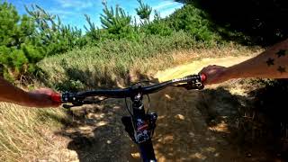
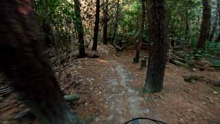
Photos of Tunnel Gully (Pakuratahi Forest) Mountain Bike
trail: Remutaka Rail Trail
25 |
Apr 18, 2022 @ 3:44am
Apr 18, 2022
trail: Taniwha
25 |
Nov 27, 2020 @ 4:47pm
Nov 27, 2020
trail: 2 Bee Line
23 |
Nov 27, 2020 @ 4:36pm
Nov 27, 2020
trail: Half Flow (The Wolf)
21 |
Nov 27, 2020 @ 4:36pm
Nov 27, 2020
trail: Flow K
19 |
Nov 27, 2020 @ 3:28pm
Nov 27, 2020
trail: Flow K
17 |
Nov 27, 2020 @ 3:28pm
Nov 27, 2020
trail: Remutaka Rail Trail
89 |
Nov 13, 2020 @ 6:32pm
Nov 13, 2020
trail: Remutaka Rail Trail
73 |
Nov 13, 2020 @ 6:32pm
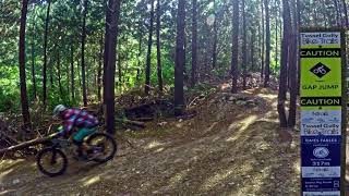
Nov 13, 2020Videos of Tunnel Gully (Pakuratahi Forest) Mountain Bike
youtuber
![Half Flow @ Tunnel Gully. Upper Hutt]()
trail: Half Flow (The Wolf)
2:10 |
7 |
Jul 5, 2022 , Upper Hutt

trail: G-Drop Extension
2:51 |
19 |
Mar 30, 2022 , Upper Hutt

trail: G-Drop
2:51 |
22 |
Mar 30, 2022 , Upper Hutt

trail: Lower Times Tables
4:16 |
16 |
Mar 30, 2022 , Upper Hutt

trail: Upper Times Tables
4:16 |
28 |
Mar 30, 2022 , Upper Hutt
youtuber
![Middle Pig @ Tunnel Gully. Upper Hutt]()

trail: Middle Pig
4:20 |
50 |
Mar 18, 2022 , Upper Hutt
youtuber
![Dirt Surfin' @ Tunnel Gully. Upper Hutt]()
5:38 |
76 |
Nov 16, 2021
youtuber
![Lower Pig Track @ Tunnel Gully. Upper Hutt]()
trail: Lower Pig Track
1:27 |
112 |
Oct 12, 2021 , Upper Hutt
Recent Trail Reports
| status | trail | date | condition | info | user |
|---|---|---|---|---|---|
| Bees 2 Bridge | Jul 5, 2022 @ 1:02am 1 day | Ideal | broadleyresidence | ||
| Station Drive | May 29, 2022 @ 2:41am May 29, 2022 | Wet | wideopennewzealand | ||
| Dela Rosa | May 28, 2022 @ 3:33pm May 28, 2022 | Wet | wideopennewzealand | ||
| Goat Rock | May 28, 2022 @ 3:33pm May 28, 2022 | Wet | wideopennewzealand | ||
| Mangaroa Tunnel | May 28, 2022 @ 3:33pm May 28, 2022 | Wet | wideopennewzealand | ||
| G-Drop Extension | Apr 24, 2022 @ 3:45pm Apr 24, 2022 | Wet | wideopennewzealand | ||
| Station Link - Easy Up | Apr 24, 2022 @ 3:45pm Apr 24, 2022 | Wet | wideopennewzealand | ||
| BeeSwitched | Apr 24, 2022 @ 3:45pm Apr 24, 2022 | Wet | wideopennewzealand | ||
| 250 East Climb | Apr 24, 2022 @ 3:45pm Apr 24, 2022 | Wet | wideopennewzealand | ||
| 250 East DH | Apr 24, 2022 @ 3:45pm Apr 24, 2022 | Wet | wideopennewzealand |
Activity Feed
| username | action | type | title | date | |
|---|---|---|---|---|---|
 | trailforks | add | video | Half Flow @ Tunnel Gully. Upper Hutt | Jul 5, 2022 @ 11:00pm 4 hours |
 | broadleyresidence | add | report | Bees 2 Bridge | Jul 5, 2022 @ 1:02am 1 day |
| broadleyresidence | comment | report | Bees 2 Bridge | Jul 5, 2022 @ 1:00am 1 day |
 | JordanZOPXMp | ridden | trail | Remutaka Rail Trail and 6 more | Jun 27, 2022 @ 5:51pm Jun 27, 2022 |
| Swanndre | ridden | trail | Remutaka Rail Trail | Jun 11, 2022 @ 1:59am Jun 11, 2022 |
Recent Comments
| username | type | title | comment | date | |
|---|---|---|---|---|---|
| report | It’s always wet, it’s a good challenge. | Jul 5, 2022 @ 1:00am 1 day | ||
| trail | Marked as intermediate level trail at trail... | May 6, 2022 @ 8:24pm May 6, 2022 | ||
| report | Wet, and not in a good way | Mar 30, 2022 @ 10:49pm Mar 30, 2022 | ||
| trail | Fastest way up to 250 | Feb 25, 2022 @ 1:48pm Feb 25, 2022 | ||
 | trail | Proper old school mountainbiking, combine with... | Jan 22, 2022 @ 3:06pm Jan 22, 2022 |
Nearby Areas
| name | distance | ||||
|---|---|---|---|---|---|
| Kaitoke Regional Park | 2 | 2 | 2.3 km | ||
| Totara Park | 3 | 4 | 3.4 km | ||
| Akatarawa Forest Park (Upper Hutt) | 1 | 4.1 km | |||
| Featherston | 9.4 km | ||||
| Akatarawa Forest Park (Kapiti Coast) | 3 | 1 | 4 | 9.6 km |
Local Badges
-

Completionist0 awarded
Activity Type Stats
| activitytype | trails | distance | descent | descent distance | total vertical | rating | global rank | state rank | photos | reports | routes | ridelogs |
|---|---|---|---|---|---|---|---|---|---|---|---|---|
| Mountain Bike | 35 | 34 miles | 8,278 ft | 16 miles | 2,490 ft | #1,106 | #50 | 119 | 341 | 11 | 1,703 | |
| E-Bike | 10 | 13 miles | 2,769 ft | 7 miles | 912 ft | #645 | #37 | 236 | 1 | 162 | ||
| Hike | 30 | 33 miles | 7,910 ft | 16 miles | 2,490 ft | #964 | #32 | 315 | 18 | |||
| Trail Running | 30 | 33 miles | 7,910 ft | 16 miles | 2,490 ft | #970 | #32 | 315 | 43 |
- By nikholden BAMBA & contributors
- Admins: Jimmymtbnz, NtrailZ
- #5453 - 24,177 views
- tunnel gully (pakuratahi forest) activity log | embed map of Tunnel Gully (Pakuratahi Forest) mountain bike trails | tunnel gully (pakuratahi forest) mountain biking points of interest
Downloading of trail gps tracks in kml & gpx formats is enabled for Tunnel Gully (Pakuratahi Forest).
You must login to download files.