close
Trail Conditions
- Unknown
- Snow Groomed
- Snow Packed
- Snow Covered
- Snow Cover Inadequate
- Freeze/thaw Cycle
- Icy
- Prevalent Mud
- Wet
- Variable
- Ideal
- Dry
- Very Dry
Trail Flow (Ridden Direction)
Trailforks scans users ridelogs to determine the most popular direction each trail is ridden. A good flowing trail network will have most trails flowing in a single direction according to their intension.
The colour categories are based on what percentage of riders are riding a trail in its intended direction.
The colour categories are based on what percentage of riders are riding a trail in its intended direction.
- > 96%
- > 90%
- > 80%
- > 70%
- > 50%
- < 50%
- bi-directional trail
- no data
Trail Last Ridden
Trailforks scans ridelogs to determine the last time a trail was ridden.
- < 2 days
- < 1 week
- < 2 weeks
- < 1 month
- < 6 months
- > 6 months
Trail Ridden Direction
The intended direction a trail should be ridden.
- Downhill Only
- Downhill Primary
- Both Directions
- Uphill Primary
- Uphill Only
- One Direction
Contribute Details
Colors indicate trail is missing specified detail.
- Description
- Photos
- Description & Photos
- Videos
Trail Popularity ?
Trailforks scans ridelogs to determine which trails are ridden the most in the last 9 months.
Trails are compared with nearby trails in the same city region with a possible 25 colour shades.
Think of this as a heatmap, more rides = more kinetic energy = warmer colors.
- most popular
- popular
- less popular
- not popular
ATV/ORV/OHV Filter
Max Vehicle Width
inches
Radar Time
x
Activity Recordings
Trailforks users anonymized public ridelogs from the past 6 months.
- mountain biking recent
- mountain biking (>6 month)
- hiking (1 year)
- moto (1 year)
Activity Recordings
Trailforks users anonymized public skilogs from the past 12 months.
- Downhill Ski
- Backcountry Ski
- Nordic Ski
Jump Magnitude Heatmap
Heatmap of where riders jump on trails. Zoom in to see individual jumps, click circles to view jump details.
Trails Deemphasized
Trails are shown in grey.
Only show trails with NO bikes.
Save the current map location and zoom level as your default home location whenever this page is loaded.
Save
No description for Bridger Range has been added yet!
Login or register to submit one.
 google parking directions
Primary Trail Type: Cross-Country
Land Status: National Forest
google parking directions Activities Click to view
- Mountain Bike
48 trails
- E-Bike
26 trails
- Hike
65 trails
- Trail Running
64 trails
- Horse
26 trails
- Dirtbike/Moto
21 trails
- ATV/ORV/OHV
13 trails
Region Details
- 17
- 14
- 13
- 4
Region Status
Caution as of Sep 20, 2020Stats
- Avg Trail Rating
- Trails (view details)
- 65
- Trails Mountain Bike
- 48
- Trails E-Bike
- 26
- Trails Hike
- 65
- Trails Trail Running
- 64
- Trails Horse
- 26
- Trails Dirtbike/Moto
- 21
- Trails Observed Trials
- 8
- Trails ATV/ORV/OHV
- 13
- Trails Snowshoe
- 1
- Trails Backcountry Ski
- 1
- Trails Nordic Ski
- 1
- Total Distance
- 187 miles
- Total Descent
- 38,929 ft
- Total Vertical
- 4,772 ft
- Highest Trailhead
- 9,651 ft
- Reports
- 299
- Photos
- 194
- Ridden Counter
- 3,081
Popular Bridger Range Mountain Biking Trails
Bridger Range Mountain Bike Routes
| title | rating | distance |
|---|---|---|
| Fairyhouse Loop | 9 miles | |
| Western Bridger Traverse | 34 miles | |
| Bridger Crown | 14 miles | |
| Bridger Traverse | 33 miles | |
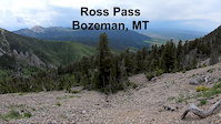
| Big Day Ross Pass and Shafthouse | 20 miles | |
| Truman Lollipop | 4 miles | |
| Ross Pass Loop | 19 miles | |
| race | 11 miles |
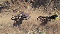
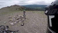
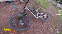
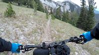
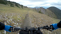
Photos of Bridger Range Mountain Bike
trail: Corbly Gulch
0 |
Jul 5, 2022 @ 1:49pm
13 hours
trail: Corbly Gulch
0 |
Jul 5, 2022 @ 1:48pm
13 hours
trail: Corbly Gulch
11 |
Jun 22, 2022 @ 10:00pm
Jun 22, 2022
trail: Truman Gulch (Upper)
2 |
Jun 6, 2022 @ 8:07am
Jun 6, 2022
trail: Truman Gulch (Upper)
1 |
Jun 6, 2022 @ 8:07am
Jun 6, 2022
trail: Truman Gulch (Upper)
1 |
Jun 6, 2022 @ 8:07am
Jun 6, 2022
trail: Truman Gulch (Upper)
2 |
Jun 6, 2022 @ 8:07am
Jun 6, 2022
trail: Truman Gulch (Upper)
5 |
Jun 6, 2022 @ 8:06am
Jun 6, 2022Videos of Bridger Range Mountain Bike

trail: Sacajawea Summit Trail
1420 |
Jan 3, 2022

trail: Corbly Gulch
91 |
Jul 6, 2021
trail: Johnson Canyon
0:56 |
73 |
Aug 11, 2020
trail: Sypes Canyon
50:51 |
100 |
Jun 29, 2020
1:00 |
156 |
Feb 13, 2020
trail: Sypes Canyon
14:47 |
197 |
May 21, 2019
7:03 |
99 |
Oct 3, 2018
7:35 |
93 |
Oct 3, 2018
Recent Trail Reports
| status | trail | date | condition | info | user |
|---|---|---|---|---|---|
| Shafthouse | Jul 4, 2022 @ 1:50pm 2 days | Ideal | jkerr11 | ||
| Slushman's Return | Jun 30, 2022 @ 8:21am Jun 30, 2022 | Dry | summers8288 | ||
| East Bridger North | Jun 29, 2022 @ 1:17pm Jun 29, 2022 | Ideal | jonbudreski | ||
| Corbly Gulch | Jun 27, 2022 @ 6:56pm Jun 27, 2022 | Dry | Jough | ||
| Truman Gulch | Jun 26, 2022 @ 3:18pm Jun 26, 2022 | Dry | MikeyMT | ||
| Fairy Lake | Jun 23, 2022 @ 2:34pm Jun 23, 2022 | Variable | cbrine | ||
| Bracket Creek Road (South) | Jun 19, 2022 @ 8:40am Jun 19, 2022 | Wet | jeepnphreak | ||
| Truman Gulch (Upper) | Jun 12, 2022 @ 12:30pm Jun 12, 2022 | Variable | MikeyMT | ||
| Bridger Foothills Trail (Sypes to "M") | Jun 11, 2022 @ 10:09am Jun 11, 2022 | Ideal | phess907 | ||
| Johnson Canyon | Jun 10, 2022 @ 6:59am Jun 10, 2022 | Ideal | MTSnail |
Activity Feed
| username | action | type | title | date | |
|---|---|---|---|---|---|
 | Dlloud | add | photo | in My City, Montana, United States and 1 more | Jul 5, 2022 @ 6:16pm 8 hours |
 | greingruber | wishlist | trail | Carrol Creek and 1 more | Jul 5, 2022 @ 5:56pm 9 hours |
| theposko | comment | report | Bracket Creek Road (North) | Jul 4, 2022 @ 4:12pm 1 day |
| Ztondre | comment | report | Bracket Creek Road (North) | Jul 4, 2022 @ 2:22pm 2 days |
| jkerr11 | add | report | Shafthouse | Jul 4, 2022 @ 1:50pm 2 days |
Recent Comments
| username | type | title | comment | date | |
|---|---|---|---|---|---|
| report | @theposko: Thanks for the beta, bummer we... | Jul 4, 2022 @ 4:44pm 1 day | ||
| report | @Ztondre: I'd really love to be wrong about... | Jul 4, 2022 @ 4:12pm 1 day | ||
| report | Did you ever confirm if this road is open or... | Jul 4, 2022 @ 2:22pm 2 days | ||
 | trail | Riding great overall, still a little bit of... | Jul 2, 2022 @ 6:06pm Jul 2, 2022 | ||
| report | Hope this is left. It's rideable both ways and... | Jun 23, 2022 @ 7:24am Jun 23, 2022 |
Nearby Areas
| name | distance | ||||
|---|---|---|---|---|---|
| Crosscut Trail System | 11 | 6 | 1 | 3.9 km | |
| Bangtail Divide | 5 | 6.2 km | |||
| Triangle Trail System | 31 | 2 | 9.9 km | ||
| Moser | 4 | 18 | 1 | 1 | 19.1 km |
| City Trails | 21.5 km |
Local Badges
-

Completionist0 awarded
Local Products
Activity Type Stats
| activitytype | trails | distance | descent | descent distance | total vertical | rating | global rank | state rank | photos | reports | routes | ridelogs |
|---|---|---|---|---|---|---|---|---|---|---|---|---|
| Mountain Bike | 48 | 166 miles | 34,462 ft | 77 miles | 4,035 ft | #2,094 | #1,092 | 194 | 299 | 8 | 1,809 | |
| E-Bike | 26 | 97 miles | 16,362 ft | 40 miles | 3,809 ft | #1,496 | #366 | 220 | 24 | |||
| Hike | 65 | 187 miles | 38,927 ft | 84 miles | 4,774 ft | #1,645 | #967 | 299 | 1 | 754 | ||
| Trail Running | 64 | 186 miles | 38,924 ft | 84 miles | 4,774 ft | #1,649 | #966 | 299 | 1 | 778 | ||
| Horse | 26 | 116 miles | 22,618 ft | 52 miles | 3,809 ft | #98 | #79 | 192 | ||||
| Dirtbike/Moto | 21 | 89 miles | 14,951 ft | 35 miles | 3,809 ft | #46 | #25 | 157 | 9 | |||
| Observed Trials | 8 | 32 miles | 3,307 ft | 11 miles | 2,605 ft | 4 | ||||||
| ATV/ORV/OHV | 13 | 61 miles | 7,680 ft | 23 miles | 2,759 ft | #62 | #34 | 111 | ||||
| Snowshoe | 1 | 6 miles | 72 ft | 2,667 ft | 1,699 ft | 4 | 1 | |||||
| Backcountry Ski | 1 | 6 miles | 72 ft | 2,667 ft | 1,699 ft | 4 | 16 | |||||
| Nordic Ski | 1 | 6 miles | 72 ft | 2,667 ft | 1,699 ft | 4 | 5 |
- By dirtweasel
 & contributors
 - Admins: SWMMBA
- #15051 - 5,701 views
- bridger range activity log | embed map of Bridger Range mountain bike trails | bridger range mountain biking points of interest
Downloading of trail gps tracks in kml & gpx formats is enabled for Bridger Range.
You must login to download files.