4,916 ft
Distance
89 ft
Climb
-412 ft
Descent
00:09:48
Avg time
Beaver Pond Details
-
Activities
- Mountain Bike
- Hike
- Trail Running
-
Riding AreaTokul West
Fall City, Washington -
Difficulty Rating
-
Trail TypeSingletrack
-
DirectionBoth Directions
-
Climb DifficultyBlue
-
SeasonJan-Dec
-
Dogs AllowedYes
-
eBike Allowed
-
Ride in RainYes
-
Global Ranking
-
Local Popularity45 in Mountain Biking [+]
- 95 in Trail Running
- 5 in Hiking
-
Land ManagerHancock Forest Management
No description for Beaver Pond trail has been added yet! Submit one here.
Beaver Pond is a 4,916 ft moderately popular blue singletrack trail located near Fall City Washington. This mountain bike primary trail can be used both directions with a 89 ft blue climb. On average it takes 9 minutes to complete this trail.
Local Trail Association
-

-
Please consider joining or donating to the local trail association to supportdonate to earn trail karma!
trail development & maintenance.
Traditionally Indigenous Territory
More Stats for Beaver Pond mountain bike trail trail
-
Altitude change-323 ft
-
Altitude min293 ft
-
Altitude max632 ft
-
Altitude start617 ft
-
Altitude end293 ft
-
Grade-6.58%
-
Grade max-59.036%
-
Grade min40.977%
-
Distance climb931 ft
-
Distance down3,088 ft
-
Distance flat897 ft
-
Avg time00:09:48
-
Avg reverse time00:15:56
- view trail stats
close
Trail Conditions
- Unknown
- Snow Groomed
- Snow Packed
- Snow Covered
- Snow Cover Inadequate
- Freeze/thaw Cycle
- Icy
- Prevalent Mud
- Wet
- Variable
- Ideal
- Dry
- Very Dry
Trail Flow (Ridden Direction)
Trailforks scans users ridelogs to determine the most popular direction each trail is ridden. A good flowing trail network will have most trails flowing in a single direction according to their intension.
The colour categories are based on what percentage of riders are riding a trail in its intended direction.
The colour categories are based on what percentage of riders are riding a trail in its intended direction.
- > 96%
- > 90%
- > 80%
- > 70%
- > 50%
- < 50%
- bi-directional trail
- no data
Trail Last Ridden
Trailforks scans ridelogs to determine the last time a trail was ridden.
- < 2 days
- < 1 week
- < 2 weeks
- < 1 month
- < 6 months
- > 6 months
Trail Ridden Direction
The intended direction a trail should be ridden.
- Downhill Only
- Downhill Primary
- Both Directions
- Uphill Primary
- Uphill Only
- One Direction
Contribute Details
Colors indicate trail is missing specified detail.
- Description
- Photos
- Description & Photos
- Videos
Trail Popularity ?
Trailforks scans ridelogs to determine which trails are ridden the most in the last 9 months.
Trails are compared with nearby trails in the same city region with a possible 25 colour shades.
Think of this as a heatmap, more rides = more kinetic energy = warmer colors.
- most popular
- popular
- less popular
- not popular
ATV/ORV/OHV Filter
Max Vehicle Width
inches
Radar Time
x
Activity Recordings
Trailforks users anonymized public ridelogs from the past 6 months.
- mountain biking recent
- mountain biking (>6 month)
- hiking (1 year)
- moto (1 year)
Activity Recordings
Trailforks users anonymized public skilogs from the past 12 months.
- Downhill Ski
- Backcountry Ski
- Nordic Ski
Jump Magnitude Heatmap
Heatmap of where riders jump on trails. Zoom in to see individual jumps, click circles to view jump details.
Trails Deemphasized
Trails are shown in grey.
Only show trails with NO bikes.
Save the current map location and zoom level as your default home location whenever this page is loaded.
Save
Directions to beaver-pond-17247 trailhead
(47.585700, -121.879120)
update trails status or condition
Beaver Pond Trail Reports
view all reports »
Recent Ridelog Activity on Trail
Past Week
- 0 rides
6 Months
- 70 rides
- 14 miles avg distance
All
- 920 rides
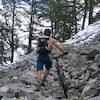
Photos
more »
Routes with this trail
more »
Trail Products
-
+ 0
jakedudek
 (Aug 5, 2021 at 20:39)
Rode in early August ‘21 and this thing was so shitty. Super overgrown. I’m all for some bushwhacking adventure rides but when the blackberry brambles come in to rip you apart, I cry for parking lot beers. Fine way up the hill if it is clear - wander up at your own risk!
[Reply]
BlueBeauty
(Jun 13, 2021 at 17:50)
I rode this today...it was very, very overgrown, someone really needs to go back and trim just about the whole entire upper beaver pond...My arms got very cut up and my friend got a rash...Although I have to say that if it was trimmed and not so wet I would love it! 
[Reply]
 Samspade21
If you like to eat blackberries direct off the bush while riding as the bushes hit you in the face, this is the trail for you.
[Reply]
Karyou
(Jul 22, 2019 at 10:54)
Trail hasn’t been brushed, completely overgrown with blackberries in spots. Trail almost invisible.
[Reply]
Videos
more »
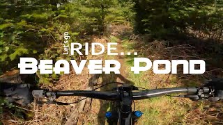
4:09 |
32 |
Mar 25, 2022 , Fall City
Nearby Trails
- Access Road To Upper Beaver Pond 0 ft
- Logjam/beaver Pond Connector Cutoff 0 ft
- Logjam 1,184 ft
- 30300 Rd. 1,686 ft
- Bobsled 1,686 ft
- embed Beaver Pond trail on your website
- By jebike & contributors
- #17247 - 2,713 views
- subscribe
- login to download gpx or kml files.