close
Trail Conditions
- Unknown
- Snow Groomed
- Snow Packed
- Snow Covered
- Snow Cover Inadequate
- Freeze/thaw Cycle
- Icy
- Prevalent Mud
- Wet
- Variable
- Ideal
- Dry
- Very Dry
Trail Flow (Ridden Direction)
Trailforks scans users ridelogs to determine the most popular direction each trail is ridden. A good flowing trail network will have most trails flowing in a single direction according to their intension.
The colour categories are based on what percentage of riders are riding a trail in its intended direction.
The colour categories are based on what percentage of riders are riding a trail in its intended direction.
- > 96%
- > 90%
- > 80%
- > 70%
- > 50%
- < 50%
- bi-directional trail
- no data
Trail Last Ridden
Trailforks scans ridelogs to determine the last time a trail was ridden.
- < 2 days
- < 1 week
- < 2 weeks
- < 1 month
- < 6 months
- > 6 months
Trail Ridden Direction
The intended direction a trail should be ridden.
- Downhill Only
- Downhill Primary
- Both Directions
- Uphill Primary
- Uphill Only
- One Direction
Contribute Details
Colors indicate trail is missing specified detail.
- Description
- Photos
- Description & Photos
- Videos
Trail Popularity ?
Trailforks scans ridelogs to determine which trails are ridden the most in the last 9 months.
Trails are compared with nearby trails in the same city region with a possible 25 colour shades.
Think of this as a heatmap, more rides = more kinetic energy = warmer colors.
- most popular
- popular
- less popular
- not popular
ATV/ORV/OHV Filter
Max Vehicle Width
inches
Radar Time
x
Activity Recordings
Trailforks users anonymized public ridelogs from the past 6 months.
- mountain biking recent
- mountain biking (>6 month)
- hiking (1 year)
- moto (1 year)
Activity Recordings
Trailforks users anonymized public skilogs from the past 12 months.
- Downhill Ski
- Backcountry Ski
- Nordic Ski
Jump Magnitude Heatmap
Heatmap of where riders jump on trails. Zoom in to see individual jumps, click circles to view jump details.
Trails Deemphasized
Trails are shown in grey.
Only show trails with NO bikes.
Save the current map location and zoom level as your default home location whenever this page is loaded.
SaveThis area is owned by a timber company, Campbell Global. Campbell Global allows non-motorized recreation on their trails with the purchase of a recreation permit. Please buy a pass if you ride here. Each person entering the property must have a permit or be listed on a family permit. Permits are available on line and need to be printed out from your own computer. There are an unlimited number of permits available. Annual individual and family permits are $50. Day use permits cost $10 for an individual and $15 for a family. For the purpose of this permit, family is defined as married spouses and their children less than 19 years of age.
Note: E bike's are absolutely not allowed. This is more than just discouraged, you will actively and legally pursued, including the confiscation of E-bikes, no kidding.
All Mountain, Downhill. Tokul drains really well, and thus is a great Winter riding area. Tokul East is more burly than its XC/AM brother, Tokul West. East is noted for its loose, steep and flowy descending trails with a number of optional natural features, and is typically ridden by doing uphill access laps on the fire roads followed by trail descents.
NOTE ON PARKING: Trailhead parking lot at the junction of 356th Ave SE and the SVT (Snoqualmie Valley Trail) just East of Fall City. If you are parking at the 356th lot, be a good steward and respect the no-parking signs and neighbors on 356th. Don't be loud, don't park like a kook (along the street), and be respectful
This parking area is limited, so if the lot is full, or if you have a large crew meeting up (3+ cars), PLEASE PARK at the roundabout at Tokul West by the intersection of 202 and 203 and pedal up SE 39th PL onto the Snoqualmie Valley Trail into East (turn right onto the SVT).
Primary Trail Type: Cross-Country
eBikes Allowed:
No
Land Status: Private Property
Land Manager: Campbell Global Forest and Natural Resource Investments
Disclaimer:
Using Tokul trails without a permit is Trespassing. NO EBIKES ALLOWED. WDFW has permission to confiscate your bike and trespass you for either.
Links
Activities Click to view
- Mountain Bike
49 trails
- Hike
47 trails
- Trail Running
46 trails
Region Details
- 12
- 13
- 12
- 12
Region Status
Caution as of Jun 9, 2022Local Trail Association
Stats
- Avg Trail Rating
- Trails (view details)
- 49
- Trails Mountain Bike
- 49
- Trails Hike
- 47
- Trails Trail Running
- 46
- Trails Horse
- 1
- Total Distance
- 21 miles
- Total Descent
- 5,957 ft
- Total Vertical
- 926 ft
- Highest Trailhead
- 1,015 ft
- Reports
- 1,906
- Photos
- 187
- Ridden Counter
- 26,722
Popular Tokul West Mountain Biking Trails
Tokul West Mountain Bike Routes
| title | rating | distance |
|---|---|---|
| West is the New Black | 5 miles | |
| Brew Crew Climb - Lot to Clearing | 2 miles | |
| TOKUL TOUR | 13 miles | |
| TKW Goods | 8 miles | |
| Easy Tokul West | 6 miles | |
| Tokul West starting route | 8 miles | |
| Tokul Rodeo | 9 miles | |
| Tokul West XC Loop | 7 miles | |
| A Tokul West XC Loop | 8 miles | |
| Tokul Dyna 1 | 10 miles |
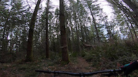
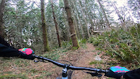
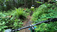
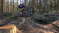
Photos of Tokul West Mountain Bike
trail: Chewy
24 |
Apr 11, 2022 @ 10:11am
Apr 11, 2022
trail: Upper Jerry Springer
15 |
Apr 3, 2022 @ 12:21pm
Apr 3, 2022
trail: Tokyo Drift
545 |
Apr 6, 2019 @ 5:34am
Apr 6, 2019
trail: Poopy D
157 |
Mar 13, 2018 @ 9:17am
Mar 13, 2018
trail: Poopy D
253 |
Mar 13, 2018 @ 9:16am
Mar 13, 2018
trail: Pink Beaver
77 |
Jan 31, 2018 @ 2:38pm
Jan 31, 2018
trail: Pink Beaver
83 |
Jan 31, 2018 @ 2:38pm
Jan 31, 2018
trail: Tokyo Drift
649 |
Oct 26, 2016 @ 11:54am
Oct 26, 2016Videos of Tokul West Mountain Bike

trail: Tokyo Drift
165 |
Apr 23, 2021
trail: Rainier
105 |
Mar 27, 2021
trail: Kamikaze
110 |
Mar 21, 2021
trail: Rainier
5 |
Mar 20, 2021
trail: Tokyo Drift
0:10 |
432 |
Jun 4, 2020
trail: Tokyo Drift
1:00 |
208 |
Feb 19, 2020
trail: Tokyo Drift
0:04 |
321 |
Oct 11, 2019
trail: Tokyo Drift
2:21 |
595 |
Oct 11, 2019
Recent Trail Reports
| status | trail | date | condition | info | user |
|---|---|---|---|---|---|
| Beaver Pond | Jul 4, 2022 @ 10:04am 2 days | Ideal | krau | ||
| Bobsled | Jun 18, 2022 @ 8:12pm Jun 18, 2022 | Ideal | krau | ||
| Upper Jerry Springer | Jun 11, 2022 @ 6:09pm Jun 11, 2022 | Ideal | braydonh | ||
| Bypass | Jun 10, 2022 @ 6:05pm Jun 10, 2022 | Ideal | tfornelius | ||
| Macaroni Pony | Jun 10, 2022 @ 6:04pm Jun 10, 2022 | Ideal | tfornelius | ||
| Tokyo Drift | Jun 10, 2022 @ 6:04pm Jun 10, 2022 | Variable | tfornelius | ||
| Dog Wash | Jun 10, 2022 @ 6:02pm Jun 10, 2022 | Variable | tfornelius | ||
| Jerry Springer | Jun 9, 2022 @ 10:29am Jun 9, 2022 | Ideal | Pmccain | ||
| Rainier | Jun 7, 2022 @ 11:54am Jun 7, 2022 | Ideal | IndianapolisJones | ||
| Kamikaze | Jun 6, 2022 @ 10:51am Jun 6, 2022 | Ideal | IndianapolisJones |
Activity Feed
| username | action | type | title | date | |
|---|---|---|---|---|---|
 | krau | add | report | Beaver Pond | Jul 4, 2022 @ 10:04am 2 days |
 | Dylan4542 | wishlist | route | Tokul West starting route | Jun 26, 2022 @ 7:30am Jun 26, 2022 |
| letsgoskiing | add | report | Beaver Pond | Jun 25, 2022 @ 4:11pm Jun 25, 2022 |
| letsgoskiing | ridden | trail | Beaver Pond | Jun 25, 2022 @ 1:57pm Jun 25, 2022 |
| letsgoskiing | wishlist | region | Tokul West | Jun 25, 2022 @ 10:19am Jun 25, 2022 |
Recent Comments
| username | type | title | comment | date | |
|---|---|---|---|---|---|
| trail | Waste of elevation. Goes pretty straight down... | Jun 19, 2022 @ 2:24pm Jun 19, 2022 | ||
 | report | E bikes are the future | Jun 5, 2022 @ 12:39pm Jun 5, 2022 | ||
| report | We're here we're on E bikes, get used to it. | Jun 4, 2022 @ 8:44am Jun 4, 2022 | ||
| trail | Great trail, can tell it doesn't get ridden... | May 16, 2022 @ 9:05pm May 16, 2022 | ||
| trail | Not passable. | May 6, 2022 @ 7:34am May 6, 2022 |
Nearby Areas
| name | distance | ||||
|---|---|---|---|---|---|
| Tokul East | 7 | 18 | 10 | 2 | 1.7 km |
| Snoqualmie Ridge | 5 | 4.8 km | |||
| Tolt MacDonald Park | 12 | 45 | 4 | 4.9 km | |
| Duthie Hill Mountain Bike Park | 6 | 7 | 6 | 6 | 4.9 km |
| Soaring Eagle Park | 20 | 9 | 5.3 km |
Local Badges
-

Completionist0 awarded
Local Products
Local Trail Supporters
- Bob Bournique
Activity Type Stats
| activitytype | trails | distance | descent | descent distance | total vertical | rating | global rank | state rank | photos | reports | routes | ridelogs |
|---|---|---|---|---|---|---|---|---|---|---|---|---|
| Mountain Bike | 49 | 21 miles | 5,958 ft | 11 miles | 925 ft | #213 | #92 | 187 | 1,906 | 13 | 9,826 | |
| Hike | 47 | 21 miles | 5,558 ft | 10 miles | 925 ft | #145 | #76 | 1,876 | 20 | |||
| Trail Running | 46 | 21 miles | 5,558 ft | 10 miles | 925 ft | #146 | #75 | 1,874 | 156 | |||
| Horse | 1 | 1,047 ft | 43 ft | 59 ft | 610 | 2 |
- By nsteele
 & contributors
 - Admins: mattpatt, bedell99
- #5667 - 27,044 views
- tokul west activity log | embed map of Tokul West mountain bike trails | tokul west mountain biking points of interest
Downloading of trail gps tracks in kml & gpx formats is enabled for Tokul West.
You must login to download files.