close
Trail Conditions
- Unknown
- Snow Groomed
- Snow Packed
- Snow Covered
- Snow Cover Inadequate
- Freeze/thaw Cycle
- Icy
- Prevalent Mud
- Wet
- Variable
- Ideal
- Dry
- Very Dry
Trail Flow (Ridden Direction)
Trailforks scans users ridelogs to determine the most popular direction each trail is ridden. A good flowing trail network will have most trails flowing in a single direction according to their intension.
The colour categories are based on what percentage of riders are riding a trail in its intended direction.
The colour categories are based on what percentage of riders are riding a trail in its intended direction.
- > 96%
- > 90%
- > 80%
- > 70%
- > 50%
- < 50%
- bi-directional trail
- no data
Trail Last Ridden
Trailforks scans ridelogs to determine the last time a trail was ridden.
- < 2 days
- < 1 week
- < 2 weeks
- < 1 month
- < 6 months
- > 6 months
Trail Ridden Direction
The intended direction a trail should be ridden.
- Downhill Only
- Downhill Primary
- Both Directions
- Uphill Primary
- Uphill Only
- One Direction
Contribute Details
Colors indicate trail is missing specified detail.
- Description
- Photos
- Description & Photos
- Videos
Trail Popularity ?
Trailforks scans ridelogs to determine which trails are ridden the most in the last 9 months.
Trails are compared with nearby trails in the same city region with a possible 25 colour shades.
Think of this as a heatmap, more rides = more kinetic energy = warmer colors.
- most popular
- popular
- less popular
- not popular
ATV/ORV/OHV Filter
Max Vehicle Width
inches
Radar Time
x
Activity Recordings
Trailforks users anonymized public ridelogs from the past 6 months.
- mountain biking recent
- mountain biking (>6 month)
- hiking (1 year)
- moto (1 year)
Activity Recordings
Trailforks users anonymized public skilogs from the past 12 months.
- Downhill Ski
- Backcountry Ski
- Nordic Ski
Jump Magnitude Heatmap
Heatmap of where riders jump on trails. Zoom in to see individual jumps, click circles to view jump details.
Trails Deemphasized
Trails are shown in grey.
Only show trails with NO bikes.
Save the current map location and zoom level as your default home location whenever this page is loaded.
Save
No description for Capital Hill has been added yet!
Login or register to submit one.
 google parking directions
Shuttleable: YES
Land Status: National Forest
google parking directions Access Info:
Gravel area at bottom of 2 Mile Rd. immediately North of I-90
Activities Click to view
- Mountain Bike
6 trails
- Hike
6 trails
- Trail Running
6 trails
Region Details
- 1
- 5
Region Status
Caution as of 2 daysStats
- Avg Trail Rating
- Trails (view details)
- 6
- Trails Mountain Bike
- 6
- Trails Hike
- 6
- Trails Trail Running
- 6
- Trails Dirtbike/Moto
- 3
- Total Distance
- 20 miles
- Total Descent
- 4,334 ft
- Total Vertical
- 3,941 ft
- Highest Trailhead
- 6,445 ft
- Reports
- 26
- Photos
- 24
- Ridden Counter
- 83
Popular Capital Hill Mountain Biking Trails
| status | title | difficulty | rating |
|---|---|---|---|
| Jewel Gulch | |||
| Beef Camp | |||
| 2 Mile Road, NF 271, NF 424, NF 2322 | |||
| Capital Hill | |||
| Idaho Centennial Trail | |||
| Evolution |
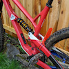
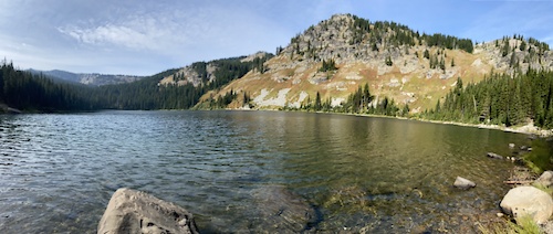
Photos of Capital Hill Mountain Bike
trail: Jewel Gulch
69 |
Jun 17, 2020 @ 6:58pm
Jun 17, 2020
trail: Jewel Gulch
84 |
Jun 17, 2020 @ 6:57pm
Jun 17, 2020
trail: Jewel Gulch
122 |
Jul 17, 2018 @ 4:29pm
Jul 17, 2018
trail: Idaho Centennial Trail
112 |
Oct 4, 2016 @ 9:00pm
Oct 4, 2016
trail: Idaho Centennial Trail
113 |
Oct 4, 2016 @ 9:00pm
Oct 4, 2016
trail: Idaho Centennial Trail
119 |
Oct 4, 2016 @ 9:00pm
Oct 4, 2016Current Trail Warnings
| status | trail | date | condition | user | info |
|---|---|---|---|---|---|
| Capital Hill | Jul 4, 2022 @ 8:57am 2 days | Variable | airschooled | Biked 50%, walked 25%, Tarzan tree... |
Recent Trail Reports
| status | trail | date | condition | info | user |
|---|---|---|---|---|---|
| 2 Mile Road, NF 271, NF 424, NF 2322 | Jun 18, 2022 @ 8:24pm Jun 18, 2022 | Dry | Carlwilke | ||
| Jewel Gulch | Aug 17, 2020 @ 10:05am Aug 17, 2020 | Dry | fletchridesagain | ||
| Evolution | Oct 21, 2018 @ 12:07pm Oct 21, 2018 | Dry | chemistrybiker | ||
| Beef Camp | Jul 26, 2016 @ 2:55pm Jul 26, 2016 | Dry | willygfresh SMR |
Activity Feed
| username | action | type | title | date | |
|---|---|---|---|---|---|
 | johnakrause | ridden | trail | Beef Camp | Jul 5, 2022 @ 10:02pm 4 hours |
| airschooled | add | report | Capital Hill | Jul 4, 2022 @ 8:57am 2 days |
 | eatplasticwater | comment | trail | Jewel Gulch and 1 more | Jun 26, 2022 @ 8:19pm Jun 26, 2022 |
| eatplasticwater | vote | trail | Jewel Gulch | Jun 26, 2022 @ 8:17pm Jun 26, 2022 |
| Carlwilke | add | report | 2 Mile Road, NF 271, NF 424, NF 2322 and 4 more | Jun 18, 2022 @ 8:23pm Jun 18, 2022 |
Recent Comments
| username | type | title | comment | date | |
|---|---|---|---|---|---|
| trail | This is a moto tail. Steep, rutted, loose and... | Jun 26, 2022 @ 8:20pm Jun 26, 2022 | ||
| trail | This is a moto tail. Steep, rutted, loose and... | Jun 26, 2022 @ 8:19pm Jun 26, 2022 | ||
 | trail | i found the description to be somewhat... | Jul 3, 2019 @ 10:00pm Jul 3, 2019 | ||
 | report | 1 tree across trail, loose rock on most steep... | Oct 21, 2018 @ 12:05pm Oct 21, 2018 | ||
| trail | The upper section is dry and rideable.... | May 11, 2018 @ 8:43pm May 11, 2018 |
Nearby Areas
| name | distance | ||||
|---|---|---|---|---|---|
| Graham Mountain | 1 | 4 | 6.7 km | ||
| Silver Mountain Resort | 9 | 16 | 17 | 6 | 7.7 km |
| Lost Creek | 1 | 14 km | |||
| Lookout Pass Bike Park | 3 | 4 | 14.8 km | ||
| St. Joe River | 5 | 2 | 15.5 km |
National Scenic Trails & Official Routes
-
Idaho Centennial Trail
- Mountain Bike
- Hike
- Trail Running
Local Products
Activity Type Stats
| activitytype | trails | distance | descent | descent distance | total vertical | rating | global rank | state rank | photos | reports | routes | ridelogs |
|---|---|---|---|---|---|---|---|---|---|---|---|---|
| Mountain Bike | 6 | 20 miles | 4,334 ft | 8 miles | 3,940 ft | #3,734 | #1,704 | 24 | 26 | 58 | ||
| Hike | 6 | 20 miles | 4,334 ft | 8 miles | 3,940 ft | #3,025 | #1,552 | 26 | 1 | |||
| Trail Running | 6 | 20 miles | 4,334 ft | 8 miles | 3,940 ft | #3,032 | #1,553 | 26 | ||||
| Dirtbike/Moto | 3 | 9 miles | 2,621 ft | 5 miles | 1,991 ft | 16 | 1 |
- By willygfresh SMR & contributors
- Admins: SMR, Silvermt, Silvermtn
- #15493 - 1,706 views
- capital hill activity log | embed map of Capital Hill mountain bike trails | capital hill mountain biking points of interest
Downloading of trail gps tracks in kml & gpx formats is enabled for Capital Hill.
You must login to download files.