close
Trail Conditions
- Unknown
- Snow Groomed
- Snow Packed
- Snow Covered
- Snow Cover Inadequate
- Freeze/thaw Cycle
- Icy
- Prevalent Mud
- Wet
- Variable
- Ideal
- Dry
- Very Dry
Trail Flow (Ridden Direction)
Trailforks scans users ridelogs to determine the most popular direction each trail is ridden. A good flowing trail network will have most trails flowing in a single direction according to their intension.
The colour categories are based on what percentage of riders are riding a trail in its intended direction.
The colour categories are based on what percentage of riders are riding a trail in its intended direction.
- > 96%
- > 90%
- > 80%
- > 70%
- > 50%
- < 50%
- bi-directional trail
- no data
Trail Last Ridden
Trailforks scans ridelogs to determine the last time a trail was ridden.
- < 2 days
- < 1 week
- < 2 weeks
- < 1 month
- < 6 months
- > 6 months
Trail Ridden Direction
The intended direction a trail should be ridden.
- Downhill Only
- Downhill Primary
- Both Directions
- Uphill Primary
- Uphill Only
- One Direction
Contribute Details
Colors indicate trail is missing specified detail.
- Description
- Photos
- Description & Photos
- Videos
Trail Popularity ?
Trailforks scans ridelogs to determine which trails are ridden the most in the last 9 months.
Trails are compared with nearby trails in the same city region with a possible 25 colour shades.
Think of this as a heatmap, more rides = more kinetic energy = warmer colors.
- most popular
- popular
- less popular
- not popular
ATV/ORV/OHV Filter
Max Vehicle Width
inches
Radar Time
x
Activity Recordings
Trailforks users anonymized public ridelogs from the past 6 months.
- mountain biking recent
- mountain biking (>6 month)
- hiking (1 year)
- moto (1 year)
Activity Recordings
Trailforks users anonymized public skilogs from the past 12 months.
- Downhill Ski
- Backcountry Ski
- Nordic Ski
Jump Magnitude Heatmap
Heatmap of where riders jump on trails. Zoom in to see individual jumps, click circles to view jump details.
Trails Deemphasized
Trails are shown in grey.
Only show trails with NO bikes.
Save the current map location and zoom level as your default home location whenever this page is loaded.
Save
No description for Northern Gallatin Range has been added yet!
Login or register to submit one.
 google parking directions
Primary Trail Type: All-Mountain & Downhill
Land Status: National Forest
google parking directions Activities Click to view
- Mountain Bike
111 trails
- E-Bike
46 trails
- Hike
112 trails
- Trail Running
113 trails
- Horse
37 trails
- Dirtbike/Moto
44 trails
- ATV/ORV/OHV
31 trails
- Snowshoe
15 trails
- Backcountry Ski
17 trails
Region Details
- 29
- 18
- 35
- 26
- 3
Region Status
Caution as of Jun 9, 2022Stats
- Avg Trail Rating
- Trails (view details)
- 115
- Trails Mountain Bike
- 111
- Trails E-Bike
- 46
- Trails Hike
- 112
- Trails Trail Running
- 113
- Trails Horse
- 37
- Trails Dirtbike/Moto
- 44
- Trails ATV/ORV/OHV
- 31
- Trails Snowmobile
- 12
- Trails Snowshoe
- 15
- Trails Backcountry Ski
- 17
- Trails Nordic Ski
- 2
- Total Distance
- 329 miles
- Total Descent
- 38,281 ft
- Total Vertical
- 4,935 ft
- Highest Trailhead
- 10,207 ft
- Reports
- 553
- Photos
- 312
- Ridden Counter
- 10,280
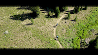
Popular Northern Gallatin Range Mountain Biking Trails
Northern Gallatin Range Mountain Bike Routes
| title | rating | distance |
|---|---|---|
| Blackmore to South Cottonwood | 17 miles | |
| Fox to S. Cottonwood | 13 miles | |
| DT BZN > Sourdough > History > South Cottonwood | 45 miles | |
| South Cottonwood Lollipop | 27 miles | |
| Triple Crown of Bozeman | 68 miles | |
| Trail Creek Loop | 13 miles | |
| Shooutout Park Loop | 13 miles | |
| Bear Canyon - Mystical Bear - New World Gulch | 16 miles | |
| Bogart > History > Blackmore > Wheeler > Bogart | 57 miles | |
| The Gallatin Trail, Montana | 112 miles |
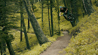
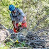
Photos of Northern Gallatin Range Mountain Bike
trail: Wheeler Gulch Trail
2 |
Jul 5, 2022 @ 10:25am
16 hours
trail: South Cottonwood (Lower)
10 |
Jun 20, 2022 @ 1:30pm
Jun 20, 2022
trail: Leverich Canyon
10 |
Jun 3, 2022 @ 3:27pm
Jun 3, 2022
trail: History Rock
37 |
Oct 3, 2021 @ 7:44pm
Oct 3, 2021
trail: Mt. Blackmore
139 |
Oct 7, 2020 @ 2:08pm
Oct 7, 2020Videos of Northern Gallatin Range Mountain Bike

trail: Wheeler Gulch Trail
110 |
Aug 26, 2021
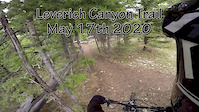
trail: Leverich Canyon
1:00 |
8112 |
Jul 8, 2020
trail: Emerald Lake
1:00 |
251 |
Jul 7, 2020
trail: Leverich Canyon
10:35 |
284 |
May 18, 2020
trail: Wheeler Gulch Trail
0:06 |
|
Mar 20, 2020
trail: Emerald Lake
10:17 |
57 |
Dec 12, 2019
trail: Emerald Lake
0:45 |
84 |
Dec 12, 2019
trail: Wall of Death
1:00 |
184 |
Jun 14, 2019
Current Trail Warnings
| status | trail | date | condition | user | info |
|---|---|---|---|---|---|
| Upper Wildhorse (South) | Jul 5, 2022 @ 7:10am 19 hours | Prevalent Mud | ShredNepo0617 | Rode top to bottom on the lick horse... | |
| Shootout Park Mystical Bear Road | Jun 19, 2022 @ 6:01am Jun 19, 2022 | Dry | MattRothschillerWqC | Snow pack for ~1/4 mile at and above... | |
| Moser Creek Road | Jun 9, 2022 @ 12:50pm Jun 9, 2022 | Wet | kfizzlemynizzle | Very soft, lots of running water from... |
Recent Trail Reports
| status | trail | date | condition | info | user |
|---|---|---|---|---|---|
| Lick-Horse | Jul 5, 2022 @ 7:08am 19 hours | Wet | ShredNepo0617 | ||
| Shootout Park Meadow Trail | Jul 2, 2022 @ 6:00pm Jul 2, 2022 | Variable | delmue | ||
| Fox Creek | Jul 2, 2022 @ 2:33pm Jul 2, 2022 | Ideal | dcornesjr | ||
| History Rock | Jul 2, 2022 @ 2:13pm Jul 2, 2022 | Ideal | livefreerdie SWMMBA | ||
| Upper Wildhorse (North) | Jul 1, 2022 @ 8:00pm Jul 1, 2022 | Dry | Mmiles | ||
| Yellow Sign Trail (Moser to Wildhorse) | Jul 1, 2022 @ 7:57pm Jul 1, 2022 | Dry | Mmiles | ||
| South Cottonwood (Lower) | Jun 29, 2022 @ 7:46pm Jun 29, 2022 | Ideal | Jough | ||
| Leverich Canyon | Jun 29, 2022 @ 9:30am Jun 29, 2022 | Dry | dadbod420 | ||
| Wheeler Gulch Trail | Jun 25, 2022 @ 6:08pm Jun 25, 2022 | Ideal | Wpshanahan | ||
| Mystical Bear | Jun 24, 2022 @ 10:00pm Jun 24, 2022 | Variable | UTj7piVU |
Activity Feed
| username | action | type | title | date | |
|---|---|---|---|---|---|
 | halb | ridden | trail | Leverich Canyon | Jul 5, 2022 @ 7:24pm 7 hours |
| greingruber | wishlist | trail | Wheeler Gulch Trail and 2 more | Jul 5, 2022 @ 5:53pm 9 hours |
| MT-HRO | wishlist | route | Bear Canyon - Mystical Bear - New World Gulch | Jul 5, 2022 @ 3:03pm 11 hours |
 | mumumumu | add | photo | in Bozeman, Montana, United States | Jul 5, 2022 @ 10:26am 16 hours |
| derektice | ridden | trail | Chestnut Mountain Trail and 1 more | Jul 5, 2022 @ 8:16am 18 hours |
Recent Comments
| username | type | title | comment | date | |
|---|---|---|---|---|---|
| trail | This is the Lick Creek Trail. People who... | Jul 2, 2022 @ 12:38pm Jul 2, 2022 | ||
| trail | Not sure why this trail is marked “no” for... | Jul 2, 2022 @ 12:36pm Jul 2, 2022 | ||
| trail | Not sure why this trail is marked “no” for... | Jul 2, 2022 @ 12:34pm Jul 2, 2022 | ||
 | report | Thanks for the report, but you marked this as... | Jun 29, 2022 @ 11:56am Jun 29, 2022 | ||
| report | Just water, not hot :) | Jun 27, 2022 @ 4:44pm Jun 27, 2022 |
Nearby Areas
| name | distance | ||||
|---|---|---|---|---|---|
| Moser | 4 | 18 | 1 | 1 | 7.9 km |
| Paradise Valley | 1 | 2 | 3 | 13.6 km | |
| Southern Gallatin Range | 4 | 15 | 8 | 18.7 km | |
| Triangle Trail System | 31 | 2 | 19.3 km | ||
| Big Sky Community Trail System | 12 | 14 | 1 | 20.3 km |
Local Badges
-

Completionist0 awarded
Local Products
Activity Type Stats
| activitytype | trails | distance | descent | descent distance | total vertical | rating | global rank | state rank | photos | reports | routes | ridelogs |
|---|---|---|---|---|---|---|---|---|---|---|---|---|
| Mountain Bike | 111 | 324 miles | 38,179 ft | 111 miles | 4,862 ft | #1,078 | #568 | 303 | 549 | 13 | 12,801 | |
| E-Bike | 46 | 177 miles | 17,812 ft | 63 miles | 4,498 ft | #2,046 | #473 | 317 | 41 | |||
| Hike | 112 | 316 miles | 36,266 ft | 104 miles | 4,934 ft | #805 | #490 | 8 | 548 | 6 | 460 | |
| Trail Running | 113 | 316 miles | 36,266 ft | 104 miles | 4,934 ft | #805 | #485 | 1 | 548 | 5 | 506 | |
| Horse | 37 | 158 miles | 13,022 ft | 50 miles | 4,531 ft | #77 | #63 | 257 | 4 | |||
| Dirtbike/Moto | 44 | 172 miles | 17,316 ft | 61 miles | 4,498 ft | #111 | #70 | 176 | 13 | |||
| ATV/ORV/OHV | 31 | 133 miles | 11,450 ft | 45 miles | 3,809 ft | #58 | #32 | 167 | ||||
| Snowmobile | 12 | 63 miles | 3,973 ft | 21 miles | 2,677 ft | 3 | 1 | |||||
| Snowshoe | 15 | 73 miles | 5,463 ft | 26 miles | 2,864 ft | #313 | #174 | 53 | 6 | |||
| Backcountry Ski | 17 | 81 miles | 5,548 ft | 26 miles | 4,728 ft | #50 | #25 | 57 | 51 | |||
| Nordic Ski | 2 | 6 miles | 594 ft | 4 miles | 384 ft | 4 | 85 |
- By dirtweasel
 & contributors
 - Admins: apply
- #15038 - 6,127 views
- northern gallatin range activity log | embed map of Northern Gallatin Range mountain bike trails | northern gallatin range mountain biking points of interest
Downloading of trail gps tracks in kml & gpx formats is enabled for Northern Gallatin Range.
You must login to download files.