close
Trail Conditions
- Unknown
- Snow Groomed
- Snow Packed
- Snow Covered
- Snow Cover Inadequate
- Freeze/thaw Cycle
- Icy
- Prevalent Mud
- Wet
- Variable
- Ideal
- Dry
- Very Dry
Trail Flow (Ridden Direction)
Trailforks scans users ridelogs to determine the most popular direction each trail is ridden. A good flowing trail network will have most trails flowing in a single direction according to their intension.
The colour categories are based on what percentage of riders are riding a trail in its intended direction.
The colour categories are based on what percentage of riders are riding a trail in its intended direction.
- > 96%
- > 90%
- > 80%
- > 70%
- > 50%
- < 50%
- bi-directional trail
- no data
Trail Last Ridden
Trailforks scans ridelogs to determine the last time a trail was ridden.
- < 2 days
- < 1 week
- < 2 weeks
- < 1 month
- < 6 months
- > 6 months
Trail Ridden Direction
The intended direction a trail should be ridden.
- Downhill Only
- Downhill Primary
- Both Directions
- Uphill Primary
- Uphill Only
- One Direction
Contribute Details
Colors indicate trail is missing specified detail.
- Description
- Photos
- Description & Photos
- Videos
Trail Popularity ?
Trailforks scans ridelogs to determine which trails are ridden the most in the last 9 months.
Trails are compared with nearby trails in the same city region with a possible 25 colour shades.
Think of this as a heatmap, more rides = more kinetic energy = warmer colors.
- most popular
- popular
- less popular
- not popular
ATV/ORV/OHV Filter
Max Vehicle Width
inches
Radar Time
x
Activity Recordings
Trailforks users anonymized public ridelogs from the past 6 months.
- mountain biking recent
- mountain biking (>6 month)
- hiking (1 year)
- moto (1 year)
Activity Recordings
Trailforks users anonymized public skilogs from the past 12 months.
- Downhill Ski
- Backcountry Ski
- Nordic Ski
Jump Magnitude Heatmap
Heatmap of where riders jump on trails. Zoom in to see individual jumps, click circles to view jump details.
Trails Deemphasized
Trails are shown in grey.
Only show trails with NO bikes.
Save the current map location and zoom level as your default home location whenever this page is loaded.
SavePopular Trail Networks
view all areas »
No description for Netherlands has been added yet!
Login or register to submit one.
This region uses the Uk/Euro style trail grading system.
Stats
- Avg Trail Rating
- Trails (view details)
- 706
- Trails Mountain Bike
- 709
- Trails E-Bike
- 186
- Trails Hike
- 365
- Trails Trail Running
- 365
- Trails Horse
- 1
- Total Distance
- 804 miles
- Total Descent
- 38,753 ft
- Total Vertical
- 1,037 ft
- Highest Trailhead
- 1,037 ft
- Reports
- 3,676
- Photos
- 1,973
- Ridden Counter
- 94,549
Sub Regions
- Drenthe (17)
- Flevoland (1)
- Emmeloord (1)
- Emmeloord (1)
- Fryslân (3)
- Drachten (1)
- Drachten (1)
- Gelderland (0)
- Groningen (0)
- Kroondomein (0)
- Limburg (62)
- North Brabant (50)
- Bergen op Zoom (4)
- Best (2)
- Bladel (7)
- Boekel (1)
- Boxmeer (2)
- Breda (3)
- Drunen (2)
- Eersel (1)
- Heeze-Leende (4)
- Helmond (2)
- Hoogerheide (3)
- Nuenen (1)
- oosterhout (6)
- Oss (1)
- Tilburg (3)
- Waalre (7)
- Bergen op Zoom (4)
- North Holland (102)
- Texel (26)
- Den Burg (14)
- Amsterdam (4)
- Haarlem (5)
- Heerhugowaard (2)
- Langedijk (24)
- Schoorl (29)
- Velsen-Zuid (1)
- Wieringerwerf (10)
- Texel (26)
- Overijssel (95)
- Almelo (2)
- Haaksbergen (72)
- Hellendoorn (2)
- Lemele (1)
- Lochem (8)
- Rijssen (9)
- Vasse (0)
- Almelo (2)
- Rotterdam Rijnmond (1)
- South Holland (25)
- Bergschenhoek (1)
- Den Haag (1)
- Katwijk (1)
- Noordwijk (16)
- Oostvoorne (1)
- Rozenburg (1)
- Spijkenisse (1)
- Vlaardingen (2)
- Zoetermeer (1)
- Bergschenhoek (1)
- Utrecht (105)
- Amersfoort (9)
- Lage Vuursche (14)
- Soest (1)
- Zeist (5)
- Amersfoort (9)
- Zeeland (5)
- Burgh-haamstede (1)
- Terneuzen (3)
- Wolphaartsdijk (1)
- Burgh-haamstede (1)
- Gelderland (1)
- Almere (11)
- Amerongen (1)
- Apeldoorn (1)
- Arnhem (1)
- Ede (80)
- Ermelo (32)
- Groesbeek (3)
- Groningen (11)
- Harderwijk (17)
- Leersum (2)
- Nijmegen (3)
- Oldenzaal (3)
- Rheden (20)
- Valkenswaard (1)
- Wageningen (1)
- wijchen (2)
- Winterswijk (1)
Popular Netherlands Mountain Biking Trails
| status | title | difficulty | rating |
|---|---|---|---|
| Amerongen Amerongen | |||
| Amerongen to Leersum Utrechtse Heuvelrug | |||
| Leersum Leersum | |||
| Traumatrail Nijmegen | |||
| Zeist Zeist | |||
| Rhenen Utrechtse Heuvelrug | |||
| Onbekend Naam Lage Vuursche | |||
| Easy Difficult Schoorl | |||
| Access Road Lage Vuursche | |||
| Koninginneduin Schoorlse Duinen | |||
| Bokkenweide Schoorlse Duinen | |||
| lage vuursche Lage Vuursche | |||
| Wortelklim Schoorlse Duinen | |||
| Hoog Schoorlse Duinen | |||
| Paardenweide Schoorlse Duinen |
Netherlands Mountain Bike Routes
| title | rating | distance |
|---|---|---|
| Schoorl | 9 miles | |
| Amerongen Amerongen | 11 miles | |
| Nijmegen - Groesbeek Route (Purple) Nijmegen | 9 miles | |
| Waalre - Aalsterhut Waalre | 6 miles | |
| Geestmerambacht Geestmerambacht | 5 miles | |
| MTBroute Harderwijk 514 (c) MTBroutes.n Harderwijk | 13 miles | |
| Lunteren 3.0 Ede | 19 miles | |
| MTBUH-route-LageVuursche Lage Vuursche | 7 miles | |
| MTB Route - Gulpen Gulpen | 16 miles | |
| Waalre - Oude Spoorbaan Waalre | 8 miles |
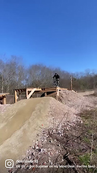
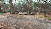
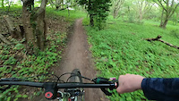
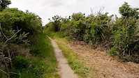
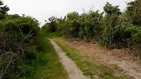
Photos of Netherlands Mountain Bike
trail: Drunen
25 |
Jun 26, 2022 @ 11:16am
Jun 26, 2022
trail: Drunen
16 |
Jun 26, 2022 @ 11:15am
Jun 26, 2022
trail: Drunen
7 |
Jun 26, 2022 @ 11:15am
Jun 26, 2022
trail: Drunen
5 |
Jun 26, 2022 @ 11:15am
Jun 26, 2022
trail: Drunen
2 |
Jun 26, 2022 @ 11:15am
Jun 26, 2022
trail: Drunen
2 |
Jun 26, 2022 @ 11:14am
Jun 26, 2022
trail: Drunen
3 |
Jun 26, 2022 @ 11:14am
Jun 26, 2022
trail: Drunen
5 |
Jun 26, 2022 @ 11:14am
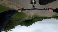
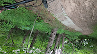
Jun 26, 2022Videos of Netherlands Mountain Bike

72 |
Jun 19, 2022
trail: Bikepark Mook Black Line
77 |
Feb 24, 2022
|
Jan 5, 2022
trail: Oostvoorne
21 |
Jun 5, 2021
trail: Oostvoorne
17 |
Jun 5, 2021
trail: Oostvoorne
80 |
Jun 5, 2021
trail: Oostvoorne
20 |
May 27, 2021
trail: Oostvoorne
16 |
May 27, 2021
Current Trail Warnings
| status | trail | date | condition | user | info |
|---|---|---|---|---|---|
| Naar 150KV Ermelo | Jun 16, 2022 @ 4:50am Jun 16, 2022 | Dry | HorstF |
Recent Trail Reports
| status | trail | date | condition | info | user |
|---|---|---|---|---|---|
| MTB route ede 2.0 Ede | Jul 5, 2022 @ 5:48am 20 hours | Dry | GertMtb | ||
| Singletrack Knoefweg MTB Route Haaksbergen | Jul 3, 2022 @ 1:19am Jul 3, 2022 | Ideal | Knagie | ||
| Verbindingsstuk Knoefweg - Langenbergweg MTB Route Haaksbergen | Jul 3, 2022 @ 1:19am Jul 3, 2022 | Ideal | Knagie | ||
| MTBroute Harderwijk Harderwijk | Jul 2, 2022 @ 11:41pm Jul 2, 2022 | Dry | Pierewaaier | ||
| MTBroute Harderwijk Harderwijk | Jul 2, 2022 @ 11:41pm Jul 2, 2022 | Ideal | Pierewaaier | ||
| MTBroute Harderwijk Harderwijk | Jul 2, 2022 @ 11:41pm Jul 2, 2022 | Ideal | Pierewaaier | ||
| MTBroute Harderwijk Harderwijk | Jul 2, 2022 @ 11:41pm Jul 2, 2022 | Ideal | Pierewaaier | ||
| MTBroute Harderwijk Harderwijk | Jul 2, 2022 @ 11:41pm Jul 2, 2022 | Ideal | Pierewaaier | ||
| MTBroute Harderwijk Harderwijk | Jul 2, 2022 @ 11:41pm Jul 2, 2022 | Dry | Pierewaaier | ||
| MTBroute Harderwijk Harderwijk | Jul 2, 2022 @ 11:41pm Jul 2, 2022 | Ideal | Pierewaaier |
Recent Comments
| username | type | title | comment | date | |
|---|---|---|---|---|---|
 | report | Ok | Jul 5, 2022 @ 12:04am 1 day | ||
| trail | Welke features kun je hier vinden ? | Jun 24, 2022 @ 10:14am Jun 24, 2022 | ||
| trail | The trail maintainer doesn't want this trail... | Jun 22, 2022 @ 9:01am Jun 22, 2022 | ||
| trail | The trail is completely renovated. With new... | Jun 12, 2022 @ 2:51pm Jun 12, 2022 | ||
| trail | Dit hoort geen rood te zijn | Apr 23, 2022 @ 12:45pm Apr 23, 2022 |
Bike & Skill Parks
| name | type | city | rating |
|---|---|---|---|
| Bikepark Apeldoorn | skill park | Apeldoorn | |
| Bikepark Bommelerwaard | skill park | Zaltbommel | |
| Bikepark Groningen | skill park | Groningen | |
| Bikepark Harderwijk | skill park | Harderwijk | |
| Bikepark Hendrik | skill park | Brunssum |
Activity Type Stats
| activitytype | trails | distance | descent | descent distance | total vertical | rating | global rank | state rank | photos | reports | routes | ridelogs |
|---|---|---|---|---|---|---|---|---|---|---|---|---|
| Mountain Bike | 707 | 804 miles | 38,750 ft | 280 miles | 1,037 ft | #16 | 1,969 | 3,682 | 221 | 250,182 | ||
| E-Bike | 186 | 151 miles | 9,344 ft | 57 miles | 1,037 ft | #20 | 4 | 3,245 | 33 | 4,425 | ||
| Hike | 365 | 435 miles | 19,265 ft | 156 miles | 1,037 ft | #25 | 3,419 | 2 | 4,263 | |||
| Trail Running | 365 | 434 miles | 19,268 ft | 156 miles | 1,037 ft | #25 | 3,419 | 858 | ||||
| Horse | 1 | 5,095 ft | 7 ft | 571 ft | 16 ft | #31 | 408 | 1 |
- By dleidelmeijer
 & contributors
 - Admins: apply
- #3131 - 33,882 views
- netherlands activity log | embed map of Netherlands mountain bike trails | netherlands mountain biking points of interest polygons
-
- subscribe
- 3d map
Downloading of trail gps tracks in kml & gpx formats is enabled for Netherlands.
You must login to download files.