4,045 ft
Distance
13 ft
Climb
-498 ft
Descent
00:06:25
Avg time
Supporters, Builders, Maintainers & Land Managers of Pseudo-Tsuga - Part 3 Trail

Smith Optics
since 2020Sponsor
Dream WizardsMaintainer
Dream WizardsBuilder
Details
-
Activities
- Mountain Bike
- E-Bike
-
Riding AreaDiamond Head
Squamish, British Columbia -
Difficulty Rating
-
Trail TypeMachine Groomed
-
Bike TypeDH, AM, XC
-
DirectionDownhill OnlyPopular direction shown
-
Dogs AllowedYes
-
eBike AllowedYes up to Class 1
-
TTFs on TrailBerm, Jump
-
Ride in RainYes
-
Global Ranking
-
Local Popularity100 in Mountain Biking [+]
- 100 in E-Biking
A continuation of Pseudo-Tsuga - Part 1 and Pseudo-Tsuga - Part 2, featuring a few small rollable jumps, a scenic bridge to check out a waterfall, and finishes with a high-speed roller coaster of a section featuring the best berms of the entire trail.
Takes riders down to the lower Diamond Head parking lot. There's a reason why that parking lot is generally referred to as the Pseudo lot - the trail takes riders right there.
Access Info
Pseudo-Tsuga - Part 2
Local Trail Association
-

-

-
Please consider joining or donating to the local trail association to supportdonate to earn trail karma!
trail development & maintenance.
Traditionally Indigenous Territory
More Stats for Pseudo-Tsuga - Part 3 mountain bike trail trail
-
Altitude change-485 ft
-
Altitude min688 ft
-
Altitude max1,173 ft
-
Altitude start1,173 ft
-
Altitude end689 ft
-
Grade-12%
-
Grade max-61.1%
-
Grade min5%
-
Distance climb407 ft
-
Distance down3,547 ft
-
Distance flat92 ft
-
Avg time00:06:25
-
Avg reverse time00:17:57
- view trail stats
close
Trail Conditions
- Unknown
- Snow Groomed
- Snow Packed
- Snow Covered
- Snow Cover Inadequate
- Freeze/thaw Cycle
- Icy
- Prevalent Mud
- Wet
- Variable
- Ideal
- Dry
- Very Dry
Trail Flow (Ridden Direction)
Trailforks scans users ridelogs to determine the most popular direction each trail is ridden. A good flowing trail network will have most trails flowing in a single direction according to their intension.
The colour categories are based on what percentage of riders are riding a trail in its intended direction.
The colour categories are based on what percentage of riders are riding a trail in its intended direction.
- > 96%
- > 90%
- > 80%
- > 70%
- > 50%
- < 50%
- bi-directional trail
- no data
Trail Last Ridden
Trailforks scans ridelogs to determine the last time a trail was ridden.
- < 2 days
- < 1 week
- < 2 weeks
- < 1 month
- < 6 months
- > 6 months
Trail Ridden Direction
The intended direction a trail should be ridden.
- Downhill Only
- Downhill Primary
- Both Directions
- Uphill Primary
- Uphill Only
- One Direction
Contribute Details
Colors indicate trail is missing specified detail.
- Description
- Photos
- Description & Photos
- Videos
Trail Popularity ?
Trailforks scans ridelogs to determine which trails are ridden the most in the last 9 months.
Trails are compared with nearby trails in the same city region with a possible 25 colour shades.
Think of this as a heatmap, more rides = more kinetic energy = warmer colors.
- most popular
- popular
- less popular
- not popular
ATV/ORV/OHV Filter
Max Vehicle Width
inches
Radar Time
x
Activity Recordings
Trailforks users anonymized public ridelogs from the past 6 months.
- mountain biking recent
- mountain biking (>6 month)
- hiking (1 year)
- moto (1 year)
Activity Recordings
Trailforks users anonymized public skilogs from the past 12 months.
- Downhill Ski
- Backcountry Ski
- Nordic Ski
Jump Magnitude Heatmap
Heatmap of where riders jump on trails. Zoom in to see individual jumps, click circles to view jump details.
Trails Deemphasized
Trails are shown in grey.
Only show trails with NO bikes.
Save the current map location and zoom level as your default home location whenever this page is loaded.
Save
Directions to pseudotsuga-part-3 trailhead
(49.744280, -123.082810)
update trails status or condition
Pseudo-Tsuga -... Trail Reports
view all reports »
Recent Ridelog Activity on Trail
Past Week
- 210 rides
- 10 miles avg distance
6 Months
- 3,405 rides
- 11 miles avg distance
All
- 22,462 rides

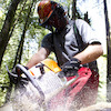
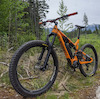
Photos
more »
Trail Lists
-
bms
28 trails
-
Squamish Diamond Head
17 trails
Routes with this trail
more »
Trail Events
Trail Products
-
 SORCA Trail SupporterTrail Pass
-
+ 0
 sully24
Is this closed right now?
[Reply]
ttrrr21
 (Aug 22, 2020 at 17:54)
Berms are well built and flowy and trail is super smooth. Would like to see some more jumps
[Reply]
aaric08
(Nov 2, 2019 at 17:58)
So much flow in these berms. Amazing work trail crews! Thanks for all your hard work.
[Reply]
tmorto
(May 21, 2019 at 15:55)
Just epic fun! Those berms keep you on your toes and give you an ear to ear grin!
[Reply]
moxiematt
(Dec 7, 2018 at 8:21)
Man, they knocked the new berms out of the park. Nice job trail crew!
[Reply]
 disruptiveone
Trail is awesome. Some few blown out bits on berms near the top. Donate to SORCA if you're riding here is it helps fund these awesome trails. Thanks builders for awesome times.
[Reply]
Videos
more »

18:24 |
115 |
Aug 27, 2021 , Squamish

7:08 |
255 |
Jul 25, 2021 , Squamish

7:35 |
174 |
Jun 3, 2021 , Squamish

9:19 |
317 |
Aug 10, 2020 , Squamish
Nearby Trails
- Whet Yer Blade 961 ft
- Flat Alley 1,010 ft
- Throwdown 1,194 ft
- Phil & Cam's 1,194 ft
- Brodown 1,450 ft
- embed Pseudo-Tsuga - Part 3 trail on your website
- By brenthillier NSMBA TRAILFORKS & contributors
- #5159 - 18,310 views
- subscribe
- login to download gpx or kml files.