close
Trail Conditions
- Unknown
- Snow Groomed
- Snow Packed
- Snow Covered
- Snow Cover Inadequate
- Freeze/thaw Cycle
- Icy
- Prevalent Mud
- Wet
- Variable
- Ideal
- Dry
- Very Dry
Trail Flow (Ridden Direction)
Trailforks scans users ridelogs to determine the most popular direction each trail is ridden. A good flowing trail network will have most trails flowing in a single direction according to their intension.
The colour categories are based on what percentage of riders are riding a trail in its intended direction.
The colour categories are based on what percentage of riders are riding a trail in its intended direction.
- > 96%
- > 90%
- > 80%
- > 70%
- > 50%
- < 50%
- bi-directional trail
- no data
Trail Last Ridden
Trailforks scans ridelogs to determine the last time a trail was ridden.
- < 2 days
- < 1 week
- < 2 weeks
- < 1 month
- < 6 months
- > 6 months
Trail Ridden Direction
The intended direction a trail should be ridden.
- Downhill Only
- Downhill Primary
- Both Directions
- Uphill Primary
- Uphill Only
- One Direction
Contribute Details
Colors indicate trail is missing specified detail.
- Description
- Photos
- Description & Photos
- Videos
Trail Popularity ?
Trailforks scans ridelogs to determine which trails are ridden the most in the last 9 months.
Trails are compared with nearby trails in the same city region with a possible 25 colour shades.
Think of this as a heatmap, more rides = more kinetic energy = warmer colors.
- most popular
- popular
- less popular
- not popular
ATV/ORV/OHV Filter
Max Vehicle Width
inches
Radar Time
x
Activity Recordings
Trailforks users anonymized public ridelogs from the past 6 months.
- mountain biking recent
- mountain biking (>6 month)
- hiking (1 year)
- moto (1 year)
Activity Recordings
Trailforks users anonymized public skilogs from the past 12 months.
- Downhill Ski
- Backcountry Ski
- Nordic Ski
Jump Magnitude Heatmap
Heatmap of where riders jump on trails. Zoom in to see individual jumps, click circles to view jump details.
Trails Deemphasized
Trails are shown in grey.
Only show trails with NO bikes.
Save the current map location and zoom level as your default home location whenever this page is loaded.
SaveA series of multi use forest service trails connected by Logging roads west of the Flathead Valley
Primary Trail Type: Cross-Country
Land Status: National Forest
 google parking directions
 Activities Click to view
- Mountain Bike
37 trails
- Hike
37 trails
- Trail Running
37 trails
Region Details
- 9
- 1
- 21
- 5
- 1
Region Status
Caution as of May 14, 2022Stats
- Avg Trail Rating
- Trails (view details)
- 37
- Trails Mountain Bike
- 37
- Trails E-Bike
- 4
- Trails Hike
- 37
- Trails Trail Running
- 37
- Trails Dirtbike/Moto
- 5
- Total Distance
- 121 miles
- Total Descent
- 24,134 ft
- Total Vertical
- 3,265 ft
- Highest Trailhead
- 6,313 ft
- Reports
- 130
- Photos
- 122
- Ridden Counter
- 971
Popular Tally Lake Area Mountain Biking Trails
Tally Lake Area Mountain Bike Routes
| title | rating | distance |
|---|---|---|
| Tally Lake Overlook | 15 miles | |
| Tally Overlook loop | 10 miles | |
| Freehub Magazine: Reid Divide | 10 miles | |
| Ingalls to 480 | 14 miles | |
| 21 mile Tally Lake Area Ride | popular ridelog | 21 miles |
| 9 mile Tally Lake Area All-Mountain Ride | popular ridelog | 9 miles |
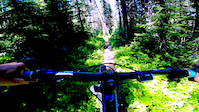
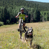
Photos of Tally Lake Area Mountain Bike
trail: TR 163
14 |
Jun 1, 2021 @ 2:52pm
Jun 1, 2021
trail: TR 163
12 |
May 28, 2021 @ 4:57pm
May 28, 2021
trail: Reid Divide
94 |
Jul 12, 2020 @ 8:11pm
Jul 12, 2020
trail: Reid Divide
114 |
Jul 12, 2020 @ 8:07pm
Jul 12, 2020
trail: Reid Divide
98 |
Jul 12, 2020 @ 8:05pm
Jul 12, 2020
trail: Reid Divide
96 |
Jul 12, 2020 @ 8:05pm
Jul 12, 2020
trail: Tally Gorge Trail #294
28 |
Jul 12, 2020 @ 7:46pm
Jul 12, 2020
trail: Reid Divide
125 |
Jun 2, 2020 @ 10:56pm
Jun 2, 2020Videos of Tally Lake Area Mountain Bike
trail: Boney Gulch
1:00 |
198 |
Apr 8, 2020

trail: The Way Back
1:23 |
566 |
Jul 15, 2010
Recent Trail Reports
| status | trail | date | condition | info | user |
|---|---|---|---|---|---|
| Ashley Mountain | Jun 30, 2022 @ 6:53pm Jun 30, 2022 | Ideal | FAMB FAMB | ||
| Reid Divide | Jun 28, 2022 @ 6:35pm Jun 28, 2022 | Ideal | FAMB FAMB | ||
| Ashley Mountain | Jun 28, 2022 @ 6:19pm Jun 28, 2022 | Ideal | FAMB FAMB | ||
| Bill Creek (#800) | Jun 24, 2022 @ 11:11am Jun 24, 2022 | Ideal | FAMB FAMB | ||
| Tally Cliff Trail | Jun 19, 2022 @ 3:45pm Jun 19, 2022 | Variable | MontanaHannah77 | ||
| The Way Back | Jun 19, 2022 @ 3:44pm Jun 19, 2022 | Variable | MontanaHannah77 | ||
| Boney Gulch | Jun 17, 2022 @ 4:27pm Jun 17, 2022 | Dry | jmed10 | ||
| Lupine Lake | May 30, 2022 @ 8:21am May 30, 2022 | Wet | Mclettau | ||
| Ashley Peak Trail | May 29, 2022 @ 11:52am May 29, 2022 | Variable | Mclettau | ||
| Tally Gorge Trail #294 | May 20, 2022 @ 7:58pm May 20, 2022 | Ideal | FAMB FAMB |
Activity Feed
| username | action | type | title | date | |
|---|---|---|---|---|---|
 | ninjeff | wishlist | trail | Reid Divide | Jul 4, 2022 @ 10:18pm 1 day |
 | FAMB | add | report | Ashley Mountain | Jun 30, 2022 @ 6:58pm Jun 30, 2022 |
| cjohnse16 | wishlist | trail | Tally Cliff Trail | Jun 30, 2022 @ 2:17pm Jun 30, 2022 |
| FAMB | add | report | Ashley Mountain and 1 more | Jun 28, 2022 @ 6:32pm Jun 28, 2022 |
 | Aneubis | add | report | Reid Divide | Jun 27, 2022 @ 11:01am Jun 27, 2022 |
Recent Comments
| username | type | title | comment | date | |
|---|---|---|---|---|---|
| trail | Lots of walking the bike from the lake up. | May 22, 2022 @ 5:59pm May 22, 2022 | ||
| trail | Lots of Walking the bike. Definitely for... | May 22, 2022 @ 5:55pm May 22, 2022 | ||
 | trail | Skip this and do the red divide down hill.... | Aug 28, 2021 @ 7:07pm Aug 28, 2021 | ||
| trail | It was steep at the beginning, makes you work... | Jul 18, 2021 @ 5:16pm Jul 18, 2021 | ||
| trail | Rode this today and there were quite a few... | May 28, 2021 @ 8:44pm May 28, 2021 |
Nearby Areas
| name | distance | ||||
|---|---|---|---|---|---|
| Whitefish Bike Retreat | 3 | 3 | 6.6 km | ||
| The Whitefish Trail | 21 | 8 | 7.3 km | ||
| Spencer Mountain | 6 | 10 | 3 | 3 | 7.4 km |
| Pig Farms | 30 | 54 | 7.6 km | ||
| Holbrook Overlook | 11.1 km |
Local Badges
-

Completionist0 awarded
Activity Type Stats
| activitytype | trails | distance | descent | descent distance | total vertical | rating | global rank | state rank | photos | reports | routes | ridelogs |
|---|---|---|---|---|---|---|---|---|---|---|---|---|
| Mountain Bike | 37 | 121 miles | 24,134 ft | 50 miles | 3,264 ft | #4,816 | #2,119 | 122 | 130 | 4 | 722 | |
| E-Bike | 4 | 12 miles | 768 ft | 3 miles | 2,664 ft | 66 | 16 | |||||
| Hike | 37 | 121 miles | 24,134 ft | 50 miles | 3,264 ft | #4,041 | #1,972 | 130 | 18 | |||
| Trail Running | 37 | 121 miles | 24,134 ft | 50 miles | 3,264 ft | #4,051 | #1,973 | 130 | 2 | |||
| Dirtbike/Moto | 5 | 22 miles | 3,891 ft | 9 miles | 2,664 ft | 70 | 10 |
- By FAMB
 FAMB & contributors
 - Admins: FAMB, jeffreyvonkiper
- #5584 - 8,334 views
- tally lake area activity log | embed map of Tally Lake Area mountain bike trails | tally lake area mountain biking points of interest
Downloading of trail gps tracks in kml & gpx formats is enabled for Tally Lake Area.
You must login to download files.