close
Trail Conditions
- Unknown
- Snow Groomed
- Snow Packed
- Snow Covered
- Snow Cover Inadequate
- Freeze/thaw Cycle
- Icy
- Prevalent Mud
- Wet
- Variable
- Ideal
- Dry
- Very Dry
Trail Flow (Ridden Direction)
Trailforks scans users ridelogs to determine the most popular direction each trail is ridden. A good flowing trail network will have most trails flowing in a single direction according to their intension.
The colour categories are based on what percentage of riders are riding a trail in its intended direction.
The colour categories are based on what percentage of riders are riding a trail in its intended direction.
- > 96%
- > 90%
- > 80%
- > 70%
- > 50%
- < 50%
- bi-directional trail
- no data
Trail Last Ridden
Trailforks scans ridelogs to determine the last time a trail was ridden.
- < 2 days
- < 1 week
- < 2 weeks
- < 1 month
- < 6 months
- > 6 months
Trail Ridden Direction
The intended direction a trail should be ridden.
- Downhill Only
- Downhill Primary
- Both Directions
- Uphill Primary
- Uphill Only
- One Direction
Contribute Details
Colors indicate trail is missing specified detail.
- Description
- Photos
- Description & Photos
- Videos
Trail Popularity ?
Trailforks scans ridelogs to determine which trails are ridden the most in the last 9 months.
Trails are compared with nearby trails in the same city region with a possible 25 colour shades.
Think of this as a heatmap, more rides = more kinetic energy = warmer colors.
- most popular
- popular
- less popular
- not popular
ATV/ORV/OHV Filter
Max Vehicle Width
inches
Radar Time
x
Activity Recordings
Trailforks users anonymized public ridelogs from the past 6 months.
- mountain biking recent
- mountain biking (>6 month)
- hiking (1 year)
- moto (1 year)
Activity Recordings
Trailforks users anonymized public skilogs from the past 12 months.
- Downhill Ski
- Backcountry Ski
- Nordic Ski
Jump Magnitude Heatmap
Heatmap of where riders jump on trails. Zoom in to see individual jumps, click circles to view jump details.
Trails Deemphasized
Trails are shown in grey.
Only show trails with NO bikes.
Save the current map location and zoom level as your default home location whenever this page is loaded.
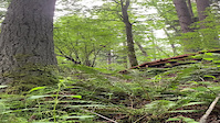
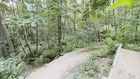
SaveJapanese Gulch is owned by the people and city of Mukilteo. The trails here will soon be getting some improvements and expansion for both riders and hikers.
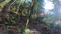
NOTE The trails to the east of the railroad tracks are technically on BNSF and Boeing property and there are no trespassing signs which indicate this. While people have ridden this area for years and there haven't been reports of problems this could change at any time. Ride at your own risk.
NOTE The trails to the east of the railroad tracks are technically on BNSF and Boeing property and there are no trespassing signs which indicate this. While people have ridden this area for years and there haven't been reports of problems this could change at any time. Ride at your own risk.
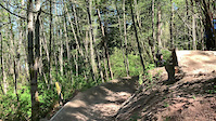
Primary Trail Type: All-Mountain & Downhill
eBikes Allowed:
No
Land Status: City Managed
 google parking directions
 Region Supporters & Maintainers
Activities Click to view
- Mountain Bike
67 trails
- E-Bike
53 trails
- Hike
54 trails
- Trail Running
54 trails
Region Details
- 4
- 14
- 34
- 8
- 5
Region Status
Open as of Jun 24, 2022Local Trail Association
Stats
- Avg Trail Rating
- Trails (view details)
- 65
- Trails Mountain Bike
- 67
- Trails E-Bike
- 53
- Trails Hike
- 54
- Trails Trail Running
- 54
- Total Distance
- 16 miles
- Total Descent Distance
- 7 miles
- Total Descent
- 3,254 ft
- Total Vertical
- 526 ft
- Highest Trailhead
- 552 ft
- Reports
- 965
- Photos
- 261
- Ridden Counter
- 11,012
Popular Japanese Gulch Mountain Biking Trails
Japanese Gulch Mountain Bike Routes
| title | rating | distance |
|---|---|---|
| Explore gulch 1 | 1 mile |
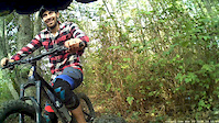
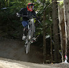
Photos of Japanese Gulch Mountain Bike
trail: Boyz to Men
7 |
Jun 15, 2022 @ 5:06am
Jun 15, 2022
trail: Dreamlifter
14 |
Apr 17, 2022 @ 4:25pm
Apr 17, 2022
trail: Zorro
9 |
Mar 13, 2022 @ 7:25pm
Mar 13, 2022
trail: Zorro
9 |
Mar 13, 2022 @ 7:24pm
Mar 13, 2022
trail: Just PEDAL IT
19 |
Feb 9, 2022 @ 10:02pm
Feb 9, 2022
trail: Rattler
16 |
Jan 24, 2022 @ 5:45pm
Jan 24, 2022
trail: Boyz to Men
28 |
Dec 27, 2021 @ 11:54am
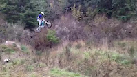
Dec 27, 2021Videos of Japanese Gulch Mountain Bike
trail: Feel The Pain
82 |
Jun 7, 2022
trail: Freedom Of Choice
|
Jul 8, 2021
trail: Freedom Of Choice
|
Apr 25, 2021
trail: Mandatory Suicide
671 |
Mar 20, 2021

trail: Mukilteo Lumber Co.
219 |
Jan 28, 2021
trail: The Dead Rapper Line
0:31 |
521 |
Mar 21, 2020

trail: Mukilteo Lumber Co.
1:03 |
949 |
Oct 31, 2017
trail: Japanese Gulch Ridge Loop
0:10 |
1405 |
Nov 30, 2015
Current Trail Warnings
| status | trail | date | condition | user | info |
|---|---|---|---|---|---|
| Dog Park | Jun 20, 2022 @ 9:24pm Jun 20, 2022 | Prevalent Mud | Bunderwater | It’s a bog, overgrown, thorns... |
Recent Trail Reports
| status | trail | date | condition | info | user |
|---|---|---|---|---|---|
| Turn n Burn | Jun 30, 2022 @ 6:22pm Jun 30, 2022 | Ideal | specialev J-GULCH | ||
| Hill Street Blue | Jun 26, 2022 @ 8:52am Jun 26, 2022 | Ideal | harking | ||
| Willy Coyote | Jun 26, 2022 @ 8:52am Jun 26, 2022 | Ideal | harking | ||
| Mukraker | Jun 26, 2022 @ 8:52am Jun 26, 2022 | Ideal | harking | ||
| Fern | Jun 26, 2022 @ 8:52am Jun 26, 2022 | Ideal | harking | ||
| Just PEDAL IT | Jun 26, 2022 @ 8:52am Jun 26, 2022 | Ideal | harking | ||
| Just PUSH IT | Jun 26, 2022 @ 8:52am Jun 26, 2022 | Unknown | harking | ||
| Feel The Pain | Jun 26, 2022 @ 8:52am Jun 26, 2022 | Unknown | harking | ||
| Quarter-Sawn | Jun 26, 2022 @ 8:52am Jun 26, 2022 | Ideal | harking | ||
| Boyz to Men | Jun 25, 2022 @ 8:24am Jun 25, 2022 | Dry | specialev J-GULCH |
Activity Feed
| username | action | type | title | date | |
|---|---|---|---|---|---|
 | chrisroecker | vote | trail | Feel The Pain | Jul 3, 2022 @ 5:17pm 2 days |
 | specialev | add | report | Turn n Burn | Jun 30, 2022 @ 6:23pm Jun 30, 2022 |
| specialev | add | report | Boyz to Men | Jun 27, 2022 @ 8:24am Jun 27, 2022 |
 | Mowboardin | add | karma | Japanese Gulch | Jun 26, 2022 @ 2:24pm Jun 26, 2022 |
 | harking | comment | trail | Zorro | Jun 26, 2022 @ 1:19pm Jun 26, 2022 |
Recent Comments
| username | type | title | comment | date | |
|---|---|---|---|---|---|
| trail | Yah, needs a trail day worth of repairs on the... | Jun 26, 2022 @ 1:19pm Jun 26, 2022 | ||
| report | Boyz was hero earlier this morning. Haven't... | Jun 21, 2022 @ 9:04pm Jun 21, 2022 | ||
 | trail | This trail no longer exists. This portion of... | Jun 19, 2022 @ 7:40am Jun 19, 2022 | ||
 | trail | So stoked to go ride this! | Jun 8, 2022 @ 11:53pm Jun 8, 2022 | ||
| trail | ... | Jun 7, 2022 @ 7:51am Jun 7, 2022 |
Nearby Areas
| name | distance | ||||
|---|---|---|---|---|---|
| Powder Mill Gulch | 1 km | ||||
| Big Gulch Park | 4 | 1.8 km | |||
| Forest Park | 21 | 3.7 km | |||
| Thornton A Sullivan Park | 2 | 4.4 km | |||
| McCollum Park | 3 | 4.8 km |
Local Badges
-

Sea 2 Sky22 awarded -

Completionist5 awarded
Activity Type Stats
| activitytype | trails | distance | descent | descent distance | total vertical | rating | global rank | state rank | photos | reports | routes | ridelogs |
|---|---|---|---|---|---|---|---|---|---|---|---|---|
| Mountain Bike | 67 | 16 miles | 3,255 ft | 7 miles | 525 ft | #492 | #251 | 253 | 965 | 1 | 5,493 | |
| E-Bike | 53 | 15 miles | 3,048 ft | 7 miles | 525 ft | #166 | #54 | 779 | 209 | |||
| Hike | 54 | 14 miles | 2,818 ft | 6 miles | 525 ft | #475 | #292 | 8 | 845 | 153 | ||
| Trail Running | 54 | 14 miles | 2,818 ft | 6 miles | 525 ft | #476 | #291 | 843 | 57 |
- By boxxerace
 TRAILFORKS J-GULCH & contributors
 - Admins: specialev, J-GULCH
- #9156 - 19,716 views
- japanese gulch activity log | embed map of Japanese Gulch mountain bike trails | japanese gulch mountain biking points of interest
Downloading of trail gps tracks in kml & gpx formats is enabled for Japanese Gulch.
You must login to download files.