Civil Disobedience Details
-
Activities
- Mountain Bike
- Trail Running
-
Riding AreaMt. Mahony
Powell River, British Columbia -
Difficulty Rating
-
Trail TypeSingletrack
-
Bike TypeAM, XC
-
DirectionDownhill OnlyPopular direction shown
-
Climb DifficultyBlack Diamond
-
Physical RatingHard
-
Trail VisibilityAlways easy to follow
-
Dogs AllowedYes
-
TTFs on TrailRock Face, Rock Garden
-
Global Ranking
-
Local Popularity80 in Mountain Biking [+]
- 5 in Trail Running
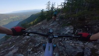
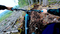
Challenging and tight single-track that starts on the top of a mountain in subalpine like terrain. great views for the first few kms of trail. very demanding and unpleasant climb up an old fire road which is mostly blast rock, loose and unrelentingly steep. expect to walk a chunk of it.
The trail begins with another 15-minute hike-a-bike to the top. The trail has small trees tightly spaced and lots of jagged rock and off-camber rooty slopes so there is not a strong sense of flow to speak of for at least the first 1/3 of the trail.
Gradually improving, the trail evolves into a more rideable flow and becomes an awesome raw wilderness trail, with plenty of jank and rock rolls and catch-you-out moves
Civil Disobedience will challenge your skills, fitness and maybe your patience. The climb alone will turn many people well off.
Access Info
Use Inland Lake FSR road and Mahoney road to access top of trail. A bit of a grunt to access but well worth it. The very upper portion of the trail is accessed by A48264 road and a hike a bike through older plantation but you'll be smiling when done Takes approx. 1.5 to 2.0 hours to get to the top of the trail from bottom of Mahoney road from Inland Lake FSR. Off the top about 50 m stay left to avoid an ATV trail that goes to the right. Awesome views.
This trail is unsanctioned.
Traditionally Indigenous Territory
More Stats for Civil Disobedience mountain bike trail trail
-
Altitude change-1,961 ft
-
Altitude min551 ft
-
Altitude max2,888 ft
-
Altitude start2,511 ft
-
Altitude end551 ft
-
Grade-7.7%
-
Grade max-43.9%
-
Grade min56.8%
-
Distance climb3,950 ft
-
Distance down4 miles
-
Distance flat814 ft
-
Avg time01:31:22
-
Avg reverse time02:45:49
- view trail stats
- Unknown
- Snow Groomed
- Snow Packed
- Snow Covered
- Snow Cover Inadequate
- Freeze/thaw Cycle
- Icy
- Prevalent Mud
- Wet
- Variable
- Ideal
- Dry
- Very Dry
The colour categories are based on what percentage of riders are riding a trail in its intended direction.
- > 96%
- > 90%
- > 80%
- > 70%
- > 50%
- < 50%
- bi-directional trail
- no data
- < 2 days
- < 1 week
- < 2 weeks
- < 1 month
- < 6 months
- > 6 months
- Downhill Only
- Downhill Primary
- Both Directions
- Uphill Primary
- Uphill Only
- One Direction
- Description
- Photos
- Description & Photos
- Videos
- most popular
- popular
- less popular
- not popular
- mountain biking recent
- mountain biking (>6 month)
- hiking (1 year)
- moto (1 year)
- Downhill Ski
- Backcountry Ski
- Nordic Ski
Save the current map location and zoom level as your default home location whenever this page is loaded.
SaveCivil Disobedience Trail Reports
Recent Ridelog Activity on Trail
Past Week
- 5 rides
- 10 miles avg distance
6 Months
- 24 rides
- 12 miles avg distance
All
- 262 rides
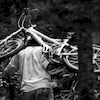
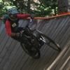
Photos
-
+ 1
 robbiekane
Reminds me trails in the 90s when biking was done on hiking trails because we hadn’t yet figured out how to build biking trails.
 nzstormer
 rkozsan
(Sep 2, 2019 at 19:28)
rkozsan
(Sep 2, 2019 at 19:28)
The trail is a slog to get to, and has several km of hike a bike before the drop in. The views at the lookout are nice, but for a trail with 834m of advertised descent, you finish the trail wondering where that all was..
The trail is raw, and the lower section after the road is super fun, but I would be surprised if anybody from the sea-to-sky area got to this trail and thought the whole endeavor was worth it once, let alone worth repeating.
 DeepInTheForest
 Blake1
The word flow does not come to mind at any point during this ride. With the exception of a very random berm and double that pops out of nowhere.
 philshep
 xTwoSnakesx
Videos
Nearby Trails
- A48264 Road 1,631 ft
- Og - Original Gangsta (lower) 3,891 ft
- Hush 4,075 ft
- Inland Fsr Extended From Og Home 2 miles
- Spur Mh012345 2 miles
- embed Civil Disobedience trail on your website
- #33789 - 8,589 views
- subscribe
- login to download gpx or kml files.