1,591 ft
Distance
-71 ft
Descent
00:06:35
Avg time
Supporters, Builders, Maintainers & Land Managers of Shaolin Trail

Traks-MalaysiaMaintainer
Shaolin Details
-
Activities
- Mountain Bike
-
Riding AreaBukit Kiara
Kuala Lumpur -
Difficulty Rating
-
Voted DifficultyBlack Diamond (1 vote)
-
Trail TypeSingletrack
-
Bike TypeDH, AM
-
DirectionDownhill Only
-
TTFs on TrailBerm, Drop, Jump, Gap Jump
-
Ride in RainYes
-
Global Ranking#46002 in Mountain Biking
-
Local Popularity60 in Mountain Biking
This is a DH only trail with two gap jumps, one of which is the infamous 'Shaolin', drops and jumps galore thereafter Take right fork at the end for 'Shriner's Convention' or left for 'Angel'.
Local Trail Association
-

-
Please consider joining or donating to the local trail association to support
trail development & maintenance.
More Stats for Shaolin mountain bike trail trail
-
Altitude change-71 ft
-
Altitude min646 ft
-
Altitude max718 ft
-
Altitude start718 ft
-
Altitude end646 ft
-
Grade-4.5%
-
Grade max-19.1%
-
Grade min-1.4%
-
Distance down1,591 ft
-
Avg time00:06:35
-
Avg reverse time00:06:40
- view trail stats
close
Trail Conditions
- Unknown
- Snow Groomed
- Snow Packed
- Snow Covered
- Snow Cover Inadequate
- Freeze/thaw Cycle
- Icy
- Prevalent Mud
- Wet
- Variable
- Ideal
- Dry
- Very Dry
Trail Flow (Ridden Direction)
Trailforks scans users ridelogs to determine the most popular direction each trail is ridden. A good flowing trail network will have most trails flowing in a single direction according to their intension.
The colour categories are based on what percentage of riders are riding a trail in its intended direction.
The colour categories are based on what percentage of riders are riding a trail in its intended direction.
- > 96%
- > 90%
- > 80%
- > 70%
- > 50%
- < 50%
- bi-directional trail
- no data
Trail Last Ridden
Trailforks scans ridelogs to determine the last time a trail was ridden.
- < 2 days
- < 1 week
- < 2 weeks
- < 1 month
- < 6 months
- > 6 months
Trail Ridden Direction
The intended direction a trail should be ridden.
- Downhill Only
- Downhill Primary
- Both Directions
- Uphill Primary
- Uphill Only
- One Direction
Contribute Details
Colors indicate trail is missing specified detail.
- Description
- Photos
- Description & Photos
- Videos
Trail Popularity ?
Trailforks scans ridelogs to determine which trails are ridden the most in the last 9 months.
Trails are compared with nearby trails in the same city region with a possible 25 colour shades.
Think of this as a heatmap, more rides = more kinetic energy = warmer colors.
- most popular
- popular
- less popular
- not popular
ATV/ORV/OHV Filter
Max Vehicle Width
inches
Radar Time
x
Activity Recordings
Trailforks users anonymized public ridelogs from the past 6 months.
- mountain biking recent
- mountain biking (>6 month)
- hiking (1 year)
- moto (1 year)
Activity Recordings
Trailforks users anonymized public skilogs from the past 12 months.
- Downhill Ski
- Backcountry Ski
- Nordic Ski
Jump Magnitude Heatmap
Heatmap of where riders jump on trails. Zoom in to see individual jumps, click circles to view jump details.
Trails Deemphasized
Trails are shown in grey.
Only show trails with NO bikes.
Save the current map location and zoom level as your default home location whenever this page is loaded.
Save
Directions to shaolin trailhead
(3.155860, 101.634400)
update trails status or condition
Shaolin Trail Reports
view all reports »
Recent Ridelog Activity on Trail
Past Week
- 14 rides
- 10 miles avg distance
6 Months
- 109 rides
- 12 miles avg distance
All
- 2,089 rides
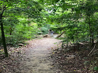
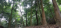
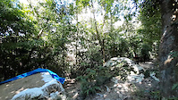
Photos
more »
Links
Videos
more »
youtuber
![South African VS Malaysian MTB Trails | Bukit...]()

8:04 |
33 |
Dec 9, 2021 , Kuala Lumpur
1 |
Jul 1, 2022 , Kuala Lumpur
54 |
Jan 12, 2021 , Kuala Lumpur
123 |
Nov 28, 2020 , Kuala Lumpur
Nearby Trails
- Sdm 217 ft
- Slippery Senórita 922 ft
- Godzilla (ゴジラ) 997 ft
- Pure Quill 997 ft
- Flintstones 1,043 ft
- embed Shaolin trail on your website
- By Joe27
 TRAKS TRAILFORKS & contributors
 - #30677 - 2,047 views
- subscribe
- login to download gpx or kml files.