close
Trail Conditions
- Unknown
- Snow Groomed
- Snow Packed
- Snow Covered
- Snow Cover Inadequate
- Freeze/thaw Cycle
- Icy
- Prevalent Mud
- Wet
- Variable
- Ideal
- Dry
- Very Dry
Trail Flow (Ridden Direction)
Trailforks scans users ridelogs to determine the most popular direction each trail is ridden. A good flowing trail network will have most trails flowing in a single direction according to their intension.
The colour categories are based on what percentage of riders are riding a trail in its intended direction.
The colour categories are based on what percentage of riders are riding a trail in its intended direction.
- > 96%
- > 90%
- > 80%
- > 70%
- > 50%
- < 50%
- bi-directional trail
- no data
Trail Last Ridden
Trailforks scans ridelogs to determine the last time a trail was ridden.
- < 2 days
- < 1 week
- < 2 weeks
- < 1 month
- < 6 months
- > 6 months
Trail Ridden Direction
The intended direction a trail should be ridden.
- Downhill Only
- Downhill Primary
- Both Directions
- Uphill Primary
- Uphill Only
- One Direction
Contribute Details
Colors indicate trail is missing specified detail.
- Description
- Photos
- Description & Photos
- Videos
Trail Popularity ?
Trailforks scans ridelogs to determine which trails are ridden the most in the last 9 months.
Trails are compared with nearby trails in the same city region with a possible 25 colour shades.
Think of this as a heatmap, more rides = more kinetic energy = warmer colors.
- most popular
- popular
- less popular
- not popular
ATV/ORV/OHV Filter
Max Vehicle Width
inches
Radar Time
x
Activity Recordings
Trailforks users anonymized public ridelogs from the past 6 months.
- mountain biking recent
- mountain biking (>6 month)
- hiking (1 year)
- moto (1 year)
Activity Recordings
Trailforks users anonymized public skilogs from the past 12 months.
- Downhill Ski
- Backcountry Ski
- Nordic Ski
Jump Magnitude Heatmap
Heatmap of where riders jump on trails. Zoom in to see individual jumps, click circles to view jump details.
Trails Deemphasized
Trails are shown in grey.
Only show trails with NO bikes.
Save the current map location and zoom level as your default home location whenever this page is loaded.
Save
No description for Elkford has been added yet!
Login or register to submit one.
Activities Click to view
- Mountain Bike
37 trails
- E-Bike
21 trails
- Hike
37 trails
- Trail Running
37 trails
Region Details
- 6
- 1
- 25
- 4
- 1
Region Status
Caution as of Jun 27, 2022Stats
- Avg Trail Rating
- Trails (view details)
- 37
- Trails Mountain Bike
- 37
- Trails E-Bike
- 21
- Trails Hike
- 37
- Trails Trail Running
- 37
- Trails Horse
- 3
- Trails Dirtbike/Moto
- 4
- Trails ATV/ORV/OHV
- 4
- Trails Snowmobile
- 1
- Trails Snowshoe
- 2
- Trails Nordic Ski
- 1
- Total Distance
- 94 miles
- Total Descent
- 9,148 ft
- Total Vertical
- 2,411 ft
- Highest Trailhead
- 6,401 ft
- Reports
- 104
- Photos
- 36
- Ridden Counter
- 969
Popular Elkford Mountain Biking Trails
Elkford Mountain Bike Routes
| title | rating | distance |
|---|---|---|
| The Great Trail- Elkford to Elk Pass | 47 miles | |
| Elkford to Fernie | 51 miles | |
| 10 minutes loop | 5,154 ft | |
| 2019 TransRockies Classic - Stage 6: Elkford to Crowsnest Pass race | 55 miles |
Photos of Elkford Mountain Bike
trail: Lost Lake Loop North
14 |
Oct 28, 2021 @ 11:43am
Oct 28, 2021
trail: Lost Lake Loop North
16 |
Oct 28, 2021 @ 11:43am
Oct 28, 2021
trail: Lost Lake Loop North
22 |
Oct 28, 2021 @ 11:42am
Oct 28, 2021
trail: Lost Lake Loop North
22 |
Oct 28, 2021 @ 11:42am
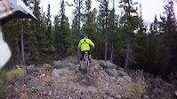
Oct 28, 2021Videos of Elkford Mountain Bike
6:52 |
268 |
May 24, 2012
6:34 |
385 |
Oct 10, 2011
Recent Trail Reports
| status | trail | date | condition | info | user |
|---|---|---|---|---|---|
| Sulphur Springs FSR- Elk Valley Trail (The Great Trail) | Jun 27, 2022 @ 10:10pm Jun 27, 2022 | Dry | colinsv0b ETA | ||
| Josephine Falls Cliff Route | Jun 24, 2022 @ 6:10am Jun 24, 2022 | Ideal | Grandgog ETA | ||
| Lower Lost Lake Area Access Road | Jun 22, 2022 @ 3:57pm Jun 22, 2022 | Ideal | colinsv0b ETA | ||
| Lily Lake | Jun 22, 2022 @ 3:55pm Jun 22, 2022 | Ideal | colinsv0b ETA | ||
| Falls Connector | Jun 22, 2022 @ 3:53pm Jun 22, 2022 | Ideal | colinsv0b ETA | ||
| Lost Lake Loop North | Jun 22, 2022 @ 3:50pm Jun 22, 2022 | Ideal | colinsv0b ETA | ||
| Upper Mountain Walk- Elk Valley Trail (The Great Trail) | May 17, 2022 @ 7:28am May 17, 2022 | Wet | Grandgog ETA | ||
| South Elkford Trail (The Great Trail) | May 17, 2022 @ 7:24am May 17, 2022 | Variable | Grandgog ETA | ||
| Middle Mountain Walk- Elk Valley Trail (The Great Trail) | May 17, 2022 @ 7:23am May 17, 2022 | Wet | Grandgog ETA | ||
| Lower Mountain Walk | May 16, 2021 @ 7:51am May 16, 2021 | Variable | Mellert |
Activity Feed
| username | action | type | title | date | |
|---|---|---|---|---|---|
 | colinsv0b | add | report | Sulphur Springs FSR- Elk Valley Trail (The Great Trail) | Jun 27, 2022 @ 10:10pm Jun 27, 2022 |
| colinsv0b | add | report | Sulphur Springs FSR- Elk Valley Trail (The Great Trail) | Jun 26, 2022 @ 9:58pm Jun 26, 2022 |
| colinsv0b | add | poi | Picnic Table | Jun 26, 2022 @ 9:51pm Jun 26, 2022 |
| Grandgog | add | report | Josephine Falls Cliff Route | Jun 24, 2022 @ 6:11am Jun 24, 2022 |
| colinsv0b | add | report | Lost Lake Loop North and 3 more | Jun 22, 2022 @ 3:50pm Jun 22, 2022 |
Recent Comments
| username | type | title | comment | date | |
|---|---|---|---|---|---|
| trail | Torn up good and proper by the motor crowd.... | Aug 23, 2020 @ 9:07pm Aug 23, 2020 | ||
| trail | Trail has been cleared and re routed with two... | Aug 17, 2020 @ 10:03am Aug 17, 2020 | ||
| trail | South half of trail is clear , rerouted and... | Jul 29, 2020 @ 11:24am Jul 29, 2020 | ||
| trail | Really nice cross-country trail, wide and... | Jul 22, 2020 @ 6:15am Jul 22, 2020 | ||
 | trail | Love it, for what we have around Elkford, this... | Jul 18, 2019 @ 10:38pm Jul 18, 2019 |
Local Badges
-

Big Ride 30k157 awarded -

Epic Ride Climb 2k29 awarded -

Climbing 10k Badge8 awarded -

Climbing 100k Badge0 awarded -

Descent 10k Badge9 awarded -

10 Green Trails6 awarded
Activity Type Stats
| activitytype | trails | distance | descent | descent distance | total vertical | rating | global rank | state rank | photos | reports | routes | ridelogs |
|---|---|---|---|---|---|---|---|---|---|---|---|---|
| Mountain Bike | 37 | 94 miles | 9,147 ft | 37 miles | 2,411 ft | #5,796 | #118 | 35 | 104 | 4 | 1,272 | |
| E-Bike | 21 | 63 miles | 4,603 ft | 21 miles | 2,411 ft | #2,269 | #66 | 68 | 1 | 3 | ||
| Hike | 37 | 94 miles | 9,147 ft | 37 miles | 2,411 ft | #4,642 | #116 | 1 | 104 | 1 | 174 | |
| Trail Running | 37 | 94 miles | 9,147 ft | 37 miles | 2,411 ft | #4,640 | #116 | 104 | 1 | 16 | ||
| Horse | 3 | 36 miles | 1,175 ft | 11 miles | 1,283 ft | 40 | 1 | |||||
| Dirtbike/Moto | 4 | 35 miles | 1,503 ft | 12 miles | 1,135 ft | 38 | 4 | |||||
| ATV/ORV/OHV | 4 | 35 miles | 1,503 ft | 12 miles | 1,135 ft | 38 | 2 | |||||
| Snowmobile | 1 | 3 miles | 459 ft | 1 mile | 515 ft | 2 | ||||||
| Snowshoe | 2 | 3 miles | 246 ft | 3,566 ft | 830 ft | 6 | 15 | |||||
| Nordic Ski | 1 | 4 miles | 1,089 ft | 4 miles | 1,040 ft | 28 |
- By Mellert & contributors
- Admins: barry-mclane, STMS, ETA
- #15388 - 5,284 views
- elkford activity log | embed map of Elkford mountain bike trails | elkford mountain biking points of interest
Downloading of trail gps tracks in kml & gpx formats is enabled for Elkford.
You must login to download files.