close
Trail Conditions
- Unknown
- Snow Groomed
- Snow Packed
- Snow Covered
- Snow Cover Inadequate
- Freeze/thaw Cycle
- Icy
- Prevalent Mud
- Wet
- Variable
- Ideal
- Dry
- Very Dry
Trail Flow (Ridden Direction)
Trailforks scans users ridelogs to determine the most popular direction each trail is ridden. A good flowing trail network will have most trails flowing in a single direction according to their intension.
The colour categories are based on what percentage of riders are riding a trail in its intended direction.
The colour categories are based on what percentage of riders are riding a trail in its intended direction.
- > 96%
- > 90%
- > 80%
- > 70%
- > 50%
- < 50%
- bi-directional trail
- no data
Trail Last Ridden
Trailforks scans ridelogs to determine the last time a trail was ridden.
- < 2 days
- < 1 week
- < 2 weeks
- < 1 month
- < 6 months
- > 6 months
Trail Ridden Direction
The intended direction a trail should be ridden.
- Downhill Only
- Downhill Primary
- Both Directions
- Uphill Primary
- Uphill Only
- One Direction
Contribute Details
Colors indicate trail is missing specified detail.
- Description
- Photos
- Description & Photos
- Videos
Trail Popularity ?
Trailforks scans ridelogs to determine which trails are ridden the most in the last 9 months.
Trails are compared with nearby trails in the same city region with a possible 25 colour shades.
Think of this as a heatmap, more rides = more kinetic energy = warmer colors.
- most popular
- popular
- less popular
- not popular
ATV/ORV/OHV Filter
Max Vehicle Width
inches
Radar Time
x
Activity Recordings
Trailforks users anonymized public ridelogs from the past 6 months.
- mountain biking recent
- mountain biking (>6 month)
- hiking (1 year)
- moto (1 year)
Activity Recordings
Trailforks users anonymized public skilogs from the past 12 months.
- Downhill Ski
- Backcountry Ski
- Nordic Ski
Jump Magnitude Heatmap
Heatmap of where riders jump on trails. Zoom in to see individual jumps, click circles to view jump details.
Trails Deemphasized
Trails are shown in grey.
Only show trails with NO bikes.
Save the current map location and zoom level as your default home location whenever this page is loaded.
SaveValley Falls State Park is more well known to kayakers than mountain bikers but that is changing. Since 2015, 4 new "enduro" style trails have been added to the park for more gravity oriented runs but still suits a modern trail bike rather than a DH bike. There is an excellent opportunity for shuttling the majority of the park, especially the enduro trails, when you really want to rack up some vertical descending.
Weather - Park ride greats whether its dry or super wet out. This place drains well.
Park Closes at Dark - No camping available on site but camping is close at Tygart Valley Lake
This park is home to a West Virginia Enduro series stop.
Weather - Park ride greats whether its dry or super wet out. This place drains well.
Park Closes at Dark - No camping available on site but camping is close at Tygart Valley Lake
This park is home to a West Virginia Enduro series stop.
Primary Trail Type: All-Mountain & Downhill
Shuttleable: YES
Land Status: State Park
 google parking directions
 Access Info:
The main parking lot down by the falls provides easy access to the trail system. Also parking up by the ranger station at the entrance of the park, and parking at the intersection of Deer Trail/Red Cardinal along the main access road.
Links
Activities Click to view
- Mountain Bike
25 trails
- Hike
18 trails
- Trail Running
18 trails
Region Details
- 2
- 16
- 4
- 3
Region Status
Caution as of Nov 29, 2020Stats
- Avg Trail Rating
- Trails (view details)
- 25
- Trails Mountain Bike
- 25
- Trails E-Bike
- 1
- Trails Hike
- 18
- Trails Trail Running
- 18
- Total Distance
- 18 miles
- Total Descent
- 5,200 ft
- Total Vertical
- 684 ft
- Highest Trailhead
- 1,668 ft
- Reports
- 186
- Photos
- 231
- Ridden Counter
- 1,334
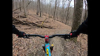
Popular Valley Falls State Park Mountain Biking Trails
Valley Falls State Park Mountain Bike Routes
| title | rating | distance |
|---|---|---|
| 2017 Valley Falls Enduro race | 16 miles | |
| race | 14 miles |
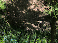
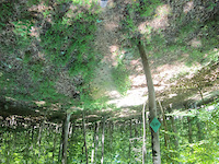
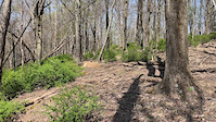
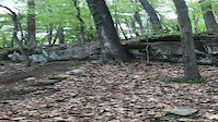
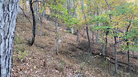
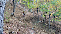
Photos of Valley Falls State Park Mountain Bike
trail: Road Side Trail
7 |
Jun 29, 2022 @ 9:20am
Jun 29, 2022
trail: Road Side Trail
8 |
Jun 29, 2022 @ 8:36am
Jun 29, 2022
trail: Sasquatch Trail
7 |
Jun 23, 2022 @ 2:03pm
Jun 23, 2022
trail: Sasquatch Trail
6 |
Jun 23, 2022 @ 2:00pm
Jun 23, 2022
trail: Fall Line Trail
40 |
Mar 27, 2022 @ 5:14pm
Mar 27, 2022
trail: Sasquatch Trail
18 |
Mar 24, 2022 @ 7:34am
Mar 24, 2022
trail: Sasquatch Trail
36 |
Mar 24, 2022 @ 7:34am
Mar 24, 2022
trail: Rocky Trail West
10 |
Mar 2, 2022 @ 6:00pm
Mar 2, 2022Videos of Valley Falls State Park Mountain Bike
trail: Copperhead Trail
12 |
Jun 25, 2022
trail: Road Side Trail
14 |
Jun 25, 2022
trail: Sasquatch Trail
146 |
Apr 24, 2022
trail: Fall Line Trail
|
May 7, 2021

trail: Boundary Trail
|
Apr 22, 2021
trail: Fall Line Trail
74 |
Feb 27, 2021
trail: Road Side Trail
|
Nov 3, 2020
trail: Road Side Trail
|
Oct 22, 2020
Recent Trail Reports
| status | trail | date | condition | info | user |
|---|---|---|---|---|---|
| Roadside Extension | Jun 27, 2022 @ 7:04pm Jun 27, 2022 | Dry | SnowshoeRider4Life | ||
| Road Side Trail | Jun 27, 2022 @ 7:03pm Jun 27, 2022 | Dry | SnowshoeRider4Life | ||
| Fall Line Trail | Jun 13, 2022 @ 6:47pm Jun 13, 2022 | Dry | SnowshoeRider4Life | ||
| Sasquatch Trail | Mar 24, 2022 @ 7:13am Mar 24, 2022 | Ideal | SnowshoeRider4Life | ||
| Copperhead Trail | Mar 2, 2022 @ 5:02am Mar 2, 2022 | Dry | SnowshoeRider4Life | ||
| Boundary Trail | Feb 22, 2022 @ 7:36am Feb 22, 2022 | Variable | SnowshoeRider4Life | ||
| Red Fox | Nov 7, 2021 @ 6:09am Nov 7, 2021 | Variable | Aspenphoto | ||
| Frog Pond Loop | Nov 7, 2021 @ 6:09am Nov 7, 2021 | Variable | Aspenphoto | ||
| Scott's Loop Short Cut | Nov 7, 2021 @ 6:09am Nov 7, 2021 | Variable | Aspenphoto | ||
| Rocky Trail West | Nov 7, 2021 @ 6:09am Nov 7, 2021 | Variable | Aspenphoto |
Activity Feed
| username | action | type | title | date | |
|---|---|---|---|---|---|
 | mdwhaley | wishlist | route | 2017 Valley Falls Enduro | Jul 1, 2022 @ 4:47am Jul 1, 2022 |
 | Nick8312 | add | photo | in Bridgeport, West Virginia, United States and 1 more | Jun 29, 2022 @ 8:36am Jun 29, 2022 |
 | SnowshoeRider4Life | add | report | Road Side Trail and 1 more | Jun 27, 2022 @ 7:03pm Jun 27, 2022 |
| SnowshoeRider4Life | add | trail | Enduro Race Connector | Jun 25, 2022 @ 1:56pm Jun 25, 2022 |
| SnowshoeRider4Life | update | trail | Access Rd and 1 more | Jun 25, 2022 @ 1:32pm Jun 25, 2022 |
Recent Comments
| username | type | title | comment | date | |
|---|---|---|---|---|---|
| trail | Trail is primo right now. Jumps have new lips,... | Mar 2, 2022 @ 4:16am Mar 2, 2022 | ||
 | trail | This trail has been renamed to Black Bear loop. | Jun 2, 2021 @ 6:11am Jun 2, 2021 | ||
| trail | Not really ridden. I mean, you could use it as... | May 14, 2021 @ 5:11am May 14, 2021 | ||
| trail | It’ll remain as Charlie’s on trailforks... | May 7, 2021 @ 6:26am May 7, 2021 | ||
| trail | Haha for sure | May 6, 2021 @ 7:41am May 6, 2021 |
Nearby Areas
| name | distance | ||||
|---|---|---|---|---|---|
| White Park | 6 | 9 | 16.5 km | ||
| Westover City Park | 1 | 17 km | |||
| Baker's Ridge Park | 2 | 4 | 20.8 km | ||
| Coopers Rock State Forest | 11 | 16 | 1 | 22.8 km | |
| Watters Smith State Park | 6 | 8 | 1 | 23.3 km |
Local Badges
-

Completionist0 awarded
Activity Type Stats
| activitytype | trails | distance | descent | descent distance | total vertical | rating | global rank | state rank | photos | reports | routes | ridelogs |
|---|---|---|---|---|---|---|---|---|---|---|---|---|
| Mountain Bike | 25 | 18 miles | 5,200 ft | 10 miles | 682 ft | #3,342 | #1,560 | 231 | 185 | 2 | 590 | |
| E-Bike | 1 | 76 | 2 | |||||||||
| Hike | 18 | 14 miles | 3,031 ft | 7 miles | 679 ft | #3,787 | #1,867 | 121 | 22 | |||
| Trail Running | 18 | 14 miles | 3,031 ft | 7 miles | 679 ft | #3,798 | #1,868 | 121 | 13 |
- By SnowshoeRider4Life
 & contributors
 - Admins: theWVPedaler, Turntex, PlumbBobM, Chris-Campbell, SnowshoeRider4Life
- #6518 - 8,573 views
- valley falls state park activity log | embed map of Valley Falls State Park mountain bike trails | valley falls state park mountain biking points of interest
-
- subscribe
- 3d map
Downloading of trail gps tracks in kml & gpx formats is enabled for Valley Falls State Park.
You must login to download files.