6.1 miles
Distance
2,833 ft
Climb
-195 ft
Descent
07:14:52
Avg time
Supporters, Builders, Maintainers & Land Managers of Muskrat Creek Trail

BLMLand Manager
USFSLand Manager
Muskrat Creek Details
-
Activities
- Mountain Bike
- Hike
- Trail Running
- Horse
- Snowshoe
- Backcountry Ski
- Nordic Ski
-
Riding AreaSouth Elkhorns
Boulder, Montana -
Ref Number#72
-
Difficulty Rating
-
Hiking SAC ScaleT1 Hiking
-
Trail TypeSingletrack
-
Bike TypeDH, AM, XC, Fat
-
DirectionBoth Directions
-
Climb DifficultyBlue
-
Physical RatingHard
-
Trail VisibilityAlways easy to follow
-
SeasonMay-November
-
Dogs AllowedYes
-
eBike Allowed
-
TTFs on TrailBridge, Drop, Jump, Rock Face, Wallride
-
Global Ranking
-
Local Popularity100 in Mountain Biking [+]
- 5 in Trail Running
- 100 in Hiking
- 5 in Horseback
- 5 in Snowshoeing
- 5 in Skiing
- 5 in Skiing
-
Land ManagerUSFS
Muskrat Creek Trail 72 is a popular out-and-back ride that offers lots of playtime rocks along the trail.
Access Info
Exit I-90 and Boulder and turn onto the frontage road. Turn right on Sloans Lane, and then left on Upper Valley Road. Follow Upper Valley / Muskrat Road along Muskrat Creek until the road ends at the trailhead.
Local Trail Association
-

-
Please consider joining or donating to the local trail association to supportdonate to earn trail karma!
trail development & maintenance.
Traditionally Indigenous Territory
More Stats for Muskrat Creek bike trail trail
-
Altitude change2,637 ft
-
Altitude min5,353 ft
-
Altitude max8,000 ft
-
Altitude start5,353 ft
-
Altitude end7,990 ft
-
Grade8.205%
-
Grade max-17.127%
-
Grade min40.685%
-
Distance climb5 miles
-
Distance down3,879 ft
-
Distance flat833 ft
-
Avg time07:14:52
-
Avg reverse time00:28:07
- view trail stats
close
Trail Conditions
- Unknown
- Snow Groomed
- Snow Packed
- Snow Covered
- Snow Cover Inadequate
- Freeze/thaw Cycle
- Icy
- Prevalent Mud
- Wet
- Variable
- Ideal
- Dry
- Very Dry
Trail Flow (Ridden Direction)
Trailforks scans users ridelogs to determine the most popular direction each trail is ridden. A good flowing trail network will have most trails flowing in a single direction according to their intension.
The colour categories are based on what percentage of riders are riding a trail in its intended direction.
The colour categories are based on what percentage of riders are riding a trail in its intended direction.
- > 96%
- > 90%
- > 80%
- > 70%
- > 50%
- < 50%
- bi-directional trail
- no data
Trail Last Ridden
Trailforks scans ridelogs to determine the last time a trail was ridden.
- < 2 days
- < 1 week
- < 2 weeks
- < 1 month
- < 6 months
- > 6 months
Trail Ridden Direction
The intended direction a trail should be ridden.
- Downhill Only
- Downhill Primary
- Both Directions
- Uphill Primary
- Uphill Only
- One Direction
Contribute Details
Colors indicate trail is missing specified detail.
- Description
- Photos
- Description & Photos
- Videos
Trail Popularity ?
Trailforks scans ridelogs to determine which trails are ridden the most in the last 9 months.
Trails are compared with nearby trails in the same city region with a possible 25 colour shades.
Think of this as a heatmap, more rides = more kinetic energy = warmer colors.
- most popular
- popular
- less popular
- not popular
ATV/ORV/OHV Filter
Max Vehicle Width
inches
Radar Time
x
Activity Recordings
Trailforks users anonymized public ridelogs from the past 6 months.
- mountain biking recent
- mountain biking (>6 month)
- hiking (1 year)
- moto (1 year)
Activity Recordings
Trailforks users anonymized public skilogs from the past 12 months.
- Downhill Ski
- Backcountry Ski
- Nordic Ski
Jump Magnitude Heatmap
Heatmap of where riders jump on trails. Zoom in to see individual jumps, click circles to view jump details.
Trails Deemphasized
Trails are shown in grey.
Only show trails with NO bikes.
Save the current map location and zoom level as your default home location whenever this page is loaded.
Save
Directions to muskrat-creek trailhead
(46.306900, -112.028430)
update trails status or condition
Muskrat Creek Trail Reports
view all reports »
Recent Ridelog Activity on Trail
Past Week
- 2 rides
- 13 miles avg distance
6 Months
- 6 rides
- 9 miles avg distance
All
- 146 rides

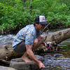
Photos
more »
Routes with this trail
-
+ 0
luciannovo
(Sep 29, 2020 at 14:36)
Phenomenal downhill. Will test your ability to dodge, flow and guesstimate short drops. I would put this in my top 3 for the Helena region.
[Reply]
Camelot
 (Nov 24, 2019 at 10:28)
Current blowdown greatly takes away from the flow; needs to be cleared.
[Reply]
pcullen
(Jun 3, 2018 at 13:57)
Trail clear of logs up to 4.5 miles, then about 8 more trees above. 6/3/18
[Reply]
 evasive
Like most Helenans, this trail is my least favorite climb, and my absolute favorite downhill. The climb doesn't give you a break, but then the downhill doesn't either. There is a fantastic raspberry patch at the bridge in late summer. It's a big ride, but not too far from town.
[Reply]
Videos
more »

21:03 |
569 |
Jun 17, 2019 , Boulder
Nearby Trails
- Ninety Cent Gulch 5 miles
- Rawhide 5 miles
- Twentyone Gulch 6 miles
- Go Around 6 miles
- Mccarty Creek 6 miles
- embed Muskrat Creek trail on your website
- By evasive MBG & contributors
- #18001 - 6,062 views
- subscribe
- login to download gpx or kml files.