close
Trail Conditions
- Unknown
- Snow Groomed
- Snow Packed
- Snow Covered
- Snow Cover Inadequate
- Freeze/thaw Cycle
- Icy
- Prevalent Mud
- Wet
- Variable
- Ideal
- Dry
- Very Dry
Trail Flow (Ridden Direction)
Trailforks scans users ridelogs to determine the most popular direction each trail is ridden. A good flowing trail network will have most trails flowing in a single direction according to their intension.
The colour categories are based on what percentage of riders are riding a trail in its intended direction.
The colour categories are based on what percentage of riders are riding a trail in its intended direction.
- > 96%
- > 90%
- > 80%
- > 70%
- > 50%
- < 50%
- bi-directional trail
- no data
Trail Last Ridden
Trailforks scans ridelogs to determine the last time a trail was ridden.
- < 2 days
- < 1 week
- < 2 weeks
- < 1 month
- < 6 months
- > 6 months
Trail Ridden Direction
The intended direction a trail should be ridden.
- Downhill Only
- Downhill Primary
- Both Directions
- Uphill Primary
- Uphill Only
- One Direction
Contribute Details
Colors indicate trail is missing specified detail.
- Description
- Photos
- Description & Photos
- Videos
Trail Popularity ?
Trailforks scans ridelogs to determine which trails are ridden the most in the last 9 months.
Trails are compared with nearby trails in the same city region with a possible 25 colour shades.
Think of this as a heatmap, more rides = more kinetic energy = warmer colors.
- most popular
- popular
- less popular
- not popular
ATV/ORV/OHV Filter
Max Vehicle Width
inches
Radar Time
x
Activity Recordings
Trailforks users anonymized public ridelogs from the past 6 months.
- mountain biking recent
- mountain biking (>6 month)
- hiking (1 year)
- moto (1 year)
Activity Recordings
Trailforks users anonymized public skilogs from the past 12 months.
- Downhill Ski
- Backcountry Ski
- Nordic Ski
Jump Magnitude Heatmap
Heatmap of where riders jump on trails. Zoom in to see individual jumps, click circles to view jump details.
Trails Deemphasized
Trails are shown in grey.
Only show trails with NO bikes.
Save the current map location and zoom level as your default home location whenever this page is loaded.
Save
No description for Twelvemile has been added yet!
Login or register to submit one.
Primary Trail Type: Cross-Country
Shuttleable: YES
AKA: 12mi, 12 mile, twelve mile
Links
Activities Click to view
- Mountain Bike
38 trails
- E-Bike
4 trails
- Hike
38 trails
- Trail Running
38 trails
- Horse
10 trails
Region Details
- 2
- 2
- 15
- 16
- 2
- 1
Region Status
Open as of Aug 7, 2021Stats
- Avg Trail Rating
- Trails (view details)
- 38
- Trails Mountain Bike
- 38
- Trails E-Bike
- 4
- Trails Hike
- 38
- Trails Trail Running
- 38
- Trails Horse
- 10
- Trails Dirtbike/Moto
- 3
- Trails ATV/ORV/OHV
- 1
- Total Distance
- 64 miles
- Total Descent
- 16,366 ft
- Total Vertical
- 3,897 ft
- Highest Trailhead
- 8,173 ft
- Reports
- 276
- Photos
- 105
- Ridden Counter
- 257
Popular Twelvemile Mountain Biking Trails
Twelvemile Mountain Bike Routes
| title | rating | distance |
|---|---|---|
| Twelvemile to Lime Creek | 12 miles |
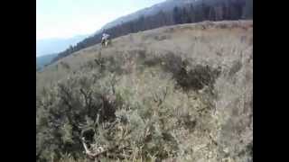
Photos of Twelvemile Mountain Bike
trail: Bull Ah Vard Singletrack
2 |
Jun 16, 2022 @ 3:19pm
Jun 16, 2022
trail: Bull Ah Vard Troad
0 |
Jun 16, 2022 @ 3:19pm
Jun 16, 2022
trail: Bull Ah Vard Troad
0 |
Jun 16, 2022 @ 3:19pm
Jun 16, 2022
trail: Bull Ah Vard Troad
0 |
Jun 16, 2022 @ 3:18pm
Jun 16, 2022
trail: Bull Ah Vard Troad
1 |
Jun 16, 2022 @ 3:18pm
Jun 16, 2022
trail: Bull Ah Vard Troad
1 |
Jun 7, 2022 @ 5:04pm
Jun 7, 2022
trail: Bull Ah Vard Troad
4 |
Jun 7, 2022 @ 3:59pm
Jun 7, 2022
trail: Meadow Connector
2 |
Jun 6, 2022 @ 6:28pm
Jun 6, 2022Videos of Twelvemile Mountain Bike
trail: Twelvemile Meadow (South)
608 |
Oct 3, 2014 , Salmon
Recent Trail Reports
| status | trail | date | condition | info | user |
|---|---|---|---|---|---|
| Lime Creek (West) | Jun 26, 2022 @ 11:25am Jun 26, 2022 | Dry | wildbillmac simba | ||
| Lime Creek | Jun 26, 2022 @ 11:20am Jun 26, 2022 | Variable | wildbillmac simba | ||
| Twelvemile Meadow (South) | Jun 26, 2022 @ 11:01am Jun 26, 2022 | Variable | wildbillmac simba | ||
| North Basin | Jun 21, 2022 @ 11:23pm Jun 21, 2022 | Ideal | wildbillmac simba | ||
| Twelvemile Meadow (North) | Jun 19, 2022 @ 9:48pm Jun 19, 2022 | Variable | wildbillmac simba | ||
| Meadow Connector | Jun 19, 2022 @ 9:37pm Jun 19, 2022 | Variable | wildbillmac simba | ||
| Thoroughfare | Jun 17, 2022 @ 10:33pm Jun 17, 2022 | Ideal | chuktA TRAILFORKS | ||
| Bull Ah Vard Singletrack | Jun 7, 2022 @ 4:47pm Jun 7, 2022 | Dry | sidehiller1 TRAILFORKS | ||
| Bull Ah Vard Troad | Jun 7, 2022 @ 4:45pm Jun 7, 2022 | Dry | sidehiller1 TRAILFORKS | ||
| Hunter Shortcut | Jun 6, 2022 @ 6:22pm Jun 6, 2022 | Dry | sidehiller1 TRAILFORKS |
Activity Feed
| username | action | type | title | date | |
|---|---|---|---|---|---|
 | Azdolan | vote | trail | Crevice | Jul 5, 2022 @ 7:42pm 7 hours |
 | ShaeKosmo | wishlist | trail | Porcupine Spring | Jul 4, 2022 @ 6:26pm 1 day |
| ynpbrandon | wishlist | region | Twelvemile | Jul 2, 2022 @ 7:29pm Jul 2, 2022 |
| wildbillmac | add | report | Twelvemile Meadow (South) and 2 more | Jun 26, 2022 @ 11:19am Jun 26, 2022 |
 | chuktA | comment | report | North Basin | Jun 24, 2022 @ 8:17am Jun 24, 2022 |
Recent Comments
| username | type | title | comment | date | |
|---|---|---|---|---|---|
| report | And likely overgrown Alder on the way up to... | Jun 24, 2022 @ 8:17am Jun 24, 2022 | ||
| report | The N. Basin outfitter cuts a lot up the too,... | Jun 19, 2021 @ 8:24pm Jun 19, 2021 | ||
 | report | Thanks Bill. | Jun 17, 2021 @ 6:20pm Jun 17, 2021 | ||
| trail | This is a terrible trail. It’s like someone... | Oct 1, 2020 @ 4:15pm Oct 1, 2020 | ||
| trail | So here's the deal with this trail (as of July... | Jul 29, 2020 @ 9:27am Jul 29, 2020 |
Nearby Areas
| name | distance | ||||
|---|---|---|---|---|---|
| Barracks Lane - Mulkey Creek | 18 | 9 | 1 | 9.6 km | |
| Landfill | 1 | 15 | 3 | 1 | 10.2 km |
| Williams Creek | 1 | 22 | 27 | 13 | 10.2 km |
| Iron Creek/Hat Creek | 1 | 13 | 19 | 2 | 12.9 km |
| Discovery Hill | 5 | 26 | 8 | 16.9 km |
Local Badges
-

Completionist0 awarded
Local Products
Activity Type Stats
| activitytype | trails | distance | descent | descent distance | total vertical | rating | global rank | state rank | photos | reports | routes | ridelogs |
|---|---|---|---|---|---|---|---|---|---|---|---|---|
| Mountain Bike | 38 | 64 miles | 16,365 ft | 30 miles | 3,898 ft | #4,624 | #2,041 | 105 | 276 | 1 | 177 | |
| E-Bike | 4 | 17 miles | 971 ft | 4 miles | 3,570 ft | #1,712 | #405 | 171 | ||||
| Hike | 38 | 64 miles | 16,365 ft | 30 miles | 3,898 ft | #3,882 | #1,900 | 276 | 12 | |||
| Trail Running | 38 | 64 miles | 16,365 ft | 30 miles | 3,898 ft | #3,896 | #1,903 | 276 | 1 | |||
| Horse | 10 | 24 miles | 5,020 ft | 10 miles | 3,868 ft | #212 | #151 | 179 | ||||
| Dirtbike/Moto | 3 | 15 miles | 692 ft | 3 miles | 3,061 ft | 100 | 1 | |||||
| ATV/ORV/OHV | 1 | 9 miles | 16 ft | 833 ft | 2,454 ft | 97 |
- By todd
 Trailforks & contributors
 - Admins: simba, sidehiller1
- #4966 - 2,917 views
- twelvemile activity log | embed map of Twelvemile mountain bike trails | twelvemile mountain biking points of interest
Downloading of trail gps tracks in kml & gpx formats is enabled for Twelvemile.
You must login to download files.