close
Trail Conditions
- Unknown
- Snow Groomed
- Snow Packed
- Snow Covered
- Snow Cover Inadequate
- Freeze/thaw Cycle
- Icy
- Prevalent Mud
- Wet
- Variable
- Ideal
- Dry
- Very Dry
Trail Flow (Ridden Direction)
Trailforks scans users ridelogs to determine the most popular direction each trail is ridden. A good flowing trail network will have most trails flowing in a single direction according to their intension.
The colour categories are based on what percentage of riders are riding a trail in its intended direction.
The colour categories are based on what percentage of riders are riding a trail in its intended direction.
- > 96%
- > 90%
- > 80%
- > 70%
- > 50%
- < 50%
- bi-directional trail
- no data
Trail Last Ridden
Trailforks scans ridelogs to determine the last time a trail was ridden.
- < 2 days
- < 1 week
- < 2 weeks
- < 1 month
- < 6 months
- > 6 months
Trail Ridden Direction
The intended direction a trail should be ridden.
- Downhill Only
- Downhill Primary
- Both Directions
- Uphill Primary
- Uphill Only
- One Direction
Contribute Details
Colors indicate trail is missing specified detail.
- Description
- Photos
- Description & Photos
- Videos
Trail Popularity ?
Trailforks scans ridelogs to determine which trails are ridden the most in the last 9 months.
Trails are compared with nearby trails in the same city region with a possible 25 colour shades.
Think of this as a heatmap, more rides = more kinetic energy = warmer colors.
- most popular
- popular
- less popular
- not popular
ATV/ORV/OHV Filter
Max Vehicle Width
inches
Radar Time
x
Activity Recordings
Trailforks users anonymized public ridelogs from the past 6 months.
- mountain biking recent
- mountain biking (>6 month)
- hiking (1 year)
- moto (1 year)
Activity Recordings
Trailforks users anonymized public skilogs from the past 12 months.
- Downhill Ski
- Backcountry Ski
- Nordic Ski
Jump Magnitude Heatmap
Heatmap of where riders jump on trails. Zoom in to see individual jumps, click circles to view jump details.
Trails Deemphasized
Trails are shown in grey.
Only show trails with NO bikes.
Save the current map location and zoom level as your default home location whenever this page is loaded.
SaveFast, flowy, and smooth is the main theme in the Rattlesnake....at least close to the main trail head. Venture out to the Stuart Peak Trail, Sheep Mountain Trail, or Mineral Peak Trail, and you will find plenty of scenic backcountry terrain and technical challenges. There's something for everyone here in Missoula's most popular trail system. There are a lot of weekend users, so please be courteous and yield to others. Check out MTB Missoula's recommended routes on Trailforks if you are new to town and looking for a good ride.
Primary Trail Type: Cross-Country
eBikes Allowed:
No
Land Status: National Forest
 google parking directions
 Region Supporters & Maintainers
![]()
MTB MissoulaMaintainer
Activities Click to view
- Mountain Bike
94 trails
- E-Bike
4 trails
- Hike
120 trails
- Trail Running
120 trails
- Horse
51 trails
- Snowshoe
59 trails
- Backcountry Ski
10 trails
- Nordic Ski
42 trails
Region Details
- 8
- 5
- 48
- 27
- 6
Region Status
Open as of Apr 22, 2022Local Trail Association
Stats
- Avg Trail Rating
- Trails (view details)
- 120
- Trails Mountain Bike
- 94
- Trails E-Bike
- 4
- Trails Hike
- 120
- Trails Trail Running
- 120
- Trails Horse
- 51
- Trails Dirtbike/Moto
- 2
- Trails ATV/ORV/OHV
- 2
- Trails Snowmobile
- 1
- Trails Snowshoe
- 59
- Trails Backcountry Ski
- 10
- Trails Nordic Ski
- 42
- Total Distance
- 150 miles
- Total Descent
- 30,128 ft
- Total Vertical
- 4,383 ft
- Highest Trailhead
- 7,604 ft
- Reports
- 2,013
- Photos
- 251
- Ridden Counter
- 16,018
Popular The Rattlesnake Mountain Biking Trails
The Rattlesnake Mountain Bike Routes
| title | rating | distance |
|---|---|---|
| MTBM - Classic Sheep Mountain Loop | 25 miles | |
| MTBM - Fenceline - Rattlesnake - Blue | 9 miles | |
| MT Alpha Sawmill Triple | 13 miles | |
| Short Ewok Loop | 2 miles | |
| Lincoln Hills Tour | 14 miles | |
| sawmill/fish ladder to fencline | 8 miles | |
| Snowbowl Overlook Loop | 10 miles | |
| Woods Gulch - Three Larch Route - MT Dirt Girls | 7 miles | |
| Freehub Magazine: Three Larch | 2 miles | |
| Freehub Magazine: Hot Sauce | 2 miles |
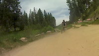
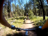
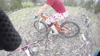
Photos of The Rattlesnake Mountain Bike
trail: Fish Ladder
1 |
Jul 5, 2022 @ 8:47pm
6 hours
trail: Three Larch
5 |
Jun 25, 2022 @ 2:56pm
Jun 25, 2022
trail: Sheep Mountain
75 |
Nov 17, 2021 @ 9:27am
Nov 17, 2021
trail: Sheep Mountain
79 |
Aug 22, 2021 @ 7:30pm
Aug 22, 2021
trail: Mineral Peak Lookout
27 |
Aug 15, 2021 @ 7:46pm
Aug 15, 2021
trail: Mineral Peak Lookout
19 |
Aug 15, 2021 @ 7:44pm
Aug 15, 2021
trail: Stuart Peak
302 |
Sep 26, 2017 @ 3:58pm
Sep 26, 2017
trail: Stuart Peak
192 |
Sep 26, 2017 @ 3:57pm
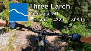
Sep 26, 2017Videos of The Rattlesnake Mountain Bike
trail: Fenceline
16:35 |
619 |
Jun 21, 2015
trail: Three Larch
3:48 |
1315 |
Jan 13, 2012
trail: Hidden Trail
1:27 |
357 |
May 22, 2011
trail: Three Larch
14:06 |
12 |
Jun 29, 2022 , Missoula

trail: Sidewinder
14:12 |
7 |
Jun 29, 2022 , Missoula

trail: Sound of Music
9:50 |
9 |
Jun 29, 2022 , Missoula
trail: Stuart Peak
30:55 |
177 |
Oct 14, 2020 , Missoula

trail: Sidewinder
9:38 |
189 |
Sep 13, 2020 , Missoula
Current Trail Warnings
| status | trail | date | condition | user | info |
|---|---|---|---|---|---|
| Spring Gulch | Jul 4, 2022 @ 6:45pm 1 day | Dry | Lando406 | Down log 200 yards from Overlook... | |
| Twin Creek Trail | Jun 21, 2022 @ 6:18am Jun 21, 2022 | Ideal | tpg460 | Major progress was made Saturday, June... | |
| East Fork of Rattlesnake Creek | Jun 21, 2022 @ 6:18am Jun 21, 2022 | Ideal | tpg460 | Major progress was made Saturday, June... |
Recent Trail Reports
| status | trail | date | condition | info | user |
|---|---|---|---|---|---|
| Sheep Mountain | Jun 29, 2022 @ 7:43pm Jun 29, 2022 | Variable | Tcolbert | ||
| Three Larch | Jun 29, 2022 @ 7:35pm Jun 29, 2022 | Ideal | Tcolbert | ||
| Sheep Mountain | Jun 29, 2022 @ 7:21pm Jun 29, 2022 | Snow Covered | Tcolbert | ||
| Mineral Peak | Jun 28, 2022 @ 6:35am Jun 28, 2022 | Dry | BKM | ||
| 1513 | Jun 26, 2022 @ 9:12am Jun 26, 2022 | Variable | mt-outlaw | ||
| The Burn | Jun 25, 2022 @ 7:57am Jun 25, 2022 | Ideal | aaronrbaldwin TRAILFORKS | ||
| Ewok | Jun 23, 2022 @ 10:36am Jun 23, 2022 | Ideal | aaronrbaldwin TRAILFORKS | ||
| Sawmill Gulch | Jun 23, 2022 @ 10:36am Jun 23, 2022 | Ideal | aaronrbaldwin TRAILFORKS | ||
| Fish Ladder | Jun 23, 2022 @ 10:36am Jun 23, 2022 | Ideal | aaronrbaldwin TRAILFORKS | ||
| Snowbowl Overlook | Jun 23, 2022 @ 10:36am Jun 23, 2022 | Ideal | aaronrbaldwin TRAILFORKS |
Activity Feed
| username | action | type | title | date | |
|---|---|---|---|---|---|
 | Ramihz | add | photo | in Meridian, Idaho, United States | Jul 5, 2022 @ 8:47pm 6 hours |
| MTSnail | wishlist | route | TNR Three Larch, Sidewinder, & Sound of Music and 1 more | Jul 5, 2022 @ 1:17pm 13 hours |
| Lando406 | add | report | Spring Gulch and 1 more | Jul 4, 2022 @ 6:44pm 1 day |
| Jbrunner988 | wishlist | trail | Sawmill Gulch Road | Jul 4, 2022 @ 12:16pm 2 days |
| evandunbar | wishlist | route | MTBM - Classic Sheep Mountain Loop and 2 more | Jul 3, 2022 @ 8:34am 3 days |
Recent Comments
| username | type | title | comment | date | |
|---|---|---|---|---|---|
| trail | Soon to be the best flow trail in Missoula... | Jun 5, 2022 @ 5:30pm Jun 5, 2022 | ||
| trail | After about 1.3 miles there’s a junction... | Jun 3, 2022 @ 12:25pm Jun 3, 2022 | ||
| trail | It is so hard to actually get a map to show up... | Sep 23, 2021 @ 8:44am Sep 23, 2021 | ||
| trail | Such steep, rocky radness. If only it was... | Sep 7, 2021 @ 8:07am Sep 7, 2021 | ||
| trail | NOT A TRAIL, clearly the loggers never... | Jul 4, 2021 @ 2:49pm Jul 4, 2021 |
Nearby Areas
| name | distance | ||||
|---|---|---|---|---|---|
| Marshall Mountain | 3 | 9 | 3 | 3 km | |
| Frenchtown | 4.1 km | ||||
| Pattee Canyon | 26 | 17 | 4 | 6.1 km | |
| Montana Snowbowl | 4 | 4 | 3 | 6.7 km | |
| South Hills | 17 | 6 | 7.6 km |
Local Badges
-

Completionist1 awarded
Activity Type Stats
| activitytype | trails | distance | descent | descent distance | total vertical | rating | global rank | state rank | photos | reports | routes | ridelogs |
|---|---|---|---|---|---|---|---|---|---|---|---|---|
| Mountain Bike | 94 | 138 miles | 28,468 ft | 63 miles | 4,383 ft | #313 | #150 | 246 | 1,999 | 23 | 13,816 | |
| E-Bike | 4 | 16 miles | 1,923 ft | 7 miles | 2,474 ft | #1,096 | 1,570 | 7 | ||||
| Hike | 120 | 150 miles | 30,128 ft | 66 miles | 4,383 ft | #202 | #110 | 1 | 1,991 | 3 | 567 | |
| Trail Running | 120 | 150 miles | 30,128 ft | 66 miles | 4,383 ft | #200 | #106 | 4 | 1,991 | 3 | 1,829 | |
| Horse | 51 | 86 miles | 19,131 ft | 43 miles | 4,117 ft | #24 | #22 | 461 | ||||
| Dirtbike/Moto | 2 | 15 miles | 1,827 ft | 7 miles | 2,474 ft | 301 | 2 | |||||
| ATV/ORV/OHV | 2 | 15 miles | 1,827 ft | 7 miles | 2,474 ft | 301 | ||||||
| Snowmobile | 1 | 7 miles | 1,699 ft | 6 miles | 1,686 ft | 9 | ||||||
| Snowshoe | 59 | 104 miles | 22,096 ft | 49 miles | 4,232 ft | #20 | #12 | 219 | 1 | 6 | ||
| Backcountry Ski | 10 | 27 miles | 8,691 ft | 16 miles | 4,072 ft | #8 | #6 | 58 | 17 | |||
| Nordic Ski | 42 | 73 miles | 10,774 ft | 30 miles | 2,635 ft | #7 | #7 | 142 | 94 |
- By Fanderson
 MTBM & contributors
 - Admins: MONTANABIKERMAN, evasive, wyomont, MTBM, aaronrbaldwin
- #7481 - 15,168 views
- the rattlesnake activity log | embed map of The Rattlesnake mountain bike trails | the rattlesnake mountain biking points of interest
Downloading of trail gps tracks in kml & gpx formats is enabled for The Rattlesnake.
You must login to download files.