close
Trail Conditions
- Unknown
- Snow Groomed
- Snow Packed
- Snow Covered
- Snow Cover Inadequate
- Freeze/thaw Cycle
- Icy
- Prevalent Mud
- Wet
- Variable
- Ideal
- Dry
- Very Dry
Trail Flow (Ridden Direction)
Trailforks scans users ridelogs to determine the most popular direction each trail is ridden. A good flowing trail network will have most trails flowing in a single direction according to their intension.
The colour categories are based on what percentage of riders are riding a trail in its intended direction.
The colour categories are based on what percentage of riders are riding a trail in its intended direction.
- > 96%
- > 90%
- > 80%
- > 70%
- > 50%
- < 50%
- bi-directional trail
- no data
Trail Last Ridden
Trailforks scans ridelogs to determine the last time a trail was ridden.
- < 2 days
- < 1 week
- < 2 weeks
- < 1 month
- < 6 months
- > 6 months
Trail Ridden Direction
The intended direction a trail should be ridden.
- Downhill Only
- Downhill Primary
- Both Directions
- Uphill Primary
- Uphill Only
- One Direction
Contribute Details
Colors indicate trail is missing specified detail.
- Description
- Photos
- Description & Photos
- Videos
Trail Popularity ?
Trailforks scans ridelogs to determine which trails are ridden the most in the last 9 months.
Trails are compared with nearby trails in the same city region with a possible 25 colour shades.
Think of this as a heatmap, more rides = more kinetic energy = warmer colors.
- most popular
- popular
- less popular
- not popular
ATV/ORV/OHV Filter
Max Vehicle Width
inches
Radar Time
x
Activity Recordings
Trailforks users anonymized public ridelogs from the past 6 months.
- mountain biking recent
- mountain biking (>6 month)
- hiking (1 year)
- moto (1 year)
Activity Recordings
Trailforks users anonymized public skilogs from the past 12 months.
- Downhill Ski
- Backcountry Ski
- Nordic Ski
Jump Magnitude Heatmap
Heatmap of where riders jump on trails. Zoom in to see individual jumps, click circles to view jump details.
Trails Deemphasized
Trails are shown in grey.
Only show trails with NO bikes.
Save the current map location and zoom level as your default home location whenever this page is loaded.
Save
No description for Florestal do Alto has been added yet!
Login or register to submit one.
Primary Trail Type: All-Mountain & Downhill
Shuttleable: YES
Land Status: Private Property
This region uses the Uk/Euro style trail grading system.
Activities Click to view
- Mountain Bike
9 trails
- E-Bike
9 trails
- Hike
6 trails
- Trail Running
6 trails
Region Details
- 4
- 1
- 2
- 2
Region Status
Caution as of Jan 9, 2022Stats
- Avg Trail Rating
- Trails (view details)
- 9
- Trails Mountain Bike
- 9
- Trails E-Bike
- 9
- Trails Hike
- 6
- Trails Trail Running
- 6
- Total Distance
- 3 miles
- Total Descent Distance
- 1 mile
- Total Descent
- 713 ft
- Total Vertical
- 453 ft
- Highest Trailhead
- 1,178 ft
- Reports
- 500
- Photos
- 609
- Ridden Counter
- 162
Popular Florestal do Alto Mountain Biking Trails
Florestal do Alto Mountain Bike Routes
| title | rating | distance |
|---|---|---|
| EscolasTPENDSMA | 8 miles | |
| SMA_END15PRT | 3,317 ft | |
| SMA_END14VRM | 2,828 ft | |
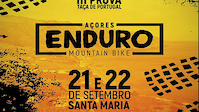
| Monbike_E_2018 race | 19 miles | |
| ENDSMA_12JUN_22 race | 13 miles | |
| Morning Ride race | 10 miles | |
| Enduro Santa Maria 2021 Prova 1 race | 10 miles | |
| race | 10 miles |
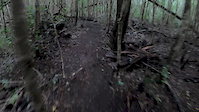
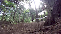
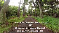
Photos of Florestal do Alto Mountain Bike
trail: KidsPedal
40 |
Aug 29, 2018 @ 5:52pm
Aug 29, 2018
trail: SMA_END13-AZpedal_Original
94 |
Apr 30, 2018 @ 10:38am
Apr 30, 2018
trail: SMA_END13-AZpedal_Original
30 |
Apr 30, 2018 @ 10:38am
Apr 30, 2018
trail: SMA_END13-AZpedal_Original
21 |
Apr 30, 2018 @ 10:38am
Apr 30, 2018
trail: SMA_END13-AZpedal_Original
28 |
Apr 30, 2018 @ 10:38am
Apr 30, 2018
trail: SMA_END13-AZpedal_Original
245 |
Mar 23, 2014 @ 12:04pm
Mar 23, 2014
trail: SMA_END13-AZpedal_Original
248 |
Mar 23, 2014 @ 11:56am
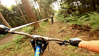
Mar 23, 2014Videos of Florestal do Alto Mountain Bike

trail: SMA_END13-AZpedal_Original
103 |
Oct 18, 2021
trail: O Estreito
3:44 |
53 |
Jan 25, 2020
trail: SMA_END13-AZpedal_Original
8:35 |
27 |
Oct 4, 2019
trail: SMA_END13-AZpedal_Original
2:11 |
54 |
Sep 29, 2019

trail: SMA_END13-AZpedal_Original
2:19 |
78 |
Mar 31, 2019
trail: SMA_END13-AZpedal_Original
1:04 |
104 |
Mar 28, 2019
trail: SMA_END13-AZpedal_Original
5:21 |
115 |
Mar 25, 2019

trail: SMA_END13-AZpedal_Original
5:55 |
90 |
Mar 12, 2019
Recent Trail Reports
| status | trail | date | condition | info | user |
|---|---|---|---|---|---|
| Grota | Jun 24, 2022 @ 5:37pm Jun 24, 2022 | Wet | Gruta AZPEDAL | ||
| SMA_END13-AZpedal_Original | Apr 23, 2022 @ 10:31am Apr 23, 2022 | Dry | Gruta AZPEDAL | ||
| Ligação Anaconda | Mar 13, 2022 @ 1:29am Mar 13, 2022 | Variable | Easr AZPEDAL | ||
| Pedreira Vermelha | Mar 10, 2022 @ 11:31am Mar 10, 2022 | Variable | Gruta AZPEDAL | ||
| O Estreito | Jan 7, 2022 @ 2:53pm Jan 7, 2022 | Wet | Gruta AZPEDAL | ||
| KidsPedal | Jan 7, 2022 @ 2:53pm Jan 7, 2022 | Wet | Gruta AZPEDAL | ||
| Caminho Casa do Guarda | Jan 3, 2022 @ 9:03am Jan 3, 2022 | Prevalent Mud | Gruta AZPEDAL | ||
| Ligação Pedreira Vermelha | Jan 3, 2022 @ 9:03am Jan 3, 2022 | Prevalent Mud | Gruta AZPEDAL | ||
| Ligação_Parque | Jan 3, 2022 @ 9:03am Jan 3, 2022 | Prevalent Mud | Gruta AZPEDAL | ||
| Saída_Alternativa | Jan 3, 2022 @ 9:03am Jan 3, 2022 | Prevalent Mud | Gruta AZPEDAL |
Activity Feed
| username | action | type | title | date | |
|---|---|---|---|---|---|
 | Gruta | update | route | EscolasTPENDSMA | Jun 27, 2022 @ 1:50am Jun 27, 2022 |
| Gruta | add | report | Grota | Jun 24, 2022 @ 5:37pm Jun 24, 2022 |
| Gruta | add | report | Grota | Jun 4, 2022 @ 4:14pm Jun 4, 2022 |
| Gruta | add | report | Grota and 1 more | Jun 3, 2022 @ 1:49pm Jun 3, 2022 |
| Gruta | add | report | Grota | May 25, 2022 @ 11:53pm May 25, 2022 |
Nearby Areas
| name | distance | ||||
|---|---|---|---|---|---|
| Pico Alto | 6 | 1 km | |||
| São Pedro | 1 | 1.6 km | |||
| Santa Bárbara | 1 | 1.9 km | |||
| Almagreira | 2 | 2.1 km | |||
| Santo Espírito | 2.9 km |
Activity Type Stats
| activitytype | trails | distance | descent | descent distance | total vertical | rating | global rank | state rank | photos | reports | routes | ridelogs |
|---|---|---|---|---|---|---|---|---|---|---|---|---|
| Mountain Bike | 9 | 3 miles | 712 ft | 1 mile | 453 ft | #6,214 | #38 | 609 | 500 | 8 | 427 | |
| E-Bike | 9 | 3 miles | 712 ft | 1 mile | 453 ft | #2,383 | #25 | 376 | 3 | |||
| Hike | 6 | 2 miles | 338 ft | 3,724 ft | 453 ft | #2,190 | #11 | 395 | 151 | |||
| Trail Running | 6 | 2 miles | 381 ft | 4,446 ft | 453 ft | #5,475 | #33 | 405 |
- By Gruta
 AZPEDAL AZPEDAL & contributors
 - Admins: bikesafaritour
- #18443 - 1,528 views
- florestal do alto activity log | embed map of Florestal do Alto mountain bike trails | florestal do alto mountain biking points of interest
Downloading of trail gps tracks in kml & gpx formats is enabled for Florestal do Alto.
You must login to download files.