close
Trail Conditions
- Unknown
- Snow Groomed
- Snow Packed
- Snow Covered
- Snow Cover Inadequate
- Freeze/thaw Cycle
- Icy
- Prevalent Mud
- Wet
- Variable
- Ideal
- Dry
- Very Dry
Trail Flow (Ridden Direction)
Trailforks scans users ridelogs to determine the most popular direction each trail is ridden. A good flowing trail network will have most trails flowing in a single direction according to their intension.
The colour categories are based on what percentage of riders are riding a trail in its intended direction.
The colour categories are based on what percentage of riders are riding a trail in its intended direction.
- > 96%
- > 90%
- > 80%
- > 70%
- > 50%
- < 50%
- bi-directional trail
- no data
Trail Last Ridden
Trailforks scans ridelogs to determine the last time a trail was ridden.
- < 2 days
- < 1 week
- < 2 weeks
- < 1 month
- < 6 months
- > 6 months
Trail Ridden Direction
The intended direction a trail should be ridden.
- Downhill Only
- Downhill Primary
- Both Directions
- Uphill Primary
- Uphill Only
- One Direction
Contribute Details
Colors indicate trail is missing specified detail.
- Description
- Photos
- Description & Photos
- Videos
Trail Popularity ?
Trailforks scans ridelogs to determine which trails are ridden the most in the last 9 months.
Trails are compared with nearby trails in the same city region with a possible 25 colour shades.
Think of this as a heatmap, more rides = more kinetic energy = warmer colors.
- most popular
- popular
- less popular
- not popular
ATV/ORV/OHV Filter
Max Vehicle Width
inches
Radar Time
x
Activity Recordings
Trailforks users anonymized public ridelogs from the past 6 months.
- mountain biking recent
- mountain biking (>6 month)
- hiking (1 year)
- moto (1 year)
Activity Recordings
Trailforks users anonymized public skilogs from the past 12 months.
- Downhill Ski
- Backcountry Ski
- Nordic Ski
Jump Magnitude Heatmap
Heatmap of where riders jump on trails. Zoom in to see individual jumps, click circles to view jump details.
Trails Deemphasized
Trails are shown in grey.
Only show trails with NO bikes.
Save the current map location and zoom level as your default home location whenever this page is loaded.
SaveUlpift information here: https://www.adrenalinuplift.co.uk/
Innerleithen is an official trail centre ("Innerleithen Bike Park") with XC and downhill trails, part of the 7 Stanes.
Most mountain bikers referring to "Innerleithen" mean these trails. There are a couple of other areas including the "Golfie" all within a few minutes pedal. You can pedal between here and Glentress on a disused railway line in about 20 minutes. There are lots of unofficial enduro trails and marked DH trails.
The XC route is clearly marked, red only, though the final descent is black. Ignore most of those trails, use the climbs to get you to the good stuff, maybe ride Caddon Bank now and again. Things have moved on and everyone loves Angry Sheep!
There are no facilities in the car park, but there is an excellent bike shop (I-Cycles), public toilets, a Co-Op supermarket and a couple of great cafe's a couple of minutes from the trails. There's a free-standing GreaseMonkeyCycles.com bike stand outside the Co-Op, which is just across the road from I-Cycles. If you can't fix it outside the Co-op, standard price for quick and simple repairs at I-Cycles seems to be £10 and they have a coffee machine and a friendly dog!
Adrenalin Uplift who run the uplifts is a bit of a side project for an ATOL company who run ski holidays. They have holiday package deals, guides, accomadation etc. They have a tie in with I-Cycles so if you break your bike on an uplift day you get priority in the workshop.
Innerleithen is home to Findra Clothing, there are also some great pubs, an award winning Indian restaurant and plenty of great places to stay.
Primary Trail Type: All-Mountain & Downhill
AKA: Inners
Land Status: National Forest
 google parking directions
 Disclaimer:
All trails currently closed to cycling except fire roads.
This region uses the Uk/Euro style trail grading system.
Region Supporters & Maintainers
![]()
Adrenalin UpliftMaintainer
Activities Click to view
- Mountain Bike
110 trails
- E-Bike
110 trails
- Hike
26 trails
- Trail Running
25 trails
- Horse
4 trails
Bike Park Details
- 30
- 1
- 2
- 24
- 44
- 9
Region Status
Open as of Jan 2, 2022- Day Ticket
- £32 GBP
- Uplift Type
- Shuttle
Stats
- Avg Trail Rating
- Trails (view details)
- 110
- Trails Mountain Bike
- 110
- Trails E-Bike
- 110
- Trails Hike
- 26
- Trails Trail Running
- 25
- Trails Horse
- 4
- Total Distance
- 53 miles
- Total Descent Distance
- 33 miles
- Total Descent
- 19,857 ft
- Total Vertical
- 1,377 ft
- Highest Trailhead
- 1,850 ft
- Reports
- 1,226
- Photos
- 559
- Ridden Counter
- 48,730
Popular Innerleithen Trails Mountain Biking Trails
Innerleithen Trails Mountain Bike Routes
| title | rating | distance |
|---|---|---|
| Three Brethren | 36.9 km | |
| Innerleithen Red XC | 18.5 km | |
| Inners to Gypsy Glen | 30.4 km | |
| inners loop with angry sheep | 20.1 km | |
| EWS 2022 #1 Tweed Valley race | 42.2 km | |
| EWS #9 Vittoria EWS & EWS-E Tweed Valley race | 42.4 km | |
| 20 km Innerleithen Trails All-Mountain Ride | popular ridelog | 19.9 km |
| 26 km Innerleithen Trails All-Mountain Ride | popular ridelog | 25.7 km |
| 34 km Innerleithen Trails All-Mountain Ride | popular ridelog | 33.9 km |
| 19 km Innerleithen Trails All-Mountain Ride | popular ridelog | 18.8 km |
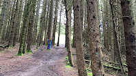
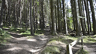
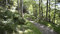
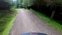
Photos of Innerleithen Trails Mountain Bike
trail: Matador
199 |
Oct 14, 2021 @ 11:16am
Oct 14, 2021
trail: Access Track
46 |
Aug 31, 2021 @ 11:46pm
Aug 31, 2021
trail: Minch Moor Climb
28 |
Jul 27, 2021 @ 5:36am
Jul 27, 2021
trail: Angry Sheep
114 |
Jul 11, 2021 @ 2:46pm
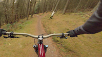
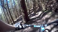
Jul 11, 2021Videos of Innerleithen Trails Mountain Bike

trail: Make or Brake
78 |
Jun 23, 2021

trail: Make or Brake
81 |
Jun 17, 2021
trail: IXS Line (Section Open)
83 |
Jan 12, 2021
trail: Matador
325 |
Jan 12, 2021
trail: Matador
182 |
Jan 12, 2021
trail: Cresta Run
169 |
Nov 10, 2020
trail: Make or Brake
0:42 |
378 |
Aug 1, 2020
trail: Gold Run
4:09 |
346 |
Apr 15, 2020
Recent Trail Reports
| status | trail | date | condition | info | user |
|---|---|---|---|---|---|
| The Mouse Trap | Jun 7, 2022 @ 12:34pm Jun 7, 2022 | Dry | gav-s TRAILFORKS | ||
| A Salmon's Journey | Apr 30, 2022 @ 3:02pm Apr 30, 2022 | Ideal | gav-s TRAILFORKS | ||
| Minch Moor Climb | Mar 20, 2022 @ 2:30pm Mar 20, 2022 | Dry | gav-s TRAILFORKS | ||
| Taniel Hill | Mar 20, 2022 @ 2:27pm Mar 20, 2022 | Unknown | gav-s TRAILFORKS | ||
| Forest Trail | Mar 20, 2022 @ 2:22pm Mar 20, 2022 | Dry | gav-s TRAILFORKS | ||
| Taniel Hill | Mar 20, 2022 @ 2:07pm Mar 20, 2022 | Ideal | gav-s TRAILFORKS | ||
| Rooty Bank | Mar 20, 2022 @ 2:04pm Mar 20, 2022 | Wet | gav-s TRAILFORKS | ||
| Minch Moor Descent | Mar 20, 2022 @ 1:54pm Mar 20, 2022 | Ideal | gav-s TRAILFORKS | ||
| IXS Line (Section Closed) | Jan 25, 2022 @ 10:52am Jan 25, 2022 | Variable | gav-s TRAILFORKS | ||
| The Tunnel (Section Closed) | Jan 25, 2022 @ 10:50am Jan 25, 2022 | Variable | gav-s TRAILFORKS |
Activity Feed
| username | action | type | title | date | |
|---|---|---|---|---|---|
 | mtbmiff | ridden | trail | A Salmon's Journey and 1 more | Jul 1, 2022 @ 12:46pm Jul 1, 2022 |
 | r1kaelin | ridden | trail | Angry Sheep and 7 more | Jul 1, 2022 @ 8:50am Jul 1, 2022 |
 | oholmes42 | wishlist | region | Innerleithen Trails | Jun 29, 2022 @ 3:53pm Jun 29, 2022 |
 | airmuppet | vote | trail | ProSpacker | Jun 28, 2022 @ 2:32pm Jun 28, 2022 |
| Bcots | wishlist | trail | Minch Moor Lower Descent | Jun 27, 2022 @ 12:03pm Jun 27, 2022 |
Recent Comments
| username | type | title | comment | date | |
|---|---|---|---|---|---|
| trail | Steepest/hardest of the man made runs at... | Jan 24, 2022 @ 1:54am Jan 24, 2022 | ||
| trail | Red route Typo | Jan 15, 2022 @ 2:13pm Jan 15, 2022 | ||
| trail | This is open but red egg lite before and after... | Jan 15, 2022 @ 2:12pm Jan 15, 2022 | ||
| trail | Recently used in SDA so way better than it... | Aug 9, 2021 @ 6:39am Aug 9, 2021 | ||
| trail | Mad run, way more advanced and steep than... | Apr 19, 2021 @ 2:45pm Apr 19, 2021 |
Nearby Areas
| name | distance | ||||
|---|---|---|---|---|---|
| Dod Hill | 2.6 km | ||||
| Caberston | 2 | 2.7 km | |||
| Elibank | 2 | 2.8 km | |||
| Cardrona | 1 | 2 | 3.5 km | ||
| Thornielee | 8 | 3.8 km |
Local Badges
-

Completionist0 awarded
Activity Type Stats
| activitytype | trails | distance | descent | descent distance | total vertical | rating | global rank | state rank | photos | reports | routes | ridelogs |
|---|---|---|---|---|---|---|---|---|---|---|---|---|
| Mountain Bike | 110 | 53 miles | 19,859 ft | 33 miles | 1,378 ft | #82 | #7 | 558 | 1,226 | 6 | 12,778 | |
| E-Bike | 110 | 53 miles | 19,859 ft | 33 miles | 1,378 ft | #33 | #5 | 1,076 | 1 | 550 | ||
| Hike | 26 | 23 miles | 3,540 ft | 11 miles | 1,355 ft | #2,587 | #82 | 991 | 55 | |||
| Trail Running | 25 | 23 miles | 3,540 ft | 11 miles | 1,355 ft | #2,592 | #81 | 991 | 130 | |||
| Horse | 4 | 13 miles | 1,480 ft | 6 miles | 922 ft | #93 | #2 | 475 |
- By 20twenty-p
 TVTA & contributors
 - Admins: TVTA
- #5982 - 35,001 views
- innerleithen trails activity log | embed map of Innerleithen Trails mountain bike trails | innerleithen trails mountain biking points of interest
Downloading of trail gps tracks in kml & gpx formats is enabled for Innerleithen Trails.
You must login to download files.