close
Trail Conditions
- Unknown
- Snow Groomed
- Snow Packed
- Snow Covered
- Snow Cover Inadequate
- Freeze/thaw Cycle
- Icy
- Prevalent Mud
- Wet
- Variable
- Ideal
- Dry
- Very Dry
Trail Flow (Ridden Direction)
Trailforks scans users ridelogs to determine the most popular direction each trail is ridden. A good flowing trail network will have most trails flowing in a single direction according to their intension.
The colour categories are based on what percentage of riders are riding a trail in its intended direction.
The colour categories are based on what percentage of riders are riding a trail in its intended direction.
- > 96%
- > 90%
- > 80%
- > 70%
- > 50%
- < 50%
- bi-directional trail
- no data
Trail Last Ridden
Trailforks scans ridelogs to determine the last time a trail was ridden.
- < 2 days
- < 1 week
- < 2 weeks
- < 1 month
- < 6 months
- > 6 months
Trail Ridden Direction
The intended direction a trail should be ridden.
- Downhill Only
- Downhill Primary
- Both Directions
- Uphill Primary
- Uphill Only
- One Direction
Contribute Details
Colors indicate trail is missing specified detail.
- Description
- Photos
- Description & Photos
- Videos
Trail Popularity ?
Trailforks scans ridelogs to determine which trails are ridden the most in the last 9 months.
Trails are compared with nearby trails in the same city region with a possible 25 colour shades.
Think of this as a heatmap, more rides = more kinetic energy = warmer colors.
- most popular
- popular
- less popular
- not popular
ATV/ORV/OHV Filter
Max Vehicle Width
inches
Radar Time
x
Activity Recordings
Trailforks users anonymized public ridelogs from the past 6 months.
- mountain biking recent
- mountain biking (>6 month)
- hiking (1 year)
- moto (1 year)
Activity Recordings
Trailforks users anonymized public skilogs from the past 12 months.
- Downhill Ski
- Backcountry Ski
- Nordic Ski
Jump Magnitude Heatmap
Heatmap of where riders jump on trails. Zoom in to see individual jumps, click circles to view jump details.
Trails Deemphasized
Trails are shown in grey.
Only show trails with NO bikes.
Save the current map location and zoom level as your default home location whenever this page is loaded.
SaveBike Park inserido no meio da Escarpa Devoniana
cerca de 5 pistas de Downhill algumas para xc, cavalgada e moto, com estrada para resgate, varias dificuldades, pedras, drops, duplos, mesas, curvas em parede, ofcamber, etc.
Piscina area para camping, parquinho, tanques para pesca, restaurante e banheiro.
Terreno particular, Aguas da Serra Bike Park
É cobrado taxa para utilização das trilhas e estrutura
Zéco - (41) 99187-2072 Estancia Aguas da Serra
Primary Trail Type: All-Mountain & Downhill
Land Status: Private Property
 google parking directions
 Access Info:
Estrada da faxina
Activities Click to view
- Mountain Bike
7 trails
- E-Bike
6 trails
- Hike
6 trails
- Trail Running
7 trails
- Horse
3 trails
- Dirtbike/Moto
2 trails
Bike Park Details
- 3
- 2
- 1
- 1
Region Status
Open as of Jun 13, 2021- Day Ticket
- R$20 BRL
- Uplift Type
- Magic Carpet
- Season start
- Apr 21
Stats
- Avg Trail Rating
- Trails (view details)
- 7
- Trails Mountain Bike
- 7
- Trails E-Bike
- 6
- Trails Hike
- 6
- Trails Trail Running
- 7
- Trails Horse
- 3
- Trails Dirtbike/Moto
- 2
- Total Distance
- 4 miles
- Total Descent Distance
- 2 miles
- Total Descent
- 1,725 ft
- Total Vertical
- 629 ft
- Highest Trailhead
- 3,276 ft
- Photos
- 1
- Ridden Counter
- 1
Popular Aguas da Serra Bike Park Mountain Biking Trails
| status | title | difficulty | rating |
|---|---|---|---|
| Pista 4 | |||
| Pista 1 | |||
| Pista 2 | |||
| Pista 3 | |||
| Resgate Aguas da Serra | |||
| Acesso trilha 3 | |||
| Acesso trilha 1 e 2 |
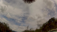
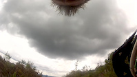
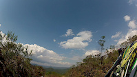
Photos of Aguas da Serra Bike Park Mountain Bike
trail: Pista 4
376 |
Jan 19, 2014 @ 5:59pm
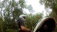
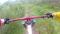
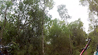
Jan 19, 2014Videos of Aguas da Serra Bike Park Mountain Bike

trail: Pista 4
2:36 |
102 |
Mar 29, 2015
trail: Pista 4
5:18 |
102 |
Jan 7, 2013
trail: Pista 4
5:32 |
57 |
Jan 7, 2013
trail: Pista 1
2:45 |
133 |
Jan 6, 2013
trail: Pista 1
2:51 |
96 |
Jan 6, 2013
trail: Pista 4
5:36 |
134 |
Nov 16, 2012
trail: Pista 1
3:22 |
46 |
Nov 15, 2012

trail: Pista 4
15:47 |
14 |
Apr 18, 2022 , São Luiz do Purunã
Activity Feed
| username | action | type | title | date | |
|---|---|---|---|---|---|
 | Rodrigo-Bruschz | add | video | São Luiz do Purunã - Pista Três 3 - Copa Astro and 2 more | Apr 18, 2022 @ 11:44am Apr 18, 2022 |
| Rodrigo-Bruschz | vote | trail | Acesso trilha 3 and 1 more | Jan 26, 2022 @ 11:49am Jan 26, 2022 |
 | andrecwb | add | video | Mtb São Luiz do Purunã - Águas da serra - Linha 1| *GoPro HERO 8 Black* | Enduro -... | Nov 22, 2021 @ 12:45pm Nov 22, 2021 |
| andrecwb | ridden | trail | Pista 1 | Oct 9, 2021 @ 8:36pm Oct 9, 2021 |
 | markholloway | update | trail | Pista 2 and 2 more | Sep 5, 2021 @ 5:32am Sep 5, 2021 |
Nearby Areas
| name | distance | ||||
|---|---|---|---|---|---|
| Morro do cal | 1 | 1 | 7.5 km | ||
| Vista Alegre Bike Park | 1 | 1 | 23 km | ||
| Downhill do Tanguá | 1 | 2 | 1 | 24 km | |
| Tamandaflow | 2 | 1 | 26 km |
Activity Type Stats
| activitytype | trails | distance | descent | descent distance | total vertical | rating | global rank | state rank | photos | reports | routes | ridelogs |
|---|---|---|---|---|---|---|---|---|---|---|---|---|
| Mountain Bike | 7 | 4 miles | 1,726 ft | 2 miles | 630 ft | #2,845 | #22 | 1 | 1 | |||
| E-Bike | 6 | 3 miles | 1,112 ft | 2 miles | 630 ft | #1,017 | #16 | |||||
| Hike | 6 | 4 miles | 1,371 ft | 2 miles | 630 ft | #2,280 | #22 | |||||
| Trail Running | 7 | 4 miles | 1,726 ft | 2 miles | 630 ft | #2,242 | #19 | |||||
| Horse | 3 | 2 miles | 354 ft | 2,585 ft | 620 ft | #142 | #4 | |||||
| Dirtbike/Moto | 2 | 1 mile | 709 ft | 4,744 ft | 354 ft | #31 | #1 |
- By Rodrigo-Bruschz & contributors
- Admins: apply
- #45222 - 759 views
- aguas da serra bike park activity log | embed map of Aguas da Serra Bike Park mountain bike trails | aguas da serra bike park mountain biking points of interest
Downloading of trail gps tracks in kml & gpx formats is enabled for Aguas da Serra Bike Park.
You must login to download files.