close
Trail Conditions
- Unknown
- Snow Groomed
- Snow Packed
- Snow Covered
- Snow Cover Inadequate
- Freeze/thaw Cycle
- Icy
- Prevalent Mud
- Wet
- Variable
- Ideal
- Dry
- Very Dry
Trail Flow (Ridden Direction)
Trailforks scans users ridelogs to determine the most popular direction each trail is ridden. A good flowing trail network will have most trails flowing in a single direction according to their intension.
The colour categories are based on what percentage of riders are riding a trail in its intended direction.
The colour categories are based on what percentage of riders are riding a trail in its intended direction.
- > 96%
- > 90%
- > 80%
- > 70%
- > 50%
- < 50%
- bi-directional trail
- no data
Trail Last Ridden
Trailforks scans ridelogs to determine the last time a trail was ridden.
- < 2 days
- < 1 week
- < 2 weeks
- < 1 month
- < 6 months
- > 6 months
Trail Ridden Direction
The intended direction a trail should be ridden.
- Downhill Only
- Downhill Primary
- Both Directions
- Uphill Primary
- Uphill Only
- One Direction
Contribute Details
Colors indicate trail is missing specified detail.
- Description
- Photos
- Description & Photos
- Videos
Trail Popularity ?
Trailforks scans ridelogs to determine which trails are ridden the most in the last 9 months.
Trails are compared with nearby trails in the same city region with a possible 25 colour shades.
Think of this as a heatmap, more rides = more kinetic energy = warmer colors.
- most popular
- popular
- less popular
- not popular
ATV/ORV/OHV Filter
Max Vehicle Width
inches
Radar Time
x
Activity Recordings
Trailforks users anonymized public ridelogs from the past 6 months.
- mountain biking recent
- mountain biking (>6 month)
- hiking (1 year)
- moto (1 year)
Activity Recordings
Trailforks users anonymized public skilogs from the past 12 months.
- Downhill Ski
- Backcountry Ski
- Nordic Ski
Jump Magnitude Heatmap
Heatmap of where riders jump on trails. Zoom in to see individual jumps, click circles to view jump details.
Trails Deemphasized
Trails are shown in grey.
Only show trails with NO bikes.
Save the current map location and zoom level as your default home location whenever this page is loaded.
SaveFor competent riders, 2-5 hours, 30km of trails in total.
Over 30km of trail is available for riding at Arapuke. Trails are mainly a mixture of grade 3 and grade 4 trails for intermediate to advanced riders, with a couple of grade 5 trails thrown in. There is plenty of smooth flowing trails to reward the 4km climb up Back Track. to get there or you can take a drive up Scott's Rd to the new car park and enjoy the trails at the top.
You can check the conditions via the webcam near the top of the park, or the weather station.
Primary Trail Type: All-Mountain & Downhill
eBikes Allowed:
Yes
Shuttleable: YES
AKA: Kahuterawa (K-Loop)
Land Status: City Managed
Land Manager: Palmerston North City Council
 google parking directions
 Access Info:
End of Kahuterawa Road, or Scotts Road
Links
Activities Click to view
- Mountain Bike
42 trails
- E-Bike
26 trails
- Hike
10 trails
- Trail Running
10 trails
Bike Park Details
- 8
- 5
- 12
- 1
- 6
- 1
Region Status
Open as of Nov 18, 2020- Uplift Type
- Shuttle
Stats
- Avg Trail Rating
- Trails (view details)
- 42
- Trails Mountain Bike
- 42
- Trails E-Bike
- 26
- Trails Hike
- 10
- Trails Trail Running
- 10
- Total Distance
- 24 miles
- Total Descent
- 7,166 ft
- Total Vertical
- 977 ft
- Highest Trailhead
- 1,457 ft
- Reports
- 311
- Photos
- 99
- Ridden Counter
- 15,419
Popular Arapuke Forest Mountain Biking Trails
Arapuke Forest Mountain Bike Routes
| title | rating | distance |
|---|---|---|
| Schools MTB Fest - (Proposed) DH course | 1 mile | |
| Schools MTB Fest - Enduro - Stage 1 | 2,313 ft | |
| Schools MTB Fest - Enduro - Stage 5 | 1,916 ft | |
| Schools MTB Fest - Enduro - Stage 4 | 4,012 ft | |
| Schools MTB Fest - XCO - Short course | 2 miles | |
| Schools MTB Fest - XCR course | 2 miles | |
| The K Loop Classic | 12 miles | |
| Schools MTB Fest - Enduro - Stage 3 | 1 mile | |
| Schools MTB Fest - DH course (Proposed) | 1 mile | |
| Family Flight | 6 miles |
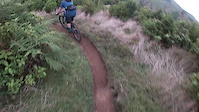
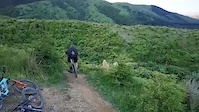
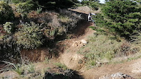
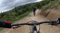
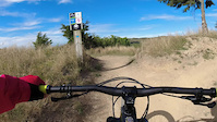
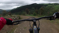
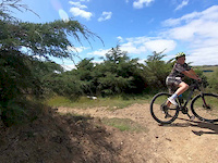
Photos of Arapuke Forest Mountain Bike
trail: Pūpū Rahi
2 |
May 6, 2022 @ 4:59pm
May 6, 2022
trail: Pūpū Rahi
3 |
May 6, 2022 @ 4:59pm
May 6, 2022
trail: Pūpū Rahi
4 |
May 6, 2022 @ 4:58pm
May 6, 2022
trail: Pūpū Rahi
19 |
May 6, 2022 @ 4:58pm
May 6, 2022
trail: Ripper
52 |
Apr 25, 2021 @ 12:24pm
Apr 25, 2021
trail: Riff Raff
73 |
Apr 23, 2021 @ 4:57am
Apr 23, 2021
trail: Ripper
65 |
Dec 21, 2020 @ 3:07pm
Dec 21, 2020
trail: Mr Twister
88 |
May 20, 2020 @ 1:39am
May 20, 2020Videos of Arapuke Forest Mountain Bike
trail: Kārearea
152 |
May 15, 2022
trail: Chewbacca
115 |
Oct 2, 2021
trail: Jumping Jack
156 |
Jun 11, 2021
trail: Mr Twister
78 |
Feb 26, 2021
trail: Jumping Jack
49 |
Feb 26, 2021
trail: Foo Fighter
83 |
Nov 24, 2020
trail: Mr Twister
13:16 |
167 |
Jun 4, 2020

trail: Kissing Rock
3:57 |
196 |
May 22, 2019
Recent Trail Reports
| status | trail | date | condition | info | user |
|---|---|---|---|---|---|
| Pūpū Rahi | Jul 3, 2022 @ 6:31pm 2 days | Wet | Robbiesmith | ||
| Chewbacca | Apr 10, 2022 @ 7:55pm Apr 10, 2022 | Ideal | Robbiesmith | ||
| Twister Link | Apr 8, 2022 @ 2:51pm Apr 8, 2022 | Variable | Smitty231 | ||
| Jack And The Beanstalk | Apr 8, 2022 @ 2:51pm Apr 8, 2022 | Variable | Smitty231 | ||
| Jack and the Beanstalk (Hard) | Apr 8, 2022 @ 2:51pm Apr 8, 2022 | Wet | Smitty231 | ||
| Ewok Rd | Apr 8, 2022 @ 2:51pm Apr 8, 2022 | Variable | Smitty231 | ||
| About Time | Apr 8, 2022 @ 2:51pm Apr 8, 2022 | Variable | Smitty231 | ||
| Foo Fighter | Apr 8, 2022 @ 2:51pm Apr 8, 2022 | Variable | Smitty231 | ||
| Jumping Jack | Apr 8, 2022 @ 2:51pm Apr 8, 2022 | Variable | Smitty231 | ||
| Humpty Jumpty | Apr 8, 2022 @ 2:51pm Apr 8, 2022 | Variable | Smitty231 |
Activity Feed
| username | action | type | title | date | |
|---|---|---|---|---|---|
 | Robbiesmith | add | report | Pūpū Rahi | Jul 3, 2022 @ 6:31pm 2 days |
| Tjma | ridden | trail | About Time and 4 more | Jul 2, 2022 @ 6:31am Jul 2, 2022 |
| paul-smillie | ridden | trail | Back Track and 1 more | Jun 8, 2022 @ 3:12am Jun 8, 2022 |
 | bikerwp | ridden | trail | Mind the Gap and 1 more | Jun 6, 2022 @ 11:07am Jun 6, 2022 |
| Andyrowe247 | wishlist | region | Arapuke Forest | May 31, 2022 @ 1:50pm May 31, 2022 |
Recent Comments
| username | type | title | comment | date | |
|---|---|---|---|---|---|
| trail | The trail is steep make sure you have enough... | Mar 20, 2022 @ 11:37pm Mar 20, 2022 | ||
 | trail | Really good track this. Definitely some... | Jan 9, 2022 @ 4:55pm Jan 9, 2022 | ||
| trail | Rode when it was still a 3 and the middle... | Jan 6, 2022 @ 12:05pm Jan 6, 2022 | ||
| trail | Long tight singletrack rather than flowy, with... | Jan 6, 2022 @ 11:59am Jan 6, 2022 | ||
| trail | Exit halfway to get to the trail intersection. | Jan 6, 2022 @ 11:47am Jan 6, 2022 |
Nearby Areas
| name | distance | ||||
|---|---|---|---|---|---|
| Paneiri Park | 4 | 3 | 6.1 km | ||
| Linklater Reserve | 1 | 10.3 km | |||
| Te Apiti | 3 | 1 | 14 km | ||
| Kohitere Forest | 2 | 4 | 1 | 18.8 km | |
| Foxton Beach Mountain Bike Trail | 1 | 20.2 km |
Local Badges
-

Completionist2 awarded
Activity Type Stats
| activitytype | trails | distance | descent | descent distance | total vertical | rating | global rank | state rank | photos | reports | routes | ridelogs |
|---|---|---|---|---|---|---|---|---|---|---|---|---|
| Mountain Bike | 42 | 24 miles | 7,165 ft | 12 miles | 978 ft | #404 | #18 | 99 | 311 | 23 | 3,701 | |
| E-Bike | 26 | 18 miles | 5,486 ft | 9 miles | 978 ft | #181 | #10 | 295 | 299 | |||
| Hike | 10 | 7 miles | 1,040 ft | 2 miles | 883 ft | #3,975 | #108 | 270 | 12 | |||
| Trail Running | 10 | 7 miles | 1,040 ft | 2 miles | 883 ft | #3,986 | #108 | 270 | 19 |
- By RoccoNZ & contributors
- Admins: MMBC, russell-brebner
- #7174 - 21,061 views
- arapuke forest activity log | embed map of Arapuke Forest mountain bike trails | arapuke forest mountain biking points of interest
-
- subscribe
- 3d map
Downloading of trail gps tracks in kml & gpx formats is enabled for Arapuke Forest.
You must login to download files.