close
Trail Conditions
- Unknown
- Snow Groomed
- Snow Packed
- Snow Covered
- Snow Cover Inadequate
- Freeze/thaw Cycle
- Icy
- Prevalent Mud
- Wet
- Variable
- Ideal
- Dry
- Very Dry
Trail Flow (Ridden Direction)
Trailforks scans users ridelogs to determine the most popular direction each trail is ridden. A good flowing trail network will have most trails flowing in a single direction according to their intension.
The colour categories are based on what percentage of riders are riding a trail in its intended direction.
The colour categories are based on what percentage of riders are riding a trail in its intended direction.
- > 96%
- > 90%
- > 80%
- > 70%
- > 50%
- < 50%
- bi-directional trail
- no data
Trail Last Ridden
Trailforks scans ridelogs to determine the last time a trail was ridden.
- < 2 days
- < 1 week
- < 2 weeks
- < 1 month
- < 6 months
- > 6 months
Trail Ridden Direction
The intended direction a trail should be ridden.
- Downhill Only
- Downhill Primary
- Both Directions
- Uphill Primary
- Uphill Only
- One Direction
Contribute Details
Colors indicate trail is missing specified detail.
- Description
- Photos
- Description & Photos
- Videos
Trail Popularity ?
Trailforks scans ridelogs to determine which trails are ridden the most in the last 9 months.
Trails are compared with nearby trails in the same city region with a possible 25 colour shades.
Think of this as a heatmap, more rides = more kinetic energy = warmer colors.
- most popular
- popular
- less popular
- not popular
ATV/ORV/OHV Filter
Max Vehicle Width
inches
Radar Time
x
Activity Recordings
Trailforks users anonymized public ridelogs from the past 6 months.
- mountain biking recent
- mountain biking (>6 month)
- hiking (1 year)
- moto (1 year)
Activity Recordings
Trailforks users anonymized public skilogs from the past 12 months.
- Downhill Ski
- Backcountry Ski
- Nordic Ski
Jump Magnitude Heatmap
Heatmap of where riders jump on trails. Zoom in to see individual jumps, click circles to view jump details.
Trails Deemphasized
Trails are shown in grey.
Only show trails with NO bikes.
Save the current map location and zoom level as your default home location whenever this page is loaded.
Save
No description for Arena Platoş has been added yet!
Login or register to submit one.
 google parking directions
Primary Trail Type: All-Mountain & Downhill
google parking directionsLinks
Activities Click to view
- Mountain Bike
9 trails
- E-Bike
6 trails
- Hike
5 trails
- Trail Running
5 trails
Bike Park Details
- 3
- 3
- 2
Region Status
Open as of Jun 13, 2022- Day Ticket
- 54 RON
- Uplift Type
- Chair Lift
Stats
- Avg Trail Rating
- Trails (view details)
- 9
- Trails Mountain Bike
- 9
- Trails E-Bike
- 6
- Trails Hike
- 5
- Trails Trail Running
- 5
- Total Distance
- 6 miles
- Total Descent Distance
- 2 miles
- Total Descent
- 1,111 ft
- Total Vertical
- 1,623 ft
- Highest Trailhead
- 4,690 ft
- Reports
- 7
- Ridden Counter
- 99
Popular Arena Platoş Mountain Biking Trails
Arena Platoş Mountain Bike Routes
| title | rating | distance |
|---|---|---|
| Enduro - Releu to Curmatura | 5 miles |
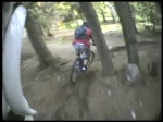
Videos of Arena Platoş Mountain Bike
trail: Paltinis
1:26 |
349 |
Oct 24, 2010
trail: Paltinis
4:09 |
293 |
Aug 17, 2010
trail: Paltinis
3:35 |
169 |
Jul 24, 2010

trail: Paltinis
3:02 |
153 |
Mar 16, 2010
trail: Paltinis
4:20 |
327 |
Feb 4, 2010
trail: Paltinis
2:37 |
116 |
Feb 4, 2010
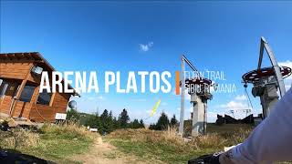
trail: Flow Trail
2:15 |
120 |
Oct 1, 2020 , Rășinari
Recent Trail Reports
| status | trail | date | condition | info | user |
|---|---|---|---|---|---|
| Paltinis | Jul 27, 2021 @ 6:42am Jul 27, 2021 | Dry | pufalot TRAILFORKS | ||
| DF Schit | Jul 27, 2021 @ 6:42am Jul 27, 2021 | Dry | pufalot TRAILFORKS | ||
| Flow Trail | Jul 27, 2021 @ 6:42am Jul 27, 2021 | Dry | pufalot TRAILFORKS | ||
| Downhill Trail | Jul 27, 2021 @ 6:42am Jul 27, 2021 | Dry | pufalot TRAILFORKS | ||
| Culmea Comenzii | Jul 27, 2021 @ 6:42am Jul 27, 2021 | Dry | pufalot TRAILFORKS |
Activity Feed
| username | action | type | title | date | |
|---|---|---|---|---|---|
 | Deiro12 | ridden | trail | Culmea Comenzii and 3 more | May 2, 2022 @ 1:58am May 2, 2022 |
 | verticalriding | like | report | Culmea Comenzii | Sep 13, 2021 @ 3:26am Sep 13, 2021 |
 | pufalot | add | report | Paltinis and 4 more | Jul 27, 2021 @ 10:27pm Jul 27, 2021 |
| pufalot | vote | trail | Culmea Comenzii and 1 more | Jul 27, 2021 @ 10:27pm Jul 27, 2021 |
 | zbangee | add | trail | Flow Trail and 6 more | Jul 26, 2021 @ 11:34pm Jul 26, 2021 |
Nearby Areas
| name | distance | ||||
|---|---|---|---|---|---|
| Voineasa | 17.8 km | ||||
| Obârșia Lotrului | 22 km |
Activity Type Stats
| activitytype | trails | distance | descent | descent distance | total vertical | rating | global rank | state rank | photos | reports | routes | ridelogs |
|---|---|---|---|---|---|---|---|---|---|---|---|---|
| Mountain Bike | 9 | 6 miles | 1,112 ft | 2 miles | 1,624 ft | #7,635 | #30 | 7 | 1 | 99 | ||
| E-Bike | 6 | 5 miles | 427 ft | 1 mile | 1,624 ft | #2,361 | #20 | 7 | 1 | 11 | ||
| Hike | 5 | 4 miles | 220 ft | 4,177 ft | 1,624 ft | #3,575 | #9 | 7 | 3 | |||
| Trail Running | 5 | 4 miles | 220 ft | 4,177 ft | 1,624 ft | #3,581 | #9 | 7 |
- By markholloway
 Trailforks & contributors
 - Admins: ATNS
- #23786 - 1,588 views
- arena platoş activity log | embed map of Arena Platoş mountain bike trails | arena platoş mountain biking points of interest
-
- subscribe
- 3d map
Downloading of trail gps tracks in kml & gpx formats is enabled for Arena Platoş.
You must login to download files.