close
Trail Conditions
- Unknown
- Snow Groomed
- Snow Packed
- Snow Covered
- Snow Cover Inadequate
- Freeze/thaw Cycle
- Icy
- Prevalent Mud
- Wet
- Variable
- Ideal
- Dry
- Very Dry
Trail Flow (Ridden Direction)
Trailforks scans users ridelogs to determine the most popular direction each trail is ridden. A good flowing trail network will have most trails flowing in a single direction according to their intension.
The colour categories are based on what percentage of riders are riding a trail in its intended direction.
The colour categories are based on what percentage of riders are riding a trail in its intended direction.
- > 96%
- > 90%
- > 80%
- > 70%
- > 50%
- < 50%
- bi-directional trail
- no data
Trail Last Ridden
Trailforks scans ridelogs to determine the last time a trail was ridden.
- < 2 days
- < 1 week
- < 2 weeks
- < 1 month
- < 6 months
- > 6 months
Trail Ridden Direction
The intended direction a trail should be ridden.
- Downhill Only
- Downhill Primary
- Both Directions
- Uphill Primary
- Uphill Only
- One Direction
Contribute Details
Colors indicate trail is missing specified detail.
- Description
- Photos
- Description & Photos
- Videos
Trail Popularity ?
Trailforks scans ridelogs to determine which trails are ridden the most in the last 9 months.
Trails are compared with nearby trails in the same city region with a possible 25 colour shades.
Think of this as a heatmap, more rides = more kinetic energy = warmer colors.
- most popular
- popular
- less popular
- not popular
ATV/ORV/OHV Filter
Max Vehicle Width
inches
Radar Time
x
Activity Recordings
Trailforks users anonymized public ridelogs from the past 6 months.
- mountain biking recent
- mountain biking (>6 month)
- hiking (1 year)
- moto (1 year)
Activity Recordings
Trailforks users anonymized public skilogs from the past 12 months.
- Downhill Ski
- Backcountry Ski
- Nordic Ski
Jump Magnitude Heatmap
Heatmap of where riders jump on trails. Zoom in to see individual jumps, click circles to view jump details.
Trails Deemphasized
Trails are shown in grey.
Only show trails with NO bikes.
Save the current map location and zoom level as your default home location whenever this page is loaded.
SaveBeing located on the upper valley of Prahova, at an altitude of 935 m, Azuga Resort is the perfect place both for leisure and for winter sports, trekking or mountain bike.
Sorica and Cazacu ski slopes were built up starting with 1990, and nowadays they totals a number of 7 kilometers of ski domain. Both ski slopes are provided with advanced equipment of producing artificial snow, being perfect both for beginners and for advanced practitioners of skiing.
Located near Sorica ski slope, at 2 kilometers of the National Road DN1, 35 kilometers of Brasov and 135 kilometers of Bucharest, Azuga Ski & Bike Resort is the perfect location also for leisure and mountain sports.
Azuga Ski & Bike Resort meets all your needs, from entertainment to relaxing, by offering a wide range of services: Hotel, Restaurant, Bowling & Billiards Arena, Gondola, Snack-Bar or ski & snowboard equipment rental.
source: azuga resort website
Primary Trail Type: All-Mountain & Downhill
eBikes Allowed:
Yes
Shuttleable: YES
Land Status: Ski Resort
Activities Click to view
- Mountain Bike
5 trails
- E-Bike
5 trails
- Hike
3 trails
- Trail Running
3 trails
Bike Park Details
- 2
- 2
- 1
Region Status
Open as of Jun 8, 2020- Day Ticket
- 60 RON
- Uplift Type
- Gondola
Stats
- Avg Trail Rating
- Trails (view details)
- 5
- Trails Mountain Bike
- 5
- Trails E-Bike
- 5
- Trails Hike
- 3
- Trails Trail Running
- 3
- Trails Horse
- 1
- Trails Dirtbike/Moto
- 1
- Total Distance
- 20 miles
- Total Descent
- 7,906 ft
- Total Vertical
- 3,099 ft
- Highest Trailhead
- 6,178 ft
- Reports
- 16
- Photos
- 8
- Ridden Counter
- 159
Popular Azuga Mountain Bike Resort Trails
| status | title | difficulty | rating |
|---|---|---|---|
| Drumul Căruţaşilor | |||
| Access to trail head | |||
| Poteca Afinarilor | |||
| Poteca Vulpilor | |||
| Culmea Baiului |
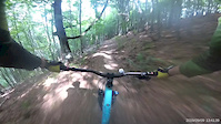
Photos of Azuga Mountain Bike Resort Mountain Bike
trail: Drumul Căruţaşilor
134 |
Nov 5, 2018 @ 12:11am
Nov 5, 2018
trail: Poteca Afinarilor
116 |
Oct 14, 2018 @ 4:23am
Oct 14, 2018
trail: Drumul Căruţaşilor
127 |
Apr 29, 2018 @ 12:04am
Apr 29, 2018
trail: Drumul Căruţaşilor
115 |
Apr 29, 2018 @ 12:04am
Apr 29, 2018
trail: Poteca Afinarilor
103 |
Apr 29, 2018 @ 12:03am
Apr 29, 2018
trail: Poteca Afinarilor
115 |
Apr 29, 2018 @ 12:03am
Apr 29, 2018
trail: Poteca Afinarilor
99 |
Apr 29, 2018 @ 12:03am
Apr 29, 2018
trail: Poteca Afinarilor
95 |
Apr 29, 2018 @ 12:03am
Apr 29, 2018Videos of Azuga Mountain Bike Resort Mountain Bike
trail: Poteca Afinarilor
0:23 |
259 |
Sep 13, 2019

trail: Drumul Căruţaşilor
13:22 |
162 |
Mar 19, 2021 , Azuga
trail: Poteca Afinarilor
130 |
Oct 30, 2020 , Azuga
Recent Trail Reports
| status | trail | date | condition | info | user |
|---|---|---|---|---|---|
| Access to trail head | Jun 25, 2022 @ 11:23pm Jun 25, 2022 | Wet | rzvrazvan | ||
| Culmea Baiului | Sep 9, 2021 @ 12:54am Sep 9, 2021 | Ideal | steff-u | ||
| Drumul Căruţaşilor | Sep 9, 2021 @ 12:54am Sep 9, 2021 | Ideal | steff-u | ||
| Poteca Afinarilor | Aug 23, 2020 @ 2:00am Aug 23, 2020 | Ideal | 3sixtee |
Activity Feed
| username | action | type | title | date | |
|---|---|---|---|---|---|
 | szergen | wishlist | trail | Drumul Căruţaşilor and 2 more | Jun 30, 2022 @ 7:11am Jun 30, 2022 |
| alexandrei64 | ridden | trail | Drumul Căruţaşilor | Jun 29, 2022 @ 9:38pm Jun 29, 2022 |
| rzvrazvan | add | report | Access to trail head | Jun 26, 2022 @ 1:21pm Jun 26, 2022 |
| alexandrei64 | wishlist | trail | Drumul Căruţaşilor | Jun 13, 2022 @ 11:10pm Jun 13, 2022 |
| MihaiVasile | wishlist | trail | Drumul Căruţaşilor | Nov 12, 2021 @ 8:13am Nov 12, 2021 |
Nearby Areas
| name | distance | ||||
|---|---|---|---|---|---|
| Sinaia Mountain Bike Resort | 1 | 3 | 1 | 6.2 km | |
| Piatra Mare | 10 | 5 | 3 | 1 | 8.6 km |
| Postăvaru | 67 | 31 | 11 | 2 | 9.8 km |
| Glăjărie | 1 | 1 | 9.9 km | ||
| Noua | 2 | 2 | 12.6 km |
Bike & Skill Parks
| name | type | city | rating |
|---|---|---|---|
| Azuga Skill park | skill park | Azuga |
Local Trail Supporters
- Richea Vasile
Activity Type Stats
| activitytype | trails | distance | descent | descent distance | total vertical | rating | global rank | state rank | photos | reports | routes | ridelogs |
|---|---|---|---|---|---|---|---|---|---|---|---|---|
| Mountain Bike | 5 | 20 miles | 7,907 ft | 14 miles | 3,100 ft | #3,803 | #9 | 8 | 16 | 128 | ||
| E-Bike | 5 | 20 miles | 7,907 ft | 14 miles | 3,100 ft | #1,422 | #6 | 16 | 13 | |||
| Hike | 3 | 18 miles | 6,001 ft | 12 miles | 3,100 ft | #3,338 | #8 | 16 | 4 | |||
| Trail Running | 3 | 18 miles | 6,001 ft | 12 miles | 3,100 ft | #3,350 | #8 | 16 | ||||
| Horse | 1 | 4 miles | 1,952 ft | 3 miles | 1,883 ft | 2 | ||||||
| Dirtbike/Moto | 1 | 10 miles | 2,438 ft | 6 miles | 1,808 ft |
- By SurmontClub Surmont & contributors
- Admins: apply
- #23098 - 4,582 views
- azuga mountain bike resort activity log | embed map of Azuga Mountain Bike Resort mountain bike trails | azuga mountain bike resort mountain biking points of interest
Downloading of trail gps tracks in kml & gpx formats is enabled for Azuga Mountain Bike Resort.
You must login to download files.