close
Trail Conditions
- Unknown
- Snow Groomed
- Snow Packed
- Snow Covered
- Snow Cover Inadequate
- Freeze/thaw Cycle
- Icy
- Prevalent Mud
- Wet
- Variable
- Ideal
- Dry
- Very Dry
Trail Flow (Ridden Direction)
Trailforks scans users ridelogs to determine the most popular direction each trail is ridden. A good flowing trail network will have most trails flowing in a single direction according to their intension.
The colour categories are based on what percentage of riders are riding a trail in its intended direction.
The colour categories are based on what percentage of riders are riding a trail in its intended direction.
- > 96%
- > 90%
- > 80%
- > 70%
- > 50%
- < 50%
- bi-directional trail
- no data
Trail Last Ridden
Trailforks scans ridelogs to determine the last time a trail was ridden.
- < 2 days
- < 1 week
- < 2 weeks
- < 1 month
- < 6 months
- > 6 months
Trail Ridden Direction
The intended direction a trail should be ridden.
- Downhill Only
- Downhill Primary
- Both Directions
- Uphill Primary
- Uphill Only
- One Direction
Contribute Details
Colors indicate trail is missing specified detail.
- Description
- Photos
- Description & Photos
- Videos
Trail Popularity ?
Trailforks scans ridelogs to determine which trails are ridden the most in the last 9 months.
Trails are compared with nearby trails in the same city region with a possible 25 colour shades.
Think of this as a heatmap, more rides = more kinetic energy = warmer colors.
- most popular
- popular
- less popular
- not popular
ATV/ORV/OHV Filter
Max Vehicle Width
inches
Radar Time
x
Activity Recordings
Trailforks users anonymized public ridelogs from the past 6 months.
- mountain biking recent
- mountain biking (>6 month)
- hiking (1 year)
- moto (1 year)
Activity Recordings
Trailforks users anonymized public skilogs from the past 12 months.
- Downhill Ski
- Backcountry Ski
- Nordic Ski
Jump Magnitude Heatmap
Heatmap of where riders jump on trails. Zoom in to see individual jumps, click circles to view jump details.
Trails Deemphasized
Trails are shown in grey.
Only show trails with NO bikes.
Save the current map location and zoom level as your default home location whenever this page is loaded.
Save
No description for Bike Centrum Kálnica has been added yet!
Login or register to submit one.
 google parking directions
Primary Trail Type: All-Mountain & Downhill
Shuttleable: YES
Land Status: Ski Resort
google parking directions Access Info:
Ski area Kálnica
Links
Activities Click to view
- Mountain Bike
13 trails
- Hike
0 trails
- Trail Running
0 trails
Bike Park Details
- 2
- 4
- 2
- 2
- 2
Region Status
Open as of May 22, 2022- Day Ticket
- 15 EUR
- Uplift Type
- T-Bar
- Season start
- Apr 1
- Season end
- Dec 1
Stats
- Avg Trail Rating
- Trails (view details)
- 13
- Trails Mountain Bike
- 13
- Total Distance
- 4 miles
- Total Descent
- 2,851 ft
- Total Vertical
- 358 ft
- Highest Trailhead
- 1,169 ft
- Reports
- 162
- Photos
- 43
- Ridden Counter
- 2,314
Popular Bike Centrum Kálnica Mountain Biking Trails
| status | title | difficulty | rating |
|---|---|---|---|
| Funny Enduro | |||
| Airline | |||
| Super Enduro | |||
| Fox | |||
| Pump line | |||
| Era | |||
| Vito | |||
| Austrália | |||
| Big Air Line | |||
| SlopeStyle | |||
| SP DH | |||
| Bikefest Test trail |
Bike Centrum Kálnica Mountain Bike Routes
| title | rating | distance |
|---|---|---|
| Kalnica 2016 Enduro race race | 15 miles | |
| Kalnica 2017 CTM Enduro Race race | 15 miles |
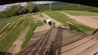
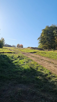
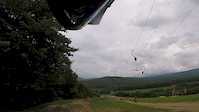
Photos of Bike Centrum Kálnica Mountain Bike
trail: SlopeStyle
29 |
Oct 30, 2021 @ 7:43am
Oct 30, 2021
trail: Airline
11 |
Oct 30, 2021 @ 7:43am
Oct 30, 2021
trail: Big Air Line
12 |
Oct 30, 2021 @ 7:43am
Oct 30, 2021
trail: Vito
15 |
Oct 30, 2021 @ 7:42am
Oct 30, 2021
trail: SlopeStyle
18 |
Oct 30, 2021 @ 7:42am
Oct 30, 2021
trail: SlopeStyle
12 |
Oct 30, 2021 @ 7:42am
Oct 30, 2021
trail: SlopeStyle
51 |
Oct 30, 2021 @ 7:42am
Oct 30, 2021
trail: SlopeStyle
61 |
Sep 25, 2020 @ 10:22am
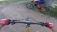
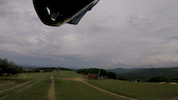
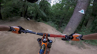
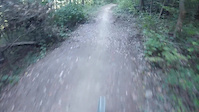
Sep 25, 2020Videos of Bike Centrum Kálnica Mountain Bike
trail: Era
20 |
May 28, 2022
trail: Big Air Line
46 |
Nov 19, 2021
trail: Comeback
17 |
Apr 30, 2021
trail: Austrália
1:35 |
48 |
Nov 10, 2019
trail: Comeback
0:46 |
15 |
Nov 10, 2019
trail: Funny Enduro
1:33 |
111 |
Nov 9, 2019
trail: SlopeStyle
1:08 |
149 |
Oct 15, 2019
trail: Funny Enduro
1:01 |
33 |
Oct 9, 2018
Recent Trail Reports
| status | trail | date | condition | info | user |
|---|---|---|---|---|---|
| Funny Enduro | Jun 25, 2022 @ 1:41am Jun 25, 2022 | Dry | gabor0315 | ||
| Airline | Jun 25, 2022 @ 1:41am Jun 25, 2022 | Dry | gabor0315 | ||
| Pump line | Jun 25, 2022 @ 1:41am Jun 25, 2022 | Dry | gabor0315 | ||
| Super Enduro | Jun 25, 2022 @ 1:41am Jun 25, 2022 | Dry | gabor0315 | ||
| Fox | Jun 25, 2022 @ 1:41am Jun 25, 2022 | Dry | gabor0315 | ||
| Vito | Jun 25, 2022 @ 1:41am Jun 25, 2022 | Dry | gabor0315 | ||
| Era | May 22, 2022 @ 4:28am May 22, 2022 | Ideal | Knapo | ||
| Austrália | May 22, 2022 @ 4:28am May 22, 2022 | Ideal | Knapo | ||
| Big Air Line | May 22, 2022 @ 4:28am May 22, 2022 | Dry | Knapo | ||
| SP DH | May 22, 2022 @ 4:28am May 22, 2022 | Ideal | Knapo |
Activity Feed
| username | action | type | title | date | |
|---|---|---|---|---|---|
 | gabor0315 | add | report | Funny Enduro and 5 more | Jun 25, 2022 @ 11:29pm Jun 25, 2022 |
 | Sullabrenta | wishlist | region | Bike Centrum Kálnica | Jun 12, 2022 @ 5:19am Jun 12, 2022 |
 | HegNasty | add | photo | at SlopeStyle in Budapest, Hungary and 6 more | Jun 9, 2022 @ 3:14am Jun 9, 2022 |
 | wiktorczerwiec | add | video | edit | May 28, 2022 @ 7:34am May 28, 2022 |
| Knapo | add | report | Funny Enduro and 9 more | May 22, 2022 @ 9:32pm May 22, 2022 |
Nearby Areas
| name | distance | ||||
|---|---|---|---|---|---|
| Inovec | 7 | 3 | 5 km | ||
| Hrádok | 3 | 1 | 5.6 km | ||
| Čachtice | 4 | 1 | 2 | 2 | 8.8 km |
| Vinište | 3 | 2 | 9 km | ||
| Ostrý vrch | 1 | 10.3 km |
Bike & Skill Parks
| name | type | city | rating |
|---|---|---|---|
| Pumptrack Kellys Bikepark Kálnica | skill park | Nove Mesto nad Vahom |
- By jxxw
 TRAILFORKS & contributors
 - Admins: apply
- #13757 - 6,512 views
- bike centrum kálnica activity log | embed map of Bike Centrum Kálnica mountain bike trails | bike centrum kálnica mountain biking points of interest
-
- subscribe
- 3d map
Downloading of trail gps tracks in kml & gpx formats is enabled for Bike Centrum Kálnica.
You must login to download files.