close
Trail Conditions
- Unknown
- Snow Groomed
- Snow Packed
- Snow Covered
- Snow Cover Inadequate
- Freeze/thaw Cycle
- Icy
- Prevalent Mud
- Wet
- Variable
- Ideal
- Dry
- Very Dry
Trail Flow (Ridden Direction)
Trailforks scans users ridelogs to determine the most popular direction each trail is ridden. A good flowing trail network will have most trails flowing in a single direction according to their intension.
The colour categories are based on what percentage of riders are riding a trail in its intended direction.
The colour categories are based on what percentage of riders are riding a trail in its intended direction.
- > 96%
- > 90%
- > 80%
- > 70%
- > 50%
- < 50%
- bi-directional trail
- no data
Trail Last Ridden
Trailforks scans ridelogs to determine the last time a trail was ridden.
- < 2 days
- < 1 week
- < 2 weeks
- < 1 month
- < 6 months
- > 6 months
Trail Ridden Direction
The intended direction a trail should be ridden.
- Downhill Only
- Downhill Primary
- Both Directions
- Uphill Primary
- Uphill Only
- One Direction
Contribute Details
Colors indicate trail is missing specified detail.
- Description
- Photos
- Description & Photos
- Videos
Trail Popularity ?
Trailforks scans ridelogs to determine which trails are ridden the most in the last 9 months.
Trails are compared with nearby trails in the same city region with a possible 25 colour shades.
Think of this as a heatmap, more rides = more kinetic energy = warmer colors.
- most popular
- popular
- less popular
- not popular
ATV/ORV/OHV Filter
Max Vehicle Width
inches
Radar Time
x
Activity Recordings
Trailforks users anonymized public ridelogs from the past 6 months.
- mountain biking recent
- mountain biking (>6 month)
- hiking (1 year)
- moto (1 year)
Activity Recordings
Trailforks users anonymized public skilogs from the past 12 months.
- Downhill Ski
- Backcountry Ski
- Nordic Ski
Jump Magnitude Heatmap
Heatmap of where riders jump on trails. Zoom in to see individual jumps, click circles to view jump details.
Trails Deemphasized
Trails are shown in grey.
Only show trails with NO bikes.
Save the current map location and zoom level as your default home location whenever this page is loaded.
Save
No description for Bike Park Kronplatz has been added yet!
Login or register to submit one.
 google parking directions
google parking directions Activities Click to view
- Mountain Bike
21 trails
- E-Bike
13 trails
- Hike
1 trails
- Trail Running
1 trails
Bike Park Details
- 1
- 8
- 7
- 5
Region Status
Open as of Jul 9, 2021- Day Ticket
- 35 EUR
- Uplift Type
- Gondola
Stats
- Avg Trail Rating
- Trails (view details)
- 21
- Trails Mountain Bike
- 21
- Trails E-Bike
- 13
- Trails Hike
- 1
- Trails Trail Running
- 1
- Total Distance
- 31 miles
- Total Descent
- 26,347 ft
- Total Vertical
- 4,807 ft
- Highest Trailhead
- 8,078 ft
- Reports
- 146
- Photos
- 108
- Ridden Counter
- 2,971
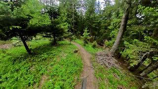
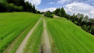
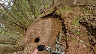
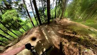
Popular Bike Park Kronplatz Mountain Biking Trails
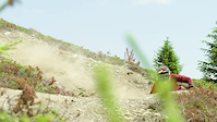
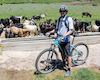
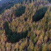
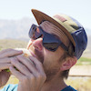
Photos of Bike Park Kronplatz Mountain Bike
trail: Uschi
45 |
Sep 7, 2020 @ 12:46am
Sep 7, 2020
trail: Uschi
44 |
Sep 7, 2020 @ 12:46am
Sep 7, 2020
trail: Andreas Trail
40 |
Sep 7, 2020 @ 12:45am
Sep 7, 2020
trail: Andreas Trail
35 |
Sep 7, 2020 @ 12:45am
Sep 7, 2020
trail: Andreas Trail
28 |
Sep 7, 2020 @ 12:44am
Sep 7, 2020
trail: Andreas Trail
31 |
Sep 7, 2020 @ 12:44am
Sep 7, 2020
trail: Andreas Trail
32 |
Sep 7, 2020 @ 12:44am
Sep 7, 2020
trail: Andreas Trail
35 |
Sep 7, 2020 @ 12:44am
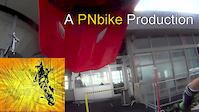
Sep 7, 2020Videos of Bike Park Kronplatz Mountain Bike
trail: Furcia Trail
1:26 |
265 |
Feb 14, 2018
trail: Freeride Trail Herrnsteig
6:13 |
172 |
Jan 31, 2016
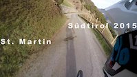
trail: Christian
2:12 |
115 |
Apr 16, 2015
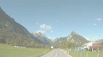
trail: Christian
5:57 |
272 |
Oct 9, 2010
trail: Richard-Anton
3:13 |
19 |
May 24, 2022 , Brunico
trail: Uschi
2:46 |
18 |
May 24, 2022 , Brunico
trail: Franz
3:22 |
28 |
May 24, 2022 , Brunico
trail: Freeride Trail Herrnsteig
8:55 |
28 |
May 24, 2022 , Brunico
Recent Trail Reports
| status | trail | date | condition | info | user |
|---|---|---|---|---|---|
| Freeride Trail Herrnsteig | Jun 19, 2022 @ 4:50am Jun 19, 2022 | Ideal | larch3102 | ||
| Furcia Trail | Jun 19, 2022 @ 4:41am Jun 19, 2022 | Dry | larch3102 | ||
| Uschi | Jun 5, 2022 @ 9:49am Jun 5, 2022 | Ideal | Zen55 | ||
| Alex Trail | Jun 5, 2022 @ 9:44am Jun 5, 2022 | Variable | Zen55 | ||
| CC-Top | Aug 28, 2021 @ 5:01am Aug 28, 2021 | Ideal | Giobike73 | ||
| CCTop1 | Aug 28, 2021 @ 5:01am Aug 28, 2021 | Ideal | Giobike73 | ||
| CCTop2 | Aug 28, 2021 @ 5:01am Aug 28, 2021 | Ideal | Giobike73 | ||
| LittleTop | Aug 28, 2021 @ 5:01am Aug 28, 2021 | Ideal | Giobike73 | ||
| Freeride Piz de Plaies | Aug 23, 2021 @ 9:27am Aug 23, 2021 | Dry | raimundpr | ||
| GASSL trail | Aug 14, 2021 @ 8:16am Aug 14, 2021 | Very Dry | Dellamar |
Activity Feed
| username | action | type | title | date | |
|---|---|---|---|---|---|
 | Timtail | wishlist | trail | Richard-Anton | Jun 24, 2022 @ 6:50am Jun 24, 2022 |
 | Johnvai | vote | trail | Alex Trail | Jun 24, 2022 @ 4:53am Jun 24, 2022 |
| Schnurzel | wishlist | region | Bike Park Kronplatz | Jun 20, 2022 @ 11:57am Jun 20, 2022 |
 | larch3102 | add | report | Furcia Trail and 1 more | Jun 19, 2022 @ 4:41am Jun 19, 2022 |
 | Zen55 | vote | trail | Furcia Trail | Jun 17, 2022 @ 8:08am Jun 17, 2022 |
Recent Comments
| username | type | title | comment | date | |
|---|---|---|---|---|---|
| trail | cool, but not double black. | Jun 14, 2022 @ 1:43am Jun 14, 2022 | ||
| trail | Cool trail, but not black, not even blue.... | Jun 14, 2022 @ 1:08am Jun 14, 2022 | ||
| trail | @ Troubletoni: I think you didn't ride the... | Nov 7, 2021 @ 9:39pm Nov 7, 2021 | ||
| trail | Really great trail !!! | Nov 7, 2021 @ 9:34pm Nov 7, 2021 | ||
 | trail | Why would that be Double Black? It‘s classic... | Oct 20, 2021 @ 1:47pm Oct 20, 2021 |
Nearby Areas
| name | distance | ||||
|---|---|---|---|---|---|
| Dobbiaco / Toblach | 1 | 3 | 4 | 12.5 km | |
| Bike Beats - Movimënt Alta Badia Trails | 5 | 3 | 1 | 12.9 km | |
| Cortina | 1 | 8 | 2 | 1 | 16.8 km |
| Arabba | 2 | 5 | 1 | 19.2 km | |
| Fassa Bike District | 4 | 8 | 4 | 2 | 19.5 km |
Local Badges
-

Completionist0 awarded
Activity Type Stats
| activitytype | trails | distance | descent | descent distance | total vertical | rating | global rank | state rank | photos | reports | routes | ridelogs |
|---|---|---|---|---|---|---|---|---|---|---|---|---|
| Mountain Bike | 21 | 31 miles | 26,348 ft | 21 miles | 4,806 ft | #1,123 | #14 | 108 | 146 | 1,586 | ||
| E-Bike | 13 | 14 miles | 13,802 ft | 7 miles | 4,124 ft | #397 | #15 | 133 | 167 | |||
| Hike | 1 | 2 miles | 1,332 ft | 2 miles | 1,332 ft | #2,938 | #101 | 118 | 34 | |||
| Trail Running | 1 | 2 miles | 1,332 ft | 2 miles | 1,332 ft | #3,655 | #131 | 117 | 2 |
- By brenthillier
 NSMBA TRAILFORKS & contributors
 - Admins: apply
- #6606 - 7,348 views
- bike park kronplatz activity log | embed map of Bike Park Kronplatz mountain bike trails | bike park kronplatz mountain biking points of interest
Downloading of trail gps tracks in kml & gpx formats is enabled for Bike Park Kronplatz.
You must login to download files.