close
Trail Conditions
- Unknown
- Snow Groomed
- Snow Packed
- Snow Covered
- Snow Cover Inadequate
- Freeze/thaw Cycle
- Icy
- Prevalent Mud
- Wet
- Variable
- Ideal
- Dry
- Very Dry
Trail Flow (Ridden Direction)
Trailforks scans users ridelogs to determine the most popular direction each trail is ridden. A good flowing trail network will have most trails flowing in a single direction according to their intension.
The colour categories are based on what percentage of riders are riding a trail in its intended direction.
The colour categories are based on what percentage of riders are riding a trail in its intended direction.
- > 96%
- > 90%
- > 80%
- > 70%
- > 50%
- < 50%
- bi-directional trail
- no data
Trail Last Ridden
Trailforks scans ridelogs to determine the last time a trail was ridden.
- < 2 days
- < 1 week
- < 2 weeks
- < 1 month
- < 6 months
- > 6 months
Trail Ridden Direction
The intended direction a trail should be ridden.
- Downhill Only
- Downhill Primary
- Both Directions
- Uphill Primary
- Uphill Only
- One Direction
Contribute Details
Colors indicate trail is missing specified detail.
- Description
- Photos
- Description & Photos
- Videos
Trail Popularity ?
Trailforks scans ridelogs to determine which trails are ridden the most in the last 9 months.
Trails are compared with nearby trails in the same city region with a possible 25 colour shades.
Think of this as a heatmap, more rides = more kinetic energy = warmer colors.
- most popular
- popular
- less popular
- not popular
ATV/ORV/OHV Filter
Max Vehicle Width
inches
Radar Time
x
Activity Recordings
Trailforks users anonymized public ridelogs from the past 6 months.
- mountain biking recent
- mountain biking (>6 month)
- hiking (1 year)
- moto (1 year)
Activity Recordings
Trailforks users anonymized public skilogs from the past 12 months.
- Downhill Ski
- Backcountry Ski
- Nordic Ski
Jump Magnitude Heatmap
Heatmap of where riders jump on trails. Zoom in to see individual jumps, click circles to view jump details.
Trails Deemphasized
Trails are shown in grey.
Only show trails with NO bikes.
Save the current map location and zoom level as your default home location whenever this page is loaded.
Save
No description for Bike Park Stożek has been added yet!
Login or register to submit one.
 google parking directions
Primary Trail Type: All-Mountain & Downhill
Land Status: Managed by Local Riding Association
google parking directionsLinks
This region uses the Uk/Euro style trail grading system.
Activities Click to view
- Mountain Bike
6 trails
- Hike
0 trails
- Trail Running
0 trails
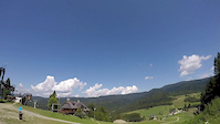
Bike Park Details
- 4
- 2
Region Status
Caution as of Aug 3, 2020- Day Ticket
- zł55 PLN
- Uplift Type
- Chair Lift
- Season start
- Mar 10
- Season end
- Nov 20
Stats
- Avg Trail Rating
- Trails (view details)
- 6
- Trails Mountain Bike
- 6
- Total Distance
- 3 miles
- Total Descent
- 2,398 ft
- Total Vertical
- 812 ft
- Highest Trailhead
- 3,159 ft
- Reports
- 21
- Photos
- 67
- Ridden Counter
- 200
Popular Bike Park Stożek Mountain Biking Trails
| status | title | difficulty | rating |
|---|---|---|---|
| Fun Track Lower | |||
| Fun Track Upper | |||
| A-Line | |||
| Dh 2 | |||
| Downhill UCI | |||
| LSD line |
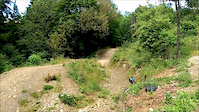
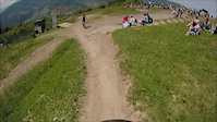
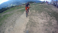
Photos of Bike Park Stożek Mountain Bike
trail: LSD line
152 |
Aug 24, 2018 @ 1:55pm
Aug 24, 2018
trail: A-Line
481 | | 2 comments
Jan 19, 2018 @ 2:09pm
Jan 19, 2018
trail: A-Line
72 |
Oct 11, 2017 @ 1:52am
Oct 11, 2017
trail: Downhill UCI
121 |
Jul 5, 2017 @ 3:14am
Jul 5, 2017
trail: Downhill UCI
91 |
Jul 5, 2017 @ 3:14am
Jul 5, 2017
trail: Downhill UCI
127 |
Jul 5, 2017 @ 3:13am
Jul 5, 2017
trail: Downhill UCI
153 |
Jul 5, 2017 @ 3:13am
Jul 5, 2017
trail: Downhill UCI
98 |
Jul 5, 2017 @ 3:12am
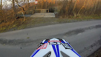
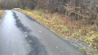
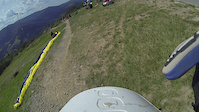
Jul 5, 2017Videos of Bike Park Stożek Mountain Bike
trail: A-Line
0:10 |
86 |
Jul 1, 2017
trail: A-Line
3:15 |
84 |
Jun 28, 2017

trail: A-Line
4:48 |
82 |
Jun 4, 2017
trail: A-Line
0:59 |
170 |
Nov 23, 2016
trail: A-Line
6:11 |
121 |
Nov 11, 2016
trail: A-Line
1:48 |
50 |
Sep 15, 2016
trail: A-Line
2:47 |
51 |
Aug 22, 2016
trail: A-Line
2:01 |
13 |
Aug 8, 2016
Recent Trail Reports
| status | trail | date | condition | info | user |
|---|---|---|---|---|---|
| Downhill UCI | Aug 9, 2020 @ 2:54am Aug 9, 2020 | Dry | paciu666 | ||
| A-Line | Jul 28, 2020 @ 12:27am Jul 28, 2020 | Dry | kanalizer | ||
| Fun Track Lower | Jul 28, 2020 @ 12:27am Jul 28, 2020 | Dry | kanalizer | ||
| Fun Track Upper | Jul 28, 2020 @ 12:27am Jul 28, 2020 | Dry | kanalizer | ||
| Dh 2 | Jul 28, 2020 @ 12:27am Jul 28, 2020 | Dry | kanalizer | ||
| LSD line | Aug 18, 2019 @ 11:15pm Aug 18, 2019 | Dry | cadmortess |
Activity Feed
| username | action | type | title | date | |
|---|---|---|---|---|---|
 | mtb-owclimber | wishlist | trail | Downhill UCI | May 17, 2022 @ 10:54am May 17, 2022 |
 | LiMuBai81 | wishlist | region | Bike Park Stożek | May 13, 2022 @ 1:20pm May 13, 2022 |
 | xidedix | add | event | Hard Downhill League 2022 - Wisła, Stożek #5 | May 12, 2022 @ 3:52am May 12, 2022 |
 | janko-ritter | ridden | trail | LSD line and 1 more | Feb 6, 2022 @ 11:29pm Feb 6, 2022 |
| xidedix | add | event | Uphill MTB Stożek 2021 | Oct 6, 2021 @ 7:08am Oct 6, 2021 |
Recent Comments
| username | type | title | comment | date | |
|---|---|---|---|---|---|
 | trail | swietnie to wyglada ^^ | Nov 11, 2015 @ 12:28am Nov 11, 2015 |
Nearby Areas
| name | distance | ||||
|---|---|---|---|---|---|
| Skolnity Wisła Ski & Bike | 1 | 1 | 3.5 km | ||
| Nowa Osada | 1 | 1 | 3.8 km | ||
| Bike Park Palenica | 1 | 6.9 km | |||
| Mosty u Jablunkova | 3 | 1 | 7.8 km | ||
| Javorový vrch | 1 | 5 | 1 | 1 | 9.7 km |
- By bartek457
 TRAILFORKS FS & contributors
 - Admins: apply
- #11487 - 5,288 views
- bike park stożek activity log | embed map of Bike Park Stożek mountain bike trails | bike park stożek mountain biking points of interest
-
- subscribe
- 3d map
Downloading of trail gps tracks in kml & gpx formats is enabled for Bike Park Stożek.
You must login to download files.