This region is closed or decommissioned.
close
Trail Conditions
- Unknown
- Snow Groomed
- Snow Packed
- Snow Covered
- Snow Cover Inadequate
- Freeze/thaw Cycle
- Icy
- Prevalent Mud
- Wet
- Variable
- Ideal
- Dry
- Very Dry
Trail Flow (Ridden Direction)
Trailforks scans users ridelogs to determine the most popular direction each trail is ridden. A good flowing trail network will have most trails flowing in a single direction according to their intension.
The colour categories are based on what percentage of riders are riding a trail in its intended direction.
The colour categories are based on what percentage of riders are riding a trail in its intended direction.
- > 96%
- > 90%
- > 80%
- > 70%
- > 50%
- < 50%
- bi-directional trail
- no data
Trail Last Ridden
Trailforks scans ridelogs to determine the last time a trail was ridden.
- < 2 days
- < 1 week
- < 2 weeks
- < 1 month
- < 6 months
- > 6 months
Trail Ridden Direction
The intended direction a trail should be ridden.
- Downhill Only
- Downhill Primary
- Both Directions
- Uphill Primary
- Uphill Only
- One Direction
Contribute Details
Colors indicate trail is missing specified detail.
- Description
- Photos
- Description & Photos
- Videos
Trail Popularity ?
Trailforks scans ridelogs to determine which trails are ridden the most in the last 9 months.
Trails are compared with nearby trails in the same city region with a possible 25 colour shades.
Think of this as a heatmap, more rides = more kinetic energy = warmer colors.
- most popular
- popular
- less popular
- not popular
ATV/ORV/OHV Filter
Max Vehicle Width
inches
Radar Time
x
Activity Recordings
Trailforks users anonymized public ridelogs from the past 6 months.
- mountain biking recent
- mountain biking (>6 month)
- hiking (1 year)
- moto (1 year)
Activity Recordings
Trailforks users anonymized public skilogs from the past 12 months.
- Downhill Ski
- Backcountry Ski
- Nordic Ski
Jump Magnitude Heatmap
Heatmap of where riders jump on trails. Zoom in to see individual jumps, click circles to view jump details.
Trails Deemphasized
Trails are shown in grey.
Only show trails with NO bikes.
Save the current map location and zoom level as your default home location whenever this page is loaded.
SaveBike park is closed
Primary Trail Type: All-Mountain & Downhill
Land Status: National Park
Activities Click to view
- Mountain Bike
4 trails
- Hike
0 trails
- Trail Running
0 trails
Bike Park Details
- 1
- 2
- 1
Region Status
Closed as of Aug 10, 2021- Day Ticket
- 26 EUR
Stats
- Avg Trail Rating
- Trails (view details)
- 4
- Trails Mountain Bike
- 4
- Total Distance
- 6 miles
- Total Descent
- 5,812 ft
- Total Vertical
- 3,120 ft
- Highest Trailhead
- 6,536 ft
- Reports
- 6
- Ridden Counter
- 105
Popular Bike World Jasná Mountain Biking Trails
| status | title | difficulty | rating |
|---|---|---|---|
| Deer Track | |||
| Summit Flatline | |||
| Rocky Face DH | |||
| Fun Track |
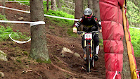
Videos of Bike World Jasná Mountain Bike
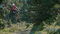
trail: Rocky Face DH
3:03 |
11968 |
Aug 9, 2017
trail: Rocky Face DH
2:10 |
207 |
Jun 28, 2016
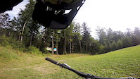
trail: Fun Track
3:28 |
276 |
Aug 10, 2015
trail: Fun Track
0:26 |
147 |
Apr 24, 2011
trail: Fun Track
0:29 |
133 |
Apr 24, 2011

trail: Fun Track
2:49 |
1898 |
Jul 6, 2010
trail: Deer Track
664 |
Feb 22, 2017 , Liptovský Mikuláš
Recent Trail Reports
| status | trail | date | condition | info | user |
|---|---|---|---|---|---|
| Summit Flatline | Feb 4, 2022 @ 4:19am Feb 4, 2022 | Snow Covered | petooon | ||
| Rocky Face DH | Aug 10, 2021 @ 7:46am Aug 10, 2021 | Dry | Igocza | ||
| Fun Track | Aug 10, 2021 @ 7:46am Aug 10, 2021 | Dry | Igocza |
Activity Feed
| username | action | type | title | date | |
|---|---|---|---|---|---|
 | Igocza | add | report | Summit Flatline and 4 more | Aug 10, 2021 @ 7:45am Aug 10, 2021 |
 | tomasooo | wishlist | trail | Fun Track | Apr 9, 2021 @ 12:44pm Apr 9, 2021 |
| Djexpres | ridden | trail | Summit Flatline | Aug 3, 2020 @ 4:50am Aug 3, 2020 |
 | kkkuba | ridden | trail | Summit Flatline and 3 more | Jul 22, 2020 @ 4:05am Jul 22, 2020 |
| kkkuba | vote | trail | Summit Flatline and 3 more | Jul 22, 2020 @ 4:05am Jul 22, 2020 |
Nearby Areas
| name | distance | ||||
|---|---|---|---|---|---|
| Demänovské Vrchy | 1 | 2.2 km | |||
| Čertovica | 1 | 5.9 km | |||
| Mýto pod Ďumbierom Bikepark | 2 | 2 | 8.1 km | ||
| Hradská Hora Trails | 6 | 5 | 13 | 8.9 km | |
| Liptovská Lúžna | 4 | 7 | 1 | 10.4 km |
- By jxxw
 TRAILFORKS & contributors
 - Admins: apply
- #17818 - 4,279 views
- bike world jasná activity log | embed map of Bike World Jasná mountain bike trails |
-
- subscribe
- 3d map
Downloading of trail gps tracks in kml & gpx formats is enabled for Bike World Jasná.
You must login to download files.