close
Trail Conditions
- Unknown
- Snow Groomed
- Snow Packed
- Snow Covered
- Snow Cover Inadequate
- Freeze/thaw Cycle
- Icy
- Prevalent Mud
- Wet
- Variable
- Ideal
- Dry
- Very Dry
Trail Flow (Ridden Direction)
Trailforks scans users ridelogs to determine the most popular direction each trail is ridden. A good flowing trail network will have most trails flowing in a single direction according to their intension.
The colour categories are based on what percentage of riders are riding a trail in its intended direction.
The colour categories are based on what percentage of riders are riding a trail in its intended direction.
- > 96%
- > 90%
- > 80%
- > 70%
- > 50%
- < 50%
- bi-directional trail
- no data
Trail Last Ridden
Trailforks scans ridelogs to determine the last time a trail was ridden.
- < 2 days
- < 1 week
- < 2 weeks
- < 1 month
- < 6 months
- > 6 months
Trail Ridden Direction
The intended direction a trail should be ridden.
- Downhill Only
- Downhill Primary
- Both Directions
- Uphill Primary
- Uphill Only
- One Direction
Contribute Details
Colors indicate trail is missing specified detail.
- Description
- Photos
- Description & Photos
- Videos
Trail Popularity ?
Trailforks scans ridelogs to determine which trails are ridden the most in the last 9 months.
Trails are compared with nearby trails in the same city region with a possible 25 colour shades.
Think of this as a heatmap, more rides = more kinetic energy = warmer colors.
- most popular
- popular
- less popular
- not popular
ATV/ORV/OHV Filter
Max Vehicle Width
inches
Radar Time
x
Activity Recordings
Trailforks users anonymized public ridelogs from the past 6 months.
- mountain biking recent
- mountain biking (>6 month)
- hiking (1 year)
- moto (1 year)
Activity Recordings
Trailforks users anonymized public skilogs from the past 12 months.
- Downhill Ski
- Backcountry Ski
- Nordic Ski
Jump Magnitude Heatmap
Heatmap of where riders jump on trails. Zoom in to see individual jumps, click circles to view jump details.
Trails Deemphasized
Trails are shown in grey.
Only show trails with NO bikes.
Save the current map location and zoom level as your default home location whenever this page is loaded.
SaveBikearena Aflenz is located at Aflenzer Bürgeralm. Very relaxed riding area with a double chairlift.
Primary Trail Type: All-Mountain & Downhill
AKA: Aflenzer Bürgeralm
 google parking directions
Links
This region uses the Uk/Euro style trail grading system.
Region Supporters & Maintainers
trail builderSponsor
Activities Click to view
- Mountain Bike
7 trails
- E-Bike
7 trails
- Hike
1 trails
- Trail Running
1 trails
Bike Park Details
- 4
- 2
- 1
Region Status
Open as of Sep 4, 2021- Day Ticket
- 20 EUR
- Uplift Type
- Chair Lift
Stats
- Avg Trail Rating
- Trails (view details)
- 7
- Trails Mountain Bike
- 7
- Trails E-Bike
- 7
- Trails Hike
- 1
- Trails Trail Running
- 1
- Total Distance
- 7 miles
- Total Descent
- 3,625 ft
- Total Vertical
- 3,199 ft
- Highest Trailhead
- 5,871 ft
- Reports
- 25
- Photos
- 4
- Ridden Counter
- 132
Popular Bikearena Aflenz Mountain Biking Trails
Photos of Bikearena Aflenz Mountain Bike
trail: Windgruben Trail
4 |
Apr 18, 2022 @ 2:55am
Apr 18, 2022
trail: Windgruben Trail
25 |
Apr 18, 2022 @ 2:55am
Apr 18, 2022
trail: AB-Trail
42 |
Mar 21, 2020 @ 8:09am
Mar 21, 2020
trail: AB-Trail
97 |
Aug 16, 2019 @ 9:06am
Aug 16, 2019Videos of Bikearena Aflenz Mountain Bike
trail: AB-Trail
2:17 |
81 |
Mar 21, 2020
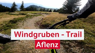
trail: Windgruben Trail
5:45 |
33 |
Apr 18, 2022 , Aflenz

trail: AB-Trail
4:36 |
387 |
Jul 22, 2019 , Aflenz

trail: Pierergut Trail
2:12 |
230 |
Jul 22, 2019 , Aflenz
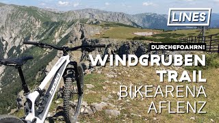
trail: Windgruben Trail
4:31 |
317 |
Jul 22, 2019 , Aflenz
Recent Trail Reports
| status | trail | date | condition | info | user |
|---|---|---|---|---|---|
| Windgruben Trail | Sep 4, 2021 @ 1:24am Sep 4, 2021 | Dry | laimer83 | ||
| Access AB-Trail | Sep 4, 2021 @ 1:24am Sep 4, 2021 | Ideal | laimer83 | ||
| AB-Trail | Sep 4, 2021 @ 1:24am Sep 4, 2021 | Ideal | laimer83 | ||
| Intermezzo AB- & Pierergut Trail | Sep 4, 2021 @ 1:24am Sep 4, 2021 | Ideal | laimer83 | ||
| Pierergut Trail | Sep 4, 2021 @ 1:24am Sep 4, 2021 | Dry | laimer83 | ||
| Return to Chairlift | Sep 4, 2021 @ 1:24am Sep 4, 2021 | Ideal | laimer83 | ||
| Uphill Windgruben Trail | May 28, 2020 @ 8:36am May 28, 2020 | Unknown | cbtp TRAILFORKS |
Activity Feed
| username | action | type | title | date | |
|---|---|---|---|---|---|
 | Eto03 | wishlist | region | Bikearena Aflenz | Jun 19, 2022 @ 6:45am Jun 19, 2022 |
| U4IMfv | wishlist | trail | AB-Trail | May 20, 2022 @ 1:24pm May 20, 2022 |
| ProfessorTrail | ridden | trail | Windgruben Trail and 3 more | Apr 18, 2022 @ 1:51pm Apr 18, 2022 |
| hochitom | add | video | Windgruben Trail | Mountainbike-Trail in der Bikearena Aflenz | Apr 18, 2022 @ 3:05am Apr 18, 2022 |
| hochitom | add | photo | in My City and 1 more | Apr 18, 2022 @ 2:55am Apr 18, 2022 |
Nearby Areas
| name | distance | ||||
|---|---|---|---|---|---|
| Bike Arena Präbichl | 1 | 2 | 12.9 km | ||
| Bikealps Mariazeller Bürgeralpe | 1 | 3 | 15.7 km | ||
| Josiberg Trails | 3 | 19.9 km | |||
| Bikepark Königsberg-Hollenstein | 1 | 1 | 25.4 km | ||
| Schöckl Trail Area | 3 | 28 km |
Activity Type Stats
| activitytype | trails | distance | descent | descent distance | total vertical | rating | global rank | state rank | photos | reports | routes | ridelogs |
|---|---|---|---|---|---|---|---|---|---|---|---|---|
| Mountain Bike | 7 | 7 miles | 3,625 ft | 4 miles | 3,199 ft | #4,557 | #31 | 4 | 25 | 36 | ||
| E-Bike | 7 | 7 miles | 3,625 ft | 4 miles | 3,199 ft | #1,758 | #26 | 25 | 1 | |||
| Hike | 1 | 1,365 ft | 7 ft | 299 ft | 115 ft | #48 | 24 | 7 | ||||
| Trail Running | 1 | 1,365 ft | 7 ft | 299 ft | 115 ft | #26 | 24 |
- By lines
 TRAILFORKS & contributors
 - Admins: TrailAreaWeiz
- #30219 - 1,357 views
- bikearena aflenz activity log | embed map of Bikearena Aflenz mountain bike trails | bikearena aflenz mountain biking points of interest
Downloading of trail gps tracks in kml & gpx formats is enabled for Bikearena Aflenz.
You must login to download files.