close
Trail Conditions
- Unknown
- Snow Groomed
- Snow Packed
- Snow Covered
- Snow Cover Inadequate
- Freeze/thaw Cycle
- Icy
- Prevalent Mud
- Wet
- Variable
- Ideal
- Dry
- Very Dry
Trail Flow (Ridden Direction)
Trailforks scans users ridelogs to determine the most popular direction each trail is ridden. A good flowing trail network will have most trails flowing in a single direction according to their intension.
The colour categories are based on what percentage of riders are riding a trail in its intended direction.
The colour categories are based on what percentage of riders are riding a trail in its intended direction.
- > 96%
- > 90%
- > 80%
- > 70%
- > 50%
- < 50%
- bi-directional trail
- no data
Trail Last Ridden
Trailforks scans ridelogs to determine the last time a trail was ridden.
- < 2 days
- < 1 week
- < 2 weeks
- < 1 month
- < 6 months
- > 6 months
Trail Ridden Direction
The intended direction a trail should be ridden.
- Downhill Only
- Downhill Primary
- Both Directions
- Uphill Primary
- Uphill Only
- One Direction
Contribute Details
Colors indicate trail is missing specified detail.
- Description
- Photos
- Description & Photos
- Videos
Trail Popularity ?
Trailforks scans ridelogs to determine which trails are ridden the most in the last 9 months.
Trails are compared with nearby trails in the same city region with a possible 25 colour shades.
Think of this as a heatmap, more rides = more kinetic energy = warmer colors.
- most popular
- popular
- less popular
- not popular
ATV/ORV/OHV Filter
Max Vehicle Width
inches
Radar Time
x
Activity Recordings
Trailforks users anonymized public ridelogs from the past 6 months.
- mountain biking recent
- mountain biking (>6 month)
- hiking (1 year)
- moto (1 year)
Activity Recordings
Trailforks users anonymized public skilogs from the past 12 months.
- Downhill Ski
- Backcountry Ski
- Nordic Ski
Jump Magnitude Heatmap
Heatmap of where riders jump on trails. Zoom in to see individual jumps, click circles to view jump details.
Trails Deemphasized
Trails are shown in grey.
Only show trails with NO bikes.
Save the current map location and zoom level as your default home location whenever this page is loaded.
Savethere are 18km of trails around the Wurmberg, each around 3km with 400m descent.
Primary Trail Type: All-Mountain & Downhill
Shuttleable: YES
Land Status: National Forest
 google parking directions
Links
Activities Click to view
- Mountain Bike
11 trails
- E-Bike
1 trails
- Hike
0 trails
- Trail Running
0 trails
Bike Park Details
- 4
- 5
- 1
Region Status
Caution as of Aug 28, 2021- Uplift Type
- Gondola
Stats
- Avg Trail Rating
- Trails (view details)
- 11
- Trails Mountain Bike
- 11
- Trails E-Bike
- 1
- Total Distance
- 8 miles
- Total Descent
- 4,853 ft
- Total Vertical
- 1,193 ft
- Highest Trailhead
- 3,173 ft
- Reports
- 12
- Photos
- 9
- Ridden Counter
- 383
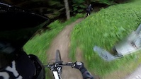
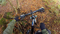
Popular Bikepark Braunlage Mountain Biking Trails
Photos of Bikepark Braunlage Mountain Bike
trail: Singletrail Lower
11 |
Jun 18, 2022 @ 7:53am
Jun 18, 2022
trail: Downhill Lower Section
11 |
Nov 12, 2021 @ 9:56am
Nov 12, 2021
trail: Downhill Lower Section
42 |
Nov 12, 2021 @ 9:56am
Nov 12, 2021
trail: Downhill Lower Section
18 |
Nov 12, 2021 @ 6:23am
Nov 12, 2021
trail: Enduro Upper
24 |
Nov 12, 2021 @ 6:06am
Nov 12, 2021
trail: Enduro Upper
34 |
Nov 12, 2021 @ 6:05am
Nov 12, 2021
trail: Singletrail Lower
154 |
Aug 29, 2009 @ 12:44pm
Aug 29, 2009
trail: Singletrail Lower
170 |
Feb 14, 2008 @ 1:58pm
Feb 14, 2008Videos of Bikepark Braunlage Mountain Bike
trail: Singletrail Lower
3:35 |
219 |
Jun 8, 2017
trail: Singletrail Lower
1:27 |
39 |
Oct 30, 2016

trail: Singletrail Lower
8:55 |
177 |
Jul 19, 2009
Recent Trail Reports
| status | trail | date | condition | info | user |
|---|---|---|---|---|---|
| Singletrail Lower | Jun 18, 2022 @ 7:53am Jun 18, 2022 | Dry | cHrIs2505 | ||
| Singletrail Upper | Jun 18, 2022 @ 7:51am Jun 18, 2022 | Dry | cHrIs2505 | ||
| Freeride Upper | Aug 28, 2021 @ 12:43am Aug 28, 2021 | Ideal | henrikst | ||
| Freeride Lower | Aug 28, 2021 @ 12:43am Aug 28, 2021 | Ideal | henrikst | ||
| Downhill Middle Section | Dec 19, 2019 @ 11:14pm Dec 19, 2019 | Snow Covered | kyleluvsdh | ||
| DH upper w | Dec 19, 2019 @ 11:14pm Dec 19, 2019 | Snow Covered | kyleluvsdh | ||
| Enduro Upper | Dec 19, 2019 @ 11:14pm Dec 19, 2019 | Snow Covered | kyleluvsdh | ||
| Downhill Lower Section | Dec 19, 2019 @ 11:14pm Dec 19, 2019 | Snow Covered | kyleluvsdh | ||
| Wurmberg Roller upper DH | Dec 19, 2019 @ 11:14pm Dec 19, 2019 | Snow Covered | kyleluvsdh |
Activity Feed
| username | action | type | title | date | |
|---|---|---|---|---|---|
 | cHrIs2505 | add | photo | in My City | Jun 18, 2022 @ 7:53am Jun 18, 2022 |
| cHrIs2505 | ridden | trail | Singletrail Upper and 1 more | Jun 18, 2022 @ 7:51am Jun 18, 2022 |
| cHrIs2505 | add | report | Singletrail Upper and 1 more | Jun 18, 2022 @ 7:51am Jun 18, 2022 |
| Leopp2 | ridden | trail | Freeride Upper and 4 more | Jun 1, 2022 @ 8:21am Jun 1, 2022 |
 | Windfinder | add | trail | Enduro Lower | Apr 24, 2022 @ 6:50am Apr 24, 2022 |
Recent Comments
| username | type | title | comment | date | |
|---|---|---|---|---|---|
| trail | Überwiegend Kies Schotter. Viele kleine... | Nov 12, 2021 @ 9:55am Nov 12, 2021 | ||
| trail | it seems like i took the wrong lane for the... | Jun 23, 2021 @ 2:00am Jun 23, 2021 |
Nearby Areas
| name | distance | ||||
|---|---|---|---|---|---|
| Brocken | 1 | 3.7 km | |||
| MSB-X-Trail | 2 | 4 | 4.4 km | ||
| Torfhaus | 2 | 5.2 km | |||
| Ilsetal | 3 | 4 | 8.4 km | ||
| Darlingerode | 2 | 2 | 8.5 km |
Activity Type Stats
| activitytype | trails | distance | descent | descent distance | total vertical | rating | global rank | state rank | photos | reports | routes | ridelogs |
|---|---|---|---|---|---|---|---|---|---|---|---|---|
| Mountain Bike | 11 | 8 miles | 4,852 ft | 8 miles | 1,194 ft | #4,465 | #78 | 9 | 12 | 236 | ||
| E-Bike | 1 | 3,474 ft | 341 ft | 3,415 ft | 341 ft | #2,160 | #63 | 10 | 21 |
- By traukainehm & contributors
- Admins: apply
- #20855 - 2,801 views
- bikepark braunlage activity log | embed map of Bikepark Braunlage mountain bike trails | bikepark braunlage mountain biking points of interest
-
- subscribe
- 3d map
Downloading of trail gps tracks in kml & gpx formats is enabled for Bikepark Braunlage.
You must login to download files.