close
Trail Conditions
- Unknown
- Snow Groomed
- Snow Packed
- Snow Covered
- Snow Cover Inadequate
- Freeze/thaw Cycle
- Icy
- Prevalent Mud
- Wet
- Variable
- Ideal
- Dry
- Very Dry
Trail Flow (Ridden Direction)
Trailforks scans users ridelogs to determine the most popular direction each trail is ridden. A good flowing trail network will have most trails flowing in a single direction according to their intension.
The colour categories are based on what percentage of riders are riding a trail in its intended direction.
The colour categories are based on what percentage of riders are riding a trail in its intended direction.
- > 96%
- > 90%
- > 80%
- > 70%
- > 50%
- < 50%
- bi-directional trail
- no data
Trail Last Ridden
Trailforks scans ridelogs to determine the last time a trail was ridden.
- < 2 days
- < 1 week
- < 2 weeks
- < 1 month
- < 6 months
- > 6 months
Trail Ridden Direction
The intended direction a trail should be ridden.
- Downhill Only
- Downhill Primary
- Both Directions
- Uphill Primary
- Uphill Only
- One Direction
Contribute Details
Colors indicate trail is missing specified detail.
- Description
- Photos
- Description & Photos
- Videos
Trail Popularity ?
Trailforks scans ridelogs to determine which trails are ridden the most in the last 9 months.
Trails are compared with nearby trails in the same city region with a possible 25 colour shades.
Think of this as a heatmap, more rides = more kinetic energy = warmer colors.
- most popular
- popular
- less popular
- not popular
ATV/ORV/OHV Filter
Max Vehicle Width
inches
Radar Time
x
Activity Recordings
Trailforks users anonymized public ridelogs from the past 6 months.
- mountain biking recent
- mountain biking (>6 month)
- hiking (1 year)
- moto (1 year)
Activity Recordings
Trailforks users anonymized public skilogs from the past 12 months.
- Downhill Ski
- Backcountry Ski
- Nordic Ski
Jump Magnitude Heatmap
Heatmap of where riders jump on trails. Zoom in to see individual jumps, click circles to view jump details.
Trails Deemphasized
Trails are shown in grey.
Only show trails with NO bikes.
Save the current map location and zoom level as your default home location whenever this page is loaded.
SaveManitoba is home to some of the most enjoyable single track and technical riding around, come check it out :-)
The Birch Ski Area was the site for the 1999 Pan Am Games XC event, and Bison Butte Recreational Trails was the site for the 2017 Canada Summer Games XC event.
Most of the popular trails that are maintained and ridden regularly are across the southern 200 km of the province.
Trail difficulty ranges from green to blue mostly, with some sections of black and double black challenges.
There is a fair selection of river trails within the Winnipeg city limits, and from 2018, the Bison Butte Recreational Trails area has been open to the public with a variety of easy to very challenging trails with berms, table tops, drops, steep roll downs, logs, rocks, and single track.
Within 1-3 hours drive from the city of Winnipeg are a wide variety of trail types..
Tight hard pack single track near the city (Birds Hill Park), predominantly flat with some mild elevation changes.
Rocky outcrops of the Canadian shield in east, rock face, dirt single track, double track (Falcon Ridge Ski Area, Blue Highway, Pinawa, Ingolf).. lot's of small steep hills. Five of Diamonds and Blue Highway routes both have berms, table tops, natural rock drops and open granite rock face roll downs.
Grand Beach (North of Winnipeg) Double track/ single track, hard pack, sandy sections, some rock gardens
Falcon Trails, Blue Highway, and Grand Beach trails are in Provincial parks so a provincial park pass is needed to enter with your car.
Riding Mountain (central) has some new hard pack single track trails.
The southwest region including Brandon, Morden, and Carmon areas have some of the sweetest hard pack single track around, with regularly maintained and improved trail networks. Lots of short to medium elevation changes going through valleys, including some challenging climbs.
Trails are snow free and free of spring mud drying usually by late April - mid May. Snow starts again in late Oct-Nov. Winter riding on groomed fat bike trail growing in popularity (Oak Ridge Mountain Bike Trail, Grand Beach, Falcon Ridge Ski Area).
If you're visiting bring your bike(s) Manitoba has some trails you don't want to miss. Local clubs will help you find the trails. We have some fine XC races that run generally from May to September (mbcycling.ca)
Stats
- Avg Trail Rating
- Trails (view details)
- 1,077
- Trails Mountain Bike
- 728
- Trails E-Bike
- 323
- Trails Hike
- 847
- Trails Trail Running
- 748
- Trails Horse
- 101
- Trails Dirtbike/Moto
- 25
- Trails ATV/ORV/OHV
- 25
- Trails Snowmobile
- 39
- Trails Snowshoe
- 250
- Trails Downhill Ski
- 24
- Trails Backcountry Ski
- 8
- Trails Nordic Ski
- 297
- Total Distance
- 1,763 mile
- Total Descent
- 66,113 ft
- Total Vertical
- 2,110 ft
- Highest Trailhead
- 2,721 ft
- Reports
- 6,046
- Photos
- 1,994
- Ridden Counter
- 38,618
Popular Trail Networks
view all areas »Sub Regions
- Central Region (197)
- Eastern Region (18)
- Northern Region (10)
- NorthGate Trails Dauphin (4)
- Sandilands Provincial Forest (41)
- Western Region (97)
- Whiteshell Provincial Park (111)
- North Whiteshell (25)
- South Whiteshell (86)
Popular Manitoba Mountain Biking Trails
| status | title | difficulty | rating |
|---|---|---|---|
| Wolf Ridge Trail Grand Beach Provincial Park | |||
| Oak Ridge Mountain Bike Trail Birds Hill Provincial Park | |||
| Happy Ending Bison Butte Recreational Trails | |||
| Summit to the plummet Bison Butte Recreational Trails | |||
| Back 40 Bison Butte Recreational Trails | |||
| BMX Track Bison Butte Recreational Trails | |||
| Oak Ridge - Advanced 1 Birds Hill Provincial Park | |||
| Wrath of Man Bison Butte Recreational Trails | |||
| Cris's Corner Bison Butte Recreational Trails | |||
| Green route start Bison Butte Recreational Trails | |||
| Oak Ridge - Advanced 2 Birds Hill Provincial Park | |||
| Wayne's World Bison Butte Recreational Trails | |||
| Goose it Bison Butte Recreational Trails | |||
| Blue Highway McGillivray Falls / Caddy Lake | |||
| Goose poop boogie Bison Butte Recreational Trails |
Manitoba Mountain Bike Routes
| title | rating | distance |
|---|---|---|
| Blue Highway McGillivray Falls / Caddy Lake | 4 miles | |
| Five of Diamonds Falcon Ridge Ski Slopes | 4 miles | |
| Stanley Trail RM of Stanley | 39 miles | |
| Brandon Hills Tasty Brandon | 9 miles | |
| 3 km PMC outer loop Dari Ilse Trails | 2 miles | |
| 6 km Double loop - STRAVA segment Dari Ilse Trails | 3 miles | |
| Northgate Trails Grand Tour NorthGate Trail Network | 9 miles | |
| Head for the Hills Trail Route RM of Stanley | 18 miles | |
| Tuesday Morning Rust Removing Brandon | 5 miles | |
| Damp Conditions Route Falcon Ridge Ski Slopes | 3 miles |
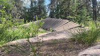
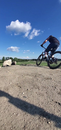
Photos of Manitoba Mountain Bike
trail: Bald Hill Trail
0 |
Jul 2, 2022 @ 4:40pm
Jul 2, 2022
trail: Bald Hill Trail
1 |
Jul 2, 2022 @ 4:36pm
Jul 2, 2022
trail: Deep Bay Viewpoint Access
10 |
Jun 16, 2022 @ 10:00am
Jun 16, 2022
trail: Clear Lake South Shore
65 |
Jun 4, 2020 @ 11:56am
Jun 4, 2020
trail: Clear Lake South Shore
69 |
Jun 4, 2020 @ 11:55am
Jun 4, 2020
trail: Naurco Flats
368 |
Aug 19, 2016 @ 4:09am
Aug 19, 2016
trail: Naurco Flats
467 |
Jul 12, 2016 @ 8:45am
Jul 12, 2016
trail: Naurco Flats
467 |
Jul 12, 2016 @ 8:45am
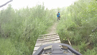
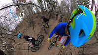
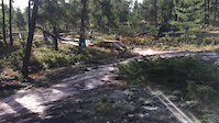
Jul 12, 2016Videos of Manitoba Mountain Bike
trail: Top of The World
4 |
Jul 5, 2022
trail: Wrath of Man
|
Apr 8, 2022
trail: Nimowin Self-guiding Trail
40 |
Oct 8, 2021
trail: Shocker
119 |
Aug 2, 2021
trail: Neepawa Bike Park Trail #9
100 |
Jul 5, 2021

73 |
Jun 25, 2021
trail: West Coast
|
May 3, 2021
trail: Blue Highway Skills Loop
88 |
Jan 16, 2021
Activity Feed
| username | action | type | title | date | |
|---|---|---|---|---|---|
 | absquared | add | report | UofM Trail | Jul 5, 2022 @ 1:21pm 13 hours |
 | Dinglebert | checkin | trail | Back 40 | Jul 5, 2022 @ 10:57am 15 hours |
| Dinglebert | ridden | trail | Back 40 | Jul 5, 2022 @ 10:57am 15 hours |
| Dinglebert | add | report | Back 40 | Jul 5, 2022 @ 10:57am 15 hours |
| BbOsV | ridden | trail | Clear Lake Trail - Boat Cove to Lakeshore | Jul 4, 2022 @ 9:16pm 1 day |
Recent Comments
| username | type | title | comment | date | |
|---|---|---|---|---|---|
| trail | Fun trail. Narrow trail that winds through... | Jul 4, 2022 @ 9:15pm 1 day | ||
| trail | Nice trail, but the mosquitos are terrible,... | Jul 3, 2022 @ 7:11am 3 days | ||
| trail | Some of the most scenic trail in Spruce Woods.... | May 30, 2022 @ 8:30am May 30, 2022 | ||
| trail | A nice choice that goes along the creek. ... | May 30, 2022 @ 8:25am May 30, 2022 | ||
 | report | Not sure who did the good deed, but tree has... | May 27, 2022 @ 9:25pm May 27, 2022 |
Local Badges
-

Trail Explorer 100199 awarded -

10 Blue Trails142 awarded -

Big Ride 30k3,730 awarded -
10 Blue Trails107 awarded -
10 Blue Trails82 awarded -
10 Blue Trails17 awarded
Bike & Skill Parks
| name | type | city | rating |
|---|---|---|---|
| Asessippi Ski Area & Bike Park | bike park | Dropmore | |
| River's Edge bike Skills park. | skill park | Minnedosa | |
| Skinnyville | skill park | Dauphin |
Upcoming Local Events
Activity Type Stats
| activitytype | trails | distance | descent | descent distance | total vertical | rating | global rank | state rank | photos | reports | routes | ridelogs |
|---|---|---|---|---|---|---|---|---|---|---|---|---|
| Mountain Bike | 728 | 1,015 mile | 41,765 ft | 318 miles | 1,759 ft | #43 | 1,294 | 5,016 | 47 | 64,162 | ||
| E-Bike | 323 | 433 miles | 17,648 ft | 147 miles | 1,755 ft | #23 | 4 | 4,255 | 1 | 299 | ||
| Hike | 847 | 1,222 mile | 50,797 ft | 387 miles | 2,110 ft | #43 | 541 | 5,502 | 10 | 3,401 | ||
| Trail Running | 748 | 1,142 mile | 48,107 ft | 368 miles | 1,900 ft | #43 | 5 | 4,928 | 7 | 989 | ||
| Horse | 101 | 302 miles | 10,128 ft | 118 miles | 1,706 ft | #35 | 4 | 1,982 | 2 | |||
| Dirtbike/Moto | 25 | 13 miles | 709 ft | 4 miles | 184 ft | #16 | 1,932 | 19 | ||||
| ATV/ORV/OHV | 25 | 28 miles | 1,391 ft | 10 miles | 1,302 ft | #8 | 1,933 | 47 | ||||
| Snowmobile | 39 | 446 miles | 5,833 ft | 137 miles | 1,673 ft | #23 | 169 | 52 | ||||
| Snowshoe | 250 | 284 miles | 12,959 ft | 86 miles | 1,693 ft | #19 | 39 | 466 | 2 | 474 | ||
| Downhill Ski | 24 | 5 miles | 4,826 ft | 5 miles | 344 ft | 147 | 79 | |||||
| Backcountry Ski | 8 | 36 miles | 1,096 ft | 14 miles | 1,312 ft | #36 | 139 | 72 | ||||
| Nordic Ski | 297 | 328 miles | 11,611 ft | 99 miles | 1,673 ft | #25 | 107 | 1,179 | 17 | 2,795 |
- By canadaka
 Trailforks & contributors
 - Admins: IMBA Canada, brenthillier, msmcfate, MPP, crislabossiere
- #3150 - 39,518 views
- manitoba activity log | embed map of Manitoba mountain bike trails | manitoba mountain biking points of interest polygons
-
- subscribe
- 3d map
Downloading of trail gps tracks in kml & gpx formats is enabled for Manitoba.
You must login to download files.