close
Trail Conditions
- Unknown
- Snow Groomed
- Snow Packed
- Snow Covered
- Snow Cover Inadequate
- Freeze/thaw Cycle
- Icy
- Prevalent Mud
- Wet
- Variable
- Ideal
- Dry
- Very Dry
Trail Flow (Ridden Direction)
Trailforks scans users ridelogs to determine the most popular direction each trail is ridden. A good flowing trail network will have most trails flowing in a single direction according to their intension.
The colour categories are based on what percentage of riders are riding a trail in its intended direction.
The colour categories are based on what percentage of riders are riding a trail in its intended direction.
- > 96%
- > 90%
- > 80%
- > 70%
- > 50%
- < 50%
- bi-directional trail
- no data
Trail Last Ridden
Trailforks scans ridelogs to determine the last time a trail was ridden.
- < 2 days
- < 1 week
- < 2 weeks
- < 1 month
- < 6 months
- > 6 months
Trail Ridden Direction
The intended direction a trail should be ridden.
- Downhill Only
- Downhill Primary
- Both Directions
- Uphill Primary
- Uphill Only
- One Direction
Contribute Details
Colors indicate trail is missing specified detail.
- Description
- Photos
- Description & Photos
- Videos
Trail Popularity ?
Trailforks scans ridelogs to determine which trails are ridden the most in the last 9 months.
Trails are compared with nearby trails in the same city region with a possible 25 colour shades.
Think of this as a heatmap, more rides = more kinetic energy = warmer colors.
- most popular
- popular
- less popular
- not popular
ATV/ORV/OHV Filter
Max Vehicle Width
inches
Radar Time
x
Activity Recordings
Trailforks users anonymized public ridelogs from the past 6 months.
- mountain biking recent
- mountain biking (>6 month)
- hiking (1 year)
- moto (1 year)
Activity Recordings
Trailforks users anonymized public skilogs from the past 12 months.
- Downhill Ski
- Backcountry Ski
- Nordic Ski
Jump Magnitude Heatmap
Heatmap of where riders jump on trails. Zoom in to see individual jumps, click circles to view jump details.
Trails Deemphasized
Trails are shown in grey.
Only show trails with NO bikes.
Save the current map location and zoom level as your default home location whenever this page is loaded.
Save
No description for Bikepark Tanvaldský Špičák has been added yet!
Login or register to submit one.
Primary Trail Type: Cross-Country
Shuttleable: YES
Links
This region uses the Uk/Euro style trail grading system.
Activities Click to view
- Mountain Bike
4 trails
- Hike
0 trails
- Trail Running
0 trails
Bike Park Details
- 2
- 1
- 1
Region Status
Open as of May 20, 2022- Uplift Type
- Chair Lift
Stats
- Avg Trail Rating
- Trails (view details)
- 4
- Trails Mountain Bike
- 4
- Total Distance
- 5 miles
- Total Descent
- 1,382 ft
- Total Vertical
- 823 ft
- Highest Trailhead
- 2,629 ft
- Reports
- 31
- Photos
- 13
- Ridden Counter
- 380
Popular Bikepark Tanvaldský Špičák Trails
| status | title | difficulty | rating |
|---|---|---|---|
| Modrý | |||
| Červený | |||
| Špičácká spojka | |||
| Na Tanvaldský Špičák |
Mountain Bike Routes
| title | rating | distance |
|---|---|---|
| Modrý Tanvaldský Špičák | 4 miles |
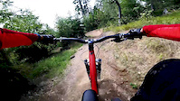
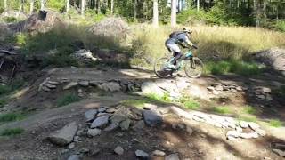
Photos of Bikepark Tanvaldský Špičák Mountain Bike
trail: Na Tanvaldský Špičák
44 |
Jul 11, 2021 @ 12:12pm
Jul 11, 2021
trail: Na Tanvaldský Špičák
58 |
Nov 12, 2020 @ 4:58pm
Nov 12, 2020
trail: Na Tanvaldský Špičák
37 |
Nov 12, 2020 @ 4:58pm
Nov 12, 2020
trail: Na Tanvaldský Špičák
36 |
Nov 12, 2020 @ 4:58pm
Nov 12, 2020
trail: Modrý
70 |
Oct 31, 2020 @ 2:37am
Oct 31, 2020
trail: Modrý
59 |
Jul 21, 2020 @ 3:39pm
Jul 21, 2020
trail: Modrý
87 |
Jul 21, 2020 @ 3:25pm
Jul 21, 2020
trail: Červený
142 |
Mar 18, 2020 @ 4:54am
Mar 18, 2020Videos of Bikepark Tanvaldský Špičák Mountain Bike
trail: Na Tanvaldský Špičák
10:40 |
75 |
Aug 25, 2019
trail: Modrý
0:37 |
299 |
Dec 27, 2019 , Jablonec nad Nisou
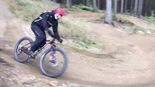
trail: Červený
1:29 |
351 |
Dec 27, 2019 , Jablonec nad Nisou
Recent Trail Reports
| status | trail | date | condition | info | user |
|---|---|---|---|---|---|
| Modrý | May 20, 2022 @ 12:05am May 20, 2022 | Unknown | trailforks OMTBO | ||
| Na Tanvaldský Špičák | May 20, 2022 @ 12:05am May 20, 2022 | Unknown | trailforks OMTBO | ||
| Červený | May 20, 2022 @ 12:05am May 20, 2022 | Unknown | trailforks OMTBO | ||
| Špičácká spojka | May 20, 2022 @ 12:05am May 20, 2022 | Unknown | trailforks OMTBO | ||
| Špičák 1 | May 20, 2022 @ 12:05am May 20, 2022 | Unknown | trailforks OMTBO |
Activity Feed
| username | action | type | title | date | |
|---|---|---|---|---|---|
 | trailforks | add | report | Modrý and 4 more | May 20, 2022 @ 12:05am May 20, 2022 |
 | michalkosik | vote | trail | Špičácká spojka and 2 more | Dec 7, 2021 @ 9:13am Dec 7, 2021 |
 | zvirze | add | report | Modrý and 4 more | Nov 25, 2021 @ 2:01am Nov 25, 2021 |
 | Dropsau | wishlist | trail | Modrý | Nov 16, 2021 @ 10:39am Nov 16, 2021 |
 | Skyt | add | report | Modrý and 2 more | Aug 15, 2021 @ 7:06am Aug 15, 2021 |
Recent Comments
| username | type | title | comment | date | |
|---|---|---|---|---|---|
 | trail | O trošku náročnější než modrý trail,... | Jul 21, 2020 @ 3:34pm Jul 21, 2020 | ||
| trail | Pěkně udělaný trail hlavně se spoustou... | Jul 21, 2020 @ 3:30pm Jul 21, 2020 |
Nearby Areas
| name | distance | ||||
|---|---|---|---|---|---|
| Bikepark Bobovka | 1 km | ||||
| Černostudniční hřbet | 6 | 3.5 km | |||
| Žulový vrch | 4 km | ||||
| Jakuszyce | 6.4 km | ||||
| Železný Brod | 3 | 7.3 km |
- By roflkoptr & contributors
- Admins: Cernoch44
- #20285 - 3,081 views
- bikepark tanvaldský Špičák activity log | embed map of Bikepark Tanvaldský Špičák mountain bike trails |
Downloading of trail gps tracks in kml & gpx formats is enabled for Bikepark Tanvaldský Špičák.
You must login to download files.