close
Trail Conditions
- Unknown
- Snow Groomed
- Snow Packed
- Snow Covered
- Snow Cover Inadequate
- Freeze/thaw Cycle
- Icy
- Prevalent Mud
- Wet
- Variable
- Ideal
- Dry
- Very Dry
Trail Flow (Ridden Direction)
Trailforks scans users ridelogs to determine the most popular direction each trail is ridden. A good flowing trail network will have most trails flowing in a single direction according to their intension.
The colour categories are based on what percentage of riders are riding a trail in its intended direction.
The colour categories are based on what percentage of riders are riding a trail in its intended direction.
- > 96%
- > 90%
- > 80%
- > 70%
- > 50%
- < 50%
- bi-directional trail
- no data
Trail Last Ridden
Trailforks scans ridelogs to determine the last time a trail was ridden.
- < 2 days
- < 1 week
- < 2 weeks
- < 1 month
- < 6 months
- > 6 months
Trail Ridden Direction
The intended direction a trail should be ridden.
- Downhill Only
- Downhill Primary
- Both Directions
- Uphill Primary
- Uphill Only
- One Direction
Contribute Details
Colors indicate trail is missing specified detail.
- Description
- Photos
- Description & Photos
- Videos
Trail Popularity ?
Trailforks scans ridelogs to determine which trails are ridden the most in the last 9 months.
Trails are compared with nearby trails in the same city region with a possible 25 colour shades.
Think of this as a heatmap, more rides = more kinetic energy = warmer colors.
- most popular
- popular
- less popular
- not popular
ATV/ORV/OHV Filter
Max Vehicle Width
inches
Radar Time
x
Activity Recordings
Trailforks users anonymized public ridelogs from the past 6 months.
- mountain biking recent
- mountain biking (>6 month)
- hiking (1 year)
- moto (1 year)
Activity Recordings
Trailforks users anonymized public skilogs from the past 12 months.
- Downhill Ski
- Backcountry Ski
- Nordic Ski
Jump Magnitude Heatmap
Heatmap of where riders jump on trails. Zoom in to see individual jumps, click circles to view jump details.
Trails Deemphasized
Trails are shown in grey.
Only show trails with NO bikes.
Save the current map location and zoom level as your default home location whenever this page is loaded.
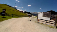
SaveNo matter if you approach from the north or south along the Brenner motorway – you will recognise right away what awaits you around the Bergeralm – at the Tyrol Bike Park. We are still quite bedazzled at how during the 2011 inaugural season, elite teams such as MS Evil or the Trek World Cup Team used the bike park as a training hotspot. Superstar of the downhill scene Aaron Gwin showed us what could be done on our freeride trails and in the slope style area
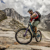
Primary Trail Type: All-Mountain & Downhill
 google parking directions
This region uses the Uk/Euro style trail grading system.
Activities Click to view
- Mountain Bike
3 trails
- E-Bike
2 trails
- Hike
1 trails
- Trail Running
1 trails
Bike Park Details
- 1
- 1
- 1
Region Status
Caution as of Jul 27, 2021- Uplift Type
- Gondola
Stats
- Avg Trail Rating
- Trails (view details)
- 3
- Trails Mountain Bike
- 3
- Trails E-Bike
- 2
- Trails Hike
- 1
- Trails Trail Running
- 1
- Total Distance
- 3 miles
- Total Descent Distance
- 3 miles
- Total Descent
- 2,845 ft
- Total Vertical
- 1,653 ft
- Highest Trailhead
- 5,169 ft
- Reports
- 7
- Photos
- 4
- Ridden Counter
- 69
Popular Bikepark Tirol Mountain Biking Trails
| status | title | difficulty | rating |
|---|---|---|---|
| Red Devil | |||
| Crazy Heart |
Videos of Bikepark Tirol Mountain Bike
trail: Red Devil
7:35 |
180 |
Jul 30, 2014

trail: Red Devil
6:02 |
558 |
Jun 12, 2018 , My City
youtuber
![Les Gets DH Track GoPro]()

3:52 |
279 |
Jun 16, 2017
youtuber
![Pumptrack Full Race Highlights | Crankworx Les...]()

2:46 |
303 |
Jun 17, 2017
youtuber
![6 DH 30 Second-ish Bike Checks | Crankworx Les...]()

5:07 |
254 |
Jun 18, 2017
youtuber
![Just The Tip Day 2 Crankworx Les Gets 2017]()

4:06 |
281 |
Jun 18, 2017
youtuber
![Full Downhill Highlights | Crankworx Les Gets 2017]()

2:58 |
249 |
Jun 18, 2017
youtuber
![Air DH Full Highlights | Crankworx Les Gets 2017]()

2:48 |
254 |
Jun 19, 2017
Recent Trail Reports
| status | trail | date | condition | info | user |
|---|---|---|---|---|---|
| Red Devil | Jul 27, 2021 @ 2:14pm Jul 27, 2021 | Wet | Mad-Dogg | ||
| Crazy Heart | Dec 20, 2020 @ 2:30pm Dec 20, 2020 | Unknown | cbtp TRAILFORKS |
Activity Feed
| username | action | type | title | date | |
|---|---|---|---|---|---|
 | cbtp | add | trail | Biketrail Flachjoch | Jun 30, 2022 @ 11:57pm Jun 30, 2022 |
 | flomurnig | vote | trail | Red Devil | Jun 17, 2022 @ 6:09am Jun 17, 2022 |
| flomurnig | ridden | trail | Red Devil | Jun 17, 2022 @ 6:09am Jun 17, 2022 |
| Mareth | wishlist | trail | Crazy Heart | Mar 12, 2022 @ 7:33am Mar 12, 2022 |
| Mad-Dogg | add | report | Red Devil | Jul 27, 2021 @ 2:14pm Jul 27, 2021 |
Nearby Areas
| name | distance | ||||
|---|---|---|---|---|---|
| Innsbruck | 3 | 6 | 13.2 km | ||
| Bike Republic Sölden | 1 | 10 | 2 | 22.4 km | |
| Bikepark Katzenkopf Leutasch | 1 | 1 | 24.1 km | ||
| Burggrafenamt | 3 | 6 | 30.9 km | ||
| Mittenwald/Wallgau Area | 6 | 3 | 6 | 31.2 km |
Activity Type Stats
| activitytype | trails | distance | descent | descent distance | total vertical | rating | global rank | state rank | photos | reports | routes | ridelogs |
|---|---|---|---|---|---|---|---|---|---|---|---|---|
| Mountain Bike | 3 | 3 miles | 2,844 ft | 3 miles | 1,654 ft | #5,584 | #37 | 4 | 7 | 60 | ||
| E-Bike | 2 | 2 miles | 1,663 ft | 2 miles | 1,654 ft | #2,728 | #34 | 4 | ||||
| Hike | 1 | #35 | 3 | 6 | ||||||||
| Trail Running | 1 | #36 | 3 |
- By void & contributors
- Admins: cbtp, mpecsi, lines, larry81541, MTBInnsbruck
- #13819 - 3,445 views
- bikepark tirol activity log | embed map of Bikepark Tirol mountain bike trails | bikepark tirol mountain biking points of interest
-
- subscribe
- 3d map
Downloading of trail gps tracks in kml & gpx formats is enabled for Bikepark Tirol.
You must login to download files.