close
Trail Conditions
- Unknown
- Snow Groomed
- Snow Packed
- Snow Covered
- Snow Cover Inadequate
- Freeze/thaw Cycle
- Icy
- Prevalent Mud
- Wet
- Variable
- Ideal
- Dry
- Very Dry
Trail Flow (Ridden Direction)
Trailforks scans users ridelogs to determine the most popular direction each trail is ridden. A good flowing trail network will have most trails flowing in a single direction according to their intension.
The colour categories are based on what percentage of riders are riding a trail in its intended direction.
The colour categories are based on what percentage of riders are riding a trail in its intended direction.
- > 96%
- > 90%
- > 80%
- > 70%
- > 50%
- < 50%
- bi-directional trail
- no data
Trail Last Ridden
Trailforks scans ridelogs to determine the last time a trail was ridden.
- < 2 days
- < 1 week
- < 2 weeks
- < 1 month
- < 6 months
- > 6 months
Trail Ridden Direction
The intended direction a trail should be ridden.
- Downhill Only
- Downhill Primary
- Both Directions
- Uphill Primary
- Uphill Only
- One Direction
Contribute Details
Colors indicate trail is missing specified detail.
- Description
- Photos
- Description & Photos
- Videos
Trail Popularity ?
Trailforks scans ridelogs to determine which trails are ridden the most in the last 9 months.
Trails are compared with nearby trails in the same city region with a possible 25 colour shades.
Think of this as a heatmap, more rides = more kinetic energy = warmer colors.
- most popular
- popular
- less popular
- not popular
ATV/ORV/OHV Filter
Max Vehicle Width
inches
Radar Time
x
Activity Recordings
Trailforks users anonymized public ridelogs from the past 6 months.
- mountain biking recent
- mountain biking (>6 month)
- hiking (1 year)
- moto (1 year)
Activity Recordings
Trailforks users anonymized public skilogs from the past 12 months.
- Downhill Ski
- Backcountry Ski
- Nordic Ski
Jump Magnitude Heatmap
Heatmap of where riders jump on trails. Zoom in to see individual jumps, click circles to view jump details.
Trails Deemphasized
Trails are shown in grey.
Only show trails with NO bikes.
Save the current map location and zoom level as your default home location whenever this page is loaded.
SaveBrian Head Resort, in cooperation with the National Forest Service, is excited to announce we will begin heavily investing in the reconstruction of our existing downhill mountain bike trail network beginning in the Summer of 2018 The resort has partnered with the legendary trail building experts at Momentum Trail Concepts to repair and construct a modern and sustainable lift-served trail experience. Momentum is excited about the potential of the unique topography Brian Head offers for trail design, and will begin efforts as soon as the Winter snow pack recedes.
Phase One will involve the complete reconstruction of our current intermediate trail from top-to-bottom, and will take approximately six weeks. Upon completion, we expect Color Country to be completely transformed into an easier, modern and fully excavated flow trail, spanning approximately 3.5 miles. We plan to have the full trail completed and ready to SHRED by mid July in time for our First Annual Rock ‘n Ride Festival on July 14th & 15th.
Phase One will involve the complete reconstruction of our current intermediate trail from top-to-bottom, and will take approximately six weeks. Upon completion, we expect Color Country to be completely transformed into an easier, modern and fully excavated flow trail, spanning approximately 3.5 miles. We plan to have the full trail completed and ready to SHRED by mid July in time for our First Annual Rock ‘n Ride Festival on July 14th & 15th.
source: Brianhead Summer Mtb Park
AKA: Brianhead
Land Status: Ski Resort
 google parking directions
Links
Activities Click to view
- Mountain Bike
45 trails
- E-Bike
2 trails
- Hike
14 trails
- Trail Running
11 trails
- Horse
5 trails
- Dirtbike/Moto
2 trails
- ATV/ORV/OHV
2 trails
Bike Park Details
- 9
- 5
- 20
- 9
- 1
Region Status
Caution as of Jul 5, 2020- Day Ticket
- $30 USD
- Uplift Type
- Chair Lift
- Season start
- Jun 11
- Season end
- Sep 26
Stats
- Avg Trail Rating
- Trails (view details)
- 60
- Trails Mountain Bike
- 45
- Trails E-Bike
- 2
- Trails Hike
- 14
- Trails Trail Running
- 11
- Trails Horse
- 5
- Trails Dirtbike/Moto
- 2
- Trails ATV/ORV/OHV
- 2
- Trails Downhill Ski
- 11
- Total Distance
- 85 miles
- Total Descent
- 28,520 ft
- Total Vertical
- 4,444 ft
- Highest Trailhead
- 11,058 ft
- Reports
- 189
- Photos
- 156
- Ridden Counter
- 8,430
Popular Brian Head Resort Mountain Biking Trails
Brian Head Resort Mountain Bike Routes
| title | rating | distance |
|---|---|---|
| Brian Head Odyssey | 47 miles | |
| 20 mile Brian Head Resort All-Mountain Ride | popular ridelog | 20 miles |
| 19 mile Brian Head Resort All-Mountain Ride | popular ridelog | 19 miles |
| 24 mile Brian Head Resort Ride | popular ridelog | 24 miles |
| 12 mile Brian Head Resort All-Mountain Ride | popular ridelog | 12 miles |
| 7 mile Brian Head Resort Ride | popular ridelog | 7 miles |
| 14 mile Brian Head Resort Ride | popular ridelog | 14 miles |
| 13 mile Brian Head Resort Ride | popular ridelog | 13 miles |
| 18 mile Brian Head Resort Ride | popular ridelog | 18 miles |
| 14 mile Brian Head Resort Ride | popular ridelog | 14 miles |
Photos of Brian Head Resort Mountain Bike
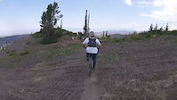
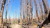
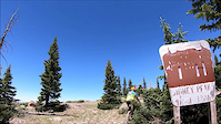
trail: Brianhead Peak Trail
1 |
Jun 29, 2022 @ 9:56pm
Jun 29, 2022
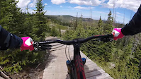
trail: Brianhead Peak Trail
1 |
Jun 29, 2022 @ 9:56pm
Jun 29, 2022
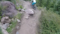
trail: Brianhead Peak Trail
1 |
Jun 29, 2022 @ 9:56pm
Jun 29, 2022
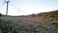
trail: Brianhead Peak Trail
1 |
Jun 29, 2022 @ 9:56pm
Jun 29, 2022
trail: Brianhead Peak Trail
2 |
Jun 29, 2022 @ 9:56pm
Jun 29, 2022
trail: Upper Timberline
223 |
Nov 17, 2017 @ 2:38pm
Nov 17, 2017
trail: Dark Hollow
3,171 | | 5 comments
Sep 19, 2010 @ 3:33pm
Sep 19, 2010
trail: Dark Hollow
339 |
Jul 6, 2009 @ 11:31pm
Jul 6, 2009Videos of Brian Head Resort Mountain Bike
trail: Timberglitter
49 |
Aug 20, 2021
trail: Timberline
81 |
Aug 20, 2021

trail: Lil' Gritty
103 |
Aug 6, 2021

trail: Lower Glitter
0:06 |
34 |
Oct 2, 2020
trail: Timberline
0:15 |
275 |
Sep 9, 2019
trail: Lower Glitter
0:23 |
232 |
Aug 23, 2019
trail: Right Fork Bunker Creek
4:05 |
129 |
Jul 22, 2019
trail: Sydney Peaks
2:31 |
131 |
Jul 22, 2019
Recent Trail Reports
| status | trail | date | condition | info | user |
|---|---|---|---|---|---|
| Dark Hollow | Jul 2, 2022 @ 7:12pm Jul 2, 2022 | Ideal | Stuart40 | ||
| Descender | Jun 26, 2022 @ 8:55am Jun 26, 2022 | Ideal | lovetoride80 | ||
| Sydney Peaks | Jun 25, 2022 @ 5:43pm Jun 25, 2022 | Dry | ATCskier | ||
| Right Fork Bunker Creek | Jun 25, 2022 @ 5:42pm Jun 25, 2022 | Dry | ATCskier | ||
| Bunker Creek | Jun 25, 2022 @ 5:39pm Jun 25, 2022 | Dry | ATCskier | ||
| Bunker Creek Middle | Jun 17, 2022 @ 8:05am Jun 17, 2022 | Dry | whipple5 | ||
| Bunker Creek Ext | Jun 17, 2022 @ 8:05am Jun 17, 2022 | Dry | whipple5 | ||
| Old Color Country | Jun 12, 2022 @ 6:49pm Jun 12, 2022 | Dry | Tdtuttle | ||
| Lowder Creek | Jun 10, 2022 @ 3:39pm Jun 10, 2022 | Dry | jyoungnomad | ||
| Marathon | Mar 5, 2022 @ 9:35pm Mar 5, 2022 | Snow Covered | Jeves1 |
Activity Feed
| username | action | type | title | date | |
|---|---|---|---|---|---|
 | Stuart40 | add | report | Dark Hollow | Jul 2, 2022 @ 7:12pm Jul 2, 2022 |
| Jokersbike | wishlist | region | Brian Head Resort | Jul 2, 2022 @ 12:39pm Jul 2, 2022 |
| AceFarley | wishlist | trail | Dark Hollow | Jul 2, 2022 @ 6:19am Jul 2, 2022 |
| cheeverbrent | ridden | trail | Lowder Creek | Jul 1, 2022 @ 7:14am Jul 1, 2022 |
| Brendarn80 | add | photo | in My City and 4 more | Jun 29, 2022 @ 9:56pm Jun 29, 2022 |
Recent Comments
| username | type | title | comment | date | |
|---|---|---|---|---|---|
| trail | The trail is mis labeled. It’s actually... | Jun 28, 2022 @ 12:18pm Jun 28, 2022 | ||
 | trail | Trails is in excellent condition. No dead... | Jun 25, 2022 @ 5:37pm Jun 25, 2022 | ||
| trail | Phenomenal trail! What a great mixture of... | Oct 8, 2021 @ 4:03pm Oct 8, 2021 | ||
| trail | Probably the worst trail in a 5 mile radius.... | Sep 28, 2021 @ 6:38am Sep 28, 2021 | ||
 | trail | Rode all over trying to find trail head, must... | Sep 18, 2021 @ 8:56am Sep 18, 2021 |
Nearby Areas
| name | distance | ||||
|---|---|---|---|---|---|
| Cedar Canyon | 3 | 1 | 6.4 km | ||
| Deer Hollow Winter Recreation Area | 12 | 4 | 11 km | ||
| Thunderbird Canyons Trail System | 1 | 6 | 1 | 11.1 km | |
| Virgin River Rim - Navajo Lake | 2 | 8 | 7 | 13.3 km | |
| Iron Hills Trail System (AKA: Southview) | 4 | 8 | 3 | 1 | 13.6 km |
Local Badges
-

Completionist0 awarded
Activity Type Stats
| activitytype | trails | distance | descent | descent distance | total vertical | rating | global rank | state rank | photos | reports | routes | ridelogs |
|---|---|---|---|---|---|---|---|---|---|---|---|---|
| Mountain Bike | 45 | 73 miles | 21,201 ft | 48 miles | 4,442 ft | #825 | #424 | 150 | 189 | 1 | 4,027 | |
| E-Bike | 2 | 5 miles | 981 ft | 3 miles | 817 ft | #1,212 | 145 | 53 | ||||
| Hike | 14 | 37 miles | 11,755 ft | 29 miles | 4,442 ft | #1,234 | #761 | 6 | 170 | 44 | ||
| Trail Running | 11 | 34 miles | 10,853 ft | 27 miles | 4,442 ft | #1,186 | #730 | 170 | 15 | |||
| Horse | 5 | 14 miles | 3,711 ft | 10 miles | 2,713 ft | #65 | #52 | 68 | ||||
| Dirtbike/Moto | 2 | 5 miles | 981 ft | 3 miles | 817 ft | #429 | 55 | |||||
| ATV/ORV/OHV | 2 | 5 miles | 981 ft | 3 miles | 817 ft | #308 | 55 | 1 | ||||
| Downhill Ski | 11 | 7 miles | 5,325 ft | 7 miles | 1,263 ft | 201 |
- By todd
 Trailforks & contributors
 - Admins: apply
- #4856 - 7,561 views
- brian head resort activity log | embed map of Brian Head Resort mountain bike trails | brian head resort mountain biking points of interest
-
- subscribe
- 3d map
Downloading of trail gps tracks in kml & gpx formats is enabled for Brian Head Resort.
You must login to download files.