close
Trail Conditions
- Unknown
- Snow Groomed
- Snow Packed
- Snow Covered
- Snow Cover Inadequate
- Freeze/thaw Cycle
- Icy
- Prevalent Mud
- Wet
- Variable
- Ideal
- Dry
- Very Dry
Trail Flow (Ridden Direction)
Trailforks scans users ridelogs to determine the most popular direction each trail is ridden. A good flowing trail network will have most trails flowing in a single direction according to their intension.
The colour categories are based on what percentage of riders are riding a trail in its intended direction.
The colour categories are based on what percentage of riders are riding a trail in its intended direction.
- > 96%
- > 90%
- > 80%
- > 70%
- > 50%
- < 50%
- bi-directional trail
- no data
Trail Last Ridden
Trailforks scans ridelogs to determine the last time a trail was ridden.
- < 2 days
- < 1 week
- < 2 weeks
- < 1 month
- < 6 months
- > 6 months
Trail Ridden Direction
The intended direction a trail should be ridden.
- Downhill Only
- Downhill Primary
- Both Directions
- Uphill Primary
- Uphill Only
- One Direction
Contribute Details
Colors indicate trail is missing specified detail.
- Description
- Photos
- Description & Photos
- Videos
Trail Popularity ?
Trailforks scans ridelogs to determine which trails are ridden the most in the last 9 months.
Trails are compared with nearby trails in the same city region with a possible 25 colour shades.
Think of this as a heatmap, more rides = more kinetic energy = warmer colors.
- most popular
- popular
- less popular
- not popular
ATV/ORV/OHV Filter
Max Vehicle Width
inches
Radar Time
x
Activity Recordings
Trailforks users anonymized public ridelogs from the past 6 months.
- mountain biking recent
- mountain biking (>6 month)
- hiking (1 year)
- moto (1 year)
Activity Recordings
Trailforks users anonymized public skilogs from the past 12 months.
- Downhill Ski
- Backcountry Ski
- Nordic Ski
Jump Magnitude Heatmap
Heatmap of where riders jump on trails. Zoom in to see individual jumps, click circles to view jump details.
Trails Deemphasized
Trails are shown in grey.
Only show trails with NO bikes.
Save the current map location and zoom level as your default home location whenever this page is loaded.
SaveMap defaulted to winter mode.
Bromont Bike Park info 2022:
One of the only mountains offering lift access in the area, it is very rocky, mostly tech trails but also has buffed out berms top to bottom trails.
350m / 1,150ft of vertical drop.
35 Downhill trails (more than 50 km of trails).
25 + Enduro trails.
Overall Bromont has one of the best Downhill and Enduro trail networks in Eastern Canada.
Weekly DH bike park chairlift schedule (Starting May 27 2022)
From May 27 :
2 Chairlifts open on Friday (Lifts #4 and #5)
4 Chairlifts open on Saturday and Sunday (Lifts #3, #4, #5 and #8.)
From June 24:
2 Chairlifts open from Monday to Thursday (Lifts #3 and #5)
3 Chairlifts open on Friday (Lifts #3, #4 and #5)
4 Chairlifts open on Saturday and Sunday (Lifts #3, #4, #5 and #8.)
source: Detailed schedule
Primary Trail Type: All-Mountain & Downhill
AKA: Bromont Bike Park, Vélo Bromont
Land Status: Ski Resort
 google parking directions
 Access Info:
Meet at parking lot P5 / Versant du Lac, chemin Huntington, Bromont.
Links
Activities Click to view
- Mountain Bike
57 trails
- E-Bike
48 trails
- Hike
6 trails
- Trail Running
6 trails
- Downhill Ski
138 trails
Region Details
- 4
- 1
- 6
- 12
- 17
- 16
- 1
Region Status
Open as of Sep 20, 2020- Day Ticket
- $45 CAD
- Uplift Type
- Chair Lift
- Season start
- May 27
- Season end
- Oct 10
Stats
- Avg Trail Rating
- Trails (view details)
- 195
- Trails Mountain Bike
- 57
- Trails E-Bike
- 48
- Trails Hike
- 6
- Trails Trail Running
- 6
- Trails Downhill Ski
- 138
- Trails Backcountry Ski
- 32
- Total Distance
- 58 miles
- Total Descent
- 38,745 ft
- Total Vertical
- 1,140 ft
- Highest Trailhead
- 1,785 ft
- Reports
- 390
- Photos
- 775
- Ridden Counter
- 28,662
Popular Bromont: Montagne d'Expériences Trails
Mountain Bike Routes
| title | rating | distance |
|---|---|---|
| Tour de la montagne | 14 miles | |
| Humus, dames, colorée | 11 miles | |
| Bromont mini enduro alternate | 10 miles | |
| Bromont mini enduro | 10 miles | |
| 2019 CNES Bromont Enduro 1st Half | 7 miles | |
| Initiation Enduro A | 8 miles | |
| Bromont | 2017 MEC Canadian National Enduro Series race | 14 miles | |
| Bromont Enduro 2018 // MEC Canadian National Enduro race | 14 miles | |
| Andre's H1 Bromont CNES Enduro 2019 race | 7 miles | |
| 12 mile Bromont: Montagne d'Expériences Ride | popular ridelog | 12 miles |
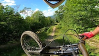
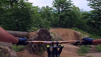
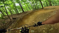
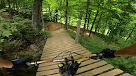
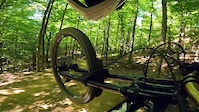
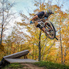
Photos of Bromont: Montagne d'Expériences Mountain Bike
trail: La Kawabunga (Bas)
0 |
Jul 4, 2022 @ 2:46pm
1 day
trail: Slick
110 |
Oct 13, 2021 @ 3:42am
Oct 13, 2021
trail: Slick
118 |
Oct 13, 2021 @ 3:42am
Oct 13, 2021
trail: La rotule
12 |
Aug 28, 2021 @ 9:51am
Aug 28, 2021
trail: La Vabo
33 |
Aug 28, 2021 @ 9:51am
Aug 28, 2021
trail: Bromance
20 |
Aug 28, 2021 @ 9:51am
Aug 28, 2021
trail: La Bête
263 |
Sep 18, 2017 @ 12:22pm
Sep 18, 2017
trail: La Bête
263 |
Sep 18, 2017 @ 12:21pm
Sep 18, 2017Videos of Bromont: Montagne d'Expériences Mountain Bike


Current Trail Warnings
| status | trail | date | condition | user | info |
|---|---|---|---|---|---|
| Celle-là | Jun 29, 2022 @ 2:29pm Jun 29, 2022 | Dry | Samuel77RPsZ |
Recent Trail Reports
| status | trail | date | condition | info | user |
|---|---|---|---|---|---|
| La Kawabunga (Haut) | Jun 29, 2022 @ 2:28pm Jun 29, 2022 | Ideal | Samuel77RPsZ | ||
| La Sept | Jun 29, 2022 @ 2:23pm Jun 29, 2022 | Wet | Samuel77RPsZ | ||
| La rotule | Jun 28, 2022 @ 2:41pm Jun 28, 2022 | Ideal | wolfvf | ||
| Extra Légère | Jun 25, 2022 @ 7:34pm Jun 25, 2022 | Ideal | marbea28 | ||
| Versant du Lac - L'Express | Jun 17, 2022 @ 3:53pm Jun 17, 2022 | Variable | Bicyk787 | ||
| La Vabo | Jun 17, 2022 @ 3:53pm Jun 17, 2022 | Variable | Bicyk787 | ||
| Indécise | Jun 15, 2022 @ 2:50pm Jun 15, 2022 | Ideal | wolfvf | ||
| Indécise | Jun 15, 2022 @ 2:50pm Jun 15, 2022 | Ideal | wolfvf | ||
| Bromance | Jun 4, 2022 @ 12:06pm Jun 4, 2022 | Variable | MirkMan | ||
| Beurre épais | Jun 4, 2022 @ 12:06pm Jun 4, 2022 | Variable | MirkMan |
Activity Feed
| username | action | type | title | date | |
|---|---|---|---|---|---|
 | StephaneMarceau | update | region | Bromont: Montagne d'Expériences | Jul 5, 2022 @ 8:16pm 6 hours |
 | todayisthegreatest | add | video | bromont jump park | Jul 5, 2022 @ 6:29pm 8 hours |
 | Waldevski | wishlist | trail | La Sept | Jul 5, 2022 @ 4:03pm 11 hours |
 | Sweetcycling | add | photo | in My City | Jul 4, 2022 @ 2:46pm 1 day |
| Sweetcycling | ridden | trail | La Kawabunga (Bas) and 2 more | Jul 4, 2022 @ 2:31pm 2 days |
Recent Comments
| username | type | title | comment | date | |
|---|---|---|---|---|---|
 | trail | Top notch track! Jeremy did an amazing job! :D \m/ | Oct 13, 2021 @ 5:58pm Oct 13, 2021 | ||
| trail | The top 1/3 should be Blue, the lower 2/3... | Apr 24, 2021 @ 12:25pm Apr 24, 2021 | ||
| trail | But a fun trail :) | Mar 24, 2021 @ 3:20pm Mar 24, 2021 | ||
| trail | Agreed! :D \m/ | Mar 21, 2021 @ 5:02pm Mar 21, 2021 | ||
| trail | This track should be rated single black in my... | Mar 21, 2021 @ 5:02pm Mar 21, 2021 |
Nearby Areas
| name | distance | ||||
|---|---|---|---|---|---|
| Réseau de la Montagne | 3 | 16 | 17 | 11 | 0.8 km |
| Réseau du Mont-Oak | 7 | 7 | 4 | 1 | 2.3 km |
| Réseau Villageois | 2 | 2.3 km | |||
| Centre National Cyclisme Bromont | 4 | 1 | 1 | 1 | 2.4 km |
| Réseau du lac Gale | 2 | 2.8 km |
Local Badges
-

Completionist0 awarded
Activity Type Stats
| activitytype | trails | distance | descent | descent distance | total vertical | rating | global rank | state rank | photos | reports | routes | ridelogs |
|---|---|---|---|---|---|---|---|---|---|---|---|---|
| Mountain Bike | 57 | 24 miles | 14,724 ft | 21 miles | 1,138 ft | #256 | #9 | 775 | 389 | 9 | 12,506 | |
| E-Bike | 48 | 24 miles | 14,564 ft | 21 miles | 1,138 ft | #80 | #3 | 365 | 281 | |||
| Hike | 6 | 6 miles | 1,795 ft | 3 miles | 1,138 ft | #1,684 | #20 | 352 | 203 | |||
| Trail Running | 6 | 6 miles | 1,795 ft | 3 miles | 1,138 ft | #1,689 | #20 | 352 | 140 | |||
| Downhill Ski | 138 | 33 miles | 24,019 ft | 28 miles | 1,122 ft | #2 | 720 | |||||
| Backcountry Ski | 32 | 5 miles | 2,326 ft | 3 miles | 725 ft | #27 | 58 |
- By Mavrey & contributors
- Admins: ASB, Bromont, v3rse
- #4403 - 20,391 views
- bromont: montagne d'expériences activity log | embed map of Bromont: Montagne d'Expériences mountain bike trails | bromont: montagne d'expériences mountain biking points of interest polygons
-
- subscribe
- 3d map
Downloading of trail gps tracks in kml & gpx formats is enabled for Bromont: Montagne d'Expériences.
You must login to download files.