close
Trail Conditions
- Unknown
- Snow Groomed
- Snow Packed
- Snow Covered
- Snow Cover Inadequate
- Freeze/thaw Cycle
- Icy
- Prevalent Mud
- Wet
- Variable
- Ideal
- Dry
- Very Dry
Trail Flow (Ridden Direction)
Trailforks scans users ridelogs to determine the most popular direction each trail is ridden. A good flowing trail network will have most trails flowing in a single direction according to their intension.
The colour categories are based on what percentage of riders are riding a trail in its intended direction.
The colour categories are based on what percentage of riders are riding a trail in its intended direction.
- > 96%
- > 90%
- > 80%
- > 70%
- > 50%
- < 50%
- bi-directional trail
- no data
Trail Last Ridden
Trailforks scans ridelogs to determine the last time a trail was ridden.
- < 2 days
- < 1 week
- < 2 weeks
- < 1 month
- < 6 months
- > 6 months
Trail Ridden Direction
The intended direction a trail should be ridden.
- Downhill Only
- Downhill Primary
- Both Directions
- Uphill Primary
- Uphill Only
- One Direction
Contribute Details
Colors indicate trail is missing specified detail.
- Description
- Photos
- Description & Photos
- Videos
Trail Popularity ?
Trailforks scans ridelogs to determine which trails are ridden the most in the last 9 months.
Trails are compared with nearby trails in the same city region with a possible 25 colour shades.
Think of this as a heatmap, more rides = more kinetic energy = warmer colors.
- most popular
- popular
- less popular
- not popular
ATV/ORV/OHV Filter
Max Vehicle Width
inches
Radar Time
x
Activity Recordings
Trailforks users anonymized public ridelogs from the past 6 months.
- mountain biking recent
- mountain biking (>6 month)
- hiking (1 year)
- moto (1 year)
Activity Recordings
Trailforks users anonymized public skilogs from the past 12 months.
- Downhill Ski
- Backcountry Ski
- Nordic Ski
Jump Magnitude Heatmap
Heatmap of where riders jump on trails. Zoom in to see individual jumps, click circles to view jump details.
Trails Deemphasized
Trails are shown in grey.
Only show trails with NO bikes.
Save the current map location and zoom level as your default home location whenever this page is loaded.
Save
No description for Northwest Territories has been added yet!
Login or register to submit one.
Stats
- Avg Trail Rating
- Trails (view details)
- 105
- Trails Mountain Bike
- 105
- Trails Hike
- 91
- Trails Trail Running
- 90
- Trails Snowshoe
- 1
- Total Distance
- 78 miles
- Total Descent
- 4,463 ft
- Total Vertical
- 775 ft
- Highest Trailhead
- 787 ft
- Reports
- 76
- Photos
- 41
- Ridden Counter
- 410
Sub Regions
Popular Northwest Territories Mountain Biking Trails
| status | title | difficulty | rating |
|---|---|---|---|
| The Holdout Ingraham Trail | |||
| Frame Lake Yellowknife | |||
| Frame Lake Hiking Trail Yellowknife | |||
| Tin Can Hill - Loop B Yellowknife | |||
| Autopilot Bristol Trail Network | |||
| Cow Path Yellowknife | |||
| Ridgeline Tin Can Hill | |||
| Tin Can Hill - Loop A Yellowknife | |||
| Tin Can Shore Trail Yellowknife | |||
| Snakes Yellowknife | |||
| Funeral Tour Yellowknife | |||
| Raven Yellowknife | |||
| Escalator Bristol Trail Network | |||
| Rat Lake Connector Yellowknife | |||
| Rycon Shaft Tin Can Hill |
Northwest Territories Mountain Bike Routes
| title | rating | distance |
|---|---|---|
| Tin Can Fatbike Loop Yellowknife | 2 miles | |
| Fall 2021 Fatbike Yellowknife | 3 miles | |
| Ridgeline and cat track Yellowknife | 1,621 ft |
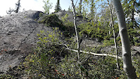
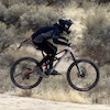
Photos of Northwest Territories Mountain Bike
trail: The Holdout
26 |
May 20, 2022 @ 9:16am
May 20, 2022
trail: tf-many1d
64 |
Nov 27, 2021 @ 4:12pm
Nov 27, 2021
trail: Mink Farm Loop
38 |
Mar 6, 2021 @ 9:34pm
Mar 6, 2021
trail: Mink Farm Loop
52 |
Mar 6, 2021 @ 9:33pm
Mar 6, 2021
trail: Prelude Lake Trail
107 |
Jun 22, 2019 @ 1:05pm
Jun 22, 2019
trail: Prelude Lake Trail
106 |
Jun 22, 2019 @ 1:05pm
Jun 22, 2019
trail: Prelude Lake Trail
109 |
Jun 22, 2019 @ 1:04pm
Jun 22, 2019
trail: Prelude Lake Trail
99 |
Jun 22, 2019 @ 1:04pm
Jun 22, 2019Videos of Northwest Territories Mountain Bike
trail: Snakes
0:11 |
63 |
Aug 25, 2019
Activity Feed
| username | action | type | title | date | |
|---|---|---|---|---|---|
 | Lupton | add | trail | Pistol Shrimp | Jul 5, 2022 @ 12:42pm 13 hours |
 | dinahmite | add | trail | Magpie and 1 more | Jul 4, 2022 @ 10:07am 2 days |
| willy-tee | ridden | trail | Raven Peak Connector | Jun 17, 2022 @ 10:13pm Jun 17, 2022 |
| JPC-MTB | add | region | Ski Club | Jun 16, 2022 @ 4:54pm Jun 16, 2022 |
| dinahmite | add | report | Ridgeline and 2 more | Jun 12, 2022 @ 3:04pm Jun 12, 2022 |
Recent Comments
| username | type | title | comment | date | |
|---|---|---|---|---|---|
| trail | Great trail | May 2, 2022 @ 12:36pm May 2, 2022 | ||
 | trail | My bad it’s actually in the northwest... | Dec 1, 2021 @ 10:20pm Dec 1, 2021 | ||
| trail | This trail system is creepy AF, who puts a... | Nov 27, 2021 @ 4:07pm Nov 27, 2021 | ||
| trail | Nice loop trail, with more flow than... | Sep 11, 2021 @ 12:34pm Sep 11, 2021 | ||
 | trail | has technology gone to far | Apr 30, 2021 @ 11:44am Apr 30, 2021 |
Local Badges
-

Descent 10k Badge3 awarded -

Epic Ride Descent 2k0 awarded -

Climbing 100k Badge0 awarded -

Epic Ride Climb 2k0 awarded -

Big Ride 30k80 awarded -

Climbing 10k Badge3 awarded
Bike & Skill Parks
| name | type | city | rating |
|---|---|---|---|
| BMX / Skate Park | skill park | Yellowknife |
Activity Type Stats
| activitytype | trails | distance | descent | descent distance | total vertical | rating | global rank | state rank | photos | reports | routes | ridelogs |
|---|---|---|---|---|---|---|---|---|---|---|---|---|
| Mountain Bike | 105 | 78 miles | 4,462 ft | 19 miles | 774 ft | #62 | 41 | 71 | 3 | 1,668 | ||
| Hike | 91 | 75 miles | 3,917 ft | 17 miles | 774 ft | #62 | 66 | 39 | ||||
| Trail Running | 90 | 75 miles | 3,914 ft | 17 miles | 774 ft | #62 | 66 | 141 | ||||
| Snowshoe | 1 | 846 ft | 3 ft | 157 ft | 36 ft | 10 |
- By NorthOfSkepty & contributors
- Admins: IMBA Canada, brenthillier, msmcfate
- #8548 - 6,410 views
- northwest territories activity log | embed map of Northwest Territories mountain bike trails | northwest territories mountain biking points of interest
-
- subscribe
- 3d map
Downloading of trail gps tracks in kml & gpx formats is enabled for Northwest Territories.
You must login to download files.