close
Trail Conditions
- Unknown
- Snow Groomed
- Snow Packed
- Snow Covered
- Snow Cover Inadequate
- Freeze/thaw Cycle
- Icy
- Prevalent Mud
- Wet
- Variable
- Ideal
- Dry
- Very Dry
Trail Flow (Ridden Direction)
Trailforks scans users ridelogs to determine the most popular direction each trail is ridden. A good flowing trail network will have most trails flowing in a single direction according to their intension.
The colour categories are based on what percentage of riders are riding a trail in its intended direction.
The colour categories are based on what percentage of riders are riding a trail in its intended direction.
- > 96%
- > 90%
- > 80%
- > 70%
- > 50%
- < 50%
- bi-directional trail
- no data
Trail Last Ridden
Trailforks scans ridelogs to determine the last time a trail was ridden.
- < 2 days
- < 1 week
- < 2 weeks
- < 1 month
- < 6 months
- > 6 months
Trail Ridden Direction
The intended direction a trail should be ridden.
- Downhill Only
- Downhill Primary
- Both Directions
- Uphill Primary
- Uphill Only
- One Direction
Contribute Details
Colors indicate trail is missing specified detail.
- Description
- Photos
- Description & Photos
- Videos
Trail Popularity ?
Trailforks scans ridelogs to determine which trails are ridden the most in the last 9 months.
Trails are compared with nearby trails in the same city region with a possible 25 colour shades.
Think of this as a heatmap, more rides = more kinetic energy = warmer colors.
- most popular
- popular
- less popular
- not popular
ATV/ORV/OHV Filter
Max Vehicle Width
inches
Radar Time
x
Activity Recordings
Trailforks users anonymized public ridelogs from the past 6 months.
- mountain biking recent
- mountain biking (>6 month)
- hiking (1 year)
- moto (1 year)
Activity Recordings
Trailforks users anonymized public skilogs from the past 12 months.
- Downhill Ski
- Backcountry Ski
- Nordic Ski
Jump Magnitude Heatmap
Heatmap of where riders jump on trails. Zoom in to see individual jumps, click circles to view jump details.
Trails Deemphasized
Trails are shown in grey.
Only show trails with NO bikes.
Save the current map location and zoom level as your default home location whenever this page is loaded.
Save
No description for Camaleon Bike Park has been added yet!
Login or register to submit one.
Primary Trail Type: All-Mountain & Downhill
Shuttleable: YES
Land Status: Community Forest
Activities Click to view
- Mountain Bike
13 trails
- E-Bike
8 trails
- Hike
7 trails
- Trail Running
7 trails
- Horse
4 trails
Bike Park Details
- 5
- 6
- 2
Region Status
Open as of Feb 21, 2022- Day Ticket
- 25 MXN
- Uplift Type
- Shuttle
Stats
- Trails (view details)
- 13
- Trails Mountain Bike
- 13
- Trails E-Bike
- 8
- Trails Hike
- 7
- Trails Trail Running
- 7
- Trails Horse
- 4
- Total Distance
- 18 miles
- Total Descent Distance
- 11 miles
- Total Descent
- 6,455 ft
- Total Vertical
- 1,984 ft
- Highest Trailhead
- 11,581 ft
- Reports
- 29
- Photos
- 5
- Ridden Counter
- 26
Popular Camaleon Bike Park Mountain Biking Trails
Photos of Camaleon Bike Park Mountain Bike
trail: Subida a llano grande
28 |
Apr 16, 2021 @ 7:27pm
Apr 16, 2021
trail: Infiernillo
13 |
Apr 9, 2021 @ 10:01am
Apr 9, 2021
trail: Infiernillo
12 |
Apr 9, 2021 @ 10:01am
Apr 9, 2021
trail: Infiernillo
23 |
Apr 9, 2021 @ 10:01am
Apr 9, 2021
trail: Infiernillo
18 |
Oct 4, 2020 @ 6:29pm
Oct 4, 2020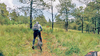


Recent Trail Reports
| status | trail | date | condition | info | user |
|---|---|---|---|---|---|
| de 4P al estacionamiento por chalmera | May 14, 2022 @ 8:17pm May 14, 2022 | Dry | TheTlatoani7 | ||
| Subida a Cascabeles | Feb 27, 2022 @ 7:56am Feb 27, 2022 | Dry | Donochoas | ||
| Cascabeles medio | Feb 27, 2022 @ 7:56am Feb 27, 2022 | Ideal | Donochoas | ||
| Continuación Cascabeles Hasta El Final | Feb 27, 2022 @ 7:56am Feb 27, 2022 | Dry | Donochoas | ||
| Costera | Feb 27, 2022 @ 7:56am Feb 27, 2022 | Ideal | Donochoas | ||
| Furiosa | Feb 27, 2022 @ 7:56am Feb 27, 2022 | Dry | Donochoas | ||
| Subida a llano grande | Feb 19, 2022 @ 5:55am Feb 19, 2022 | Variable | Swiny5 | ||
| Gigantes | Jan 16, 2022 @ 9:46am Jan 16, 2022 | Dry | ingridregina | ||
| Subida a Corral | Aug 15, 2021 @ 6:23am Aug 15, 2021 | Wet | EdgarMtz | ||
| Entrada a Tendo | Aug 15, 2021 @ 6:23am Aug 15, 2021 | Wet | EdgarMtz |
Activity Feed
| username | action | type | title | date | |
|---|---|---|---|---|---|
 | TheTlatoani7 | add | report | de 4P al estacionamiento por chalmera | May 14, 2022 @ 8:17pm May 14, 2022 |
| Swiny5 | add | report | Subida a llano grande | Feb 21, 2022 @ 11:53am Feb 21, 2022 |
Recent Comments
| username | type | title | comment | date | |
|---|---|---|---|---|---|
 | trail | Mucha subida y buenas bajadas | Aug 31, 2020 @ 10:05am Aug 31, 2020 |
Nearby Areas
| name | distance | ||||
|---|---|---|---|---|---|
| El Camaleon Bike Park | 2 | 3.7 km | |||
| Chiluca | 6 | 7 | 3 | 1 | 5.3 km |
| Salazar | 2 | 12.5 km | |||
| Bosque de Chapultepec III Sección | 1 | 2 | 13 km | ||
| Desierto de los Leones | 26 | 56 | 16 | 3 | 13 km |
Activity Type Stats
| activitytype | trails | distance | descent | descent distance | total vertical | rating | global rank | state rank | photos | reports | routes | ridelogs |
|---|---|---|---|---|---|---|---|---|---|---|---|---|
| Mountain Bike | 13 | 18 miles | 6,453 ft | 11 miles | 1,985 ft | #7,356 | #38 | 5 | 29 | 47 | ||
| E-Bike | 8 | 13 miles | 3,494 ft | 7 miles | 1,985 ft | #3,176 | #24 | 28 | 2 | |||
| Hike | 7 | 10 miles | 2,011 ft | 4 miles | 1,985 ft | #8,539 | #45 | 28 | ||||
| Trail Running | 7 | 10 miles | 2,011 ft | 4 miles | 1,985 ft | #8,519 | #45 | 28 | ||||
| Horse | 4 | 3 miles | 449 ft | 1 mile | 495 ft | #746 | #2 |
- By omarancis
 & contributors
 - Admins: apply
- #48134 - 238 views
- camaleon bike park activity log | embed map of Camaleon Bike Park mountain bike trails | camaleon bike park mountain biking points of interest
Downloading of trail gps tracks in kml & gpx formats is enabled for Camaleon Bike Park.
You must login to download files.