close
Trail Conditions
- Unknown
- Snow Groomed
- Snow Packed
- Snow Covered
- Snow Cover Inadequate
- Freeze/thaw Cycle
- Icy
- Prevalent Mud
- Wet
- Variable
- Ideal
- Dry
- Very Dry
Trail Flow (Ridden Direction)
Trailforks scans users ridelogs to determine the most popular direction each trail is ridden. A good flowing trail network will have most trails flowing in a single direction according to their intension.
The colour categories are based on what percentage of riders are riding a trail in its intended direction.
The colour categories are based on what percentage of riders are riding a trail in its intended direction.
- > 96%
- > 90%
- > 80%
- > 70%
- > 50%
- < 50%
- bi-directional trail
- no data
Trail Last Ridden
Trailforks scans ridelogs to determine the last time a trail was ridden.
- < 2 days
- < 1 week
- < 2 weeks
- < 1 month
- < 6 months
- > 6 months
Trail Ridden Direction
The intended direction a trail should be ridden.
- Downhill Only
- Downhill Primary
- Both Directions
- Uphill Primary
- Uphill Only
- One Direction
Contribute Details
Colors indicate trail is missing specified detail.
- Description
- Photos
- Description & Photos
- Videos
Trail Popularity ?
Trailforks scans ridelogs to determine which trails are ridden the most in the last 9 months.
Trails are compared with nearby trails in the same city region with a possible 25 colour shades.
Think of this as a heatmap, more rides = more kinetic energy = warmer colors.
- most popular
- popular
- less popular
- not popular
ATV/ORV/OHV Filter
Max Vehicle Width
inches
Radar Time
x
Activity Recordings
Trailforks users anonymized public ridelogs from the past 6 months.
- mountain biking recent
- mountain biking (>6 month)
- hiking (1 year)
- moto (1 year)
Activity Recordings
Trailforks users anonymized public skilogs from the past 12 months.
- Downhill Ski
- Backcountry Ski
- Nordic Ski
Jump Magnitude Heatmap
Heatmap of where riders jump on trails. Zoom in to see individual jumps, click circles to view jump details.
Trails Deemphasized
Trails are shown in grey.
Only show trails with NO bikes.
Save the current map location and zoom level as your default home location whenever this page is loaded.
SaveI was going to write up an intro after riding the park, but came across this great article (though posted in 2012) that is very useful:
"The park is one of the most accessible, legal mountain biking locations in Adelaide and includes a generous trail network that caters for a variety of mountain bike disciplines and abilities. Beginners be warned though – fitness will be more of a challenge than a lack of skill. Born with approximately 21kms of cross country trails, one downhill trail, a token “skills development” area, dirt jumps and a trials area, the park has changed for the better and worse over the years. Eagle MTB Park typically suffers periods of neglect in between events, only to receive a surge of energy to prepare for an upcoming event." For a bunch more info, go here http://www.ridemorebikes.com/eagle-mountain-bike-park/
Parking
If entering the Park from the Hawk Hill entrance, park your car on Hawk Hill just after Emmett Road, but before it bend up to the left. There's a very wide shoulder that give residents plenty of room.
There's plenty of parking at the other entrance off Mount Barker Road.
Note Escape Goat does run occasional shuttle services
Suggested Route
Most trails can be ridden both directions, but there are some better ways to ride the trails The official trail map is great in that it suggests the best direction to ride certain trails. Here's a good way to connect the trails in a loop (starting at the Hawk Hill Rd entrance);
Hawkeye > Eagle Way West > South Side > Sunset Boulevard > Overlocker > Blue Gums > Valley Road > Eagle Way West > Tunnel Vision
source: Eagle Mountain Bike Park
Primary Trail Type: All-Mountain & Downhill
eBikes Allowed:
Yes
Links
Activities Click to view
- Mountain Bike
38 trails
- E-Bike
38 trails
- Hike
33 trails
- Trail Running
32 trails
Bike Park Details
- 7
- 3
- 19
- 5
- 2
Region Status
Caution as of Jul 6, 2021- Uplift Type
- Shuttle
Stats
- Avg Trail Rating
- Trails (view details)
- 36
- Trails Mountain Bike
- 38
- Trails E-Bike
- 38
- Trails Hike
- 33
- Trails Trail Running
- 32
- Total Distance
- 13 miles
- Total Descent
- 3,411 ft
- Total Vertical
- 600 ft
- Highest Trailhead
- 1,666 ft
- Reports
- 275
- Photos
- 141
- Ridden Counter
- 13,162
Popular Eagle Mountain Bike Park Mountain Biking Trails
Eagle Mountain Bike Park Mountain Bike Routes
| title | rating | distance |
|---|---|---|
| 2021 AMBC SA State XCO Champs | 3 miles | |
| Lofty | 13 miles | |
| race | 3 miles | |
| 13 mile Eagle Mountain Bike Park Road Ride | popular ridelog | 13 miles |
| 13 mile Eagle Mountain Bike Park Ride | popular ridelog | 13 miles |
| 16 mile Eagle Mountain Bike Park All-Mountain Ride | popular ridelog | 16 miles |
| 8 mile Eagle Mountain Bike Park Ride | popular ridelog | 8 miles |
| 10 mile Eagle Mountain Bike Park All-Mountain Ride | popular ridelog | 10 miles |
| 8 mile Eagle Mountain Bike Park Ride | popular ridelog | 8 miles |
| 8 mile Eagle Mountain Bike Park All-Mountain Ride | popular ridelog | 8 miles |
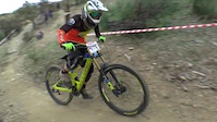
Photos of Eagle Mountain Bike Park Mountain Bike
trail: The Mixer
43 |
May 4, 2022 @ 3:27am
May 4, 2022
trail: The Mixer
150 |
Nov 5, 2019 @ 4:27am
Nov 5, 2019
trail: The Mixer
169 |
Nov 5, 2019 @ 4:26am
Nov 5, 2019
trail: The Mixer
131 |
Nov 5, 2019 @ 4:25am
Nov 5, 2019
trail: On The Verge
95 |
Feb 27, 2017 @ 11:54pm
Feb 27, 2017
trail: On The Verge
54 |
Feb 27, 2017 @ 11:32pm
Feb 27, 2017
trail: Eagle 4x
241 |
Dec 12, 2016 @ 6:21pm
Dec 12, 2016
trail: The Mixer
185 |
Aug 2, 2016 @ 5:50am
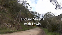
Aug 2, 2016Videos of Eagle Mountain Bike Park Mountain Bike
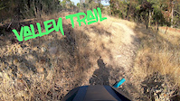
trail: Valley Trail
3:07 |
197 |
Feb 17, 2020
trail: Hawkeye
2:11 |
93 |
Jan 25, 2020
trail: On The Verge
1:09 |
229 |
Jan 14, 2020

trail: On The Verge
1:04 |
76 |
Jan 14, 2020
trail: The Mixer
0:34 |
461 |
Oct 17, 2016
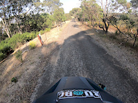
trail: Valley Road
1:26 |
172 |
Oct 11, 2016
trail: The Mixer
2:26 |
567 |
Jun 12, 2016
trail: The Mixer
9:45 |
420 |
Jun 3, 2016
Current Trail Warnings
| status | trail | date | condition | user | info |
|---|---|---|---|---|---|
| The Mixer | Jul 3, 2022 @ 1:47am Jul 3, 2022 | Dry | OscarVKOq93 | Fallen Tree | |
| South Side | Jun 8, 2022 @ 3:54am Jun 8, 2022 | Variable | Slowisfast | Broken trunk hanging over trail in one... |
Recent Trail Reports
| status | trail | date | condition | info | user |
|---|---|---|---|---|---|
| Hills Hoist | Jun 24, 2022 @ 9:49pm Jun 24, 2022 | Variable | FTwining | ||
| Top Deck | Jun 24, 2022 @ 9:48pm Jun 24, 2022 | Wet | FTwining | ||
| Jammin | Jun 24, 2022 @ 9:48pm Jun 24, 2022 | Wet | FTwining | ||
| Valley Trail | Jun 24, 2022 @ 9:47pm Jun 24, 2022 | Variable | FTwining | ||
| Valley Trail Conn | Jun 24, 2022 @ 9:47pm Jun 24, 2022 | Wet | FTwining | ||
| Overlocker | Jun 24, 2022 @ 9:46pm Jun 24, 2022 | Ideal | FTwining | ||
| Sunset Boulevard | Jun 24, 2022 @ 9:46pm Jun 24, 2022 | Variable | FTwining | ||
| Get Pitted | May 21, 2022 @ 1:29am May 21, 2022 | Variable | madrapper | ||
| Eagle Way West | Apr 22, 2022 @ 7:58pm Apr 22, 2022 | Very Dry | KRMTB2015 | ||
| Benbow Cyborg | Mar 10, 2022 @ 12:00am Mar 10, 2022 | Dry | big-rig42 |
Activity Feed
| username | action | type | title | date | |
|---|---|---|---|---|---|
 | ForestrySA | vote | trail | North Face and 7 more | Jul 5, 2022 @ 7:00pm 8 hours |
 | Lukesmith0406 | ridden | skillpark | Eagle Mountain Skills Area | Jul 3, 2022 @ 3:09am 3 days |
| OscarVKOq93 | add | report | The Mixer and 3 more | Jul 3, 2022 @ 1:47am Jul 3, 2022 |
| Lukesmith0406 | ridden | trail | Sunset Boulevard and 3 more | Jul 2, 2022 @ 8:36pm Jul 2, 2022 |
| Joemullan | vote | trail | Top Deck and 2 more | Jun 29, 2022 @ 1:28am Jun 29, 2022 |
Recent Comments
| username | type | title | comment | date | |
|---|---|---|---|---|---|
 | skillpark | Jumps good rest bad | May 22, 2021 @ 2:14am May 22, 2021 | ||
| report | Lots of loose rocks. Edges are becoming soft | Dec 28, 2017 @ 11:29pm Dec 28, 2017 |
Nearby Areas
| name | distance | ||||
|---|---|---|---|---|---|
| Cleland National Park | 11 | 14 | 5 | 1.9 km | |
| Mt Osmond | 2 | 2 | 7 | 3 | 2.1 km |
| Belair National Park | 7 | 7 | 2.8 km | ||
| Brownhill Creek | 1 | 4 | 2 | 3 km | |
| Randell Park Reserve | 3 km |
Local Badges
-

Completionist20 awarded
Bike & Skill Parks
| name | type | city | rating |
|---|---|---|---|
| Eagle Mountain Skills Area | skill park | Adelaide |
Activity Type Stats
| activitytype | trails | distance | descent | descent distance | total vertical | rating | global rank | state rank | photos | reports | routes | ridelogs |
|---|---|---|---|---|---|---|---|---|---|---|---|---|
| Mountain Bike | 38 | 13 miles | 3,412 ft | 6 miles | 600 ft | #487 | #46 | 141 | 275 | 3 | 4,081 | |
| E-Bike | 38 | 13 miles | 3,412 ft | 6 miles | 600 ft | #148 | #27 | 225 | 1 | 268 | ||
| Hike | 33 | 10 miles | 2,277 ft | 5 miles | 600 ft | #489 | #32 | 249 | 40 | |||
| Trail Running | 32 | 10 miles | 2,244 ft | 4 miles | 591 ft | #492 | #33 | 245 | 20 |
- By canadaka
 Trailforks & contributors
 - Admins: MTBA, NPSA, Coneofsilence, ForestrySA
- #5065 - 23,760 views
- eagle mountain bike park activity log | embed map of Eagle Mountain Bike Park mountain bike trails | eagle mountain bike park mountain biking points of interest
-
- subscribe
- 3d map
Downloading of trail gps tracks in kml & gpx formats is enabled for Eagle Mountain Bike Park.
You must login to download files.