close
Trail Conditions
- Unknown
- Snow Groomed
- Snow Packed
- Snow Covered
- Snow Cover Inadequate
- Freeze/thaw Cycle
- Icy
- Prevalent Mud
- Wet
- Variable
- Ideal
- Dry
- Very Dry
Trail Flow (Ridden Direction)
Trailforks scans users ridelogs to determine the most popular direction each trail is ridden. A good flowing trail network will have most trails flowing in a single direction according to their intension.
The colour categories are based on what percentage of riders are riding a trail in its intended direction.
The colour categories are based on what percentage of riders are riding a trail in its intended direction.
- > 96%
- > 90%
- > 80%
- > 70%
- > 50%
- < 50%
- bi-directional trail
- no data
Trail Last Ridden
Trailforks scans ridelogs to determine the last time a trail was ridden.
- < 2 days
- < 1 week
- < 2 weeks
- < 1 month
- < 6 months
- > 6 months
Trail Ridden Direction
The intended direction a trail should be ridden.
- Downhill Only
- Downhill Primary
- Both Directions
- Uphill Primary
- Uphill Only
- One Direction
Contribute Details
Colors indicate trail is missing specified detail.
- Description
- Photos
- Description & Photos
- Videos
Trail Popularity ?
Trailforks scans ridelogs to determine which trails are ridden the most in the last 9 months.
Trails are compared with nearby trails in the same city region with a possible 25 colour shades.
Think of this as a heatmap, more rides = more kinetic energy = warmer colors.
- most popular
- popular
- less popular
- not popular
ATV/ORV/OHV Filter
Max Vehicle Width
inches
Radar Time
x
Activity Recordings
Trailforks users anonymized public ridelogs from the past 6 months.
- mountain biking recent
- mountain biking (>6 month)
- hiking (1 year)
- moto (1 year)
Activity Recordings
Trailforks users anonymized public skilogs from the past 12 months.
- Downhill Ski
- Backcountry Ski
- Nordic Ski
Jump Magnitude Heatmap
Heatmap of where riders jump on trails. Zoom in to see individual jumps, click circles to view jump details.
Trails Deemphasized
Trails are shown in grey.
Only show trails with NO bikes.
Save the current map location and zoom level as your default home location whenever this page is loaded.
SaveThis riding area stretches from Bielsko-Biala to Wilkowice and Szczyrk, with two Gondola lifts and dozens of trails it is most likely the biggest Trail Park or Bike Park in this part of Europe. EnjoY
Primary Trail Type: All-Mountain & Downhill
eBikes Allowed:
Yes
 google parking directions
Links
This region uses the Uk/Euro style trail grading system.
Activities Click to view
- Mountain Bike
34 trails
- Backcountry Ski
0 trails
Bike Park Details
- 8
- 6
- 5
- 9
- 5
Region Status
Open as of May 15, 2021- Day Ticket
- zł59 PLN
- Uplift Type
- Gondola
- Season start
- Apr 3
- Season end
- Nov 3
Stats
- Avg Trail Rating
- Trails (view details)
- 33
- Trails Mountain Bike
- 34
- Trails E-Bike
- 30
- Trails Hike
- 10
- Trails Trail Running
- 10
- Total Distance
- 36 miles
- Total Descent
- 15,826 ft
- Total Vertical
- 2,670 ft
- Highest Trailhead
- 3,963 ft
- Reports
- 1,260
- Photos
- 463
- Ridden Counter
- 14,276
Popular Enduro Trails Mountain Biking Trails
Enduro Trails Mountain Bike Routes
| title | rating | distance |
|---|---|---|
| E-Bike BSK-Klimczok-Borsuk-Dębowiec-Twist-BSK | 18 miles | |
| Loop around Szczyrk | 27 miles |
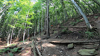
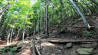
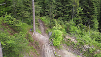
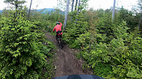
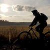
Photos of Enduro Trails Mountain Bike
trail: Dziabar
422 |
Jul 6, 2018 @ 1:43am
Jul 6, 2018
trail: DH+
166 |
Nov 26, 2017 @ 12:30pm
Nov 26, 2017
trail: DH+
171 |
Nov 26, 2017 @ 12:29pm
Nov 26, 2017
trail: Twister
694 |
Sep 4, 2016 @ 8:55am
Sep 4, 2016
trail: TW+
440 |
Jun 9, 2016 @ 3:01pm
Jun 9, 2016
trail: TW+
366 |
Jun 9, 2016 @ 2:58pm
Jun 9, 2016
trail: Twister
1,960 | | 9 comments
Nov 1, 2015 @ 9:32am
Nov 1, 2015
trail: Dziabar
319 |
Sep 18, 2014 @ 12:35pm
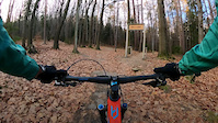
Sep 18, 2014Videos of Enduro Trails Mountain Bike


Recent Trail Reports
| status | trail | date | condition | info | user |
|---|---|---|---|---|---|
| HipHopA (Air) | Jun 26, 2022 @ 3:16am Jun 26, 2022 | Very Dry | Malekithan | ||
| HipHopA (Flow) | Jun 26, 2022 @ 3:16am Jun 26, 2022 | Very Dry | Malekithan | ||
| Loop 1 | Jun 26, 2022 @ 12:44am Jun 26, 2022 | Very Dry | gpeczek | ||
| ROCKnRolla | Jun 25, 2022 @ 4:08am Jun 25, 2022 | Ideal | clord | ||
| Bystry | Jun 25, 2022 @ 4:08am Jun 25, 2022 | Ideal | clord | ||
| Otik | Jun 21, 2022 @ 12:38am Jun 21, 2022 | Ideal | Hruby | ||
| Zbój | Jun 19, 2022 @ 12:42am Jun 19, 2022 | Dry | R62 | ||
| Gaciok | Jun 18, 2022 @ 12:48pm Jun 18, 2022 | Ideal | qrzy | ||
| Podjazd Schronisko | Jun 18, 2022 @ 3:48am Jun 18, 2022 | Ideal | Rafu | ||
| Twister | Jun 18, 2022 @ 3:48am Jun 18, 2022 | Ideal | Rafu |
Activity Feed
| username | action | type | title | date | |
|---|---|---|---|---|---|
 | Malekithan | add | report | HipHopA (Air) and 1 more | Jun 27, 2022 @ 5:08am Jun 27, 2022 |
| gpeczek | add | report | Loop 1 and 1 more | Jun 26, 2022 @ 6:44am Jun 26, 2022 |
| clord | add | report | ROCKnRolla and 1 more | Jun 25, 2022 @ 1:10pm Jun 25, 2022 |
 | Hruby | add | report | HipHopA (Flow) and 3 more | Jun 21, 2022 @ 2:35pm Jun 21, 2022 |
 | Rafu | add | report | Daglezjowy and 4 more | Jun 21, 2022 @ 5:32am Jun 21, 2022 |
Recent Comments
| username | type | title | comment | date | |
|---|---|---|---|---|---|
 | report | dzięki za wstępne porządki! | Sep 22, 2021 @ 2:40pm Sep 22, 2021 | ||
 | trail | Ktoś mi kiedyś mówił, że nie przepada za... | Sep 3, 2021 @ 1:45pm Sep 3, 2021 | ||
| trail | Tym podjazdem jeżdżą też dzieci, a w... | Sep 3, 2021 @ 12:32pm Sep 3, 2021 | ||
| trail | To był kiedyś mój ulubiony podjazd w... | Aug 21, 2021 @ 4:29pm Aug 21, 2021 | ||
| report | Juz nie | Aug 17, 2021 @ 11:56am Aug 17, 2021 |
Nearby Areas
| name | distance | ||||
|---|---|---|---|---|---|
| Straconka Elduro | 1 | 5 km | |||
| PKL Bike Park Góra Żar | 1 | 8.5 km | |||
| Bike Park Palenica | 1 | 8.9 km | |||
| Nowa Osada | 1 | 1 | 9.6 km | ||
| Skolnity Wisła Ski & Bike | 1 | 1 | 10.3 km |
Local Badges
-

Completionist2 awarded
Activity Type Stats
| activitytype | trails | distance | descent | descent distance | total vertical | rating | global rank | state rank | photos | reports | routes | ridelogs |
|---|---|---|---|---|---|---|---|---|---|---|---|---|
| Mountain Bike | 34 | 36 miles | 15,827 ft | 23 miles | 2,671 ft | #246 | #2 | 462 | 1,254 | 2 | 15,460 | |
| E-Bike | 30 | 34 miles | 14,977 ft | 22 miles | 2,671 ft | #160 | #1 | 1 | 1,067 | 1 | 983 | |
| Hike | 10 | 8 miles | 1,555 ft | 3 miles | 2,195 ft | #1,919 | #20 | 956 | 224 | |||
| Trail Running | 10 | 8 miles | 1,555 ft | 3 miles | 2,195 ft | #1,920 | #20 | 956 | 66 |
- By micolai
 TRAILFORKS & contributors
 - Admins: Ecoriders, WŚ
- #25271 - 14,949 views
- enduro trails activity log | embed map of Enduro Trails mountain bike trails | enduro trails mountain biking points of interest
Downloading of trail gps tracks in kml & gpx formats is enabled for Enduro Trails.
You must login to download files.