close
Trail Conditions
- Unknown
- Snow Groomed
- Snow Packed
- Snow Covered
- Snow Cover Inadequate
- Freeze/thaw Cycle
- Icy
- Prevalent Mud
- Wet
- Variable
- Ideal
- Dry
- Very Dry
Trail Flow (Ridden Direction)
Trailforks scans users ridelogs to determine the most popular direction each trail is ridden. A good flowing trail network will have most trails flowing in a single direction according to their intension.
The colour categories are based on what percentage of riders are riding a trail in its intended direction.
The colour categories are based on what percentage of riders are riding a trail in its intended direction.
- > 96%
- > 90%
- > 80%
- > 70%
- > 50%
- < 50%
- bi-directional trail
- no data
Trail Last Ridden
Trailforks scans ridelogs to determine the last time a trail was ridden.
- < 2 days
- < 1 week
- < 2 weeks
- < 1 month
- < 6 months
- > 6 months
Trail Ridden Direction
The intended direction a trail should be ridden.
- Downhill Only
- Downhill Primary
- Both Directions
- Uphill Primary
- Uphill Only
- One Direction
Contribute Details
Colors indicate trail is missing specified detail.
- Description
- Photos
- Description & Photos
- Videos
Trail Popularity ?
Trailforks scans ridelogs to determine which trails are ridden the most in the last 9 months.
Trails are compared with nearby trails in the same city region with a possible 25 colour shades.
Think of this as a heatmap, more rides = more kinetic energy = warmer colors.
- most popular
- popular
- less popular
- not popular
ATV/ORV/OHV Filter
Max Vehicle Width
inches
Radar Time
x
Activity Recordings
Trailforks users anonymized public ridelogs from the past 6 months.
- mountain biking recent
- mountain biking (>6 month)
- hiking (1 year)
- moto (1 year)
Activity Recordings
Trailforks users anonymized public skilogs from the past 12 months.
- Downhill Ski
- Backcountry Ski
- Nordic Ski
Jump Magnitude Heatmap
Heatmap of where riders jump on trails. Zoom in to see individual jumps, click circles to view jump details.
Trails Deemphasized
Trails are shown in grey.
Only show trails with NO bikes.
Save the current map location and zoom level as your default home location whenever this page is loaded.
SaveLocated within Crested Butte Mountain Resort, access the lift-served riding from the base area of the ski resort.
Primary Trail Type: All-Mountain & Downhill
Land Status: Ski Resort
 google parking directions
Links
Activities Click to view
- Mountain Bike
42 trails
- Hike
17 trails
- Trail Running
16 trails
Bike Park Details
- 12
- 10
- 11
- 7
- 1
- 1
Region Status
Caution as of Aug 26, 2020- Day Ticket
- $39 USD
- Uplift Type
- Chair Lift
- Season start
- Jun 14
- Season end
- Sep 28
Stats
- Avg Trail Rating
- Trails (view details)
- 44
- Trails Mountain Bike
- 42
- Trails E-Bike
- 3
- Trails Hike
- 17
- Trails Trail Running
- 16
- Trails Horse
- 3
- Trails Dirtbike/Moto
- 2
- Trails ATV/ORV/OHV
- 1
- Total Distance
- 59 miles
- Total Descent
- 13,800 ft
- Total Vertical
- 3,677 ft
- Highest Trailhead
- 12,620 ft
- Reports
- 158
- Photos
- 183
- Ridden Counter
- 11,471
Popular Evolution Bike Park Mountain Biking Trails
Evolution Bike Park Mountain Bike Routes
| title | rating | distance |
|---|---|---|
| 409.5 loop | 15 miles | |
| Strawberry Loop | 12 miles | |
| Whetstone Vista Loop | 3 miles | |
| Westside to Happy Hour | 7 miles | |
| Snodgrass Mountain | 6 miles | |
| Upper Westside to Crested Butte | 11 miles | |
| Ruby Road Loop | 10 miles | |
| Brush Creek | 4 miles | |
| Messer Memorial Loop | 18 miles | |
| CB: Snodgrass, 403 and 401 | 29 miles |
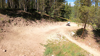
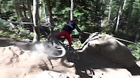
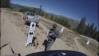
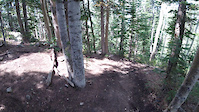
Photos of Evolution Bike Park Mountain Bike
trail: Avery
115 |
Nov 24, 2020 @ 10:38am
Nov 24, 2020
trail: West Brush Creek Rd.
97 |
Jun 23, 2020 @ 5:38pm
Jun 23, 2020
trail: Avery
239 |
Aug 13, 2018 @ 10:23am
Aug 13, 2018
trail: Avery
122 |
Aug 13, 2018 @ 10:16am
Aug 13, 2018
trail: Avery
226 |
Sep 7, 2016 @ 11:42am
Sep 7, 2016
trail: Avery
331 |
Apr 26, 2016 @ 12:05pm
Apr 26, 2016
trail: Crusader
347 |
Oct 26, 2014 @ 8:02pm
Oct 26, 2014
trail: Crusader
681 |
Oct 19, 2014 @ 2:54pm
Oct 19, 2014Videos of Evolution Bike Park Mountain Bike
trail: Timeline
84 |
Aug 29, 2021
trail: Captain Jack
0:36 |
209 |
Mar 27, 2020

trail: Timeline
0:58 |
196 |
Nov 7, 2019
trail: Avery
2:42 |
78 |
Dec 10, 2018
trail: Captain Jack
0:30 |
573 |
Sep 9, 2018
trail: Psycho Rocks
4:59 |
448 |
Dec 13, 2017

trail: Teaser
2:31 |
344 |
Jul 13, 2017

trail: Avery
3:38 |
254 |
Jun 27, 2017
Current Trail Warnings
| status | trail | date | condition | user | info |
|---|---|---|---|---|---|
| Sharp Shooter | Jun 27, 2022 @ 11:45am Jun 27, 2022 | Ideal | mwl1622 | ||
| Schofield Pass Rd. | Jun 12, 2022 @ 9:46pm Jun 12, 2022 | Dry | Ridlam | The road on Schofield pass is closed to... |
Recent Trail Reports
| status | trail | date | condition | info | user |
|---|---|---|---|---|---|
| Practice Loop | Jun 27, 2022 @ 1:25pm Jun 27, 2022 | Ideal | mwl1622 | ||
| Luge | Jun 27, 2022 @ 1:25pm Jun 27, 2022 | Ideal | mwl1622 | ||
| Timeline | Jun 27, 2022 @ 1:25pm Jun 27, 2022 | Ideal | mwl1622 | ||
| Time Table | Jun 27, 2022 @ 1:25pm Jun 27, 2022 | Ideal | mwl1622 | ||
| Frequency | Jun 27, 2022 @ 1:25pm Jun 27, 2022 | Ideal | mwl1622 | ||
| Awakening | Jun 27, 2022 @ 11:45am Jun 27, 2022 | Ideal | mwl1622 | ||
| Lower Awakening | Jun 27, 2022 @ 11:45am Jun 27, 2022 | Ideal | mwl1622 | ||
| Down Time | Jun 27, 2022 @ 11:45am Jun 27, 2022 | Ideal | mwl1622 | ||
| Up and Away | Jun 27, 2022 @ 11:45am Jun 27, 2022 | Ideal | mwl1622 | ||
| Deer Creek Road (582.1) | Jun 25, 2022 @ 9:14am Jun 25, 2022 | Ideal | Kcfarley |
Activity Feed
| username | action | type | title | date | |
|---|---|---|---|---|---|
 | Emlyle | wishlist | route | CB: Snodgrass, 403 and 401 | Jul 4, 2022 @ 9:40pm 1 day |
| jH1Nt5F6 | wishlist | trail | Taylor Pass Divide | Jul 3, 2022 @ 10:33am 3 days |
| Silverchippy | ridden | trail | Schofield Pass Rd. | Jun 29, 2022 @ 6:28pm Jun 29, 2022 |
| cornelldewitt | wishlist | route | CB: Snodgrass, 403 and 401 | Jun 28, 2022 @ 10:23am Jun 28, 2022 |
 | epatt250 | wishlist | trail | Lower Meander and 1 more | Jun 28, 2022 @ 9:30am Jun 28, 2022 |
Recent Comments
| username | type | title | comment | date | |
|---|---|---|---|---|---|
 | trail | Were are the rocks? Im pretty sure there isn't... | Sep 18, 2021 @ 8:24am Sep 18, 2021 | ||
 | trail | Holy brake bumps | Aug 24, 2021 @ 9:45pm Aug 24, 2021 | ||
| trail | Pretty flowy and buff. Great warm up | Aug 24, 2021 @ 9:43pm Aug 24, 2021 | ||
| trail | Fuck 12 | Sep 2, 2020 @ 12:34pm Sep 2, 2020 | ||
 | trail | Closed past the Lando Calrissian intersection,... | Aug 31, 2020 @ 4:01pm Aug 31, 2020 |
Nearby Areas
| name | distance | ||||
|---|---|---|---|---|---|
| Crested Butte Town Trails | 13 | 6 | 9 | 2.2 km | |
| Brush Creek | 5 | 10 | 3.8 km | ||
| Gothic | 1 | 4 | 1 | 7.1 km | |
| Cement Creek | 12 | 13 | 7.7 km | ||
| Kebler Pass | 2 | 6 | 3 | 8.2 km |
Local Badges
-

Completionist0 awarded
Activity Type Stats
| activitytype | trails | distance | descent | descent distance | total vertical | rating | global rank | state rank | photos | reports | routes | ridelogs |
|---|---|---|---|---|---|---|---|---|---|---|---|---|
| Mountain Bike | 42 | 51 miles | 12,215 ft | 25 miles | 3,337 ft | #570 | #294 | 190 | 158 | 11 | 3,364 | |
| E-Bike | 3 | 16 miles | 1,280 ft | 4 miles | 3,091 ft | #925 | 153 | 14 | ||||
| Hike | 17 | 31 miles | 5,879 ft | 12 miles | 3,432 ft | #894 | #553 | 151 | 5 | 141 | ||
| Trail Running | 16 | 26 miles | 5,768 ft | 12 miles | 3,432 ft | #898 | #551 | 151 | 5 | 37 | ||
| Horse | 3 | 16 miles | 1,280 ft | 4 miles | 3,091 ft | #968 | 78 | |||||
| Dirtbike/Moto | 2 | 10 miles | 33 ft | 4,039 ft | 1,512 ft | #327 | 78 | 3 | ||||
| ATV/ORV/OHV | 1 | 6 miles | 16 ft | 2,359 ft | 1,260 ft | #150 | 77 | 1 |
- By crestedbuttemountainbikepark & contributors
- Admins: CBMBA, BigMtnEnduro, cbmba, teocalliridge, CBMtnBike, SWCCA
- #4444 - 9,869 views
- evolution bike park activity log | embed map of Evolution Bike Park mountain bike trails | evolution bike park mountain biking points of interest
-
- subscribe
- 3d map
Downloading of trail gps tracks in kml & gpx formats is enabled for Evolution Bike Park.
You must login to download files.