close
Trail Conditions
- Unknown
- Snow Groomed
- Snow Packed
- Snow Covered
- Snow Cover Inadequate
- Freeze/thaw Cycle
- Icy
- Prevalent Mud
- Wet
- Variable
- Ideal
- Dry
- Very Dry
Trail Flow (Ridden Direction)
Trailforks scans users ridelogs to determine the most popular direction each trail is ridden. A good flowing trail network will have most trails flowing in a single direction according to their intension.
The colour categories are based on what percentage of riders are riding a trail in its intended direction.
The colour categories are based on what percentage of riders are riding a trail in its intended direction.
- > 96%
- > 90%
- > 80%
- > 70%
- > 50%
- < 50%
- bi-directional trail
- no data
Trail Last Ridden
Trailforks scans ridelogs to determine the last time a trail was ridden.
- < 2 days
- < 1 week
- < 2 weeks
- < 1 month
- < 6 months
- > 6 months
Trail Ridden Direction
The intended direction a trail should be ridden.
- Downhill Only
- Downhill Primary
- Both Directions
- Uphill Primary
- Uphill Only
- One Direction
Contribute Details
Colors indicate trail is missing specified detail.
- Description
- Photos
- Description & Photos
- Videos
Trail Popularity ?
Trailforks scans ridelogs to determine which trails are ridden the most in the last 9 months.
Trails are compared with nearby trails in the same city region with a possible 25 colour shades.
Think of this as a heatmap, more rides = more kinetic energy = warmer colors.
- most popular
- popular
- less popular
- not popular
ATV/ORV/OHV Filter
Max Vehicle Width
inches
Radar Time
x
Activity Recordings
Trailforks users anonymized public ridelogs from the past 6 months.
- mountain biking recent
- mountain biking (>6 month)
- hiking (1 year)
- moto (1 year)
Activity Recordings
Trailforks users anonymized public skilogs from the past 12 months.
- Downhill Ski
- Backcountry Ski
- Nordic Ski
Jump Magnitude Heatmap
Heatmap of where riders jump on trails. Zoom in to see individual jumps, click circles to view jump details.
Trails Deemphasized
Trails are shown in grey.
Only show trails with NO bikes.
Save the current map location and zoom level as your default home location whenever this page is loaded.
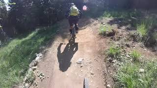
SaveThe FAI ZONE, represents the historic Bike Park of the Dolomiti Paganella Bike. Located in the locality of Santel at Fai della Paganella, it has been active since 2011, served by a fast 4-seater chairlift with automatic coupling (Santel 1.040m - Meriz 1.440m), it is composed of 4 main tracks plus some variants.
Primary Trail Type: All-Mountain & Downhill
Shuttleable: YES
Land Status: Managed by Local Riding Association
Access Info:
Santel - Fai della Paganella
Links
Region Supporters & Maintainers
![]()
Danger Zone Trail SolutionBuilder
Activities Click to view
- Mountain Bike
5 trails
- Hike
1 trails
- Trail Running
1 trails
Bike Park Details
- 1
- 2
- 1
- 1
Region Status
Open as of Jun 13, 2022- Day Ticket
- 24 EUR
- Uplift Type
- Chair Lift
- Season start
- Apr 28
- Season end
- Sep 10
Stats
- Avg Trail Rating
- Trails (view details)
- 5
- Trails Mountain Bike
- 5
- Trails Hike
- 1
- Trails Trail Running
- 1
- Total Distance
- 8 miles
- Total Descent
- 5,020 ft
- Total Vertical
- 1,543 ft
- Highest Trailhead
- 4,942 ft
- Reports
- 91
- Photos
- 18
- Ridden Counter
- 2,044
Popular Fai ZONE Mountain Biking Trails
| status | title | difficulty | rating |
|---|---|---|---|
| Peter Pan | |||
| Easy Rider | |||
| Apocalypse Now | |||
| Arancia Meccanica | |||
| Malghette, Giada, Rib's Access |
Fai ZONE Mountain Bike Routes
| title | rating | distance |
|---|---|---|
| Paganella Bear Trails (more park version) | 40 miles | |
| 13 mile Fai ZONE Cross-country Ride | popular ridelog | 13 miles |
| 9 mile Fai ZONE Ride | popular ridelog | 9 miles |
| 4 mile Fai ZONE Ride | popular ridelog | 4 miles |
| 26 mile Andalo ZONE Ride | popular ridelog | 26 miles |
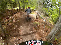
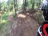
Photos of Fai ZONE Mountain Bike
trail: Easy Rider
7 |
Jun 18, 2022 @ 9:04am
Jun 18, 2022
trail: Apocalypse Now
20 |
Jun 18, 2022 @ 9:02am
Jun 18, 2022
trail: Peter Pan
142 |
Oct 15, 2019 @ 1:14pm
Oct 15, 2019
trail: Apocalypse Now
108 |
Oct 2, 2019 @ 11:37pm
Oct 2, 2019
trail: Easy Rider
96 |
Oct 2, 2019 @ 11:35pm
Oct 2, 2019
trail: Peter Pan
71 |
Aug 9, 2019 @ 9:40am
Aug 9, 2019
trail: Peter Pan
89 |
Aug 9, 2019 @ 9:40am
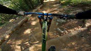
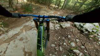
Aug 9, 2019Videos of Fai ZONE Mountain Bike

trail: Easy Rider
1:27 |
308 |
Jul 23, 2014
trail: Apocalypse Now
4:19 |
783 |
May 18, 2013
trail: Easy Rider
4:40 |
217 |
Jul 29, 2012
youtuber
![Paganella Bikepark – FAI Zone Black Lines |...]()

trail: Apocalypse Now
5:42 |
19 |
Jul 3, 2022 , Fai Della Paganella
trail: Easy Rider
3:54 |
75 |
Oct 4, 2021 , Fai Della Paganella
trail: Arancia Meccanica
3:05 |
111 |
Sep 9, 2021 , Fai Della Paganella
trail: Peter Pan
11:07 |
250 |
Feb 15, 2020 , Fai Della Paganella

trail: Peter Pan
7:22 |
329 |
Jul 24, 2019 , Fai Della Paganella
Recent Trail Reports
| status | trail | date | condition | info | user |
|---|---|---|---|---|---|
| Easy Rider | Jun 27, 2022 @ 2:34am Jun 27, 2022 | Ideal | ElMomos | ||
| Peter Pan | Jun 26, 2022 @ 12:22am Jun 26, 2022 | Ideal | ElMomos | ||
| Apocalypse Now | Jun 11, 2022 @ 1:54pm Jun 11, 2022 | Dry | FraV8 | ||
| Santel Fai Connector | Jun 2, 2022 @ 7:44am Jun 2, 2022 | Ideal | filiori | ||
| Malghette, Giada, Rib's Access | Aug 30, 2021 @ 10:56pm Aug 30, 2021 | Ideal | katko | ||
| Arancia Meccanica | Aug 6, 2020 @ 8:58am Aug 6, 2020 | Ideal | DriaBen |
Activity Feed
| username | action | type | title | date | |
|---|---|---|---|---|---|
 | fontafox | add | route | Paganella Bear Trails (more park version) | Jul 5, 2022 @ 4:10am 23 hours |
 | Radde | add | video | Paganella Bikepark – FAI Zone Black Lines | Apocalypse Now / Arancia Meccanica | Jul 3, 2022 @ 1:00pm 3 days |
 | og-keule | ridden | trail | Easy Rider and 1 more | Jul 3, 2022 @ 12:12pm 3 days |
 | ElMomos | difficultyvote | trail | Easy Rider | Jun 27, 2022 @ 2:34am Jun 27, 2022 |
| ElMomos | add | report | Peter Pan and 1 more | Jun 27, 2022 @ 2:32am Jun 27, 2022 |
Recent Comments
| username | type | title | comment | date | |
|---|---|---|---|---|---|
| trail | Very trited | Jul 11, 2021 @ 5:08am Jul 11, 2021 | ||
 | trail | Easy rider is great . Here it shows it as a... | Aug 29, 2019 @ 12:18pm Aug 29, 2019 | ||
| trail | Fucking awesome ✌️???? | Aug 2, 2017 @ 4:32am Aug 2, 2017 |
Nearby Areas
| name | distance | ||||
|---|---|---|---|---|---|
| Andalo ZONE | 1 | 5 | 2 | 1.9 km | |
| Dolomiti Paganella Bike | 1 | 4 | 4 | 2.9 km | |
| Molveno ZONE | 2 | 2 | 1 | 4.5 km | |
| Monte Corona | 1 | 3 | 4.7 km | ||
| Calisio | 5 | 6 | 1 | 6.5 km |
Bike & Skill Parks
| name | type | city | rating |
|---|---|---|---|
| Pumptrack & Skill Area | skill park | Fai Della Paganella |
Activity Type Stats
| activitytype | trails | distance | descent | descent distance | total vertical | rating | global rank | state rank | photos | reports | routes | ridelogs |
|---|---|---|---|---|---|---|---|---|---|---|---|---|
| Mountain Bike | 5 | 8 miles | 5,020 ft | 5 miles | 1,542 ft | #1,532 | #25 | 18 | 91 | 1 | 1,812 | |
| Hike | 1 | 3 miles | 207 ft | 1 mile | 279 ft | #555 | 63 | 8 | ||||
| Trail Running | 1 | 3 miles | 207 ft | 1 mile | 279 ft | #543 | 63 | 2 |
- By steve-U
 PBP PaganellaBike & contributors
 - Admins: PBP, PaganellaBike
- #4267 - 5,557 views
- fai zone activity log | embed map of Fai ZONE mountain bike trails | fai zone mountain biking points of interest
-
- subscribe
- 3d map
Downloading of trail gps tracks in kml & gpx formats is enabled for Fai ZONE.
You must login to download files.