close
Trail Conditions
- Unknown
- Snow Groomed
- Snow Packed
- Snow Covered
- Snow Cover Inadequate
- Freeze/thaw Cycle
- Icy
- Prevalent Mud
- Wet
- Variable
- Ideal
- Dry
- Very Dry
Trail Flow (Ridden Direction)
Trailforks scans users ridelogs to determine the most popular direction each trail is ridden. A good flowing trail network will have most trails flowing in a single direction according to their intension.
The colour categories are based on what percentage of riders are riding a trail in its intended direction.
The colour categories are based on what percentage of riders are riding a trail in its intended direction.
- > 96%
- > 90%
- > 80%
- > 70%
- > 50%
- < 50%
- bi-directional trail
- no data
Trail Last Ridden
Trailforks scans ridelogs to determine the last time a trail was ridden.
- < 2 days
- < 1 week
- < 2 weeks
- < 1 month
- < 6 months
- > 6 months
Trail Ridden Direction
The intended direction a trail should be ridden.
- Downhill Only
- Downhill Primary
- Both Directions
- Uphill Primary
- Uphill Only
- One Direction
Contribute Details
Colors indicate trail is missing specified detail.
- Description
- Photos
- Description & Photos
- Videos
Trail Popularity ?
Trailforks scans ridelogs to determine which trails are ridden the most in the last 9 months.
Trails are compared with nearby trails in the same city region with a possible 25 colour shades.
Think of this as a heatmap, more rides = more kinetic energy = warmer colors.
- most popular
- popular
- less popular
- not popular
ATV/ORV/OHV Filter
Max Vehicle Width
inches
Radar Time
x
Activity Recordings
Trailforks users anonymized public ridelogs from the past 6 months.
- mountain biking recent
- mountain biking (>6 month)
- hiking (1 year)
- moto (1 year)
Activity Recordings
Trailforks users anonymized public skilogs from the past 12 months.
- Downhill Ski
- Backcountry Ski
- Nordic Ski
Jump Magnitude Heatmap
Heatmap of where riders jump on trails. Zoom in to see individual jumps, click circles to view jump details.
Trails Deemphasized
Trails are shown in grey.
Only show trails with NO bikes.
Save the current map location and zoom level as your default home location whenever this page is loaded.
SaveKostenloser spaßiger Bikepark mit zwei Trails (Wild Hog und No Jokes) sowie ein Übungsparcours mit Pumptrack.
Kein Lift oder Shuttle, selbst pedalieren ist angesagt.
Oben steht auch eine Spendenbox, bitte auch immer brav etwas reinwerfen
Kein Lift oder Shuttle, selbst pedalieren ist angesagt.
Oben steht auch eine Spendenbox, bitte auch immer brav etwas reinwerfen
Primary Trail Type: All-Mountain & Downhill
 google parking directions
Links
Activities Click to view
- Mountain Bike
6 trails
- E-Bike
6 trails
- Hike
2 trails
- Trail Running
2 trails
Bike Park Details
- 2
- 2
- 1
- 1
Region Status
Open as of Apr 26, 2020- Season start
- Apr 1
- Season end
- Nov 1
Stats
- Avg Trail Rating
- Trails (view details)
- 6
- Trails Mountain Bike
- 6
- Trails E-Bike
- 6
- Trails Hike
- 2
- Trails Trail Running
- 2
- Total Distance
- 4 miles
- Total Descent
- 845 ft
- Total Vertical
- 559 ft
- Highest Trailhead
- 1,502 ft
- Reports
- 52
- Photos
- 47
- Ridden Counter
- 878
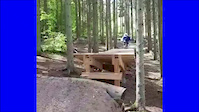
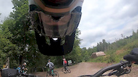
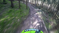
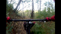
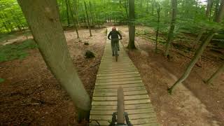
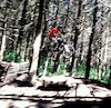
Photos of Flowtrail Stromberg Mountain Bike
trail: Wild Hog
87 |
Jun 3, 2021 @ 3:05pm
Jun 3, 2021
trail: No Jokes
54 |
Jun 3, 2021 @ 3:02pm
Jun 3, 2021
trail: No Jokes
60 |
Jun 3, 2021 @ 3:02pm
Jun 3, 2021
trail: No Jokes
70 |
May 5, 2021 @ 3:05pm
May 5, 2021
trail: Wild Hog
188 |
Apr 11, 2020 @ 12:08pm
Apr 11, 2020
trail: Wild Hog
112 |
Apr 11, 2020 @ 12:08pm
Apr 11, 2020
trail: Wild Hog
144 |
Apr 11, 2020 @ 12:08pm
Apr 11, 2020
trail: Wild Hog
269 |
May 12, 2013 @ 12:02pm
May 12, 2013Videos of Flowtrail Stromberg Mountain Bike
trail: Wild Hog
0:07 |
327 |
Sep 12, 2019
trail: Wild Hog
4:18 |
88 |
Jul 26, 2019
trail: Trail
0:45 |
32 |
Mar 23, 2017
trail: Wild Hog
0:52 |
422 |
Apr 4, 2015
trail: Trail
0:44 |
213 |
Oct 31, 2013
trail: Trail
3:25 |
151 |
Sep 8, 2012
trail: Trail
1:52 |
132 |
May 12, 2011
trail: No Jokes
1:58 |
60 |
Sep 17, 2021 , Stromberg
Recent Trail Reports
| status | trail | date | condition | info | user |
|---|---|---|---|---|---|
| Wild Hog | May 11, 2022 @ 12:18pm May 11, 2022 | Dry | Luesincostan | ||
| Trail | Oct 24, 2020 @ 1:24am Oct 24, 2020 | Ideal | Vectra130 | ||
| No Jokes | Oct 24, 2020 @ 1:24am Oct 24, 2020 | Ideal | Vectra130 | ||
| Forstweg | Apr 15, 2020 @ 9:37am Apr 15, 2020 | Dry | Lugigloe0405 | ||
| Forstweg | Oct 26, 2019 @ 1:41am Oct 26, 2019 | Dry | Nickstnkwsk |
Activity Feed
| username | action | type | title | date | |
|---|---|---|---|---|---|
 | nitro-nik | wishlist | skillpark | Übungsparcours und Pumptrack | Jun 29, 2022 @ 8:28am Jun 29, 2022 |
 | FULDAWG | wishlist | region | Flowtrail Stromberg | Jun 20, 2022 @ 8:00pm Jun 20, 2022 |
| hanswurst1245 | vote | trail | No Jokes | Jun 10, 2022 @ 4:36am Jun 10, 2022 |
| Grzegorz83 | wishlist | trail | Wild Hog and 1 more | Jun 8, 2022 @ 3:25am Jun 8, 2022 |
| MartinWe | wishlist | trail | Wild Hog | Jun 5, 2022 @ 10:48am Jun 5, 2022 |
Recent Comments
| username | type | title | comment | date | |
|---|---|---|---|---|---|
| trail | Guter Zustand lohnt sich auf jeden! | Aug 23, 2021 @ 7:11am Aug 23, 2021 | ||
| trail | Super Trail mit schönen Sprüngen. Erstes... | May 24, 2021 @ 12:49am May 24, 2021 | ||
| trail | Super gebaut, schöne Sprünge in... | May 24, 2021 @ 12:46am May 24, 2021 | ||
 | trail | Sehr geile Strecke, die den Namen Flowtrail... | Nov 4, 2017 @ 12:47pm Nov 4, 2017 |
Nearby Areas
| name | distance | ||||
|---|---|---|---|---|---|
| Donnersberg | 1 | 2 | 19.8 km | ||
| Taunus | 4 | 2 | 1 | 21.6 km | |
| Donnersberg | 10 | 23.3 km | |||
| Platte | 12 | 6 | 24.3 km | ||
| Malberg | 1 | 2 | 1 | 26.9 km |
Bike & Skill Parks
| name | type | city | rating |
|---|---|---|---|
| Übungsparcours und Pumptrack | skill park | Stromberg |
Activity Type Stats
| activitytype | trails | distance | descent | descent distance | total vertical | rating | global rank | state rank | photos | reports | routes | ridelogs |
|---|---|---|---|---|---|---|---|---|---|---|---|---|
| Mountain Bike | 6 | 4 miles | 846 ft | 2 miles | 558 ft | #2,025 | #16 | 47 | 52 | 1,219 | ||
| E-Bike | 6 | 4 miles | 846 ft | 2 miles | 558 ft | #622 | #4 | 50 | 105 | |||
| Hike | 2 | 2 miles | 36 ft | 1,335 ft | 528 ft | #189 | 46 | 8 | ||||
| Trail Running | 2 | 2 miles | 36 ft | 1,335 ft | 528 ft | #189 | 46 | 11 |
- By BastiEnduro & contributors
- Admins: apply
- #5972 - 3,857 views
- flowtrail stromberg activity log | embed map of Flowtrail Stromberg mountain bike trails | flowtrail stromberg mountain biking points of interest
Downloading of trail gps tracks in kml & gpx formats is enabled for Flowtrail Stromberg.
You must login to download files.