close
Trail Conditions
- Unknown
- Snow Groomed
- Snow Packed
- Snow Covered
- Snow Cover Inadequate
- Freeze/thaw Cycle
- Icy
- Prevalent Mud
- Wet
- Variable
- Ideal
- Dry
- Very Dry
Trail Flow (Ridden Direction)
Trailforks scans users ridelogs to determine the most popular direction each trail is ridden. A good flowing trail network will have most trails flowing in a single direction according to their intension.
The colour categories are based on what percentage of riders are riding a trail in its intended direction.
The colour categories are based on what percentage of riders are riding a trail in its intended direction.
- > 96%
- > 90%
- > 80%
- > 70%
- > 50%
- < 50%
- bi-directional trail
- no data
Trail Last Ridden
Trailforks scans ridelogs to determine the last time a trail was ridden.
- < 2 days
- < 1 week
- < 2 weeks
- < 1 month
- < 6 months
- > 6 months
Trail Ridden Direction
The intended direction a trail should be ridden.
- Downhill Only
- Downhill Primary
- Both Directions
- Uphill Primary
- Uphill Only
- One Direction
Contribute Details
Colors indicate trail is missing specified detail.
- Description
- Photos
- Description & Photos
- Videos
Trail Popularity ?
Trailforks scans ridelogs to determine which trails are ridden the most in the last 9 months.
Trails are compared with nearby trails in the same city region with a possible 25 colour shades.
Think of this as a heatmap, more rides = more kinetic energy = warmer colors.
- most popular
- popular
- less popular
- not popular
ATV/ORV/OHV Filter
Max Vehicle Width
inches
Radar Time
x
Activity Recordings
Trailforks users anonymized public ridelogs from the past 6 months.
- mountain biking recent
- mountain biking (>6 month)
- hiking (1 year)
- moto (1 year)
Activity Recordings
Trailforks users anonymized public skilogs from the past 12 months.
- Downhill Ski
- Backcountry Ski
- Nordic Ski
Jump Magnitude Heatmap
Heatmap of where riders jump on trails. Zoom in to see individual jumps, click circles to view jump details.
Trails Deemphasized
Trails are shown in grey.
Only show trails with NO bikes.
Save the current map location and zoom level as your default home location whenever this page is loaded.
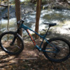
SaveWe are a private, family-run mountain, professionally-built bike trail network on Freeman Ridge Road in Freeman Township, Maine, one mile outside of downtown Kingfield. We offer approximately 5 miles of hand and machine constructed mountain bike trail, and we are continuing to expand our network. Our trails are gravity-based and progression-oriented. We are excited to be a part of the growing mountain bike scene here in the Western Mountains of Maine, and hope you make time for a visit
Adult Day Pass: $10
Junior Day Pass: $5
Adult Season Pass: $50
Junior Season Pass: $25
2021 Hours of Operation:
*Tuesday: 3pm-7pm
*Wednesday: 3pm-7pm
*Thursday: 10am-7pm
*Friday: 10am-7pm
*Saturday: 9am-5pm
*Sunday: 9am-5pm
CLOSED Monday
Adult Day Pass: $10
Junior Day Pass: $5
Adult Season Pass: $50
Junior Season Pass: $25
2021 Hours of Operation:
*Tuesday: 3pm-7pm
*Wednesday: 3pm-7pm
*Thursday: 10am-7pm
*Friday: 10am-7pm
*Saturday: 9am-5pm
*Sunday: 9am-5pm
CLOSED Monday
source: FRBP Website
Primary Trail Type: All-Mountain & Downhill
eBikes Allowed:
Yes
Land Status: Private Property
 google parking directions
Links
Activities Click to view
- Mountain Bike
16 trails
- E-Bike
16 trails
- Hike
17 trails
- Trail Running
17 trails
Bike Park Details
- 6
- 7
- 2
- 1
Region Status
Open as of Oct 10, 2021- Day Ticket
- $10 USD
- Season start
- Jun 3
- Season end
- Oct 11
Stats
- Avg Trail Rating
- Trails (view details)
- 17
- Trails Mountain Bike
- 16
- Trails E-Bike
- 16
- Trails Hike
- 17
- Trails Trail Running
- 17
- Total Distance
- 9 miles
- Total Descent Distance
- 4 miles
- Total Descent
- 1,565 ft
- Total Vertical
- 3,370 ft
- Highest Trailhead
- 4,033 ft
- Reports
- 112
- Photos
- 13
- Ridden Counter
- 2,112
Popular Freeman Ridge Bike Park Mountain Biking Trails
Photos of Freeman Ridge Bike Park Mountain Bike
trail: Deertree
39 |
Jul 29, 2021 @ 10:24am
Jul 29, 2021
trail: Deertree
26 |
Jul 29, 2021 @ 10:24am
Jul 29, 2021
trail: Stanley
36 |
Jul 29, 2021 @ 10:23am
Jul 29, 2021
trail: Stanley
43 |
Jul 29, 2021 @ 10:23am
Jul 29, 2021
trail: Hyde
67 |
Jul 29, 2021 @ 10:22am
Jul 29, 2021
trail: Stanley
79 |
Sep 7, 2020 @ 7:27am
Sep 7, 2020
trail: Starboard
64 |
Sep 7, 2020 @ 7:24am
Sep 7, 2020
trail: Leather Lane
60 |
Sep 7, 2020 @ 7:23am
Sep 7, 2020Videos of Freeman Ridge Bike Park Mountain Bike

trail: The Cache
9:38 |
184 |
Sep 27, 2020 , Kingfield
Recent Trail Reports
| status | trail | date | condition | info | user |
|---|---|---|---|---|---|
| Leather Lane | Oct 10, 2021 @ 5:13am Oct 10, 2021 | Ideal | NewEnglandSkier13 MV NEMBA | ||
| Arrowtree | Oct 10, 2021 @ 5:13am Oct 10, 2021 | Ideal | NewEnglandSkier13 MV NEMBA | ||
| Deertree | Oct 10, 2021 @ 5:13am Oct 10, 2021 | Ideal | NewEnglandSkier13 MV NEMBA | ||
| The Cache | Oct 10, 2021 @ 5:13am Oct 10, 2021 | Ideal | NewEnglandSkier13 MV NEMBA | ||
| Hyde | Oct 10, 2021 @ 5:13am Oct 10, 2021 | Ideal | NewEnglandSkier13 MV NEMBA | ||
| Steamer | Oct 10, 2021 @ 5:13am Oct 10, 2021 | Ideal | NewEnglandSkier13 MV NEMBA | ||
| The Climb | Oct 9, 2021 @ 11:25am Oct 9, 2021 | Ideal | NewEnglandSkier13 MV NEMBA | ||
| Leeway | Oct 9, 2021 @ 11:25am Oct 9, 2021 | Ideal | NewEnglandSkier13 MV NEMBA | ||
| Boundary | Oct 9, 2021 @ 11:25am Oct 9, 2021 | Ideal | NewEnglandSkier13 MV NEMBA | ||
| Traveled Way | Oct 9, 2021 @ 11:25am Oct 9, 2021 | Ideal | NewEnglandSkier13 MV NEMBA |
Activity Feed
| username | action | type | title | date | |
|---|---|---|---|---|---|
 | Tylersnowboarder | ridden | trail | Starboard | Jun 5, 2022 @ 9:19pm Jun 5, 2022 |
| JordieP | wishlist | region | Freeman Ridge Bike Park | May 16, 2022 @ 9:57am May 16, 2022 |
| Brule127 | ridden | trail | Arrowtree | Mar 19, 2022 @ 6:10am Mar 19, 2022 |
 | NewEnglandSkier13 | add | report | Leather Lane and 5 more | Oct 10, 2021 @ 6:11am Oct 10, 2021 |
| NewEnglandSkier13 | add | report | The Climb and 12 more | Oct 9, 2021 @ 1:06pm Oct 9, 2021 |
Recent Comments
| username | type | title | comment | date | |
|---|---|---|---|---|---|
| report | X | Jul 26, 2020 @ 8:41am Jul 26, 2020 |
Nearby Areas
| name | distance | ||||
|---|---|---|---|---|---|
| Sugarloaf Mountain Resort | 2 | 2 | 5 | 3 | 11.1 km |
| Carrabassett Valley Trail Network | 23 | 36 | 10 | 12.1 km | |
| Powder House Hill Trail System | 23 | 9 | 6 | 1 | 18 km |
| Clifford Woods | 3 | 7 | 1 | 1 | 18 km |
| Nina's Woods | 3 | 18.3 km |
Activity Type Stats
| activitytype | trails | distance | descent | descent distance | total vertical | rating | global rank | state rank | photos | reports | routes | ridelogs |
|---|---|---|---|---|---|---|---|---|---|---|---|---|
| Mountain Bike | 16 | 4 miles | 745 ft | 2 miles | 171 ft | #1,777 | #944 | 13 | 112 | 337 | ||
| E-Bike | 16 | 4 miles | 745 ft | 2 miles | 171 ft | #546 | #178 | 112 | 1 | |||
| Hike | 17 | 9 miles | 1,565 ft | 4 miles | 3,369 ft | #1,395 | #842 | 111 | 5 | |||
| Trail Running | 17 | 9 miles | 1,565 ft | 4 miles | 3,369 ft | #1,400 | #840 | 111 |
- By mgltraveler
 & contributors
 - Admins: NEMBA, NEMBAEXEC, slick50, mappermook, NewEnglandSkier13
- #24809 - 2,373 views
- freeman ridge bike park activity log | embed map of Freeman Ridge Bike Park mountain bike trails | freeman ridge bike park mountain biking points of interest
-
- subscribe
- 3d map
Downloading of trail gps tracks in kml & gpx formats is enabled for Freeman Ridge Bike Park.
You must login to download files.