close
Trail Conditions
- Unknown
- Snow Groomed
- Snow Packed
- Snow Covered
- Snow Cover Inadequate
- Freeze/thaw Cycle
- Icy
- Prevalent Mud
- Wet
- Variable
- Ideal
- Dry
- Very Dry
Trail Flow (Ridden Direction)
Trailforks scans users ridelogs to determine the most popular direction each trail is ridden. A good flowing trail network will have most trails flowing in a single direction according to their intension.
The colour categories are based on what percentage of riders are riding a trail in its intended direction.
The colour categories are based on what percentage of riders are riding a trail in its intended direction.
- > 96%
- > 90%
- > 80%
- > 70%
- > 50%
- < 50%
- bi-directional trail
- no data
Trail Last Ridden
Trailforks scans ridelogs to determine the last time a trail was ridden.
- < 2 days
- < 1 week
- < 2 weeks
- < 1 month
- < 6 months
- > 6 months
Trail Ridden Direction
The intended direction a trail should be ridden.
- Downhill Only
- Downhill Primary
- Both Directions
- Uphill Primary
- Uphill Only
- One Direction
Contribute Details
Colors indicate trail is missing specified detail.
- Description
- Photos
- Description & Photos
- Videos
Trail Popularity ?
Trailforks scans ridelogs to determine which trails are ridden the most in the last 9 months.
Trails are compared with nearby trails in the same city region with a possible 25 colour shades.
Think of this as a heatmap, more rides = more kinetic energy = warmer colors.
- most popular
- popular
- less popular
- not popular
ATV/ORV/OHV Filter
Max Vehicle Width
inches
Radar Time
x
Activity Recordings
Trailforks users anonymized public ridelogs from the past 6 months.
- mountain biking recent
- mountain biking (>6 month)
- hiking (1 year)
- moto (1 year)
Activity Recordings
Trailforks users anonymized public skilogs from the past 12 months.
- Downhill Ski
- Backcountry Ski
- Nordic Ski
Jump Magnitude Heatmap
Heatmap of where riders jump on trails. Zoom in to see individual jumps, click circles to view jump details.
Trails Deemphasized
Trails are shown in grey.
Only show trails with NO bikes.
Save the current map location and zoom level as your default home location whenever this page is loaded.
SavePopular Trail Networks
view all areas »
No description for Alabama has been added yet!
Login or register to submit one.
Region Details
- 178
- 19
- 237
- 310
- 99
- 14
Stats
- Avg Trail Rating
- Trails (view details)
- 1,083
- Trails Mountain Bike
- 858
- Trails E-Bike
- 277
- Trails Hike
- 1,041
- Trails Trail Running
- 1,029
- Trails Horse
- 137
- Trails Dirtbike/Moto
- 11
- Trails Observed Trials
- 2
- Trails ATV/ORV/OHV
- 11
- Total Distance
- 1,398 mile
- Total Descent
- 147,103 ft
- Total Vertical
- 2,390 ft
- Highest Trailhead
- 2,392 ft
- Reports
- 50,986
- Photos
- 1,771
- Ridden Counter
- 71,751
Sub Regions
- Central Alabama (336)
- Northern Alabama (330)
- South Alabama (100)
- Southeast Alabama (38)
- West Alabama (44)
Popular Alabama Mountain Biking Trails
| status | title | difficulty | rating |
|---|---|---|---|
| Rock Slot Coldwater Mountain | |||
| Cassidy Coldwater Mountain | |||
| Mr. Toads to Snake Oak Mountain State Park | |||
| Foreplay Oak Mountain State Park | |||
| Mr Toads Snake to Fore Play Oak Mountain State Park | |||
| Rattlesnake Ridge Oak Mountain State Park | |||
| Jekyll Oak Mountain State Park | |||
| Seven Bridges Oak Mountain State Park | |||
| Mama Bear Coldwater Mountain | |||
| Johnsons Mountain Oak Mountain State Park | |||
| Cat Dog Snake Oak Mountain State Park | |||
| Lightning Oak Mountain State Park | |||
| The Chimneys Oak Mountain State Park | |||
| Quarry Road Trail Oak Mountain State Park | |||
| Bomb Dog Coldwater Mountain |
Alabama Mountain Bike Routes
| title | rating | distance |
|---|---|---|
| Black Creek Flow Black Creek Trails | 11 miles | |
| OMSP - Short West Loop Oak Mountain State Park | 13 miles | |
| Forever Wild Trail Ride Dothan | 10 miles | |
| Swayback + Jordans Wetumpka | 13 miles | |
| Swayback Bridge Wetumpka | 10 miles | |
| Thunder and Lightning Loop (Short) Oak Mountain State Park | 8 miles | |
| 2021 HAMR TTT LC 2 Monte Sano State Park and Land Trust | 4 miles | |
| Oak Mountain Full Red Loop Oak Mountain State Park | 19 miles | |
| Coldwater Top Loop Coldwater Mountain | 14 miles | |
| Go Nuts "Nutcracker" 2021 Coldwater Mountain | 4 miles |
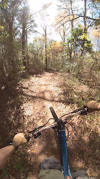
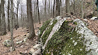
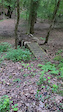
Photos of Alabama Mountain Bike
trail: Covid's Cure
8 |
Jun 23, 2022 @ 3:40pm
Jun 23, 2022
trail: Pine Hill Pump Track
1 |
Jun 23, 2022 @ 6:43am
Jun 23, 2022
trail: Upper Rip Current
1 |
Jun 23, 2022 @ 6:42am
Jun 23, 2022
trail: The Pip
109 |
May 25, 2021 @ 12:13pm
May 25, 2021
trail: Ironlegs Loop
31 |
Aug 8, 2020 @ 2:44pm
Aug 8, 2020
trail: Ironlegs Loop
34 |
Aug 8, 2020 @ 2:43pm
Aug 8, 2020
trail: Mountain Mist
139 |
Apr 9, 2019 @ 7:22pm
Apr 9, 2019
trail: Mountain Mist
133 |
Apr 9, 2019 @ 7:22pm
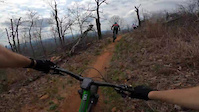
Apr 9, 2019Videos of Alabama Mountain Bike
trail: Pop & Peek
7 |
Apr 9, 2022
trail: Storyteller
107 |
Mar 7, 2022

trail: Boulder Ridge
91 |
Dec 5, 2021

trail: Storyteller
143 |
Nov 3, 2021
trail: Rollercoaster
48 |
Aug 4, 2021

trail: Upper Chewacla Access Trail
98 |
Apr 10, 2021
trail: Bomb Dog
71 |
Apr 1, 2021

trail: Redstone Arsenal Greenway
121 |
Dec 23, 2020
Activity Feed
| username | action | type | title | date | |
|---|---|---|---|---|---|
 | wfperryman | add | report | Red Road and 1 more | Jul 5, 2022 @ 7:35pm 6 hours |
 | whitedlite | add | report | Quarry Road Trail | Jul 5, 2022 @ 6:12pm 8 hours |
| KarenThrelkeldNJQ | ridden | trail | North Lakes Connector Trail | Jul 5, 2022 @ 5:28pm 9 hours |
| belchja | add | report | Apache and 1 more | Jul 5, 2022 @ 3:54pm 10 hours |
 | WillieJacobsz | add | region | Northport | Jul 5, 2022 @ 11:00am 15 hours |
Recent Comments
| username | type | title | comment | date | |
|---|---|---|---|---|---|
| report | Tree down | Jul 4, 2022 @ 8:28am 2 days | ||
| report | At north end of trail across from top of Thunder. | Jun 30, 2022 @ 7:16am Jun 30, 2022 | ||
 | report | Trees have been cleared. | Jun 25, 2022 @ 12:03pm Jun 25, 2022 | ||
| report | Trees have been cleared. | Jun 25, 2022 @ 12:02pm Jun 25, 2022 | ||
| trail | Hey y’all!! I was able to edit the trail and... | Jun 20, 2022 @ 8:24pm Jun 20, 2022 |
Local Badges
-

Big Ride 30k753 awarded -
Big Ride 30k4,364 awarded -

Trail Explorer 100421 awarded -

Completionist2 awarded -
Completionist34 awarded -

10 Blue Trails414 awarded
Bike & Skill Parks
| name | type | city | rating |
|---|---|---|---|
| Black Creek Mountain Bike Park | bike park | Birmingham | |
| Base CAMP Skills Area | skill park | Auburn | |
| Circle City BMX Track | skill park | Dothan | |
| Dirt Jumps | skill park | Auburn | |
| Playground | skill park | Mobile |
Activity Type Stats
| activitytype | trails | distance | descent | descent distance | total vertical | rating | global rank | state rank | photos | reports | routes | ridelogs |
|---|---|---|---|---|---|---|---|---|---|---|---|---|
| Mountain Bike | 858 | 1,040 mile | 97,008 ft | 406 miles | 2,375 ft | #35 | 1,723 | 50,970 | 137 | 91,861 | ||
| E-Bike | 277 | 323 miles | 24,895 ft | 123 miles | 2,375 ft | #36 | 2 | 47,088 | 10 | 749 | ||
| Hike | 1,041 | 1,358 mile | 142,785 ft | 544 miles | 2,388 ft | #35 | 38 | 50,786 | 4 | 3,392 | ||
| Trail Running | 1,029 | 1,336 mile | 140,656 ft | 536 miles | 2,388 ft | #35 | 1 | 50,785 | 13 | 2,796 | ||
| Horse | 137 | 250 miles | 28,885 ft | 108 miles | 2,247 ft | #33 | 44,287 | 11 | ||||
| Dirtbike/Moto | 11 | 47 miles | 4,718 ft | 21 miles | 1,152 ft | 6,292 | 3 | 11 | ||||
| Observed Trials | 2 | 11 miles | 820 ft | 4 miles | 837 ft | 3 | 20 | |||||
| ATV/ORV/OHV | 11 | 47 miles | 4,718 ft | 21 miles | 1,152 ft | 1 | 6,291 | 7 |
- By canadaka
 Trailforks & contributors
 - Admins: Map Team, chuktA, msmcfate, WillieJacobsz, PlumbBobM, ReckitRolley, SORBA, softbatch, PlumbBobM
- #3187 - 24,515 views
- alabama activity log | embed map of Alabama mountain bike trails | alabama mountain biking points of interest polygons
-
- subscribe
- 3d map
Downloading of trail gps tracks in kml & gpx formats is enabled for Alabama.
You must login to download files.