close
Trail Conditions
- Unknown
- Snow Groomed
- Snow Packed
- Snow Covered
- Snow Cover Inadequate
- Freeze/thaw Cycle
- Icy
- Prevalent Mud
- Wet
- Variable
- Ideal
- Dry
- Very Dry
Trail Flow (Ridden Direction)
Trailforks scans users ridelogs to determine the most popular direction each trail is ridden. A good flowing trail network will have most trails flowing in a single direction according to their intension.
The colour categories are based on what percentage of riders are riding a trail in its intended direction.
The colour categories are based on what percentage of riders are riding a trail in its intended direction.
- > 96%
- > 90%
- > 80%
- > 70%
- > 50%
- < 50%
- bi-directional trail
- no data
Trail Last Ridden
Trailforks scans ridelogs to determine the last time a trail was ridden.
- < 2 days
- < 1 week
- < 2 weeks
- < 1 month
- < 6 months
- > 6 months
Trail Ridden Direction
The intended direction a trail should be ridden.
- Downhill Only
- Downhill Primary
- Both Directions
- Uphill Primary
- Uphill Only
- One Direction
Contribute Details
Colors indicate trail is missing specified detail.
- Description
- Photos
- Description & Photos
- Videos
Trail Popularity ?
Trailforks scans ridelogs to determine which trails are ridden the most in the last 9 months.
Trails are compared with nearby trails in the same city region with a possible 25 colour shades.
Think of this as a heatmap, more rides = more kinetic energy = warmer colors.
- most popular
- popular
- less popular
- not popular
ATV/ORV/OHV Filter
Max Vehicle Width
inches
Radar Time
x
Activity Recordings
Trailforks users anonymized public ridelogs from the past 6 months.
- mountain biking recent
- mountain biking (>6 month)
- hiking (1 year)
- moto (1 year)
Activity Recordings
Trailforks users anonymized public skilogs from the past 12 months.
- Downhill Ski
- Backcountry Ski
- Nordic Ski
Jump Magnitude Heatmap
Heatmap of where riders jump on trails. Zoom in to see individual jumps, click circles to view jump details.
Trails Deemphasized
Trails are shown in grey.
Only show trails with NO bikes.
Save the current map location and zoom level as your default home location whenever this page is loaded.
SaveActivities Click to view
- Mountain Bike
13 trails
- Hike
0 trails
- Trail Running
0 trails
Bike Park Details
- 1
- 7
- 2
- 3
Region Status
Open as of Apr 3, 2021- Day Ticket
- 70 NZD
- Uplift Type
- Shuttle
Stats
- Avg Trail Rating
- Trails (view details)
- 13
- Trails Mountain Bike
- 13
- Total Distance
- 6 miles
- Total Descent
- 1,357 ft
- Total Vertical
- 624 ft
- Highest Trailhead
- 676 ft
- Reports
- 6
- Photos
- 7
- Ridden Counter
- 109
Popular Heads Up Adventures Mountain Biking Trails
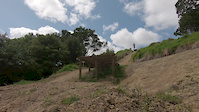
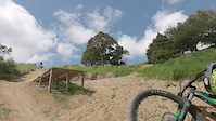
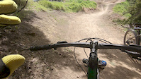
Photos of Heads Up Adventures Mountain Bike
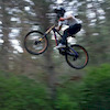
Videos of Heads Up Adventures Mountain Bike
trail: Muzza's Jump Track
0:04 |
307 |
Oct 9, 2019
trail: Muzza's Jump Track
0:04 |
315 |
Oct 9, 2019
trail: Muzza's Jump Track
0:19 |
333 |
Oct 9, 2019
Recent Trail Reports
| status | trail | date | condition | info | user |
|---|---|---|---|---|---|
| Angle's Way Green | Apr 12, 2019 @ 3:34pm Apr 12, 2019 | Dry | Mkalkoff | ||
| Rosco’s Range | Apr 12, 2019 @ 3:34pm Apr 12, 2019 | Dry | Mkalkoff | ||
| High Pressure | Apr 12, 2019 @ 3:34pm Apr 12, 2019 | Variable | Mkalkoff | ||
| Easy Stream | Apr 12, 2019 @ 3:34pm Apr 12, 2019 | Variable | Mkalkoff | ||
| Sharp Chute | Apr 12, 2019 @ 3:34pm Apr 12, 2019 | Variable | Mkalkoff |
Activity Feed
| username | action | type | title | date | |
|---|---|---|---|---|---|
 | Rodzi420 | ridden | trail | Angle's Way Green and 4 more | Jun 16, 2021 @ 5:58pm Jun 16, 2021 |
| SketchAs | ridden | trail | Muzza's Jump Track | Sep 18, 2020 @ 2:39pm Sep 18, 2020 |
| christiaanjs | ridden | trail | Rosco’s Range | Sep 6, 2020 @ 3:51pm Sep 6, 2020 |
 | isaiah10 | ridden | trail | Bush Bash and 1 more | Apr 15, 2020 @ 7:56pm Apr 15, 2020 |
| Headsupadventure | add | photo | Wyatt & Callum in Whangarei, New Zealand and 6 more | Mar 11, 2020 @ 6:44pm Mar 11, 2020 |
Recent Comments
| username | type | title | comment | date | |
|---|---|---|---|---|---|
 | trail | tracks a funn but jumps are made very badly | Nov 4, 2019 @ 11:28am Nov 4, 2019 |
Nearby Areas
| name | distance | ||||
|---|---|---|---|---|---|
| Onerahi Forest | 2 | 1.9 km | |||
| Parihaka MTB Park | 7 | 17 | 2 | 4 km | |
| Glenbervie Forest | 2 | 18 | 1 | 9 km | |
| Tutukaka Coast | 14.6 km | ||||
| Mangawhai Activity Zone | 2 | 26.4 km |
- By ralley
 TRAILFORKS & contributors
 - Admins: TFNZ, YogiNZ, ralley
- #21410 - 3,033 views
- heads up adventures activity log | embed map of Heads Up Adventures mountain bike trails | heads up adventures mountain biking points of interest
-
- subscribe
- 3d map
Downloading of trail gps tracks in kml & gpx formats is enabled for Heads Up Adventures.
You must login to download files.