close
Trail Conditions
- Unknown
- Snow Groomed
- Snow Packed
- Snow Covered
- Snow Cover Inadequate
- Freeze/thaw Cycle
- Icy
- Prevalent Mud
- Wet
- Variable
- Ideal
- Dry
- Very Dry
Trail Flow (Ridden Direction)
Trailforks scans users ridelogs to determine the most popular direction each trail is ridden. A good flowing trail network will have most trails flowing in a single direction according to their intension.
The colour categories are based on what percentage of riders are riding a trail in its intended direction.
The colour categories are based on what percentage of riders are riding a trail in its intended direction.
- > 96%
- > 90%
- > 80%
- > 70%
- > 50%
- < 50%
- bi-directional trail
- no data
Trail Last Ridden
Trailforks scans ridelogs to determine the last time a trail was ridden.
- < 2 days
- < 1 week
- < 2 weeks
- < 1 month
- < 6 months
- > 6 months
Trail Ridden Direction
The intended direction a trail should be ridden.
- Downhill Only
- Downhill Primary
- Both Directions
- Uphill Primary
- Uphill Only
- One Direction
Contribute Details
Colors indicate trail is missing specified detail.
- Description
- Photos
- Description & Photos
- Videos
Trail Popularity ?
Trailforks scans ridelogs to determine which trails are ridden the most in the last 9 months.
Trails are compared with nearby trails in the same city region with a possible 25 colour shades.
Think of this as a heatmap, more rides = more kinetic energy = warmer colors.
- most popular
- popular
- less popular
- not popular
ATV/ORV/OHV Filter
Max Vehicle Width
inches
Radar Time
x
Activity Recordings
Trailforks users anonymized public ridelogs from the past 6 months.
- mountain biking recent
- mountain biking (>6 month)
- hiking (1 year)
- moto (1 year)
Activity Recordings
Trailforks users anonymized public skilogs from the past 12 months.
- Downhill Ski
- Backcountry Ski
- Nordic Ski
Jump Magnitude Heatmap
Heatmap of where riders jump on trails. Zoom in to see individual jumps, click circles to view jump details.
Trails Deemphasized
Trails are shown in grey.
Only show trails with NO bikes.
Save the current map location and zoom level as your default home location whenever this page is loaded.
SaveAfter years of searching for the right landing spot for a mountain bike park, a gem hidden in plain sight right off of Highway 65 just north of Branson appeared and it was perfect.
In early 2021, the stars aligned and construction on what would become Howler Bike Park was underway. With a May 20, 2022 deadline, it seemed in the beginning like opening day would never get here. But, with a project of this magnitude and a crew who accepts nothing less than perfection, we instead found ourselves racing the clock and wishing for more daylight.
Nevertheless, Phase 1 of the Park was completed on time. With Howler now an established Park, our core values of ever-changing and evolving trails and experiences will continue on into the future providing riders with innovation and expertise for years to come.
Howler is a dream for me–being able to provide an incredible place for people to ride, experience the outdoors and grow in their own mountain biking journey is such a surreal experience to see. This Park is a very special place and I feel very blessed to be able to share it with everyone.
-Max Penny
source: Through The Years
Primary Trail Type: All-Mountain & Downhill
Activities Click to view
- Mountain Bike
7 trails
Bike Park Details
- 1
- 1
- 2
- 2
Region Status
Open as of Jun 18, 2022- Day Ticket
- $39.99 USD
- Uplift Type
- Shuttle
Stats
- State Ranking
- #5,646
- Trails (view details)
- 6
- Trails Mountain Bike
- 7
- Total Distance
- 2 miles
- Total Descent Distance
- 3,717 ft
- Total Descent
- 334 ft
- Total Vertical
- 362 ft
- Highest Trailhead
- 1,237 ft
- Reports
- 6
- Ridden Counter
- 88
Popular Howler Bike Park Mountain Biking Trails
| status | title | difficulty | rating |
|---|---|---|---|
| Hippie Cowboy | |||
| Shuttle Road | |||
| Swayze-Train | |||
| Stroller Coaster | |||
| Momo | |||
| Mustard Tiger |
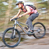
Videos of Howler Bike Park Mountain Bike
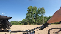
trail: Mustard Tiger
8 |
Jun 29, 2022
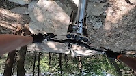
trail: Momo
19 |
Jun 29, 2022

trail: Mustard Tiger
7:22 |
6 |
Jul 4, 2022 , Branson
Recent Trail Reports
| status | trail | date | condition | info | user |
|---|---|---|---|---|---|
| Swayze-Train | Jun 18, 2022 @ 7:33am Jun 18, 2022 | Ideal | Ribar6 | ||
| Shuttle Road | Jun 18, 2022 @ 7:33am Jun 18, 2022 | Ideal | Ribar6 | ||
| Hippie Cowboy | Jun 18, 2022 @ 7:33am Jun 18, 2022 | Ideal | Ribar6 | ||
| Momo | Jun 18, 2022 @ 7:33am Jun 18, 2022 | Ideal | Ribar6 | ||
| Mustard Tiger | Jun 18, 2022 @ 7:33am Jun 18, 2022 | Ideal | Ribar6 | ||
| Stroller Coaster | Jun 18, 2022 @ 7:33am Jun 18, 2022 | Ideal | Ribar6 |
Activity Feed
| username | action | type | title | date | |
|---|---|---|---|---|---|
 | amandaham12 | add | video | Howler Bike Park Opening Weekend | Jul 4, 2022 @ 2:16pm 2 days |
| WIlliamZkAOSR | wishlist | region | Howler Bike Park | Jul 3, 2022 @ 7:36am 3 days |
 | cougar797 | add | video | Mustard Tiger | Jun 29, 2022 @ 12:08pm Jun 29, 2022 |
| EricBunchkFB | wishlist | trail | Stroller Coaster and 1 more | Jun 29, 2022 @ 10:28am Jun 29, 2022 |
 | skytoucherfarm | wishlist | region | Howler Bike Park | Jun 29, 2022 @ 3:18am Jun 29, 2022 |
Recent Comments
| username | type | title | comment | date | |
|---|---|---|---|---|---|
 | trail | More trails than on app. Please update. | Jun 5, 2022 @ 7:29pm Jun 5, 2022 |
Nearby Areas
| name | distance | ||||
|---|---|---|---|---|---|
| Busiek State Forest and Wildlife Area | 1 | 3 | 3 | 2 | 6.9 km |
| White River Trails | 1 | 12 | 2 | 13.1 km | |
| Two Rivers Bike Park | 9 | 15 | 6 | 1 | 14.5 km |
| Passion Play | 13 | 11 | 8 | 1 | 36.6 km |
| Pension Mountain | 4 | 5 | 1 | 38 km |
- By AvidTrailRider
 & contributors
 - Admins: apply
- #51124 - 331 views
- howler bike park activity log | embed map of Howler Bike Park mountain bike trails |
Downloading of trail gps tracks in kml & gpx formats is enabled for Howler Bike Park.
You must login to download files.