close
Trail Conditions
- Unknown
- Snow Groomed
- Snow Packed
- Snow Covered
- Snow Cover Inadequate
- Freeze/thaw Cycle
- Icy
- Prevalent Mud
- Wet
- Variable
- Ideal
- Dry
- Very Dry
Trail Flow (Ridden Direction)
Trailforks scans users ridelogs to determine the most popular direction each trail is ridden. A good flowing trail network will have most trails flowing in a single direction according to their intension.
The colour categories are based on what percentage of riders are riding a trail in its intended direction.
The colour categories are based on what percentage of riders are riding a trail in its intended direction.
- > 96%
- > 90%
- > 80%
- > 70%
- > 50%
- < 50%
- bi-directional trail
- no data
Trail Last Ridden
Trailforks scans ridelogs to determine the last time a trail was ridden.
- < 2 days
- < 1 week
- < 2 weeks
- < 1 month
- < 6 months
- > 6 months
Trail Ridden Direction
The intended direction a trail should be ridden.
- Downhill Only
- Downhill Primary
- Both Directions
- Uphill Primary
- Uphill Only
- One Direction
Contribute Details
Colors indicate trail is missing specified detail.
- Description
- Photos
- Description & Photos
- Videos
Trail Popularity ?
Trailforks scans ridelogs to determine which trails are ridden the most in the last 9 months.
Trails are compared with nearby trails in the same city region with a possible 25 colour shades.
Think of this as a heatmap, more rides = more kinetic energy = warmer colors.
- most popular
- popular
- less popular
- not popular
ATV/ORV/OHV Filter
Max Vehicle Width
inches
Radar Time
x
Activity Recordings
Trailforks users anonymized public ridelogs from the past 6 months.
- mountain biking recent
- mountain biking (>6 month)
- hiking (1 year)
- moto (1 year)
Activity Recordings
Trailforks users anonymized public skilogs from the past 12 months.
- Downhill Ski
- Backcountry Ski
- Nordic Ski
Jump Magnitude Heatmap
Heatmap of where riders jump on trails. Zoom in to see individual jumps, click circles to view jump details.
Trails Deemphasized
Trails are shown in grey.
Only show trails with NO bikes.
Save the current map location and zoom level as your default home location whenever this page is loaded.
SaveEl bike park de Irrisarri Land se encuentra en la localidad Navarra de Igantzi.
Tiene 75 hectarea de terreno y diferentes pistas con diferentes niveles, verde, azul, rojo y negro.
En los diferentes trails encontraremos peraltes, saltos, zonas de bosque, senderos, túneles, etc.
Complementando al bike park existen multitud de actividades en el resto del terreno, paseos a caballo, tirolina, laser tag, rutas....
Existe un forfait de remontes. El acceso tiene un coste. El precio depende del modelo de entrada elegido, toda la información la tienen en la web.
Primary Trail Type: All-Mountain & Downhill
Land Status: Private Property
Land Manager: Irrisarri Land
Access Info:
Crtra. Arantza Igantzi s/n 31790. NAVARRA
Links
Files
- Mapa_BP.jpg (253 KB)
This region uses the Uk/Euro style trail grading system.
Activities Click to view
- Mountain Bike
9 trails
- E-Bike
2 trails
Bike Park Details
- 1
- 1
- 5
- 1
- 1
Region Status
Open as of Jun 11, 2021- Day Ticket
- 25 EUR
- Uplift Type
- Shuttle
Stats
- Avg Trail Rating
- Trails (view details)
- 9
- Trails Mountain Bike
- 9
- Trails E-Bike
- 2
- Trails Hike
- 4
- Trails Trail Running
- 4
- Total Distance
- 16 miles
- Total Descent Distance
- 10 miles
- Total Descent
- 6,000 ft
- Total Vertical
- 2,562 ft
- Highest Trailhead
- 3,373 ft
- Reports
- 2
- Photos
- 1
- Ridden Counter
- 148
Popular Irrisarri Land Mountain Biking Trails
Irrisarri Land Mountain Bike Routes
| title | rating | distance |
|---|---|---|
| Circo de Arantza | 19 miles |
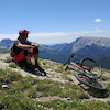
Photos of Irrisarri Land Mountain Bike
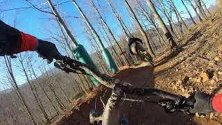
trail: Bidegurutzeta
56 |
Nov 18, 2020 @ 12:53pm
Nov 18, 2020Videos of Irrisarri Land Mountain Bike

trail: Circuito Rojo Bike Park
12:06 |
145 |
Jun 8, 2020 , Pamplona
trail: Circuito Verde Bike Park
12:06 |
132 |
Jun 8, 2020 , Pamplona
Recent Trail Reports
| status | trail | date | condition | info | user |
|---|---|---|---|---|---|
| Komizko-Ekaitza | Jun 10, 2021 @ 11:43pm Jun 10, 2021 | Ideal | Angelreing | ||
| Bidegurutzeta | Jun 10, 2021 @ 11:43pm Jun 10, 2021 | Ideal | Angelreing |
Activity Feed
| username | action | type | title | date | |
|---|---|---|---|---|---|
 | Angelreing | update | region | Irrisarri Land | Jun 20, 2022 @ 10:48pm Jun 20, 2022 |
 | tommynator | ridden | trail | Circuito Rojo Bike Park and 1 more | Apr 30, 2022 @ 9:08am Apr 30, 2022 |
| tommynator | wishlist | trail | Irrisarri - Circuito Negro and 3 more | Apr 30, 2022 @ 2:18am Apr 30, 2022 |
 | Bikingo | ridden | trail | Irrisarri - Circuito Negro and 2 more | Apr 28, 2022 @ 11:06am Apr 28, 2022 |
| Bikingo | vote | trail | Irrisarri - Circuito Negro and 2 more | Apr 28, 2022 @ 11:06am Apr 28, 2022 |
Recent Comments
| username | type | title | comment | date | |
|---|---|---|---|---|---|
| trail | Bien arreglado ciclable 100% mtb. | Feb 22, 2022 @ 9:21am Feb 22, 2022 |
Nearby Areas
| name | distance | ||||
|---|---|---|---|---|---|
| Elatzeta - Zubeltzu | 1 | 4.4 km | |||
| Artikutza | 1 | 9 | 4.8 km | ||
| Bera | 1 | 3 | 5.3 km | ||
| Santesteban | 1 | 8 | 5.4 km | ||
| Aiako Harriak | 3 | 27 | 7 km |
Activity Type Stats
| activitytype | trails | distance | descent | descent distance | total vertical | rating | global rank | state rank | photos | reports | routes | ridelogs |
|---|---|---|---|---|---|---|---|---|---|---|---|---|
| Mountain Bike | 9 | 16 miles | 6,001 ft | 10 miles | 2,562 ft | #4,707 | #139 | 1 | 2 | 1 | 91 | |
| E-Bike | 2 | 3 miles | 689 ft | 1 mile | 614 ft | #2,219 | #145 | 2 | 2 | |||
| Hike | 4 | 12 miles | 4,554 ft | 8 miles | 2,562 ft | 2 | 2 | |||||
| Trail Running | 4 | 12 miles | 4,554 ft | 8 miles | 2,562 ft | 2 |
- By zaldun & contributors
- Admins: Angelreing
- #31525 - 1,261 views
- irrisarri land activity log | embed map of Irrisarri Land mountain bike trails |
Downloading of trail gps tracks in kml & gpx formats is enabled for Irrisarri Land.
You must login to download files.